Grafton, Wisconsin
| Grafton, Wisconsin | |
|---|---|
| Village | |
|
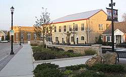
Downtown Grafton, at the Paramount Plaza | |
 Location of Grafton, Wisconsin | |
| Coordinates: 43°19′9″N 87°55′54″W / 43.31917°N 87.93167°WCoordinates: 43°19′9″N 87°55′54″W / 43.31917°N 87.93167°W | |
| Country | United States |
| State | Wisconsin |
| County | Ozaukee |
| Area[1] | |
| • Total | 5.10 sq mi (13.21 km2) |
| • Land | 5.06 sq mi (13.11 km2) |
| • Water | 0.04 sq mi (0.10 km2) |
| Elevation[2] | 709 ft (216 m) |
| Population (2010)[3] | |
| • Total | 11,459 |
| • Estimate (2012[4]) | 11,508 |
| • Density | 2,264.6/sq mi (874.4/km2) |
| Time zone | Central (CST) (UTC-6) |
| • Summer (DST) | CDT (UTC-5) |
| Area code(s) | 262 |
| FIPS code | 55-30025[5] |
| GNIS feature ID | 1583294[2] |
| Website |
village |
Grafton is a village in Ozaukee County, Wisconsin, United States. The population was 11,459 at the 2010 census. The village is adjacent to the Town of Grafton and the city of Cedarburg.
History
Grafton was originally called Hamburg.[6] A post office called Hamburgh was established in 1844.[7] The origin of the name Grafton is obscure.[6]
Geography
Grafton is located at 43°19′4″N 87°57′14″W / 43.31778°N 87.95389°W (43.317904, -87.954113).[8]
According to the United States Census Bureau, the village has a total area of 5.10 square miles (13.21 km2), of which 5.06 square miles (13.11 km2) is land and 0.04 square miles (0.10 km2) is water.[1]
The Milwaukee River flows south through the center of Grafton. Wisconsin Highway 60 (Washington Avenue) crosses the river in downtown Grafton.
Demographics
| Historical population | |||
|---|---|---|---|
| Census | Pop. | %± | |
| 1880 | 415 | — | |
| 1890 | 434 | 4.6% | |
| 1900 | 478 | 10.1% | |
| 1910 | 818 | 71.1% | |
| 1920 | 898 | 9.8% | |
| 1930 | 1,065 | 18.6% | |
| 1940 | 1,150 | 8.0% | |
| 1950 | 1,489 | 29.5% | |
| 1960 | 3,748 | 151.7% | |
| 1970 | 5,998 | 60.0% | |
| 1980 | 8,381 | 39.7% | |
| 1990 | 9,340 | 11.4% | |
| 2000 | 10,312 | 10.4% | |
| 2010 | 11,459 | 11.1% | |
| Est. 2015 | 11,527 | [9] | 0.6% |
2010 census
As of the census[3] of 2010, there were 11,459 people, 4,863 households, and 3,192 families residing in the village. The population density was 2,264.6 inhabitants per square mile (874.4/km2). There were 5,125 housing units at an average density of 1,012.8 per square mile (391.0/km2). The racial makeup of the village was 95.5% White, 0.8% African American, 0.3% Native American, 1.7% Asian, 0.6% from other races, and 1.0% from two or more races. Hispanic or Latino of any race were 2.3% of the population.
There were 4,863 households of which 29.9% had children under the age of 18 living with them, 54.1% were married couples living together, 8.2% had a female householder with no husband present, 3.4% had a male householder with no wife present, and 34.4% were non-families. 29.0% of all households were made up of individuals and 11% had someone living alone who was 65 years of age or older. The average household size was 2.36 and the average family size was 2.92.
The median age in the village was 40.7 years. 22.7% of residents were under the age of 18; 7.5% were between the ages of 18 and 24; 25.8% were from 25 to 44; 28.8% were from 45 to 64; and 15.3% were 65 years of age or older. The gender makeup of the village was 48.3% male and 51.7% female.
2000 census
As of the census[5] of 2000, there were 10,312 people, 4,048 households, and 2,878 families residing in the village. (As of January 1, 2009, the population is 11,470.) The population density was 2,552.0 people per square mile (985.5/km²). There were 4,165 housing units at an average density of 1,030.8 per square mile (398.0/km²). The racial makeup of the village was 97.72% White, 0.28% Black or African American, 0.24% Native American, 0.75% Asian, 0.01% Pacific Islander, 0.37% from other races, and 0.63% from two or more races. 1.60% of the population were Hispanic or Latino of any race.
There were 4,048 households out of which 34.5% had children under the age of 18 living with them, 61.4% were married couples living together, 7.2% had a female householder with no husband present, and 28.9% were non-families. 24.2% of all households were made up of individuals and 8.4% had someone living alone who was 65 years of age or older. The average household size was 2.54 and the average family size was 3.06.
In the village the population was spread out with 26.3% under the age of 18, 7.0% from 18 to 24, 31.4% from 25 to 44, 23.5% from 45 to 64, and 11.7% who were 65 years of age or older. The median age was 37 years. For every 100 females there were 96.5 males. For every 100 females age 18 and over, there were 93.7 males.
The median income for a household in the village was $53,918, and the median income for a family was $65,825. Males had a median income of $45,451 versus $27,488 for females. The per capita income for the village was $25,948. About 0.6% of families and 1.7% of the population were below the poverty line, including 1.7% of those under age 18 and 5.1% of those age 65 or over.
Transportation
Grafton is served by two main highways: Interstate 43 and Wisconsin Highway 60.
Public transit is provided by a commuter express bus (Route 143) to Milwaukee with two stops in Grafton. The bus, which operates Monday through Friday, is run jointly by Milwaukee County and Ozaukee County. Ozaukee County also offers a Shared Ride Taxi service, which runs daily, and makes connections to Washington County Transit and Milwaukee County Routes 12, 49 and 42u.
The Ozaukee Interurban Trail is for multi-modal (non-motor) use including pedestrian and cycling. It runs through Grafton and connects to Sheboygan County and to Brown Deer Trails via the former Milwaukee-Sheboygan Passenger Rail line.
Education
Primary and secondary education
Grafton is served by both the Grafton School District and the Cedarburg School District. The village has one high school, Grafton High School. Grafton also has Catholic and Lutheran K-8 schools.
Post-secondary education
Grafton is in the Milwaukee Area Technical College District, whose nearest campus is located in Mequon.
Notable businesses
- Cedarburg Woolen Co. Worsted Mill, listed on the National Register of Historic Places
- Paramount Records, which produced blues and jazz records between 1918 and 1935.[11] Artists that recorded in the Grafton studio included Son House, Blind Lemon Jefferson, Blind Blake, Skip James, Papa Charlie Jackson, Ida Cox, Geeshie Wiley, Charlie "Specks" McFadden[12] and Ma Rainey.
- The first Costco Store in Wisconsin, which opened on August 30, 2007
- Aurora Health Care's first "green" hospital
Notable people
- Peter Cunningham, race car driver
- Charles Guiteau, assassin
- Susan Lynn Hefle, scientist
- John J. Jungers, legislator and businessman
- Dave Levenick, football player
- Rich Strenger, football player
- Susan B. Vergeront, legislator
- Frank J. Weber, legislator and union organizer
- Ralph Zaun, legislator and businessman
Photo gallery
 Grafton Flour Mill, a Registered Historic Place. This is the back of the building, on the Milwaukee River.
 The front of the Grafton Flour Mill on 14th Avenue.
 Cedarburg Woolen Co. worsted mill, Registered Historic Place in Grafton. This is the south end of mill.
 The Milwaukee Falls Lime Company. Of five original lime kilns, three remain as monuments in Lime Kiln Park and are registered as national historic places.
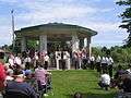 The 2007 Memorial Day service at Veterans Park next to the Milwaukee River.
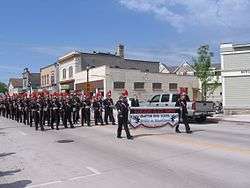 The Grafton High School The Marching Black Hawks play in downtown Grafton during the 2007 Memorial Day parade.
 Paramount Plaza in downtown Grafton during the 2007 Memorial Day parade.
References
- 1 2 "US Gazetteer files 2010". United States Census Bureau. Retrieved 2012-11-18.
- 1 2 "US Board on Geographic Names". United States Geological Survey. 2007-10-25. Retrieved 2008-01-31.
- 1 2 "American FactFinder". United States Census Bureau. Retrieved 2012-11-18.
- ↑ "Population Estimates". United States Census Bureau. Retrieved 2013-06-24.
- 1 2 "American FactFinder". United States Census Bureau. Retrieved 2008-01-31.
- 1 2 "Play the Name Game in Ozaukee". The Milwaukee Sentinel. September 4, 1967. pp. Part 5, page 1. Retrieved April 23, 2015.
- ↑ "Ozaukee County". Jim Forte Postal History. Retrieved 23 April 2015.
- ↑ "US Gazetteer files: 2010, 2000, and 1990". United States Census Bureau. 2011-02-12. Retrieved 2011-04-23.
- ↑ "Annual Estimates of the Resident Population for Incorporated Places: April 1, 2010 to July 1, 2015". Retrieved July 2, 2016.
- ↑ "Census of Population and Housing". Census.gov. Retrieved June 4, 2015.
- ↑ "ParamountsHome.Org". ParamountsHome.org. Retrieved 2016-10-31.
- ↑ Michael Taft (2005). Talkin' to Myself: Blues Lyrics, 1921-1942. Routledge. p. 479. ISBN 978-0415973786.
External links
| Wikimedia Commons has media related to Grafton, Wisconsin. |
- Village of Grafton
- Sanborn fire insurance maps: 1894 1904 1910
- Ozaukee County Transit Services
- Ozaukee County Interurban Trail
- U.S.S. Liberty Memorial-Grafton Public Library
| Central city | 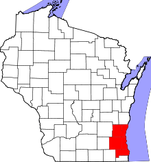 | |
|---|---|---|
| Largest municipalities (over 25,000 in 2010) | ||
| Municipalities (over 10,000 in 2010) | ||
| Smaller municipalities (under 10,000 in 2010) | ||
| Counties | ||
Municipalities and communities of Ozaukee County, Wisconsin, United States | ||
|---|---|---|
| Cities |  | |
| Villages | ||
| Towns | ||
| CDP | ||
| Unincorporated communities | ||
| Footnotes | ‡This populated place also has portions in an adjacent county or counties | |