Rainham Marshes Nature Reserve
| Site of Special Scientific Interest | |
 | |
| Area of Search |
Greater London Essex |
|---|---|
| Grid reference | TQ531800 |
| Interest | Biological |
| Area | 479.3 hectares |
| Notification | 1986 |
| Location map | Magic Map |

Rainham Marshes is an RSPB nature reserve to the east of London, adjacent to the Thames Estuary in Purfleet, Thurrock and the London Borough of Havering. In 2000, the area of land was bought from the Ministry of Defence, who used it as a test firing range.[1] With no activity for several years, the nature reserve was officially opened to the public in 2006. It has maintained much of its Medieval landscape, and is the largest area of wetland on the upper parts of the Thames Estuary.
The reserve is home to a diverse range of bird species, wetland plants and insects. It also has one of the most dense water vole populations in the country. In December 2005, the site was visited by a sociable lapwing; over 1,700 people visited the reserve to see this bird. Late in the bird's stay, four penduline tits were also found at the site. Entrance to the site is free to residents of Thurrock and the London Borough of Havering.[2]
The site is home to an environmentally friendly visitor centre which features solar panels, rainwater harvesting, natural light and ventilation and a ground heat exchange system.[3] This visitor centre, completed in 2006 at a cost £2 million, was designed by van Heyningen and Haward Architects [4] The building won six awards for its BREEAM sustainable design, including a Green Apple Award, Regeneration and Renewal Award and a Royal Institute of British Architects National Award.[5]
The site is part (77% according to a BBC article[6]) of a Site of Special Scientific Interest (SSSI) called Inner Thames Marshes,[7][8] and the part which is in the London Borough of Havering has been designated by the council as a Site of Metropolitan Importance for Nature Conservation called Wennington, Aveley and Rainham Marshes.[9][10] The area west of a drain running south from Brookway is a Local Nature Reserve (LNR), as well as being part of the SSSI.[11][12] South of the A13 road the LNR is part of the RSPB reserve, while the northern part is managed by Havering Council.
See also
- List of Sites of Special Scientific Interest in Greater London
- List of Sites of Special Scientific Interest in Essex
- Havering parks and open spaces
References
- ↑ Wetland Vision website
- ↑ RSPB - Rainham Marshes
- ↑ RSPB - About Rainham Marshes
- ↑ "RSPB Environment and Education Centre, Rainham". van Heyningen and Haward. Retrieved 2011-08-10.
- ↑ van Heyningen and Haward awards
- ↑ "Rainham Marshes - June Diary". BBC. 28 October 2014. Retrieved 25 September 2016.
- ↑ Inner Thames Marshes citation, Natural England
- ↑ "Map of Inner Thames Marshes SSSI". Natural England.
- ↑ "Wennington, Aveley and Rainham Marshes". Greenspace Information for Greater London. 2013.
- ↑ "iGiGL – helping you find London's parks and wildlife sites (map)". Greenspace Information for Greater London. 2013.
- ↑ "Rainham Marshes". Local Nature Reserves. Natural England. 6 March 2013. Retrieved 22 January 2014.
- ↑ "Map of Rainham Marshes". Local Nature Reserves. Natural England. Retrieved 22 January 2014.
External links
| Wikimedia Commons has media related to Rainham Marshes. |
Coordinates: 51°29′24″N 0°13′30″E / 51.490°N 0.225°E
| Royal parks | 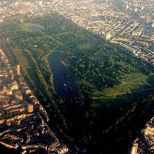 | |
|---|---|---|
| Large urban parks |
| |
| Country parks | ||
| Commons | ||
| Marshes & Wetlands | ||
| Woodland | ||
| House gardens |
| |
| Entry-fee charging | ||
| Community gardens |
| |