Woolwich Common
| Woolwich Common | |
|---|---|
|
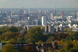
View of Woolwich Common (from Shooter's Hill) | |
| Type | common land, urban park |
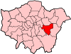
| Location | Woolwich, London |
| Coordinates | 51°28′35″N 0°03′14″E / 51.4765°N 0.0539°ECoordinates: 51°28′35″N 0°03′14″E / 51.4765°N 0.0539°E |
| Area | 60 hectares (150 acres)[1] |
| Status | military terrain (partly); conservation area |
| Public transit access | Woolwich Arsenal station |
Woolwich Common is a common in Woolwich in southeast London, England. It is partly used as military land (less than 40%)[2] and partly as an urban park[3] Woolwich Common is a conservation area. It is part of the South East London Green Chain. It is also the name of a street on the east side of the common, as well as an electoral ward of the Royal Borough of Greenwich. The population of the ward at the 2011 Census was 17,499.[4]
Location
Woolwich Common lies on the northern slope of Shooter's Hill, a 132 metres high hill in the Royal Borough of Greenwich, only a few hundred metres southwest of Woolwich town centre. It is bounded to the south side by the A207 Shooters Hill Road, although the open space continues south of this road in Oxleas Wood and Eltham Common. Academy Road (part of the A205 South Circular road) and the former Royal Military Academy form the eastern borders of the common. Repository Road and the Queen Elizabeth Hospital make up the western border. On the north side, Ha-ha Road separates the military section around the Royal Artillery Barracks from the public section. Pockets of green spaces that were once part of Woolwich Common but are now separated from the main body, remain at Green Hill and Repository Woods in the west, around Mulgrave Pond in the north and in Eaglesfield Park in the east.
History

Until the mid-18th century, Woolwich Common formed part of an open space that was much bigger than it is now. It covered a large part of the north slope of Shooter's Hill, stretching west as far as Charlton (Charlton cemetery was laid out in 1855) and continuing east in what is now Shrewsbury Park, Plumstead Common and Winn's Common. The actual common was only about 80 acres and was used for grazing cattle and sheep, as well as digging peat and gathering wood and gorse for fuel. Ownership rested with the Crown; Woolwich Common being attached to the manor of Eltham. Unlike most of Woolwich, it never became part of the Bowater estate. Because of the rapid growth of both Woolwich Dockyard and the Royal Arsenal, local people were increasingly concerned about losing their ancient rights on the common. In the 18th century parts of the common were privatized to build houses on. The Woolwich Vestry vigourously defended customary rights against enclosure when around 1760 two houses were built on the eastern edge of the common.[5][6]
In 1776 the Royal Artillery Barracks were built on land owned by the Bowater family, north of the common. However, a section of the common was added to the construction site as a future parade ground and what is now Barrack Field. The site was largely unbuilt on; the only building was the Jolly Shipwrights inn near the current location of the Second Boer War Memorial.[7] A ha-ha, built in 1778, extended westwards in 1802 and shifted southwards in 1806-08, still separates Barrack Field, the military section owned by the Ministry of Defence, from the remainder of the common. In 1777 Grand Depot Road was formed to give better access to the barracks.[8] In 1801 more land was leased by the Board of Ordnance from the Bowater family, largely to be used as military training ground (Green Hill and Repository Woods). A year later, the Board took outright possession of the land by an Act of Parliament.[9] In 1819 John Nash's Rotunda was erected here on the brow of a hill "to be appropriated to the conservation of the trophies obtained in the last war, the artillery models, and other military curiosities".[10]

Between 1796 and 1805 the Royal Military Academy was built on a site on the southeastern edge of the common where it gradually expanded. In the 19th century several military hospitals and institutions were built in its vicinity, including the Royal Herbert Hospital, Brook Fever Hospital, Victoria House and the Royal Horse Infirmary, on both sides of Shooters Hill Road. In the 1920s Memorial Hospital was added. In 2001 the remaining hospitals were replaced by the Queen Elizabeth Hospital, which takes up a site on the southwest side of the common.
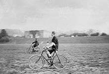
After the acquisition by the Board of Ordnance in 1802-04, Woolwich Common was kept clear for military use. To this end the greater part of its grounds were levelled and sowed to grass in 1816. This was complicated by the existence of a camp of mud huts along Ha-ha Road, built by married soldiers for their families. In 1812 they were replaced by semi-permanent married quarters on the site of the current Queen Elizabeth Hospital. These so-called Duke of York's Cottages were demolished in the late 1870s after an outbreak of diphtheria.[11] Up till the late 20th century the common was used for horse training, shooting exercises and other military activities.[12] Occasionally, it is still possible to see soldiers from the Royal Artillery Barracks and Napier Lines Barracks training on the common. In the past, parades and demonstrations were presented here to royal visitors. In 1919 en 1920 open air services took place on the common to celebrate the end of World War I.[13] In World War II the area was heavily bombed because of the military presence and the existence of a tank gun battery on the common. After the war a laboratory on Ha-ha Road was used to develop components for Britain's first nuclear weapons.[14]
In the 1730s only twenty modest houses stood along the east side of the common; in 1763 about thirty, of which seven stood empty. From the 1780s on, large houses for military officers began to replace these cottages. One of the largest belonged to Charles Hutton, professor of mathematics at the Royal Military Academy.[15] Other grand developments on this side of the common included the villas Belmont Place (1840), Clarence Place (rebuilt after a fire in 1840), Adelaide Place and Belle Vue, as well as Queen's Terrace (1830) and Kempt Terrace (1832/1850). General Gordon was born at Kempt Terrace, 29 Woolwich Common, in 1833. Between 1972 and 1975 all of this was demolished after a long and bitter conservation battle to make room for social housing (Woolwich Common Estate).[16]
Nature and leisure

Since the early 18th century Woolwich Common, more specifically Barrack Field, has been used as a cricket field, initially by Woolwich Cricket Club, since the early 19th century by the Royal Artillery Cricket Club, which until the mid-20th century only admitted officers.[17] Also in the 19th century, horseraces were held on Woolwich Common. The common was also used for football and other sports. From 1920 until around 1960 a stadium existed on the common.
During the 2012 Summer Olympics shooting took place at Barrack Field. The London Marathon passes over Woolwich Common.
These days, except for Barrack Field which is still used for sports, the common is mainly used for jogging and dog walking. In September, the Woolwich Common Funfair takes possession of a section of the common.
 Evening view
 Natural area
 Barrack Field with public access path
 Ha-ha along Barrack Field
Cultural heritage
Heritage buildings, north end

The Neoclassical façade of the Royal Artillery Barracks (James Wyatt, 1776-1802) is the longest façade in London, stretching along the north end of the common. Across the road, Government House (1781) was the quarters of the Garrison Commandant from 1855-1995 and is the only remaining grand house overlooking the common. Of the nearby Garrison Church of St George only the shell remains after it was bombed in 1944. Its Neo-Romanesque architecture and remnants of mosaics are still impressive. Situated on the northwest side of the common are Napier Lines Barracks (not listed), Green Hill Barracks and Military School, and the Rotunda. John Nash's round brick building with a leaded tent roof began life as a display space in St. James's Park during the peace celebrations in 1814 and was re-erected in Woolwich between 1819 and 1822. Until 2001 it housed the Royal Artillery Museum and now serves as a boxing ring for the King's Troop, Royal Horse Artillery in nearby Napier Lines Barracks.
 Royal Artillery Barracks
 Government House
 Ruined Garrison Church
 John Nash's Rotunda
Heritage buildings, south end
The Royal Military Academy at the south end of Woolwich Common almost mirrors the Royal Artillery Barracks at the north end. It has an almost equally long façade in Mock Tudor style and the oldest parts of the building were also designed by James Wyatt. Other military buildings that survived on this side of the common are the Royal Herbert Hospital and Victoria House, both on Shooters Hill. All three buildings have been, or currently are being converted for residential use.
 Royal Military Academy
 Royal Herbert Hospital
 Detail Herbert Hospital
 Victoria House
Monuments
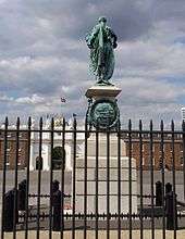
Situated on the south end of the parade ground of the Royal Artillery Barracks is the Crimean War Memorial by John Bell (1861). The bronze statue of a woman ("Honour") distributing laurel wreaths was entirely cast from Russian cannons captured at Sebastopol. On the east side of the common, along Woolwich New Road, two memorials in the shape of obelisks draw attention. The Major Little Memorial, originally a drinking fountain, dates from 1863. It is accompanied by a 19th-century drinking fountain for horses. The Second Boer War Memorial dates from around 1902. Along Repository Road several historic cannons are on display, although others were removed when the Royal Artillery left Woolwich in 2007.
 Crimean War Memorial
 Major Little Obelisk
 Second Boer War Memorial
 Drinking fountain for horses
See also
References
| Wikimedia Commons has media related to Woolwich Common. |
- Newsome, S., & A. Williams, Woolwich Common, Woolwich, Greater London. An Assessment of the Historic Environment of Woolwich Common and its Environs. Research Department Report Series #098-2009. Swindon, 2009 (online text)
- Saint, A., & Guillery, P. (ed.), Woolwich - Survey of London, Volume 48, Yale Books, London, 2012 (online text)
- 'History of Woolwich', in: Ideal homes: A history of south-east London suburbs. University of Greenwich, 2015 (online text)
- ↑ S.P.B. Mais (1939): Fifty Years of the L.C.C., p. 79 (text partially online)
- ↑ Newsome & Williams (2009), p. 1.
- ↑ "Woolwich Common and Royal Artillery Barracks". London Gardens Online. London Parks & Gardens Trust. Retrieved 14 November 2014.
- ↑ "Woolwich ward population 2011". Neighbourhood Statistics. Office for National Statistics. Retrieved 14 October 2016.
- ↑ Saint & Guillery (2012), p. 419.
- ↑ Newsome & Williams (2009), p. 6.
- ↑ Saint & Guillery (2012), p. 328.
- ↑ Saint & Guillery (2012), pp. 342-343.
- ↑ Saint & Guillery (2012), p. 350.
- ↑ Saint & Guillery (2012), pp. 354-355.
- ↑ Saint & Guillery (2012), p. 439.
- ↑ Newsome & Williams (2009), p. 9.
- ↑ Newsome & Williams (2009), pp. 21-22.
- ↑ Newsome & Williams (2009), pp. 14-18.
- ↑ Saint & Guillery (2012), pp. 420-421.
- ↑ Saint & Guillery (2012), pp. 434-437.
- ↑ Saint & Guillery (2012), p. 343.
| Royal parks | 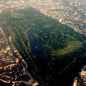 | |
|---|---|---|
| Large urban parks |
| |
| Country parks | ||
| Commons | ||
| Marshes & Wetlands | ||
| Woodland | ||
| House gardens |
| |
| Entry-fee charging | ||
| Community gardens |
| |