Rackerby, California
| Rackerby | |
|---|---|
| Census-designated place | |
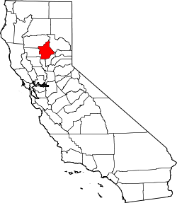
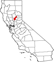
 Rackerby Location in California | |
| Coordinates: 39°26′23″N 121°20′29″W / 39.43972°N 121.34139°WCoordinates: 39°26′23″N 121°20′29″W / 39.43972°N 121.34139°W | |
| Country |
|
| State |
|
| Counties | Yuba and Butte[1] |
| Area[2] | |
| • Total | 2.954 sq mi (7.650 km2) |
| • Land | 2.954 sq mi (7.650 km2) |
| • Water | 0 sq mi (0 km2) 0% |
| Elevation[1] | 1,184 ft (361 m) |
| Population (2010) | |
| • Total | 204 |
| • Density | 69/sq mi (27/km2) |
| Time zone | Pacific (PST) (UTC-8) |
| • Summer (DST) | PDT (UTC-7) |
| GNIS feature IDs | 1659452, 2612485 |
Rackerby (formerly, Hansonville) is a census-designated place straddling the border between Butte County and Yuba County in California.[1] It is 24 miles (39 km) north-northeast of Marysville,[3] at an elevation of 1,184 feet (361 m).[1] Rackerby's population was 204 at the 2010 census.[4]
History
Rackerby post office opened in 1892 in Yuba County, moved to Butte County in 1930, and moved back in 1934.[3] The name is in honor of William M. Rackerby, its first postmaster.[3]
Demographics
The 2010 United States Census[4] reported that Rackerby had a population of 204. The population density was 69.1 people per square mile (26.7/km²). The racial makeup of Rackerby was 193 (94.6%) White, 0 (0.0%) African American, 1 (0.5%) Native American, 0 (0.0%) Asian, 0 (0.0%) Pacific Islander, 3 (1.5%) from other races, and 7 (3.4%) from two or more races. Hispanic or Latino of any race were 18 persons (8.8%).
The Census reported that 204 people (100% of the population) lived in households, 0 (0%) lived in non-institutionalized group quarters, and 0 (0%) were institutionalized.
There were 86 households, out of which 20 (23.3%) had children under the age of 18 living in them, 47 (54.7%) were opposite-sex married couples living together, 10 (11.6%) had a female householder with no husband present, 4 (4.7%) had a male householder with no wife present. There were 8 (9.3%) unmarried opposite-sex partnerships, and 3 (3.5%) same-sex married couples or partnerships. 16 households (18.6%) were made up of individuals and 6 (7.0%) had someone living alone who was 65 years of age or older. The average household size was 2.37. There were 61 families (70.9% of all households); the average family size was 2.67.
The population was spread out with 39 people (19.1%) under the age of 18, 14 people (6.9%) aged 18 to 24, 44 people (21.6%) aged 25 to 44, 70 people (34.3%) aged 45 to 64, and 37 people (18.1%) who were 65 years of age or older. The median age was 47.3 years. For every 100 females there were 100.0 males. For every 100 females age 18 and over, there were 106.3 males.
There were 106 housing units at an average density of 35.9 per square mile (13.9/km²), of which 63 (73.3%) were owner-occupied, and 23 (26.7%) were occupied by renters. The homeowner vacancy rate was 1.5%; the rental vacancy rate was 17.9%. 147 people (72.1% of the population) lived in owner-occupied housing units and 57 people (27.9%) lived in rental housing units.
References
- 1 2 3 4 "Rackerby Census Designated Place". Geographic Names Information System. United States Geological Survey.
- ↑ "2010 Census U.S. Gazetteer Files – Places – California". United States Census Bureau.
- 1 2 3 Durham, David L. (1998). California's Geographic Names: A Gazetteer of Historic and Modern Names of the State. Clovis, Calif.: Word Dancer Press. p. 543. ISBN 1-884995-14-4.
- 1 2 "2010 Census Interactive Population Search: CA - Rackerby CDP". U.S. Census Bureau. Retrieved July 12, 2014.