Soto, California
Coordinates: 39°52′37″N 122°01′15″W / 39.87694°N 122.02083°W
| Soto | |
|---|---|
| Former settlement | |
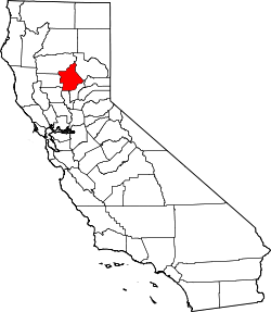
 Soto  Soto Location in California | |
| Coordinates: 39°52′37″N 122°01′15″W / 39.87694°N 122.02083°W | |
| Country | United States |
| State | California |
| County | Butte County |
| Elevation[1] | 184 ft (56 m) |
Soto is a ghost town in Butte County, California, United States. It was located 14 miles (23 km) northwest of Chico on the Southern Pacific Railroad,[2] at an elevation of 184 feet (56 m). It still appeared on maps as of 1904.
References
- ↑ U.S. Geological Survey Geographic Names Information System: Soto, California
- ↑ Durham, David L. (1998). California's Geographic Names: A Gazetteer of Historic and Modern Names of the State. Clovis, Calif.: Word Dancer Press. p. 315. ISBN 1-884995-14-4.
External links
This article is issued from Wikipedia - version of the 7/14/2016. The text is available under the Creative Commons Attribution/Share Alike but additional terms may apply for the media files.