Concow, California
| Concow | |
|---|---|
| Census designated place | |
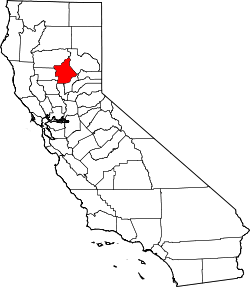
 Location in Butte County and the state of California | |
 Concow Location in the United States | |
| Coordinates: 39°44′14″N 121°30′52″W / 39.73722°N 121.51444°WCoordinates: 39°44′14″N 121°30′52″W / 39.73722°N 121.51444°W | |
| Country |
|
| State |
|
| County | Butte |
| Government | |
| • State senator | Jim Nielsen (R)[1] |
| • Assemblymember | Brian Dahle (R)[2] |
| • U. S. rep. | Doug LaMalfa (R)[3] |
| Area[4] | |
| • Total | 27.780 sq mi (71.950 km2) |
| • Land | 27.406 sq mi (70.981 km2) |
| • Water | 0.374 sq mi (0.969 km2) 1.35% |
| Elevation[5] | 2,005 ft (611 m) |
| Population (2010) | |
| • Total | 710 |
| • Density | 26/sq mi (9.9/km2) |
| Time zone | Pacific (UTC-8) |
| • Summer (DST) | PDT (UTC-7) |
| ZIP code | 95965 |
| Area code | 530 |
| FIPS code | 06-16035 |
| GNIS feature IDs | 1867007, 2407652 |
| U.S. Geological Survey Geographic Names Information System: Concow, California; U.S. Geological Survey Geographic Names Information System: Concow, California | |
Concow (formerly, Con Cow)[6] is an unincorporated community and census-designated place[7] (CDP) of 700 people in Butte County, California, United States. It is named after the Native American tribe that is indigenous to the area, the Concow Maidu . The original inhabitants ate salmon from the Feather River, acorns and pine nuts, venison, nō-kōm-hē-i'-nē, and other sources of food which abounded in the California foothills.
History
"In the beginning Wahno-no-pem, the Great Spirit, made all things. Before he came, everything on the earth and in the skies was hidden in darkness and in gloom, but where he appeared he was the light. From his essence, out of his breath, he made the sun, the moon, and the countless stars, and pinned them in the blue vault of the heavens."[8]
Colonization
There is no indication that there was external governance of the Concow region or the tribal peoples that inhabited the region during the 1697–1821 Spanish colonization or the 1821–1846 Mexican era, characterized by the spread of Californio slave ranchos. The Concow region is 20 miles north of the city of Oroville (an Anglo-Hispanic compound meaning 'gold-town') and about the same distance east of the town of Chico; named for Rancho Arroyo Chico—meaning 'little creek ranch.' Rancho Arroyo Chico was established through a land-grant from the Mexican authorities in 1844, two years before California was invaded by United States forces, an indication that there was some Mexican governance near the Concow region, but no indication of governance of the region.
Discovery
Aside from governance, starting in 1828, northern trappers including Jedediah Smith, Michel Laframboise, and John Work first made contact with the Concow region Maidu.[9] In 1851 the Beckwourth_Trail established the first transportation route to the Concow region. The route did not pass directly through the present day Concow, the trail followed a series of ridgtops 10 miles to the East. Soon began death from diseases, such as pneumonia[10] and malaria,[11] that the Maidu have no natural immunity. In addition to disease, in 1853, under the leadership of Gov. Bigler, several municipalities[12] within the State of California ordered all non-European people of California - including the Maidu - exterminated in return for a $5.00[13][14] ($134.95 in 2010 US$)[15] cash bounty for each verified male killed and a lesser cash bounty for a dead woman or child. In addition to the municipal bounty system, through funding numerous militia attacks on the native people, the resulting debt became known as the "California War Debt" or "Army Appropriations Bill".[16] In 1854 - though not entirely clear why[17][18] - Secretary of War Jefferson Davis wrote California that their 'war' expenditures could not be authorized without the original bills of sale to verify the purpose was one intended by congress.[19][20] The bill of sale for the bounty was the head. California was reimbursed $924,259.65 ($23.4M 2010US) by the United States Federal Government and again reimbursed $229,981.67 in 1861 for the intervening years.[21] Sometimes children could be sold for more than the per claim amount allowed. To maximize profits, during 'hunts' they tried to only kill children that were not old enough to work. The older children were instead enslaved[22] as provided by the Act of 1850 for the Government and Protection of Indians.[23] Assuming the $1.2M the State of California claimed in expenses for the 'War' was used entirely for $5 bounties, then this represents the death of 240,000 California natives; during that same time period the native population declined from 250,000 to less than 50,000, a comparable amount. Their fictionalized but true in spirit story is told by the real person Ishi, who may have been part or full Maidu. Ishi was from the Concow region.
Settlement
Permanent settlements soon followed and by 1856 several were well established.[6] The growth of these settlements increased after Charles Curtis constructed a toll bridge (1858) across the Feather River at Nelson's Bar and the next year (1859) an additional bridge was constructed by residents of Whiskey Town over the Feather River just North of the Concow region.[10] Basically, there was a Northernly trail and bridge from present day Oroville, and a Southernly trail and bridge from present day Magalia.
Clearances
After a decade of genocide and forcible removals, in 1859 the last of the Kon Kow peoples were forcibly removed by Tehama County ranchers as part of a larger four county 'roundup.'[24] They were held at the Mendocino Reservation until the California Reservation Administration at the camp collapsed due to lack of funding due to the Civil War occurring on the East Coast. The Kon Kow were then deported to the Nome Cult Farms at the Round Valley reservation. By 1862 the last of the native Concow inhabitants were starving on the cramped Round Valley with unrelated people relocated from surrounding regions. The damp coastal climate on the reservation contrasts with the dry climate of the California 'Gold Country' they are accustomed to. It was the midst of the North American Civil War and federal funds for California Reservations were no longer arriving.[24] In the cooling weather of late September, on September 24, 1862, a combination of the poor camp conditions, forced participation in a massacre of the local Wailaki peoples,[24] warnings by local whites that they were planning to massacre the reservation inhabitants that winter,[24] and an imminent winter disaster under the supervision of indian agent James Short[25] forced a group of over 400 men, women, children, and elderly to set out with Tome-ya-nem, without provisions, for the 130 miles back to their home in the Concow Valley: a 10-day hike for well equipped healthy young adults.[26] They made it as far as present day Chico where Agent Hanson had made an agreement with John Bidwell to stop and encamp the Kon Kow people at Bidwell's old river landing[24] - now under Lake Oroville - under the supervision of Sub Agent Eddy and employed for $.10 per hour[24] ($2.72 2013US) constructing the Chico-Humboldt road and providing labor for various employers in the area.
Massacre
The following spring three young children were attacked with the two boys killed and the kidnapped girl escaping after being forced to walk to a village near present-day Concow in what became known as the Pence massacre, the murders were within the present day Concow CDP and 9 miles from Concow Valley - the KonKow people were blamed.[27][28] These events happened amid documented incidences of local whites dressing as 'indians' and committing crimes[29] and numerous mule-trains that were attacked and plundered by the various sierra peoples; indigenous, Spanish, and whites. All indications are that the children were kidnapped by a small group of native young men. In the following days 611 KonKow people were murdered by a vigilante volunteer posse of 500 white men that sought to kill every non-white in Butte County. M.H. Wells hid 50 Kon Kows in his Yankee Hill store in the foothills above the camp at Bidwell's old river crossing; the vigilante group discovered these people. In a compromise the vigilantes inspected these people and determined four as 'bad people,' they were tied together in pairs and given a running start before the vigilantes opened fire, the rest were taken to the camp - two of the four were shot and killed.[24][27] Under a resolution passed at a mass meeting of the public at Pence Ranch on July 27[30][31][32] a group of 12 led by Thomas McDonald of Cherokee and M.H. Wells of Yankee Hill [10] found and convinced the remaining people in the surrounding area to go to the Bidwell camp for their own safety. A group of 26 led by G.G. Marquis of Concow, including Mr. Pence from Messilla Valley, B.P. Hutchinson from Cherokee Flat and John Chapman from Cherokee Ravine, gathered funds to cover the expenses for the Kon Kow peoples removal. Eventually 461 people including those who returned from Round Valley were gathered at Bidwell's Landing. From this group, for the kidnapping and killing of the Lewis children, two were tied to a tree and executed by firing squad.[33] The local US government representative Major George M. Hanson, Superintendent of Indian Affairs, Northern California, and the State Militia representative Captain Augustus W. Starr sent July 31 to assess the situation were unsure what to do with the popular movement or how to stop the acts of vigilante justice. The subsequent commanders of Camp Bidwell during the month of August, Captain Alfred Morton and then Major Ambrose E. Hooker[34] - are absent in early correspondence from Captain Starr asking for guidance with the increasing number of Konkow 'prisoners of war'.[27][35]
The End
After consulting with Superintendent Hanson and superiors Colonel Richard Cloyd Drum and General George Wright, Captain Starr was ordered by General Wright in Post Order No. 6[36] to lead 23 soldiers of Company F 2nd Regiment California Volunteer Cavalry and move the now imprisoned people the 110 miles from Camp Bidwell back to Round Valley on the Nome Cult Trail on what became a 20-day forced death march now remembered as the KonKow Trail of Tears. Despite efforts by the soldiers and the Pence resolution mandated donations of food and shelter provisions, horses and wagons, each day those who could not make the march through the hot arid early September Sacramento Valley - where afternoon temperatures top 90 °F or over the 6,000 foot crest of the North Coast Ranges - were left behind without food or water and were soon killed by a pack of wild boar that formed behind and followed the group; the survivors were told to stay at the Round Valley concentration camp or be shot on sight. They were given no provisions by the soldiers and starved to death during the winter.[9]
Bands of Rogue Natives
In 1864 a band of Kon Kow Maidu left the Round Valley reservation and again headed back to their home. The reservation agent sent a letter to the Concow post office noting their departure and that they seemed 'hostile.'[10] What became of this band is not known, the following year in August a group of 25 Kon Kow were attacked and killed after a robbery that included two murders at the Robert Workman home;[10] this became known as the Three Knolls Massacre and is seen as a smaller episode of the Mill Creek War.[37] And the following year in February, another 5 Kon Kow were killed as continued retribution for the previous years murders.[10]
Relics of Maidu
The current inhabitants of Concow, including a few Maidus, commonly find relics of the Maidu in the form of beads and stone tools while digging in and around their homes. In the Concow Lake Valley there is no monument, plaque, or other recognition to memorialize the fate of the KonKow people - few if any of the current inhabitants know.
The Commune Era
While a post office operated at Concow from 1882 to 1906, renamed from Con Cow to Concow in 1895, and relocated several times,[6] the region was sparsely populated and dominated by a few ranching families. The economy of the region rose and fell with the gold rush need for supplies, the civil war demand for pine turpentine, logging, and the water way that allowed for ranching. The economy ebbed and flowed for a hundred years under the constraint of the difficult access to the region.
In 1962 a new 4-lane alignment of California State Route 70 wrapped around the western side of the then proposed Lake Oroville and reconnected with the existing highway 70 at Jarbo Gap. The realignment placed a major throughway to the Concow region, opening the area for residential purposes and made it easier for adherents to the then blossoming 'land movement' to find inexpensive land in an undeveloped region, within commuting distance of a large metropolitan region. From this point to 2008, Concow become a haven for those escaping 'the world.' Unpermitted structures constructed with commune labor and primitive or re-purposed materials dotted the landscape and housed an eclectic community for the next 50 years.
In 2008 a 60,000 acre (large fire) wildfire destroyed 250 structures, of those 220 were unpermitted and either were not built to building codes, did not bother with building inspections, or did not use approved building materials.[38] Due to the 'land' nature of the community, affording construction following building codes was not possible initially and reconstruction to building codes is not possible or within the 'ethos' of the community.[39] The county offered special waivers for reconstruction, but the community was already gutted, those who remain are a shadow of the community.[40] Filling this void is a wave of retiring baby boomers and young couples following a current 'land movement' based on contemporary ideals but still following the core of previous movements.
Geography
According to the United States Census Bureau, the CDP has a total area of 27.78 square miles (71.9 km2), of which, 27.41 square miles (71.0 km2) of it is land and 0.37 square miles (0.96 km2) of it (1.35%) is water.
For unknown reasons the community's name was absent from the US Geological Survey files until 1990. Other nearby communities are The Pines (USGS feature ID 268203), and Deadwood (USGS feature ID 1655957). The community is off State Route 70 east of Cherokee. Concow School is shown on some maps. There is a Concow Dam, Road, and Creek nearby.
Demographics
2010
As of the census[41] of 2010, there were 710 people, 360 households, and families residing in the city. The population density was 13 inhabitants per square mile (5.0/km2). There were 360 housing units at an average density of 13 per square mile (5.0/km2). The racial makeup of the city was 85.1% White, 3.4% Native American, 0.7% Asian, 0.4% Pacific Islander, 1.4% from other races, and 8.0% from two or more races. Hispanic or Latino of any race were 7.9% of the population. here were 360 households of which 30.0% had children under the age of 18 living with them. There were 178 families, 59.0% were with children under 18 years, 146 of 178 families were husband-wife families.
2000
Population
At the 2000 census[42] the population was 1,095 and with 319 families residing in the CDP. The population density was 29.1 people per square mile (11.2/km²). There were 571 housing units at an average density of 15.2 per square mile (5.9/km²). In 2008 the Butte Lightning Complex fire destroyed 308 homes[43] In the 2010 census "the biggest [regional] percentage drop was in fire-scarred Concow, down 35.16 percent to a population of 710".[44]
Race
At the 2000 census, the racial makeup of the CDP was 90.68% White. As individuals, in the Concow CDP there are, 10 Blacks or African Americans, 25 Native Americans, 6 Asians, 12 Pacific Islanders, 12 who identify themselves as other races, 47 who identify with two or more races and 52 inhabitants of the Concow region who identify themselves as Hispanic or Latino.
Age
In the CDP the population was spread out with 23% under the age of 18, 4% from 18 to 24 (i.e., 44 individuals), 21% from 25 to 44, 34% from 45 to 64, and 18% who were 65 years of age or older. The median age was 46 years. For every 100 females there were 117.7 males. For every 100 females age 18 and over, there were 109.9 males. 24% of households had children under the age of 18 living with them. 53% were married couples living together, 8% had a female householder with no husband present, and 30% were non-families. 23% of all households were made up of individuals and 8% had someone living alone who was 65 years of age or older. The average household size was 2.4 and the average family size was 2.7.
Income
The median income for a household in the CDP was $32,000, and the median income for a family was $41,250. Males had a median income of $24,408 versus $39,479 for females. The per capita income for the CDP was $15,829. About 8% of families and 14% of the population were below the poverty line, including 27% of those under age 18 and 7% of those age 65 or over.
Industry
Historically
Historically the Concow region supported hunter-gatherer societies, turpentine extraction,[10] dairy farming, ranching, forestry, water supply, and in the areas outside the granite sands - Quartz reef mining and related industries. The region is zoned (2010 map) for timber production, 5 to 10ac foothill residential, a small area for 1ac foothill residential, and a couple small areas for commercial.[45]
Formal Market
Today, there are eight businesses/employers operating in Concow - each of these employ two or three people
- Education: Concow Elementary School
- Retail: 'The Dome' (aka Canyon Lakes Market)[46]
- Property Management: Camelot HOA
- Production: Wilsons World of Worms - aka Soil Logix
- Maintenance
- Thermalito Water and Sewer District - Lake Wilenor (aka Lake Concow)[47]
- Camelot HOA
- Concow Elementary School
- Hospitality
- Food: Scooters Cafe (technically not in Concow, but it is very close and this is the only restaurant)
Informal Market
In the late 1990s the CDP became known regionally for a significant domestic product consisting of informal market production and commerce .

The region contains marijuana agricultural production, large irrigated plantations were discovered during the 2008 fire. The 2000 domestic product from legitimate income sources is approximately $17.5 million, during and after the 2008 fires an estimated $50 million worth of marijuana was removed , indicating that the region's per-capita income is under-reported. The region's marijuana production is 1/3 of 1% of California's $14 billion (2013) dollar total production [48] . At the 2010 population of 710, that is a per capita income of $70,000 per person. The 2008 fire changed the regional micro-climate with the result that crop yields dropped.
In this list, note that 8 plants is equivalent to 1 pound processed marijuana[49], there are 16 ounces in a pound, and one ounce of processed marijuana produces one-tenth of an ounce of oil.[50][51] Several regional agencies regulate or must respond to Concow marijuana agricultural production, these are: Butte County Sheriff's Office SEU, United States Forest Service, and the Butte Interagency Narcotics Task Force(BINTF).
1996 Medical marijuana production legalized
- search for pre-2001 incidents found nothing
- 10/04/2001 marijuana grow, father of four out squirrel hunting found dead[52]
- 2002 to 2008 fire, no published incidents
- 07/04/2008 9,459 marijuana plants, valued $37,800,000[53]
- 07/10/2008 25 marijuana plants[54]
- 02/23/2009 32 pounds processed marijuana[55]
- 03/18/2009 246 pounds processed marijuana + 55 plants[56]
- 06/18/2009 processed marijuana: 3 pounds previously mailed + 12 pounds and 160 plants found at home, valued $368,000[57][58]
- 06/19/2010 man poses as federal agent and brandished a firearm to seize marijuana in Concow[59][60]
- 09/09/2010 56 marijuana plants + 200 marijuana clones
- 08/11/2011 3 pounds processed marijuana[61]
- 08/14/2011 54 + 369 marijuana plants, value $1,110 to $3,200 per pound[62] - authorities subsequently arrest witness after testifying the grow is part of a San Diego-based medical collective[63]
12/2011 the difference between informal market and formal market is sufficiently blurred at this point that adding to this list seizures less than several thousand plants or several hundred pounds of processed marijuana is not prudent[64]
- 2012 no published incidents
- 07/14/2013 2,900 marijuana plants abandoned due to water shortage[65]
- 08/16/2013 7,300 marijuana plants tended by Mexican nationals[66][67]
- 02/13/2014 terracing for large grow[68]
- 02/27/2014 2.6 pounds honey oil (26 lb processed) + 166 plants + 20 pounds processed + stolen firearms and motorcycle, Mexican nationals arrested[69]
- 07/29/2014 4,291 plants + 80 pounds processed marijuana[70]
- 11/7/2014 414 pounds processed marijuana + 83 plants (400 lb * 8 plants per pound = 3,200 plants)[71]
8/2015 due to the continued blurring over the last five years between informal and formal market, with the associated domestication of marijuana production into a cottage industry and the relation of this to households with children - adding to this list seizures involving the breakup of families is not prudent[72][73][74][75] Further, partly due to the recent surge in popularity of vaporizors, honey oil is increasingly manufactured - to maintain the ratio with plants and processed - seizures of less than several dozen pounds of honey oil will not be added to this list.[76][77]
11/2016 Non-medical marijuana production legalized.
The region is stereotypically thought of as a place for the manufacture and abuse of the US Schedule II controlled substance stimulant Methamphetamine. It is rumored that there are frequent unpublicized 'meth' raids by the Butte Interagency Narcotics Task Force (BINTF) overseen by the Butte County District Attorney's Office - but there is no citable evidence to validate these rumors.
- 08/11/2011 53.31 grams methamphetamine, value $8,000[78]
Change in economy
With the destruction of most unpermitted structures during the 2008 fire, the pattern of residences, commercial land use, informal and formal market industries, and recreational use has changed.[79] There has not been any large-scale residential development in the Concow region. The baby boomer 'bulge' was expected to result in a steady stream of retirees into the region.[80] To date, however, the population has declined despite the retirees.[41]
External links
- Concow History
- Camelot HOA
- Concow Wild Mountain Faire
- Konkow Partnership
- Lake Concow Campground
- Concow Phoenix Project
- Butte County Fire Department Battalion 1
- Concow City Data
- Yankee Hill Fire Safe Council
- Yankee Hill Historical Society
References
- ↑ "Senators". State of California. Retrieved March 20, 2013.
- ↑ "Members Assembly". State of California. Retrieved March 20, 2013.
- ↑ "California's 1st Congressional District - Representatives & District Map". Civic Impulse, LLC. Retrieved March 1, 2013.
- ↑ "2010 Census Gazetteer Files – Places – California". United States Census Bureau. Retrieved March 26, 2015.
- ↑ "Concow Census Designated Place". Geographic Names Information System. United States Geological Survey. Retrieved March 12, 2015.
- 1 2 3 Durham, David L. (1998). California's Geographic Names: A Gazetteer of Historic and Modern Names of the State. Clovis, Calif.: Word Dancer Press. p. 216. ISBN 1-884995-14-4.
- ↑ U.S. Geological Survey Geographic Names Information System: Concow, California
- ↑ "Archived copy". Archived from the original on 2010-11-12. Retrieved 2010-08-26.
- 1 2 History of the ConCow Maidu, last accessed 9/27/2011. http://www.maidu.com/maiduculture/firstcontactto1863.html
- 1 2 3 4 5 6 7 http://yankeehillhistory.com/newsApr07.pdf
- ↑ https://archive.org/stream/jstor-4575240/4575240#page/n1/mode/2up
- ↑ The West, PBS series https://www.pbs.org/weta/thewest/program/episodes/three/diggers.htm last accessed 1/26/2016
- ↑ SHORT HISTORY OF CALIFORNIA INDIANS As told by Historian Raymond "Koodie" Jeff https://web.archive.org/web/20111006082459/http://tachi-yokut.com/history2.html , last accessed 10/23/2011
- ↑ Native Americans in the Gold Rush http://www.pbs.org/wgbh/amex/goldrush/sfeature/natives_03.html last accessed 1/23/2016
- ↑ https://www.minneapolisfed.org/community_education/teacher/calc/hist1800.cfm , last accessed 10/23/2011
- ↑ New York Times, PROCEEDINGS OF CONGRESS.; SENATE. THE ARMY APPROPRIATION BILL. THE TERRITORY OF MONTANA. Published: May 20, 1864, last accessed 10/23/2011. http://www.nytimes.com/1864/05/20/news/proceedings-congress-senate-army-appropriation-bill-territory-montana.html
- ↑ Appendix to the Journals of the Senate and Assembly ... of the ..., Volume 8 By California, Appendix to the Journals of the Senate, Volume 8 - Page 509, last accessed 10/28/2011https://books.google.com/books?id=OzVNAAAAYAAJ&pg=PA509&dq=California+state+1854+army+appropriations+bill&hl=en&ei=6O-kTvKsI7DSiAKQo7jrCQ&sa=X&oi=book_result&ct=result&resnum=4&ved=0CEIQ6AEwAw#v=onepage&q&f=false
- ↑ "History of the California Old Indian War Bonds": a document with annotation by A. J. F. Phelan, 1864? http://www.oac.cdlib.org/search?query=Jefferson%20Davis;style=oac4;group=Items;idT=AFP-0230 last accessed 1/26/2016
- ↑ Journal of the Senate of the State of California, Volume 1911, Part 1 By California. Legislature. Senate, last accessed 10/28/2011. https://books.google.com/books?id=UkZNAAAAYAAJ&pg=PA227&dq=California+state+1854+army+appropriations+bill&hl=en&ei=6O-kTvKsI7DSiAKQo7jrCQ&sa=X&oi=book_result&ct=result&resnum=7&ved=0CFQQ6AEwBg#v=onepage&q&f=false
- ↑ Early California Laws and Policies Related to California Indians, California Research Bureau https://www.library.ca.gov/crb/02/14/02-014.pdf last accessed 1/26/2016
- ↑ The Congressional Globe, By United States. Congress, Francis Preston Blair, John Cook Rives, Franklin Rives, Tuesday July 25th, 1854, last accessed 10/23/2011. https://books.google.com/books?id=tT8FAAAAYAAJ&pg=PA1907&lpg=PA1907&dq=California+state+treasury+reimbursement+to+local+governments+for+indian+war+expenses&source=bl&ots=66-Wir_VzV&sig=INVq0FAUgkol0BspFbfgoj6JV7g&hl=en&ei=4eikTuCNHdHZiQLE5cR3&sa=X&oi=book_result&ct=result&resnum=3&ved=0CDAQ6AEwAg#v=onepage&q&f=false
- ↑ The Destruction of California Indians, Edited by Robert F. Heizer, University of Nebraska Press, 1993. http://weber.ucsd.edu/~rfrank/class_web/ES-110/ETHN110articles/California/Heizer_PS.pdf
- ↑ An Act for the Government and Protection of Indians April 22, 1850 (Chapter 133, Statutes of California, April 22, 1850), last accessed 10/23/2011. http://www.indiancanyon.org/ACTof1850.html
- 1 2 3 4 5 6 7 http://yankeehillhistory.com/11%20Oct%20news.pdf
- ↑ notes, page 787 note 3006, last accessed 9/27/2011. http://www.csuchico.edu/lbib/spc/bleyhl/Bleyhl_700-874.pdf
- ↑ http://www.maidu.com/images/Ghosted.pdf, last accessed 10/23/2011
- 1 2 3 Butte County CA Archives History - Books .....Indian Difficulties 1882, https://web.archive.org/web/20120421042535/http://files.usgwarchives.org/ca/butte/history/1882/historyo/indiandi55nms.txt
- ↑ Ishi the Last Yahi: A Documentary History By Robert F. Heizer, Theodora Kroeber. https://books.google.com/books?id=NcLD1rXZ2NUC&pg=PA62&lpg=PA62&dq=concow+lewis+children&source=bl&ots=iyVbPUQWje&sig=SlhVGTVaCcqvNSaLGKrxPzjxS7I&hl=en&ei=RqyEToq7BojiiAK8xZ24DA&sa=X&oi=book_result&ct=result&resnum=1&ved=0CBoQ6AEwAA#v=onepage&q=concow%20lewis%20children&f=false
- ↑ Indian-White Relationships in Northern California Essays, last accessed 9/27/2011. www.csuchico.edu/lbib/spc/bleyhl/Bleyhl_essays.pdf
- ↑ Ishi Timeline, last accessed 9/27/2011. http://www.cimcc.org/index.php?view=article&catid=49%3Aishi-education&id=62%3Aishi-education&format=pdf&option=com_content&Itemid=78
- ↑ notes, page 743 note 2805, last accessed 9/27/2011. http://www.csuchico.edu/lbib/spc/bleyhl/Bleyhl_700-874.pdf
- ↑ notes, page 743 note 2808, last accessed 9/27/2011. http://www.csuchico.edu/lbib/spc/bleyhl/Bleyhl_700-874.pdf
- ↑ Resistance to Rescue, Margaret D. Jacobs, University of Nebraska, 1997. http://digitalcommons.unl.edu/cgi/viewcontent.cgi?article=1015&context=historyfacpub&sei-redir=1#search=%22August%2028%2C%201863%20Bidwell%20Ranch%22
- ↑ On the trail of the buffalo soldier II: new and revised biographies of ... By Irene Schubert, Frank N. Schubert. https://books.google.com/books?id=rEYLD-Bx6WEC&pg=PA150&lpg=PA150&dq=%22Ambrose+Hooker%22&source=bl&ots=57fTGloMsC&sig=SlazyYxigCtdtMhsIvnJF3MejnU&hl=en&ei=YT6CTvu0F-bYiAKXufn7DA&sa=X&oi=book_result&ct=result&resnum=3&ved=0CCwQ6AEwAg#v=onepage&q=%22Ambrose%20Hooker%22&f=false
- ↑ notes, page 806 note 3086, last accessed 9/27/2011. http://www.csuchico.edu/lbib/spc/bleyhl/Bleyhl_700-874.pdf
- ↑ We were all like migrant workers here: work, community, and memory on ... By William J. Bauer, Jr., William J. Bauer (Jr.) https://books.google.com/books?id=mNERREBKYm0C&lpg=PA54&ots=z3DI1i4U13&dq=Captain%20Augustus%20Starr&pg=PA54#v=onepage&q=Captain%20Augustus%20Starr&f=false
- ↑ http://www.norcalblogs.com/yahi/2012/06/07/chapter-14-concow-and-the-thre/
- ↑ Catastrophe in Concow, by Tina Meyer and Sarah Salisbury, Chico News and Review, 8/14/2008 https://www.newsreview.com/chico/catastrophe-in-concow/content?oid=722701
- ↑ CSU Chico students help rebuild Concow http://www.csuchico.edu/ecc/documents/newsletter/ecc_connections2009s.pdf
- ↑ Concow fire victims may get break: Special ag building permits last forever, By ROGER AYLWORTH, 11/202008 http://www.orovillemr.com/general-news/20081120/concow-fire-victims-may-get-break-special-ag-building-permits-last-forever
- 1 2 "2010 Census Interactive Population Search: CA - Concow CDP". U.S. Census Bureau. Retrieved July 12, 2014.
- ↑ "American FactFinder". United States Census Bureau. Archived from the original on 2013-09-11. Retrieved 2008-01-31.
- ↑ Roger H. Aylworth $4.3 million grant to help Butte victims of 2008 fires Posted: 12/03/2010 12:13:22 AM PST http://www.chicoer.com/news/ci_16767039
- ↑ Census: Chico grows, Paradise shrinks, By AP and Staff Reports, Posted: 03/09/2011 12:09:02 AM PST http://www.chicoer.com/news/ci_17571516
- ↑ http://www.buttegeneralplan.net/products/2010-07-02_Draft_ZO/maps/ParadiseConcowYankeeHillStirlingCity_Esize.pdf
- ↑ Concow residents refuse to leave, Oroville MR News, 6/24/2008 http://www.orovillemr.com/general-news/20080624/6-pm-concow-residents-refuse-to-leave
- ↑ Water district looks at recreation for Lake Concow, Chico ER, 4/22/2009 http://www.chicoer.com/20090422/water-district-looks-at-recreation-for-lake-concow
- ↑ http://enr.construction.com/policy/legal/2013/1111-in-california-inspection-of-pot-farms-moves-out-of-the-weeds.asp
- ↑ CAULKINS, J.P. "Estimated Cost of Production for Legalized Cannabis" Working Paper WR-764-RC, RAND Drug Policy Research CenterJuly 2010. https://www.rand.org/content/dam/rand/pubs/working_papers/2010/RAND_WR764.pdf
- ↑ "How to Make Hash Oil," Concept 420, last accessed 3/14/2015.http://www.concept420.com/how-to/how-to-make-hash-oil/
- ↑ By Alison Hallett "How Hash Oil Is Blowing Up Across the U.S. — Literally," Wired Magazine, posted 02.20.13 9:30 am,last accessed 3/14/2015. http://www.wired.com/2013/02/hash-oil-explosion/
- ↑ "Briefly - Briefly - Local Stories - October 4, 2001". Chico News & Review. Retrieved 2016-04-12.
- ↑ "Pot Plants Worth $37 Million Eradicated". www.420magazine.com. Retrieved 2016-04-12.
- ↑ "10:30 p.m.: Bulletin: Camp Fire remains east of river". www.chicoer.com. Retrieved 2016-04-12.
- ↑ "Concow couple arrested for allegedly possessing marijuana for sale". Topix. Retrieved 2016-04-12.
- ↑ http://www.khsltv.com/content/topstories/story/Medical-Marijuana-Part-2-Task-Force-Makes-a/o6yJfw1He06nXETu7KTNqA.cspx
- ↑ "Arrest made in large Concow pot growing and sales operation". Topix. Retrieved 2016-04-09.
- ↑ "Arrest made in large Concow pot growing and sales operation". www.chicoer.com. Retrieved 2016-04-09.
- ↑ "Celebrifi.com". celebrifi.com. Retrieved 2016-04-09.
- ↑ "Oroville man who faked being a cop sentenced". Topix. Retrieved 2016-04-09.
- ↑ "Concow Man Arrested in BINTF Probe". Newstalk1290 KPAY. Retrieved 2016-04-09.
- ↑ "Deputies arrest witness after he testifies at hearing". www.chicoer.com. Retrieved 2016-04-09.
- ↑ By Steve Elliott "Witness Arrested After Testifying At Medical Marijuana Hearing," Toke of the Town, posted Thursday, October 20, 2011 at 12:01 pm, last assessed 3/14/2015.http://www.tokeofthetown.com/2011/10/witness_arrested_after_testifying_at_medical_marij.php
- ↑ "Trial ordered for pair arrested with pot plants". www.chicoer.com. Retrieved 2016-04-09.
- ↑ "Sacto 9-1-1: Authorities say water shortages may account for abandoned marijuana gardens - sacbee.com". The Sacramento Bee. Retrieved 2016-04-09.
- ↑ http://www.khsltv.com/content/localnews/story/Large-Concow-Pot-Bust-Leaves-Two-in-Custody/6Mmjw2wcuUe_oERSwuT72g.cspx
- ↑ Gazette, Cookie J. Arnett, The Gold City. "Pot Farm Raid in Concow". ZoomVillage. Retrieved 2016-04-09.
- ↑ "Terracing near Jordon Hill in Concow, CA," last assessed 3/14/2015. http://www.bsane.org/drupal/?q=content/terracing-near-jordon-hill-concow-ca
- ↑ "Butte County detectives bust marijuana refining labs in Concow, Magalia," ChicoER News, Posted: 04/04/14, 12:01 AM PDT, last accessed 3/14/2015. http://www.chicoer.com/general-news/20140404/butte-county-detectives-bust-marijuana-refining-labs-in-concow-magalia/1
- ↑ "BINTF busts large pot grow in Concow," Action News Now, Posted Jul 29, 2014 7:48 PM, last accessed 3/14/2015. http://www.actionnewsnow.com/news/bintf-busts-large-pot-grow-in-concow/
- ↑ "9-1-1 hang-up call leads Butte County authorities to marijuana grow; 3 arrested, 2 flee," Oroville MR News, Posted: 11/07/14, 12:01 AM PST, last accessed 3/14/2015, http://www.orovillemr.com/general-news/20141107/9-1-1-hang-up-call-leads-butte-county-authorities-to-marijuana-grow-3-arrested-2-flee
- ↑ Three arrested in Concow honey oil operation, Chico ER, 8/3/2015 http://www.chicoer.com/general-news/20150803/deputies-arrest-3-in-concow-honey-oil-lab-operation
- ↑ Lawmaker Predicts Marijuana Will Be Legal Within 5 Years, by Matt Ferner, Huffington Post, 4/2/2014 http://www.huffingtonpost.com/2014/04/02/marijuana-prohibition-ending_n_5065594.html
- ↑ Maine Voices: Let both local and larger growers coexist in Maine’s cannabis industry, by Galen Hand, Portand Press Herald, 7/27/2015http://www.pressherald.com/2015/07/27/maine-voices-maine-must-be-mindful-of-protecting-marijuana-as-a-cottage-industry/
- ↑ Medical Marijuana Business Begets A Cottage Industry of Indoor Growers, by Medical Marijuana Business Begets A Cottage Industry of Indoor Growers, CNBC, 10/29/2010http://www.cnbc.com/id/39909662
- ↑ Marijuana 'Hash Oil' Explodes In Popularity, And Kitchens, by Martin Kaste, NPR, 1/10/2014 http://www.npr.org/2014/01/10/261390781/marijuana-hash-oil-explodes-in-popularity-and-kitchens
- ↑ Court Rules That THC Wax, Honey Oil Qualify as Medical Marijuana, by Dennis Romero, LA weekly, 12/23/2014 http://www.laweekly.com/news/court-rules-that-thc-wax-honey-oil-qualify-as-medical-marijuana-5305527
- ↑ http://www.localnews1.net/files/kruger-wilfern.pdf
- ↑ Butte_Lightning_Complex Butte Lightning Complex, http://www.chicowiki.org/Butte_Lightning_Complex Butte Lightning Complex last accessed 5/3/2015
- ↑ Butte County Foothills Retirement, city data, http://www.city-data.com/forum/sacramento/2051398-warning-about-paradise-ca-retirement-town.html last accessed 5/3/2015