Marigold, California
Coordinates: 39°10′53″N 121°27′28″W / 39.18139°N 121.45778°W
| Marigold | |
|---|---|
| Former settlement | |
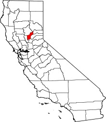
 Marigold Location in California | |
| Coordinates: 39°10′53″N 121°27′28″W / 39.18139°N 121.45778°W | |
| Country | United States |
| State | California |
| County | Yuba County |
| Elevation[1] | 108 ft (33 m) |
Marigold (formerly, Martins)[2] is a former settlement in Yuba County, California. It was located 5 miles (8.0 km) south-southwest of Browns Valley,[2] at an elevation of 108 feet (33 m). It still appeared on maps as of 1911.
A post office operated at Marigold from 1911 to 1929.[2] The name is from Marysville Gold Mining Company.[2] Gold dredging was practiced at the nearby Yuba Goldfields in the early 20th century.[2]
References
This article is issued from Wikipedia - version of the 11/19/2016. The text is available under the Creative Commons Attribution/Share Alike but additional terms may apply for the media files.