Perumbavoor

| Perumbavoor പെരുമ്പാവൂർ | |
|---|---|
| Suburb | |
|
Electricity Board Perumbavoor | |
 Perumbavoor  Perumbavoor Location in Kerala, India | |
| Coordinates: 10°07′59″N 76°28′59″E / 10.1330°N 76.4830°ECoordinates: 10°07′59″N 76°28′59″E / 10.1330°N 76.4830°E | |
| Country |
|
| State | Kerala |
| District | Ernakulam |
| Government | |
| • Type | Municipality |
| • Municipal Chairperson | Sathy Jayakrishnan |
| • Municipal Vice Chairperson | Nisha Vinayan |
| Area | |
| • Total | 13.61 km2 (5.25 sq mi) |
| Elevation | 33 m (108 ft) |
| Population (2011) | |
| • Total | 28,110 |
| • Density | 2,065.4/km2 (5,349/sq mi) |
| Languages | |
| • Official | Malayalam, English |
| Time zone | IST (UTC+5:30) |
| Telephone code | 0484 |
| Vehicle registration | KL-40 |
| Coastline | 0 kilometres (0 mi) |
| Nearest city | Kochi |
| Climate | Tropical monsoon (Köppen) |
| Avg. summer temperature | 35 °C (95 °F) |
| Avg. winter temperature | 20 °C (68 °F) |
| Website |
[ www |


Perumbavoor is a municipality in Ernakulam District in the Indian state of Kerala. It lies in the North Eastern tip of the Greater Cochin area and is also the headquarters of Kunnathunad Taluk. Perumbavoor is famed in the state for wood industries and small-scale industries. Ernakulam lies 33 km southwest of Perumbavoor. The town lies between Angamaly and Muvattupuzha on the Main Central Road (MC), which connects Thiruvananthapuram to Angamaly through the old Travancore part of Kerala. Perumbavoor lies in the banks of rivers Periyar and Muvattupuzha.Perumbavoor is the land of merchant's and business.
Perumbavoor has many immigrants from other parts of India mostly from West Bengal, Orissa, Uttar Pradesh etc. Most work in the plywood or other industries. Tamils and Nepalese have special colonies of their own.
History
Perumbavoor municipality was formed in 1936. It was one among the 4 Panchayats sanctioned by Sir C. P. Ramaswamy Iyer (Diwan-Thiruvithamcore). The others were Paravur, Nedumangad and Boothapandi.[1] Kandanthara is the nearest place & most populated area in perumbavoor, which is the largest Muslim Jamaath in Ernakulam district. Thandekkad is 4 km far from perumbavoor through Aluva Munnar Road (Private bus route). The name perumbavoor is coming from perumba+oor , were 'perum' means 'big' and 'oor' means 'place'. Others opinion is that, the name coming from perumbambu+oor 'perumbammbu' means 'pythons'-a non venomous snake 'oor' means 'place'. In olden times , most of the places are thick forest and full of pythons were Tamil peoples are coming first for hunting pythons to make sidha medicines and snake meat, snake fat etc.
Politics
Perumbavoor assembly constituency is a part of Chalakudy (Lok Sabha constituency). Eldhose Kunnapilly is the current MLA from Perumbavoor and Malayalam film artist Innocent is the current MP for Perumbavoor (Chalakudy (Lok Sabha constituency)).
Judicial Institutions
Its jurisdiction formerly encompassed the towns of Alwaye and Kolenchery, which were separated later. It has a Chief Judicial Magistrate's court, Motor Accident Claims Tribunal, Subordinate Judge's Court (Sub-court).
Economy
Perumbavoor is a predominantly agricultural town and Asia's Largest plywood industries. Commodities like rubber, pepper, ginger, turmeric, plantain, vegetables, coconut, nutmeg, cocoa, rice, arecanut, cloves, etc. are traded every day in the local market. Most of these commodities are supplied to mainstream exporters in Kochi or to local retailers. Rest of the economy is shared by government and private sectors and small industries. Perumbavoor is an important city for timber trade in Kerala.
Industries/Manufactures
- Ideal Timber Industries
- Nila Timber Traders
- Galaxy Plywoods
- South Indian Saw Mill
- Thukalil Estates
- Kattarukudiyil Timber Mills And Industries
- Perfect Sawmill and Industries
- South Indian Logistics
- F&F Furniture Store
- Thukalil Warehouses
- A P K Timber Industries
- Ummani Vineers and Plywoods
- Swapna Plywoods
- Molecules Mineral Water Plant
Migrant Workers
The economy of Perumbavoor town is highly dependent upon hundreds of thousands of migrant workers from north India. Some of them are associated with crime and drug trafficking. Recently Kerala Police arrested 12 persons for possessing banned drugs.[2]
Transportation
KL-40 is the RTO code for Kunnathunad Taluk and Perumbavoor. Perumbavoor JRTO is situated at Pattal. Perumbavoor has got a KSRTC Subdepot operating several long distance services to places inside and outside Kerala. Private bus services run into several neighbouring towns. AutoRickshaws are commonly used for small distances. There is frequent bus services to Ernakulam, Aluva, Angamaly, Kothamangalam, Muvattupuzha, Kolenchery,Thrippunithura,North Paravur etc. from here. The nearest railway stations are Angamaly and Aluva. The Cochin International Airport at Nedumbassery is only 14 km from the town.
Perumbavoor is surrounded by many small but populous commuter villages, connected to the town by bus services. The notable ones are Vallam, Koovappady, Vengola, Mudickal, Thottuva, Ponjassery, Manjappetty, Kodanad, Alattuchira, Panamkuzhy, Cheranalloor, Nedungapra, Malayidomthuruth etc. Kuruppampady town, is one of the main interchange points for public transport.
Educationl Organizations
- Jai Bharath Arts And Science College, Perumbavoor
- KMP College of Arts & Science, Perumbavoor
- Adishankara Institute of Engineering Technology
- Jama-ath Higher Secondary school, Thandekkad
- Nusrathul Islamic V.H.S.S, Marampally
- Queen Mary's English Medium High School, Mudickal
- Govt.H.S.S, Mudickal
- Asram Higher Secondary School
- Govt Boys Higher Secondary School
- Govt Girls Higher Secondary School
Healthcare
Even though Perumbavoor has a Government Taluk Headquarters hospital, and several private hospitals,numerous dental health care centers, hi-tech labs, health care sector remains underdeveloped especially for trauma, emergency and speciality health care.
Places of worship
- Meca Masjid, A.M Road perumbavoor
- Madina Masjid, Near Pvt bus stand perumbavoor
- Akashwani Masjid, Near Pathipalam, perumbavoor
- Kandanthara Juma Masjid, Kandanthara, perumbavoor
- Juma Masjid Mudickal (3.5 km) The second largest Masjid in Kerala.
- Chelattu kavu, mookambika & bhadhrakali temple, Aimury
- Perumbavoor Sri Dharmasastha Temple
- Koottumadom Sree Subramanya Swami Temple, Rayamangalam
- Iringol kavu which is the largest Kavu in Kerala
- Thottuva Dhanwanthari temple (8 km from Perumbavoor)
- Perumbavoor Jacobite Syriac Orthodox Church
- San Thome Malankara Catholic Church, MC Road, Perumbavoor Town
- Bethel Sulukko Jacobite Syrian Orthodox Cathedral, Perumbavoor Town
- St. Mary's Jacobite Syrian Cathedral, Kuruppampady is one of the oldest churches in Perumbavoor
- St. Mary's Catholic Church, MC Road. Perumbavoor Town
- St. George Latin Catholic Church, MC Road. Perumbavoor
- Evangelistic Association of the East, Head Office & Orphanage
How to Reach
Perumbavoor, lies in the north eastern corner of Kochi urban area. The geographic advantages of Perumbavoor is that, NH 47 lies closer to this town apart from Main Central Road and Aluva-Munnar highway passing through this place. Perumbavoor is surrounded by important towns like Aluva, Muvattupuzha, Angamaly etc. in close distances. Important suburban regions of Kochi like Aluva, Kalamassery, Kakkanad, Thrippunithura are all in close proximity to Perumbavoor.
- Kochi- Edapally-Pookkattupady-Chembarakky (34 km)
- Thodupuzha- Vazhakkulam-Muvattupuzha-Keezhillam (41 km)
- Thrissur- Chalakudy-Angamaly (59 km)
- Alappuzha- Cherthala-Kundannoor Junction-Petta Junction-Pallikkara-Kizhakkambalam (85 km)
- Munnar- Pallivasal-Adimaly-Kothamangalam (98 km)
- Kozhikode- Feroke-Parappanangadi-Tirur-Ponnani-North Paravur-Aluva (180 km)
- Trivandrum- Kottarakkara-Changanassery-Kottayam-Muvattupuzha (228 km)
See also
References
External links
| Wikimedia Commons has media related to Perumbavoor. |
Image Gallery
Pictures of the town taken on 9 July-2012 at 8:00 AM
 Perumbavoor Kalady Road
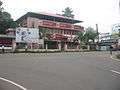 Perumbavoor GOV Hospital Junction
 Perumbavoor GOV Hospital
 Perumbavoor Vegetable Market CUM Shopping Complex
 Perumbavoor Flower Shop
 Perumbavoor Shopping Complex
Location
|
