Palakkad
| Palakkad പാലക്കാട് | |
|---|---|
| City | |
|
Nenmara paddy fields | |
 Palakkad  Palakkad | |
| Coordinates: 10°46′12″N 76°39′00″E / 10.7700°N 76.6500°ECoordinates: 10°46′12″N 76°39′00″E / 10.7700°N 76.6500°E | |
| State | Kerala |
| District | Palakkad District |
| Government | |
| • Type | Municipality |
| • Body | Palakkad Municipality |
| • Municipal Chairperson | Prameela Sasidharan (BJP) |
| • District Collector | Mary Kutty issac IAS |
| Population (2011)[1] | |
| • City | 130,955 |
| • Rank | 6 th |
| • Metro[2] | 2,93,566 |
| Languages | |
| • Official | Malayalam, English |
| Time zone | IST (UTC+5:30) |
| PIN | 678001 |
| Telephone code | Palakkad: 91-(0)491 |
| Vehicle registration |
KL-09 (Palakkad) KL-49 (Alathur) KL-50 (Mannarkkad) KL-51 (Ottappalam) KL-52 (Pattambi) KL-72 (Chittur) |
| Literacy | 94.20% |
_Dance_at_54th_Kerala_School_Kalolsavam_2014_at_Palakkad..JPG)
Palakkad (Malayalam: പാലക്കാട്) ![]() pronunciation , also known as Palghat, is a city and municipality in the state of Kerala in southern India, spread over an area of 26.60 km2 and is the administrative headquarters of the Palakkad District. In earlier times, Palakkad was known as Palakkattussery. Palakkad is the seventh most populous town in Kerala and lies near the Palghat Gap. Malayalam is the generally spoken language in Palakkad. The city is situated about 350 kilometres (217 mi) north of state capital Thiruvananthapuram and 54 kilometers south west of Coimbatore, and 66 km north east of Thrissur on the Salem-Kanyakumari National Highway NH 47.
pronunciation , also known as Palghat, is a city and municipality in the state of Kerala in southern India, spread over an area of 26.60 km2 and is the administrative headquarters of the Palakkad District. In earlier times, Palakkad was known as Palakkattussery. Palakkad is the seventh most populous town in Kerala and lies near the Palghat Gap. Malayalam is the generally spoken language in Palakkad. The city is situated about 350 kilometres (217 mi) north of state capital Thiruvananthapuram and 54 kilometers south west of Coimbatore, and 66 km north east of Thrissur on the Salem-Kanyakumari National Highway NH 47.
Etymology
The commonly held belief is that the name Palakkad is a fusion of two Malayalam words, Pala, which was the name given for barren land during the Sangam period, and Kadu, which means forest.[3]


Geography

Palakkad is the gateway to Kerala due to the presence of the Palakkad Gap, in the Western Ghats. Malayalam is the generally spoken language in Palakkad as it is the official language. The town is blessed with many small and medium rivers, which are tributaries of the Bharathapuzha River. Of the number of dams in Palakkad district, the largest Malampuzha dam is 12 km from Palakkad town.[4]
Climate
Palakkad has a tropical wet and dry climate. Temperatures remain moderate throughout the year, with exception in March and April being the hottest months. A very high amount of precipitation is received in Palakkad, mainly due to the South-West monsoon. July is the wettest month, and the total annual rainfall is around 83 inches (211 cm).
| Climate data for Palakkad | |||||||||||||
|---|---|---|---|---|---|---|---|---|---|---|---|---|---|
| Month | Jan | Feb | Mar | Apr | May | Jun | Jul | Aug | Sep | Oct | Nov | Dec | Year |
| Average high °C (°F) | 33.0 (91.4) |
35.4 (95.7) |
37.3 (99.1) |
36.5 (97.7) |
34.0 (93.2) |
29.7 (85.5) |
28.3 (82.9) |
28.8 (83.8) |
30.3 (86.5) |
31.2 (88.2) |
31.8 (89.2) |
31.9 (89.4) |
32.35 (90.22) |
| Average low °C (°F) | 21.8 (71.2) |
22.6 (72.7) |
24.2 (75.6) |
25.1 (77.2) |
24.8 (76.6) |
23.2 (73.8) |
22.5 (72.5) |
22.9 (73.2) |
23.0 (73.4) |
23.2 (73.8) |
22.9 (73.2) |
22.2 (72) |
23.2 (73.77) |
| Average precipitation mm (inches) | 3.5 (0.138) |
6.7 (0.264) |
20.4 (0.803) |
72.9 (2.87) |
151.7 (5.972) |
408.2 (16.071) |
522.6 (20.575) |
317.6 (12.504) |
253.9 (9.996) |
215.2 (8.472) |
111.1 (4.374) |
27.6 (1.087) |
2,111.4 (83.126) |
| Source: [5] | |||||||||||||
Transport
Air
The nearest international airport is Coimbatore International Airport, which is about 62 km from Palakkad.
There has been a proposal for a mini domestic airport at East Yakkara with respect to setting up domestic airports for enhanced air connectivity by the civil aviation ministry of India. 60 acres has been identified for the project at East Yakkara Palakkad.[6]
Railways
There are two railway stations serving Palakkad - Palakkad Junction is a broad gauge railway junction (located at Olavakkode, which can be called a satellite town, about 4 km from the heart of the main town) and Palakkad Town railway station located in the heart of the Palakkad town. Close to Palakkad Junction is the office of Palakkad Railway Division. The cities of Coimbatore, Erode, Salem, Thiruvananthapuram, Kollam, Kozhikode and Ernakulam are connected by the broad gauge line. Train services to Pollachi, Dindigul and Madurai are through the broad gauge line through Palakkad Town station.[7]
Road
Palakkad is well connected by roads. The National Highway 47 from Salem to Kanniyakumari via Coimbatore, Palakkad, Thrissur, Kochi, Alappuzha, Kollam and the Palakkad – Kozhikode National Highway 213 via Malappuram pass through the district.[8]
Demographics
As per Census 2011, population of Palakkad in 2011 is 130,955; of which male and female are 63,833 and 67,122 respectively.[9] Total literates in Palakkad city are 112,479 of which 56,065 are males while 56,414 are females. Average literacy rate of Palakkad city is 94.20 percent of which male and female literacy was 96.83 and 91.73 percent.[10][11] Hindus form 68% of the population with 89098 members.[9] Muslims constitute 27.9% of the population with 36620 members.[9] Christians constitute 3.8% of the population with 5006 members.[9]
The metropolitan area of Palakkad includes Hemambikanagar, Marutharode, Palakkad municipality, Pirayiri, Pudussery Central, Pudussery West, and Puthuppariyaram.[11] Its urban / metropolitan population is 293,566 of which 143,650 are males and 149,916 are females. The literacy rate of Palakkad Metropolitan Area is 92.14%, much higher than the national average of 59.5%. Malayalam is the most spoken language.[10]
Tourist attractions
- Palakkad Fort – Fort dating from 1766, built by Hyder Ali of Mysore. In 1784, after a siege which lasted eleven days, the British Colonel Fullerton stormed the Fort.[12] Later it fell into the hands of the Zamorin’s troops, but was recaptured by the British in 1790.[13] This well-preserved fort is also known as Tipu's (Tipu Sultan, son of Hyder Ali) Fort. Today there is a functioning jail and Hanuman Temple in the fort grounds.
- Jainimedu Jain Temple of Jainimedu – Situated on the western border of Palakkad town and not far from the railway station, this is an historic Jain Temple. The area around the temple is known as Jainimedu. This is one of the few places in Kerala where vestiges of Jainism in Kerala have survived without substantial damage.[14] The granite walls are devoid of decoration. The temple, 32 feet (9.8 m) long and 20 feet (6.1 m) wide, consists of four divisions with images of Jain Thirthankaras and Yakshinis in three of them. Kumaran Asan wrote his monumental poem Veena Poovu (the fallen flower) at a Jain house here during his brief stay with his master Sri. Narayana Guru.[15]
- Kalpathy One of the 21 Agraharams of Palakkad District on the banks of the Kalpathy river, famous for its annual Ratholsavam (Temple car Festival) and annual music festival. One of the oldest settlements of Tamil Brahmins in Kerala, it dates back to the 15th century. These Brahmins speak both Malayalam and Tamil.[16]
- Malampuzha Dam and Gardens -Malampuzha Dam is located eight km from Palakkad town. It was built in 1955 and the garden was renovated recentlly. The main attractions are the suspension bridge, the cable car ride and the fantasy park. There are several gardens including one cute Japanese garden. The Yakshi statue of Kanayi Kunhiraman is also reputed even though the nudity of the structure is not approved by the conservative society of Kerala. The dam is accessible by bus and the last bus returns to town by 8.00 pm. The nearest railway station is Palakkad Junction which is otherwise known as Olavakkod.
Other landmarks
- Vadakkanthara Thirupurakkal Bhagavathy temple is a popular Bhagavathy temple in Palakkad town situated at Vadakkanthara.Meenkulathi Bhagavathi and Perungottukavu Bhagavathi Temple is another famous Temple in Palakkad.Prad.[17]
- Velliangadi Sree Mariamman KovilPalakkad's biggest Mariamman pooja maholsavam temple.
- Velliangadi Sree Karnaki Amman Temple opposite Mariamman temple.
- Manappullikavu temple: Hindu religious place situated near the N.H.47 on the eastern side of the town.[18][19]
- Viswanatha Swamy Temple or locally as kundukovil is a famous Hindu temple located in the Kalpathy village of Palakkad
- Mannakulam Makham
- C.S.I Church of Hope : The only remaining presbytirian church in Palakkad town which was built by the Basel mission missionaries on 1910 situated in Mepparamba (also known as Melparamba) on the western side of the town. The congregation started in 1866.[20][21]
- Holy Trinity Church
- Fort Anjaneya Temple:an anjaneya temple inside palakkad fort
- Kunnathurmedu Sreekrishna Temple
- Chinmaya Mission Guruvayuappa Temple
Education
- Govt Medical College Palakkad
- Govt. College, Chittur
- Kerala State Civil Service Academy
- Govt. Victoria College Palakkad
- Mercy College
- Chembai Memorial Government Music College
- VV College,Kanjikode
- Co-Operative Arts & Science College, Olavakkode
- Yuvakshetra College
- Indian Institute of Technology Palakkad
- Government Engineering College, Sreekrishnapuram, Palakkad
- NSS College of Engineering, Palakkad (Government Aided)
- Ahalia School of Engineering and Technology
- Ahalia Ayurvedic Medical College
- Ammini College of Engineering
- Aryanet Institute of Technology
- Prime College of Engineering
- Sreepathy Institute of Management and Technology
- SI-MET College of Nursing, Malampuzha, Palakkad
There are 972 schools in Palakkad district including 196 highschools.
- Basel Evangelical Mission Higher Secondary School(BEM HSS)
- Vasavi Vidhyalaya CBSE School,Palakkad
- Kanikkamatha Convent - English Medium Higher Secondary School[22]
- St. Thomas Convent School,Olavakkode
- Bharatha Matha Higher Secondary School
- Guardian public school,Para
- st.raphael's higher secondary school,Chakkanthara
- Vyasa Vidya Peethom cbse school
- Holy Trinity School, Kanjikode
- Palghat Lions Senior Secondary school
- st.Agnes public school
- Govt. Boys Higher Secondary School, Chittur
Suburbs and villages
- Kannadi
- Vadakkumuri
- Prayiri
- Maruthorode
- Akathethara
- Pudussery West
- Pudussery Central
- Puthuparriyaram
- Hemambika Nagar
- Tattamangalam
Image gallery
-
Kathakali Dance at 54th Kerala School Kalolsavam
-
Ayodhya Shri Rama Temple
-
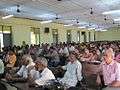
Wikipedia Meet in Palakkad
-

View from outside the northern wall of Palakkad Fort
-
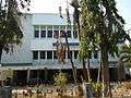
Victoria College
-

Officer's Club, V.H.Road
-
Town Hall, Palakkad
-
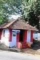
Jain Temple, Palakkad
-
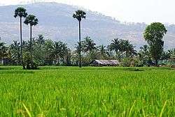
Paddy fields in Palakkad
-
Mc Donalds Palakkad
See also
- Political Divisions of Palakkad District
- Palakkad Gap, mountain pass in the Western Ghats
- Palakkad District
- Malampuzha
References
- ↑ "Census of India Search details". censusindia.gov.in. Retrieved 10 May 2015.
- ↑ "Thrissur City" (PDF). Census2011. Retrieved 3 November 2011.
- ↑ A. Sreedhara Menon (1978). Kerala Samskāram. DC Books. p. 237. ISBN 9788126415854.
- ↑ Fact sheet on Indian dams at Diehardindian.com
- ↑ "climate of palakkad, palakkad climate, palakkad climate information, weather and climate of palakkad, palakkad climate information, temperature in palakkad, palakkad temperature, temperature data of palakkad, climate data of palakkad, climate and rainfall information of palakkad, palakkad weather and climate". Delhitourism.com. Retrieved 2013-12-30.
- ↑ "60 Acres Identified For Airport Project". The Hindu. Chennai, India. 2011-05-21.
- ↑ "Train services resume on Pollachi – Palakkad section". Coimbatore. The Hindu. November 17, 2015. Retrieved 25 November 2015.
- ↑ "National Highways and their lengths". National Highways Authority of India. Retrieved September 4, 2015.
- 1 2 3 4 http://www.censusindia.gov.in/2011census/C-01/DDW32C-01%20MDDS.XLS
- 1 2 "Palakkad - Census of India". Censusindia.gov.in. Retrieved September 4, 2015.
- 1 2 "Palakkad Urban Region". Census2011.co.in. Retrieved September 4, 2015.
- ↑ ^ Imperial Gazetteer of India, v. 19, p. 358. http://dsal.uchicago.edu/reference/gazetteer/pager.html?objectid=DS405.1.I34_V19_364.gif
- ↑ Pankaja Srinivasan (2011-09-23). "Life & Style / Metroplus : The story of a forgotten fort". Chennai, India: The Hindu. Retrieved 2011-10-18.
- ↑ When Haider Ali set about restoring the fort, he is said to have used granite from the nearby Jain Medu. http://www.thehindu.com/life-and-style/metroplus/article2479470.ece
- ↑ Kerala Tradition & Fascinating Destinations - Biju Mathew - Google Books. Books.google.com. Retrieved 2013-07-20.
- ↑ "Kerala / Palakkad News : Kalpathy to become first heritage village in State". Chennai, India: The Hindu. 2008-02-03. Retrieved 2011-10-18.
- ↑ "Splendour". The Hindu. Chennai, India. 2011-05-12.
- ↑ "Temple festivals attracting foreign tourists". The Hindu. Chennai, India. 2007-04-22.
- ↑ "Bhagavati in ethereal surroundings". The Hindu. Chennai, India. 2002-06-14.
- ↑ "mission 21 / Basel Mission Image Archive". Digitallibrary.usc.edu. 1906-09-18. Retrieved 2013-12-30.
- ↑ "mission 21 / Basel Mission Image Archive". Digitallibrary.usc.edu. 1906-09-18. Retrieved 2013-12-30.
- ↑ http://www.kanikkamatha.in/
External links
| Wikimedia Commons has media related to Palakkad. |
-
 Palakkad travel guide from Wikivoyage
 - http://www.palakkad.gov.in - Official Website of Palakkad District Administration
- http://www.palakkadtourism.org - Palakkad District Tourism-Information