Perryopolis, Pennsylvania
| Perryopolis, Pennsylvania | |
|---|---|
| Borough | |
| Etymology: Oliver Hazard Perry | |
 Location of Perryopolis in Fayette County | |
 Perryopolis  Perryopolis Location in Pennsylvania | |
| Coordinates: 40°5′9″N 79°45′8″W / 40.08583°N 79.75222°WCoordinates: 40°5′9″N 79°45′8″W / 40.08583°N 79.75222°W | |
| Country | United States |
| State | Pennsylvania |
| County | Fayette |
| Established | 1814 |
| Government | |
| • Mayor | Tim Smith |
| Area | |
| • Total | 1.53 sq mi (4.0 km2) |
| • Land | 1.53 sq mi (4.0 km2) |
| • Water | 0.0 sq mi (0 km2) |
| Elevation | 1,010 ft (310 m) |
| Population (2010) | |
| • Total | 1,784 |
| • Density | 1,164.6/sq mi (449.7/km2) |
| Time zone | EST (UTC-4) |
| • Summer (DST) | EDT (UTC-5) |
| ZIP code | 15473 |
| Area code(s) | 724 |
Perryopolis is a borough in Fayette County, Pennsylvania, United States, part of the Pittsburgh metropolitan area. The population was 1,784 at the 2010 census.[1]
History
George Washington purchased 1,644 acres (6.65 km2) here when land first became available. He visited in 1770 and said, "as fine a land as I have ever seen, a great deal of rich meadow; it is well watered and has a valuable mill seat." The mill would eventually be completed in 1776. Once the mill was finished, it encouraged other business to come to the area to support and augment the business of the mill.
Washington hoped to develop the remainder of Perryopolis, drawing up plans for the streets to be laid out in the shape of a wagon-wheel. Washington's estate sold the land after his death; in 1814 Perryopolis, previously known as "New Boston", was officially laid out using Washington's plans and named for Oliver Hazard Perry for his victory on Lake Erie during the War of 1812.
In the late 19th century, the area around Perryopolis was first mined for coal. Until the 1950s, coal industries would be the area's primary economic activitiy, served by the Washington Run branch of the P&LE Railroad that continued on to Star Junction. However, Perryopolis developed differently from other nearby mining towns. Instead of housing laborers, Perryopolis was mainly inhabited by foremen and white collar workers who were associated with the mining industry.
The Karolcik Building, St. Nicholas Byzantine Catholic Church, Searight's Fulling Mill, and Youghiogheny Bank of Pennsylvania are listed on the National Register of Historic Places.[2] In 2011 it was named one of the top 50 cleanest towns in Pennsylvania.
Geography
Perryopolis is located in northern Fayette County at 40°5′9″N 79°45′8″W / 40.08583°N 79.75222°W (40.085969, -79.752088).[3] Pennsylvania Route 51 passes through the west side of the borough, leading north 31 miles (50 km) to Pittsburgh and south 15 miles (24 km) to Uniontown.
According to the United States Census Bureau, the borough has a total area of 1.53 square miles (3.97 km2), all of it land.[1]
Perryopolis is the center of the Frazier School District.
Demographics
| Historical population | |||
|---|---|---|---|
| Census | Pop. | %± | |
| 1880 | 321 | — | |
| 1960 | 1,799 | — | |
| 1970 | 2,043 | 13.6% | |
| 1980 | 2,139 | 4.7% | |
| 1990 | 1,833 | −14.3% | |
| 2000 | 1,764 | −3.8% | |
| 2010 | 1,784 | 1.1% | |
| Est. 2015 | 1,728 | [4] | −3.1% |
| Sources:[5][6][7] | |||
As of the census of 2000,[6] there are 1,764 people, 798 households, and 513 families residing in the borough. The population density is 989.6 people per square mile (382.6/km²). There are 831 housing units at an average density of 466.2 per square mile (180.3/km²). The racial makeup of the borough is 99.21% White, 0.11% African American, 0.28% Asian, and 0.40% from two or more races. 0.17% of the population are Hispanic or Latino of any race.
There are 798 households, out of which 22.6% have children under the age of 18 living with them, 52.4% are married couples living together, 9.8% have a female householder with no husband present, and 35.7% are non-families. 33.0% of all households are made up of individuals, and 20.8% have someone living alone who is 65 years of age or older. The average household size is 2.21 and the average family size is 2.81.
In the borough the population is spread out, with 17.7% under the age of 18, 6.9% from 18 to 24, 25.1% from 25 to 44, 26.0% from 45 to 64, and 24.3% who are 65 years of age or older. The median age is 45 years. For every 100 females there are 86.9 males. For every 100 females age 18 and over, there are 82.2 males.
The median income for a household in the borough is $33,092, and the median income for a family is $43,676. Males have a median income of $34,667 versus $23,854 for females. The per capita income for the borough is $17,829. 6.8% of the population and 4.3% of families are below the poverty line. Out of the total population, 7.8% of those under the age of 18 and 5.3% of those 65 and older are living below the poverty line.
- Photo Gallery
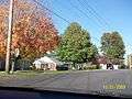 Typical mid-20th century housing
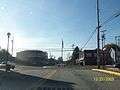 Town square
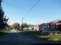 Suburban style housing
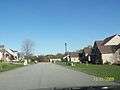 New housing development
 Frazier High School
 St. Nicholas Greek Catholic Church
References
- 1 2 "Geographic Identifiers: 2010 Census Summary File 1 (G001), Perryopolis borough, Pennsylvania". American FactFinder. U.S. Census Bureau. Retrieved July 8, 2016.
- ↑ National Park Service (2010-07-09). "National Register Information System". National Register of Historic Places. National Park Service.
- ↑ "US Gazetteer files: 2010, 2000, and 1990". United States Census Bureau. 2011-02-12. Retrieved 2011-04-23.
- ↑ "Annual Estimates of the Resident Population for Incorporated Places: April 1, 2010 to July 1, 2015". Retrieved July 2, 2016.
- ↑ "Census of Population and Housing". U.S. Census Bureau. Retrieved 11 December 2013.
- 1 2 "American FactFinder". United States Census Bureau. Retrieved 2008-01-31.
- ↑ "Incorporated Places and Minor Civil Divisions Datasets: Subcounty Resident Population Estimates: April 1, 2010 to July 1, 2012". Population Estimates. U.S. Census Bureau. Retrieved 11 December 2013.
External links
| Counties |  Map of the Pittsburgh Tri-State with green counties in the metropolitan area and yellow counties in the combined area. | |
|---|---|---|
| Major cities | ||
| Cities and towns 15k-50k (in 2010) | ||
| Airports | ||
| Topics | ||
| ||
Municipalities and communities of Fayette County, Pennsylvania, United States | ||
|---|---|---|
| Cities | 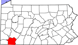 | |
| Boroughs | ||
| Townships | ||
| CDPs | ||
| Unincorporated communities | ||
| Footnotes | ‡This populated place also has portions in an adjacent county or counties | |