Pantnagar Airport
| Pantnagar Airport पंतनगर हवाई अड्डा | |||||||||||
|---|---|---|---|---|---|---|---|---|---|---|---|
| IATA: PGH – ICAO: VIPT | |||||||||||
| Summary | |||||||||||
| Airport type | Public | ||||||||||
| Operator | Airports Authority of India | ||||||||||
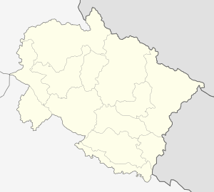
| Location | Pantnagar | ||||||||||
| Elevation AMSL | 764 ft / 233 m | ||||||||||
| Coordinates | 29°01′56″N 079°28′27″E / 29.03222°N 79.47417°E | ||||||||||
| Map | |||||||||||
 PantNagar Location of airport in India | |||||||||||
| Runways | |||||||||||
| |||||||||||
Pantnagar Airport (IATA: PGH, ICAO: VIPT) is a domestic airport located in Pantnagar of Udham Singh Nagar district in the Indian state of Uttarakhand. It is operated by the Airports Authority of India. It is the nearest airport to the Kumaon hill stations of Nainital (65 km), Bhimtal (50 km), Ranikhet (110 km) and Almora (120 km) and the Jim Corbett National Park (120 km).[2][3]
History
The airport was able to accommodate only small aircraft until 2008, when the length of the runway was increased to 4,500 feet to accommodate larger turboprop aircraft at a cost of ₹75 crores.[4]
The Government of Uttarakhand had offered a subsidy to Jagson Airlines between 2005 and 2008, to undertake daily scheduled flights between Pantnagar and Indira Gandhi International Airport, Delhi.[5] The annual subsidy was not renewed in 2008 when the runway length was increased. The government then invited Deccan Aviation to fly on the Delhi - Pantnagar route.[4] Kingfisher Airlines, which took over Deccan Aviation, undertook seasonal flights to Pantnagar as poor weather did not allow it to fly around the year.[6] The airport had been without a commercial service ever since Kingfisher ceased operations.[7] Pantnagar Airport, now, has daily Air India Regional flights to and from IGI, Delhi (since 01 Oct 2014).[8]
In August 2015, Airport Advisory Committee said that the Airport will be developed in cargo hub and the length of the runway will be increased from its present length of 1,372m to 1,865m. [9]
Airlines and destinations
| Airlines | Destinations |
|---|---|
| Air India Regional | Delhi |
See also
References
- ↑ http://www.world-airport-codes.com/india/pantnagar-5646.html World Airport Codes
- ↑ "A gem in perfect setting". The Tribune. 2008-05-11. Retrieved 2009-06-29.
- ↑ "Places of Tourist Interest".
- 1 2 "Fly to Pantnagar, Uttarakhand asks Deccan". Business Standard. 2008-03-26. Retrieved 2009-06-29.
- ↑ "In its bid to connect the state through aviation, Uttarakhand government today signed an agreement with private carrier Jagson Airlines to launch a direct flight between Delhi and Pantnagar". Asia Africa Intelligence Wire, Financial Times. 2005-10-28. Retrieved 2009-06-29.
- ↑ "Kingfisher looks to shut some stations, reduce workforce". Hindustan Times (livemint). 17 November 2011. Retrieved 12 December 2011.
- ↑ "Government fails to resume regular flights to Pantnagar airport". The Pioneer (newspaper). 22 January 2014. Retrieved 7 August 2014.
- ↑ "Pantnagar Airport to see regular flights again". The Pioneer (newspaper). 11 September 2014. Retrieved 30 September 2014.
- ↑ Pantnagar airport to be developed as cargo hub