Bihta Air Force Station
Air Force Station, Bihta वायु सेना हवाई अड्डा, बिहटा | |||||||||||
|---|---|---|---|---|---|---|---|---|---|---|---|
 | |||||||||||
| IATA: none – ICAO: none | |||||||||||
| Summary | |||||||||||
| Airport type | Military | ||||||||||
| Operator | Indian Air Force | ||||||||||
| Location | Bihta | ||||||||||
| Elevation AMSL | 194 ft / 59 m | ||||||||||
| Coordinates | 25°35′27″N 84°53′00″E / 25.59083°N 84.88333°ECoordinates: 25°35′27″N 84°53′00″E / 25.59083°N 84.88333°E | ||||||||||
| Map | |||||||||||
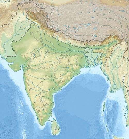 Air Force Station, Bihta Location of airport in India | |||||||||||
| Runways | |||||||||||
| |||||||||||
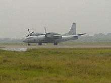
The Bihta Air Force Station is an Indian Air Force (IAF) base in Bihta, Bihar, India.[1] The military airfield, commanded by a Group Captain rank IAF officer, lies 40 kilometres southwest of state capital Patna and is spread over an area of around 900 acres.[2][3]
The Airport Authority of India (AAI) has proposed to develop a civil enclave at Bihta to serve as a second airport for Patna. The Indian Air Force gave its consent in April 2016 for commercial flight operations from the Bihta airbase as a medium-term measure for development air operations from Patna.[4] The state government was keen on developing the civil conclave on 85 acres of land on the western side of the airbase. The Khagaul-Shivala-Bihta road, which will be broadened to four lanes, will connect the airport with the city. AAI had earlier estimated a requirement of 600 acres of land for the first Phase and another 790 acres for the second Phase in lieu of the existing Lok Nayak Jayaprakash Airport in Patna.[5]
In October 2016, Bihar cabinet approved the Patna master plan 2031 which envisages development of a new airport at Bihta.[6][7] Bihar government is acquiring 126 acres of land for construction of the new airport.[8] Bihar cabinet approved a budget of Rs 260 crore for the acquisition of 126 acres for Bihta airport which will be completed by October 2019.[9][10][11]
See also
References
- ↑ "Security tightened in Bihta air force base after ISI threat". Kumod Verma, TNN. The Times of India, Patna. 23 July 2002. Retrieved 27 April 2014.
- ↑ "Land hurdle for Bihta take-off". The Telegraph (Calcutta). 12 March 2015. Retrieved 13 March 2015.
- ↑ http://economictimes.indiatimes.com/industry/transportation/airlines-/-aviation/centre-bihar-government-agree-to-resolve-patna-airport-upgrade-issues/articleshow/51986606.cms
- ↑ "Bihta gets bigger wings". The Telegraph. 8 April 2016. Retrieved 9 April 2016.
- ↑ "AAI Proposes to Develop Airport at Bihta for International Operations". Business Standard. 10 March 2015. Retrieved 13 March 2015.
- ↑ http://timesofindia.indiatimes.com/city/patna/Cabinet-OKs-Patna-master-plan-paves-way-for-big-bulidings-new-airport/articleshow/55100844.cms
- ↑ "पटना मास्टर प्लान 2031 मेट्रोपोलिटन कमेटी नक्शा पास करेगी".
- ↑ "Land identified to make Bihta airport operational for flyers".
- ↑ http://indiatoday.intoday.in/story/bihta-defence-airbase-patna-bihar-government-aai-jai-prakash-narayan-international-airport/1/811788.html
- ↑ http://timesofindia.indiatimes.com/city/patna/Flying-from-Bihta-to-be-less-expensive-than-Patna-AAI/articleshow/55463364.cms
- ↑ http://www.telegraphindia.com/1161116/jsp/bihar/story_119435.jsp#.WCyhzdJ97IU