Darbhanga
| Darbhanga दरभंगा ,دربھنگہ | |
|---|---|
| City | |
|
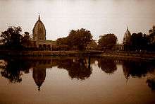
Monument at Darbhanga | |
| Nickname(s): Medical city, Cultural Capital of Bihar | |
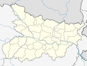 Darbhanga Location in Bihar, India | |
| Coordinates: 26°10′N 85°54′E / 26.17°N 85.9°ECoordinates: 26°10′N 85°54′E / 26.17°N 85.9°E | |
| Country | India |
| State | Bihar |
| District | Darbhanga |
| Elevation | 52 m (171 ft) |
| Population (2011) | |
| • Total | 3,937,385 |
| Languages | |
| • Official | Hindi, Maithili , Urdu |
| Time zone | IST (UTC+5:30) |
| PIN | 8460xx |
| Telephone code | 06272 |
| Vehicle registration | BR 07 |
| Sex ratio | 910:1000 ♂/♀ |
| Lok Sabha constituency | Darbhanga |
| Vidhan Sabha constituency | Darbhanga, Darbhanga Rural |
| Website |
darbhanga |

Darbhangā is 2nd sub metropolitan city of north Bihar and municipal corporation in Bihar, India. It is the headquarters of Darbhanga district and Darbhanga division. Darbhanga is 5th largest city of Bihar and rapidly developing. Darbhanga is also the second biggest medical hub of Bihar and will have a software technology park soon. A green signal has been given by Ministry of Communications and Information Technology of Indian Government. Historically, it had the seating of Darbhanga Raj.
History
The history of Darbhanga dates back to the Ramayana and Mahabharata periods; it is among the oldest cities of Bihar. According to the Vedic sources, the Videhas first migrated to the area from the banks of Saraswati in Punjab; they were guided to the east of Sadanira (Gandak River) by Agni, the God of Fire. Settlements were established and, thus, flourished the kingdom of the Videhas, the Selfless.
In the course of time, Videhas came to be ruled by a line of kings called Janaks. In this line of kings, there was a very famous king named Mithi. To commemorate his greatness the territory was named as Mithila. Another famous king was Janak Sirdhwaja, father of Sita. The legends speak of various learned men patronized by Janak Sirdhwaja, who himself was an erudite scholar. Prominent among them were Yagyavalkya, who codified the Hindu law in his Yagyavalkya Smriti and Gautam, who had various valuable philosophical treatises to his credit. King Janak was himself a great philosopher and his ideas have been eternally enshrined in the Upanishads, especially in the Brihad-āraṇyaka Upaniṣada.
The name Darbhanga is the mutated form of "Dwarbanga". That is, it is the combination of words "Dwar" (Gate) and "Banga" (Bengal) meaning "Gateway of Bengal". If one notices Bengali and Maithili, he will find many a phonetic similarities particularly in the main verbs of both the languages which ends with word sounding "Chhe".
Some scholars say that Darbhanga was named after Dar (Dwar) and Bhangaa which means broken gates. It is assumed that the gates of the Qila (at Qilaghat probably) were broken (by cannons or elephants) in 1326 AD when Tughlak forces attacked the last independent North Indian Hindu king.
According to Imperial Gazetteer of India Vol 11 Page 158 "The Darbhanga family traces its origin to one Mahes Thakur, who is said to have come from Jubbulpore about; the beginning of the sixteenth century. He took service as a priest with the descendants of :Raja Siva Singh, who still exercised a nominal supremacy in Tirhut ; but when they collapsed before the advancing Muhammadan power, Mahes Thakur induced Akbar to grant him what are now the Darbhanga Raj estates. He and his descendants gradually consolidated the power of the family in both agrarian and social matters; and though, owing to recusancy at the Permanent Settlement, the Raja of that period was for some time deprived of a portion of his property, the British Government eventually recognized him. During the first half of the nineteenth century, owing to mismanagement and litigation, the estate fell into considerable difficulties. But the litigation had the effect of deciding that the estate was impartible and that the inheritance to it was regulated by primo- geniture; and owing to a long minority of over twenty years from x860 onwards, during which the estate was under the Court of Wards, it is now in a very flourishing condition. Darbhanga town has been the headquarters of the family since 1762, prior to which date they re- sided at Madhubaru. The present Maharaja Bahadur, Sir Rameswar Singh, K.C.I.E., succeeded on the death of his brother in 1898. The estates at present comprise lands situated in the Districts of Darbhanga, Muzaffarpur, Gaya, Monghyr, Purnea, and Bhagalpur, with a total area of more than 2,410 square miles".[1]
In the thirteenth century Mithila was invaded by Afghans, who deposed the Kshatriya ruler and placed a Maithil Brahman in control of land revenues over much of this region. This family soon began calling themselves kings, distributing land to other members of their caste, so that gradually land passed into the control of Maithil Brahmans. It was taken by the Turks in the 14th century. During Akbar’s reign in the sixteenth century, a second Maithil Brahman family came to rule as the Khandavala Dynasty.
It enjoyed stability under the Mughals and Hindus began to flock to this town since the beginning of the 19th century when the Maharaja of Darbhanga shifted his residence to the town and was granted the title Maharaja by the East India Company. It was the biggest town of North Bihar for centuries, but after Muzaffarpur was connected to broad-gauge railway in the mid-1970s, the latter overtook Darbhanga due to shift of trade, commerce, business and transport to some extent.
During Akbar's reign in the sixteenth century, a second Maithil Brahmin family came to rule as the Khandavala Dynasty. During this period, Akbar also planted 100,000 mango trees in Darbhanga, at a place now known as Lakhi Bagh.[2] In British times, their estate, Darbhanga Raj, was the largest and richest of the great zamindari estates. Their capital was in Bhaur village in Madhubani, later shifted to the town of Darbhanga. They controlled most of Mithila until after Independence when the Republic of India abolished zamindari (Maharaja of Darbhanga was actually a zamindar entitled to add the title Maharaja in his name, besides the British title: KCIE (Knight Commander of Most Eminent Order of the Indian Empire).


| “ | Maharajah Sir Lakhmeshwar Singh, K.C.I.E., of Darbhanga, who was only in his forty-third year at the time of his death in 1898, was in every sense the best type of the Indian nobleman and landlord. He was the leading zamindar in India, where he owned no less than 2,152 square miles (5,570 km2) with a net yearly rental of 30 lakhs, and was the recognized head of the orthodox Hindu community. His philanthropy and his munificent contributions to all public movement won him the esteem of all classes and creeds. He took an active part in public life and enjoyed a high reputation as a progressive and liberal minded statesman. With but slight interruptions he was a member of the Supreme Legislative Council from the year 1883 until his death, and latterly he sat in that body as the elected representative of the non-official members of the Bengal Council.[3] | ” |
The Maharaja of Darbhanga, Sir Kameshwar Singh, was also an integral part of the Constituent Assembly of India and was instrumental in campaigning for retention of privy purses and land rights for rulers. He single handedly negotiated rights of various rulers and nawabs.
Maharaja of Darbhanga also spent much time in today's called kolkata, Bengal. It can be seen in various places as he has built various important places for Bengal, as in Calcutta University Building is "Darbhanga Building" Dalhousie Square and various important buildings there is also made by him. He has made great contributions to Bengal and Indian education and society.
Languages and religion
The main languages spoken in this district are Maithili, Hindi, Urdu, however Hindi is used for official documentation. Here, Urdu is spoken by locale Muslim community in a unique style. In Darbhanga City, local residents speak a relaxed style of Maithili. Other languages spoken by their respective speakers in Darbhanga are Bengali, Marwari, Punjabi and Sindhi
Important Place
1.Raj fort 2.Queen Palace 3.Darbhanga musuem 4.shayama mandir 5.Jama masjid 6.Lakes
Demographics
As per data released by the government of India for the 2011 census, Darbhanga is an Urban Agglomeration coming under category of Class I UAs/Towns. The total population of Darbhanga UA/Metropolitan region is 306,089. The male population of which is 161,346 while female population is 144,743. Total literates: 205,203. Male literates: 115,620. Female literates: 89,583. Sex ratio: 898, Child sex ratio: (0–6 years) 905 and Effective Literacy State rate (7+ Pop): total Persons: 80.88, Male: 86.43, Female: 74.68, Compare to 2001 India census, Darbhanga City had a population of 267,348 while the district had a population of 3,295,789. Males constitute 52% of the population and females 48%.[4] Darbhanga has an average literacy rate of 64%, which is higher than the national average of 59.5%: male literacy is 72% and, female literacy is 56%. In Darbhanga, 15% of the population is under 6 years of age. Darbhanga is a place where people of different languages and religions live. There are many lingual minorities which have contributed to the development of Darbhanga.
Climate
Darbhanga has a humid subtropical climate (Köppen climate classification Cwa).
| Climate data for Darbhanga | |||||||||||||
|---|---|---|---|---|---|---|---|---|---|---|---|---|---|
| Month | Jan | Feb | Mar | Apr | May | Jun | Jul | Aug | Sep | Oct | Nov | Dec | Year |
| Record high °C (°F) | 30.4 (86.7) |
33.9 (93) |
39.9 (103.8) |
42.0 (107.6) |
41.9 (107.4) |
43.4 (110.1) |
39.1 (102.4) |
38.4 (101.1) |
39.6 (103.3) |
39.2 (102.6) |
33.9 (93) |
29.9 (85.8) |
43.4 (110.1) |
| Average high °C (°F) | 22.1 (71.8) |
25.8 (78.4) |
31.0 (87.8) |
34.1 (93.4) |
35.0 (95) |
34.9 (94.8) |
32.5 (90.5) |
32.8 (91) |
32.5 (90.5) |
31.6 (88.9) |
28.0 (82.4) |
24.8 (76.6) |
30.68 (87.22) |
| Average low °C (°F) | 9.2 (48.6) |
11.0 (51.8) |
15.1 (59.2) |
19.1 (66.4) |
21.2 (70.2) |
22.9 (73.2) |
23.8 (74.8) |
24.2 (75.6) |
23.8 (74.8) |
21.2 (70.2) |
15.8 (60.4) |
10.6 (51.1) |
18.18 (64.72) |
| Record low °C (°F) | −0.2 (31.6) |
−0.2 (31.6) |
3.9 (39) |
9.2 (48.6) |
10.4 (50.7) |
15.9 (60.6) |
18.7 (65.7) |
19.4 (66.9) |
18.9 (66) |
12.7 (54.9) |
7.2 (45) |
2.4 (36.3) |
−0.2 (31.6) |
| Average precipitation mm (inches) | 13.0 (0.512) |
14.0 (0.551) |
9.0 (0.354) |
29.0 (1.142) |
76.0 (2.992) |
139.0 (5.472) |
353.0 (13.898) |
254.0 (10) |
193.0 (7.598) |
73.0 (2.874) |
6.0 (0.236) |
7.0 (0.276) |
1,166 (45.905) |
| Average rainy days | 1.6 | 1.7 | 1.6 | 2.6 | 4.6 | 7.6 | 16.4 | 12.2 | 10.5 | 3.4 | 0.5 | 1.0 | 63.7 |
| Average relative humidity (%) | 68 | 63 | 49 | 56 | 60 | 70 | 78 | 79 | 79 | 73 | 66 | 67 | 67.3 |
| Source: NOAA (1971–1990)[5] | |||||||||||||
Geography
Darbhanga is located in the northern part of Bihar.
 |
Madhubani | | ||
| Muzaffarpur | |
Saharsa | ||
| ||||
| | ||||
| Samastipur |
Transport
Darbhanga is well connected via rail and road services.
Railways
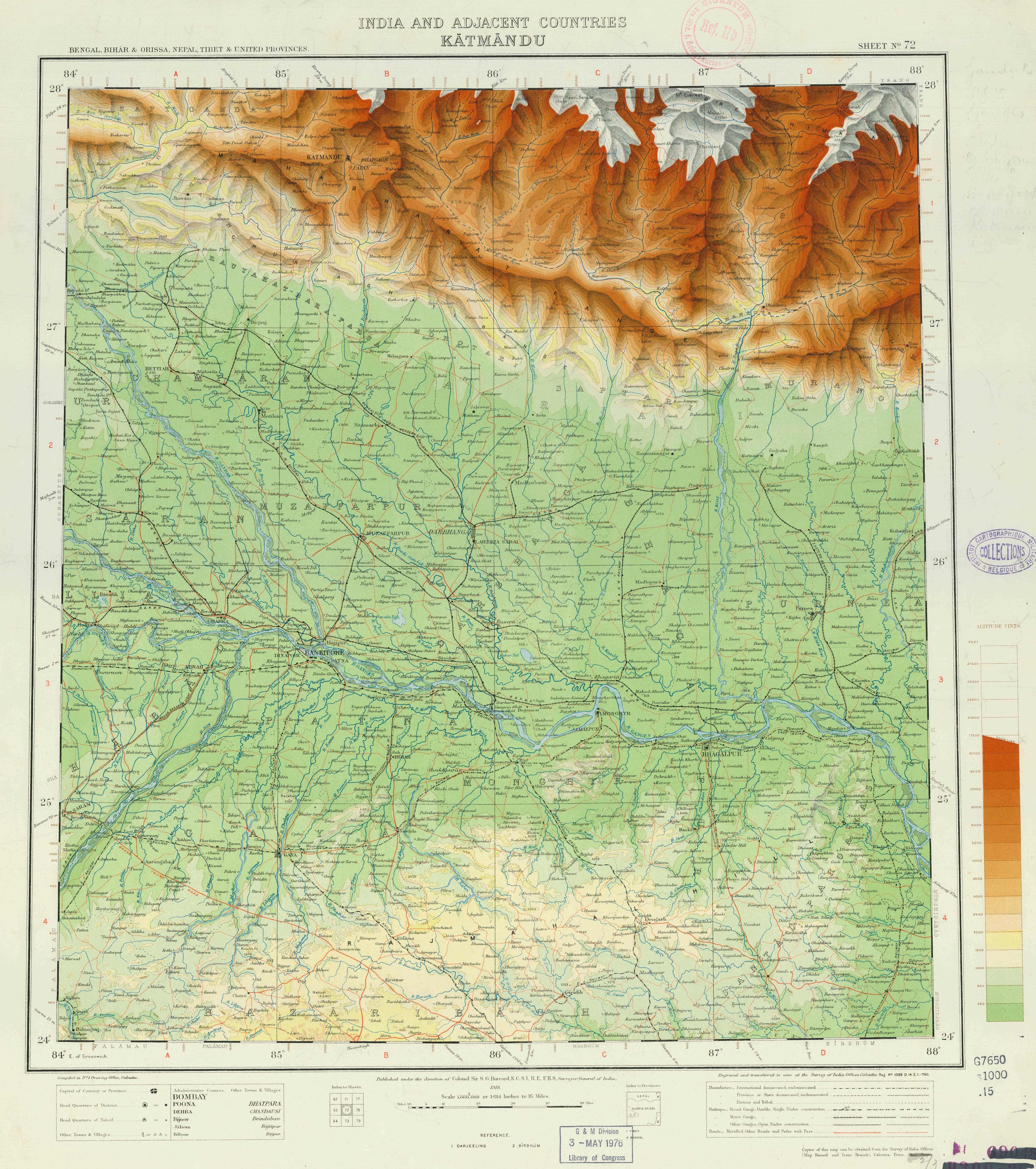
Darbhanga Junction is one of the oldest Railhead of North Bihar, It's a A1 category railway junction and a model station on the East Central Railway and is one of the highest earning most important railway junction in zone and in state, Darbhanga is the busiest station of Samastipur Division as it is connected directly to all the major cities of India, viz., Kolkata, Delhi, Bangalore, Mumbai, Amritsar, Patna, Nagpur, Kanpur, Ranchi, Pune, Guwahati, Bhubaneshwar, Ahmedabad, Hyderabad, Chennai, Raipur, Bilaspur, Lucknow, Varanasi, Siwan, Gorakhpur, Guwahati, Raxaul, Mysore, Ajmer Bangaluru etc. About the beginning of railway in Darbhanga and it's neighboring areas The Imperial Gazetteer of India, v. 11, p. 158/159. says: "The famine of 1874 gave a great impetus to the construction of railways, and the District is on the whole well off in the matter of com- munications. Its south-west corner is traversed for . 29 miles by the main line of the Bengal and North-Western Railway, and also by 25 miles of the new chord-line from Hajipur to Bachwara, which runs parallel to the Ganges embankment from east to west. From Samastipur a line runs to Darbhanga town and there branches off in two directions, the first north-west to Sitamarhi through Kamtaul and Jogiara, and the other due east to Khanwa Ghat on the Kosi (Old streem) near Pratapganj.[6] The total length of the line within the District is 146 miles. Most of the earthwork for a line from Sakri to Jaynagar on the Nepal frontier was completed as a relief work during the famine of 1897 ; and the line, which has now been opened, should tap a large grain supply from Nepal".[7] The Darbhanga Junction connects very large part of North Bihar and Tarai of Nepal with rest of India as major Rail head. It is the main station of Darbhanga & Madhubani. Some popular trains from or via Darbhanga:
- Bagmati Superfast Express to Mysore City
- Bihar Sampark Kranti Superfast to New Delhi
- Jaynagar - Puri Express to Puri
- Pawan Express to Lok Manya Tilak Terminal
- Swatantrata Sainani Express to New Delhi
- Maithili Express to Kolkata Chitpur
- Darbhanga - Secunderabad to Secunderabad
- Gyan Ganga Express to Pune
- Sabarmati Express to Ahmedabad
- Jivachh Link Express to Guwahati
- Raxaul - Hyderabad Express to Hyderabad
- Janaki InterCity Express to Saharsa
- Jan Nayak Express to Amritsar
- Shaheed Express to Amritsar
- Sarayu Yamuna Express to Amritsar
- Karmabhoomi Express to Mumbai Lokmanya Tilak Terminus
- Jnsadharan Express to Ahmedabad
- Mithilanchal Express to Kolkata Chitpur
- Darbhanga - Howrah Express to Howrah
- Raxaul - Howrah Express to Howrah
- Sitamarhi - New Jalpaiguri Express to New Jalpaiguri (Siliguri)
One more railway station of the city is known as Laheriasarai Railway Station. Laheriasarai is famous for the Lah(Lahthi).Gangasagar express no 13185 & 13186 viz stops there
Roadways
Darbhanga is connected to other parts of India by National Highway 57 , National Highway 105 and Bihar State highways 50, 56, 88 and 75. Darbhanga is also connected to the Madhubani which is located at Nepal border and Sitamarhi.
East-West Corridor expressway, which connects the Porbandar, Gujarat to Silchar, Assam passes through Darbhanga which provides greater connectivity for trade purposes.
The city has two bus stands – Darbhanga Bus Stand and Laheriasarai Bus Stand – and a new interstate bus stand is under construction for the city. Bus services are available from Darbhanga to all the nearby major cities viz. Patna, Gaya, Kolkata, Purnia, Bhagalpur, Muzaffarpur, Ranchi, Jamshedpur.
Local transport
For local transport, the commuters have the options of city bus and auto-rickshaw. Auto rickshaws are the popular mode of local commuting. The City Bus Service is also in the city by BSRTC.Low floor buses are also proposed for the city by Central Govt.
Airport
Darbhanga Airport is the longest runway airport of Bihar, and is operated by the Indian Air Force at present. It is spread over a 200-acre area of the city. It was built exclusively for the use of Maharajah of Darbhanga's aeroplanes. Spirit Air started operations from Darbhanga in 2009, but was forced to withdraw due to its smaller strip.Spirit Air has again started its service from Darbhanga Airport.
Darbhanga Aviations was a private Indian airline started in 1950 by Maharaja Kameshwar Singh of Darbhanga. It had three aircraft and became defunct by 1962.
Media and communications
All India Radio has a 20 kW medium-wave radio station in Darbhanga which transmits various programs of mass interest and cover a part of Noth Bihar and terai of Nepal. Another DAS transmitter of 20 kW MW is expected to start soon who will replace existing analog transmitter in future. Doordarshan has one DD National and one DD News LPT relay transmitters. Darbhanga still don't have FM transmitter yet.
Education
Medical colleges
- Darbhanga Medical College and Hospital
- Mithila Minority Dental College & Hospital
- Saryu Dental College & Hospital, Laheriasarai
University
- Lalit Narayan Mithila University
- Kameshwar Singh Darbhanga Sanskrit University
- IGNOU Regional Centre
- Maulana Azad National Urdu University (MANUU) Regional Centre
Engineering and technology colleges
Polytechnic colleges
- Darbhanga Polytechnic (Bihar Govt)
- MANUU Polytechnic (A Central University branch)
I T I colleges
- Govt. I T I Ramnagar
- Govt WITI
- IMTI MAHDAULI
- Mithila Private Industrial Training Institute Mabbi Darbhanga
Management institute and college
- Institute of Business Management, Delhi More, Bela, On East-West Corridor (LNMU)
- Deptt. of MBA, LNMU
Law college
- C M LAW College Darbhanga (LNMU)
Teacher training colleges
- Dr Zakir Hussain Teacher's Training College
- Oriental College of Education
- Swami Vivekananda B.Ed Teacher's Training College
- Mithila B.Ed college Darbhanga
Colleges
- C. M. Science College, Darbhanga
- C. M. College,Quilaghat
- Marwari College
- Kunwar Singh College
- Millat College, Laheriasarai
- M.R.M College
- M.L.S.M College
- M.K.College, Laheriasarai
- Nagendra Jha Mahila College
- Lohia Charan Singh (LCS)
Schools
- New Era Public School
- M.R. Public School, Chandih
- Jesus & Mary Academy
- Shafi Muslim High School
- Raj High School
- M L Academy
- Rose Public School
- +2 Marwari high school
- Jawahar Navodaya Vidyalaya, Pachadhi
- Woodbine Modern School
- Holy Cross School
- Madonna English School
- Darbhanga Public School
- Laheraisarai Public School
- Harrow English School
- Public School Bela
- Delhi Public School
- Kendriya Vidyalaya
- Don Bosco School
- D.A.V Public School
- Gyan Bharti Public School
- [Iqra Academy]
- S S Internation School, Karjapatti
- [Dr.R.L.R. Public School]
- [Jay Bharat High School, Gandhi nagar ]
- [Adarsh High School, Atihar]
- [Sarvoday High School,Madarpura]
- [St. Joseph School, Qulighat]
- [Alhira Public School, Raham Khan]
- [Gyan sarita public school, ruhellaganj]
Notable people From Darbhanga
- jawed alam, Admin in HR Riyadh KSA
- Badri Narain Sinha, poet-critic, and formerly of Indian Police Service (1952 batch)
- Bibhutibhushan Mukhopadhyay, Bengali author
- Binod Bihari Verma, Maithili littérateur
- Chandranath Mishra Amar
- Narayan Dass - First M.P from Darbhanga Central
- Gangesha Upadhyaya - Mathematician
- Gonu Jha
- Kirti Azad - Member of Parliament,1983 world cup cricket winning team member.
- Imtiaz Ali - Film director
- Yamuna Karjee - Indian independence activist
- Maharaja Lakshmeshwar Singh - King Of Darbhanga
- Sir Maharaja Rameshwar Singh - King of Darbhanga, philanthropist.
- Maharaja Sir Kameshwar Singh - last ruler of Darbhanga Raj, industrialist, philanthropist
- M J Warsi - Lingui
- Sultan Ahmad - Ex- MLA Darbhanga Town
- Nagarjun - Maithili Poet
- Nagendra Nath Jha - Diplomat
- Nigamanand - Hindu seer
- Surendra Jha 'Suman' - Maithili poet
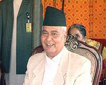
- Parmanand Jha - Vice President of Nepal
- Prem Shankar Jha - Writer
- Rafiuddin Raz - Pakistani poet
- Ram Gopal Bajaj - Film
- Hukmdev Narayan Yadav - Member Of Parliament
- Sriti Jha - T.V actress
- Lakshmi Kant Jha - Eighth Governor of The RBI
- Shariq Us Sabah - Writer
- Tochi Raina - Bollywood Singer
- Udayana - Philosopher
- Dhanik Lal Mandal - Former Governor of Haryana
- Rakesh Ranjan Kumar - Film director
- Ramnath Goenka - Journalist
- Kaveri Jha - Film actress
- Prabhat Jha - Member of Parliament
- Nigamananda Saraswati - Hindu seer
See also
References
- ↑ http://dsal.uchicago.edu/reference/gazetteer/text.html?objectid=DS405.1.I34_V11_169.gif
- ↑ "National Fruit". Govt. of India Official website.
- ↑ Cotton, H.E.A., (1909/1980) Calcutta Old and New, pp 335-336, General Printers and Publishers Pvt. Ltd.
- ↑ "Census of India: View Population Details". www.censusindia.gov.in. Government of India. 2001. Retrieved 2016-01-14.
- ↑ "Zahedan Climate Normals 1971-1990". National Oceanic and Atmospheric Administration. Retrieved 22 December 2012.
- ↑ http://www.lib.utexas.edu/maps/topo/india_1m/sheet-72-katmandu-color_elevations-1918.jpg
- ↑ http://dsal.uchicago.edu/reference/gazetteer/text.html?objectid=DS405.1.I34_V11_164.gif
External links
| Wikimedia Commons has media related to People of Bihar. |