Oklahoma State Highway 51
| ||||
|---|---|---|---|---|
 | ||||
| Route information | ||||
| Maintained by ODOT | ||||
| Length: | 332.8 mi (535.6 km) | |||
| Existed: | 1 June 1927 – present | |||
| Major junctions | ||||
| West end: |
| |||
| East end: |
| |||
| Highway system | ||||
| ||||

State Highway 51, abbreviated to SH-51 or OK-51, is a major state highway in Oklahoma. It runs for 333 miles[1] (535½ km) east–west across the state, running from the Texas state line to Arkansas. It is the third-longest state highway in the system.
Route description
Texas to I-35
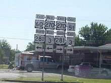
SH-51 begins at the Texas line concurrent with US-60 just east of Higgins, Texas. It remains concurrent for 61 miles (98 km) until it reaches US-270/US-281/SH-3 at Seiling, Oklahoma. At Seiling, SH-51 joins with those three highways for nine miles (14 km) before splitting off on its own.
11 miles (18 km) after splitting off, Highway 51 meets SH-58 in Canton. It then continues east, crossing the North Canadian River and meeting SH-51A before turning northeast toward Okeene, where it intersects SH-8. SH-51 will go for 24 miles (39 km) before intersecting another highway.
In Hennessey SH-51 meets U.S. Highway 81 before continuing eastward. 17 miles (27 km) later, it meets SH-74 north of Crescent. 11 miles (17 km) to the east, it shares a brief concurrency with US-77; two miles (3 km) later it has an interchange at Interstate 35, milemarker 174.
I-35 to Tulsa
After crossing I-35, SH-51 becomes a multilane highway and a major corridor linking I-35 to Stillwater, the home of Oklahoma State University. Along this 13-mile (21 km) stretch is an intersection with State Highway 86. When Highway 51 reaches Stillwater, it meets US-177.
Continuing east from Stillwater, the road returns to a two-lane highway after sharing a one-mile (1.6 km) concurrency with SH-108 and intersects with SH-18 eight miles (12.8 km) later. Four miles east of this, it passes through Yale, Oklahoma before crossing SH-99. It becomes a multilane highway again after a brief concurrency with SH-48. It passes through the small towns of Mannford and Lotsee on its way toward the Tulsa area.
Tulsa and beyond
In Sand Springs, SH-51 crosses the Arkansas River with SH-97 before merging onto the Sand Springs Expressway (U.S. Highway 412/U.S. Highway 64). When this freeway ends at I-244 near downtown Tulsa, Highway 51 merges onto I-244 southbound only to exit one mile (1.6 km) later, where it overlaps US-64/US-75. This freeway is actually Interstate 444, but the interstate designation is not shown on signs. After one more mile, SH-51 leaves the interstate with US-64 and becomes the Broken Arrow Expressway, a freeway running northwest-southeast through Tulsa which is known as "The BA" by locals and local media. US-64 leaves the freeway as a concurrency with US-169 southbound. Later, SH-51 will exit the freeway and become a four-lane highway toward Coweta. The mainline freeway becomes the Muskogee Turnpike.
At Coweta, SH-51 turns back east after heading southeast through the Tulsa area. After crossing the Muskogee Turnpike again and bridging the Verdigris River the highway soon enters Wagoner, where it junctions with US-69. Returning once again to a 2-lane road, Highway 51 crosses Ft. Gibson Lake and the town of Hulbert. 11 miles (18 km) later, it passes through Tahlequah, where it has a brief concurrency with US-62/SH-10. After spitting with these highways, it heads southeast toward Stilwell, Oklahoma, overlapping Route 59 for a mile on the way. After leaving Stilwell it provides access to Adair State Park, and then crosses the Arkansas line becoming Highway 244, which quickly connects to Highway 59.
History
SH-51 was originally commissioned on June 1, 1927 as a connector from Stilwell to Eldon at SH-27 (present-day US-62).[2] By 1928, it had been extended to Tulsa.[3] On June 15, 1933, it was extended to the east to the Arkansas state line, where it became AR-45.[2]
ODOT extended SH-51 west to Stillwater and Perry (via a segment of roadway currently serving as US-177).[2][4] On March 18, 1935, the section from Stillwater to Perry was rescinded and SH-51 was extended to SH-8 at Okeene.[2][5] It was then extended to Seiling on October 18, 1938. On March 23, 1943, it was extended to the Texas state line by a concurrency with US-60.[2][6]
The Broken Arrow Expressway was built in the early 1960s[7] and opened in 1964.[2] It was not, however, officially named the Broken Arrow Expressway until July 6, 1999 [8] by H.B. 1455.
The steel truss bridge carrying SH-51 across Stillwater Creek west of Stillwater, once considered the gateway into the city, was removed on March 25, 2008. In a first for the state of Oklahoma, the bridge, originally built in 1936, was sold to Payne County for $200,000 and transferred to a county road east of Stillwater, where it was installed over Council Creek.[9]
Spurs
Like many in the Oklahoma state highway system, SH-51 has short spurs branching from it that bear the "51" number with a lettered suffix:
- SH-51A (23 mi/37 km) runs from SH-58 northeast of Canton to SH-8 near Roman Nose State Park. It is the longest suffixed highway in the system .
- SH-51B (18½ mi/30 km) connects Coweta to US-69 north of Muskogee. It goes through the towns of Porter and Tullahassee.
- SH-51C (decommissioned) (1.7 mi/2.7 km) connected SH-51 west of Stillwater to Carl Blackwell Lake until it was decommissioned in 2005.
- SH-51D (decommissioned) connected SH-51 south of Sand Springs with I-244 in Tulsa, running along Avery Drive and W. 21st Street. It appeared on some ODOT maps as late as the 1970s, but is no longer shown.[10]
- In 2004, ODOT completed SH-51 Spur, running for 3 miles (4.8 km) through Tahlequah to end at State Highway 82. It is currently the newest Oklahoma state highway.
Junction list
| County | Location | mi[1] | km | Destinations | Notes |
|---|---|---|---|---|---|
| Ellis | | 0.0 | 0.0 | Texas state line; western terminus | |
| | 6.7 | 10.8 | West end of US 283 overlap | ||
| Arnett | 12.7 | 20.4 | Southern terminus of SH-46 | ||
| 13.7 | 22.0 | East end of US 283 overlap | |||
| Dewey | Vici | 39.6 | 63.7 | West end of SH-34 overlap | |
| 40.5 | 65.2 | East end of SH-34 overlap | |||
| | 58.8 | 94.6 | |||
| Seiling | 60.6 | 97.5 | West end of US-270/281/SH-3 overlap; east end of US-60 overlap | ||
| Hucmac | 69.0 | 111.0 | East end of US-280/281/SH-3 overlap | ||
| Blaine | Canton | 81.2 | 130.7 | Southern terminus of SH-58A | |
| 82.0 | 132.0 | West end of SH-58 overlap | |||
| 83.0 | 133.6 | East end of SH-58 overlap | |||
| Southard | 88.1 | 141.8 | |||
| Okeene | 98.9 | 159.2 | |||
| Kingfisher | Lacey | 115.1 | 185.2 | Southern terminus of SH-132 | |
| Hennessey | 122.6 | 197.3 | |||
| Logan | | 138.1 | 222.3 | Southern terminus of SH-74E | |
| | 140.1 | 225.5 | |||
| | 151.0 | 243.0 | West end of US-77 overlap | ||
| | 151.3 | 243.5 | East end of US-77 overlap | ||
| Payne | | 153.8 | 247.5 | Known as 6th Ave (I-35) - (SH-18) junctions; I-35 exit 174 | |
| | 157.3 | 253.1 | Southern terminus of SH-86 | ||
| | 162.0 | 260.7 | Road to Lake Carl Blackwell | Former southern terminus of SH-51C | |
| Stillwater | 170.4 | 274.2 | |||
| | 177.8 | 286.1 | West end of SH-108 overlap | ||
| | 178.8 | 287.8 | East end of SH-108 overlap | ||
| | 186.8 | 300.6 | |||
| Creek | | 197.6 | 318.0 | ||
| | 208.2 | 335.1 | |||
| | 215.1 | 346.2 | Interchange; southern terminus of SH-151 | ||
| Tulsa | Sand Springs | 224.3 | 361.0 | West end of SH-97 overlap | |
| 225.5 | 362.9 | East end of SH-97 overlap; west end of US-64/412 overlap; west end of freeway | |||
| South 81st West Avenue | |||||
| | South 65th West Avenue | ||||
| Tulsa | North 49th West Avenue | ||||
| North 33rd West Avenue | Westbound exit and eastbound entrance | ||||
| Gilcrease Museum Road, South 25th West Avenue | |||||
| Quanah Avenue | Eastbound exit and westbound entrance | ||||
| 232.1 | 373.5 | East end of US-412 overlap; west end of I-244 overlap; I-244 exits 5B-C | |||
| 2nd Street | Eastbound exit and westbound entrance; I-244 exit 5A | ||||
| 232.9 | 374.8 | East end of I-244 overlap; west end of I-444/US-75 overlap; I-244 exit 4B | |||
| Houston Avenue, Southwest Boulevard, 30th Street | Westbound exit and eastbound entrance | ||||
| Denver Avenue | |||||
| Detroit Avenue | Westbound exit and eastbound entrance | ||||
| 234.3 | 377.1 | East end of I-444/US-75 overlap | |||
| Utica Avenue | |||||
| Lewis Avenue | No westbound exit | ||||
| East 15th Street | No eastbound exit | ||||
| East 21st Street | |||||
| Harvard Avenue | |||||
| East 31st Street, Yale Avenue | |||||
| Sheridan Road | |||||
| 239.6 | 385.6 | I-44 exit 231 | |||
| Memorial Drive | |||||
| East 41st Street, Mingo Road | No westbound exit | ||||
| 242.0 | 389.5 | East end of US-64 overlap | |||
| Garret Road | |||||
| East 51st Street South | Eastbound exit and westbound entrance | ||||
| South 129th East Avenue | Westbound exit and eastbound entrance | ||||
| Broken Arrow | South 145th East Avenue | ||||
| Elm Place | |||||
| South 177th East Avenue | No eastbound entrance | ||||
| Kenosha Street | |||||
| 248.8 | 400.4 | East end of freeway; no eastbound entrance; Muskogee Turnpike exit 1 | |||
| Wagoner | Coweta | 258.0 | 415.2 | Northern terminus of SH-72 | |
| 261.5 | 420.8 | Muskogee Turnpike exit 13 | |||
| Wagoner | 272.6 | 438.7 | |||
| 275.1 | 442.7 | Northern terminus of SH-16 | |||
| Cherokee | Hulbert | 288.4 | 464.1 | Eastern terminus of SH-80 | |
| Tahlequah | 300.7 | 483.9 | West end of US-62/SH-10/82 overlap | ||
| 303.0 | 487.6 | East end of SH-82 overlap | |||
| | 305.0 | 490.8 | East end of SH-10 overlap | ||
| Eldon | 310.7 | 500.0 | East end of US-62 overlap | ||
| Adair | Stilwell | 324.8 | 522.7 | West end of US-59 overlap | |
| 325.7 | 524.2 | East end of US-59 overlap | |||
| | 332.8 | 535.6 | Arkansas state line; eastern terminus | ||
1.000 mi = 1.609 km; 1.000 km = 0.621 mi
| |||||
References
- 1 2 Stuve, Eric. "OK-51". OKHighways.com. Retrieved 2007-03-27.
- 1 2 3 4 5 6 Oklahoma Department of Transportation, Planning & Research Division. "Memorial Dedication & Revision History - SH-51". Retrieved 2007-02-19.
- ↑ Oklahoma Department of Transportation. 1928 Highway Map.
- ↑ Oklahoma Department of Transportation. 1935 Highway Map.
- ↑ Oklahoma Department of Transportation 1937 Highway Map
- ↑ Oklahoma Highway Commission (1943-03-23). "Minutes—Dewey & Ellis Counties, Extension of SH #51" (PDF). Retrieved 2012-09-05.
- ↑ The City of Broken Arrow, Oklahoma. "Our History". Archived from the original on 2007-04-05. Retrieved 2007-04-11.
- ↑ Oklahoma Department of Transportation, Planning & Research Division. "Oklahoma's Memorial Highways and Bridges". Retrieved 2007-04-11.
- ↑ Sutter, John David (2008-03-26). "One hefty recycling endeavor".
- ↑ Oklahoma Department of Transportation map, Average Daily Traffic Volume, Tulsa inset, 1977.