Hammon, Oklahoma
| Hammon, Oklahoma | |
|---|---|
| Town | |
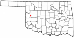 Location of Hammon, Oklahoma | |
| Coordinates: 35°37′57″N 99°22′53″W / 35.63250°N 99.38139°WCoordinates: 35°37′57″N 99°22′53″W / 35.63250°N 99.38139°W | |
| Country | United States |
| State | Oklahoma |
| Counties | Roger Mills, Custer |
| Area | |
| • Total | 0.7 sq mi (1.9 km2) |
| • Land | 0.7 sq mi (1.9 km2) |
| • Water | 0.0 sq mi (0.0 km2) |
| Elevation | 1,745 ft (532 m) |
| Population (2010) | |
| • Total | 568 |
| • Density | 810/sq mi (300/km2) |
| Time zone | Central (CST) (UTC-6) |
| • Summer (DST) | CDT (UTC-5) |
| ZIP code | 73650 |
| Area code(s) | 580 |
| FIPS code | 40-32250[1] |
| GNIS feature ID | 1093499[2] |
Hammon is a town in Custer and Roger Mills counties in the U.S. state of Oklahoma. Located at the junction of Oklahoma Highways 33 & 34, the majority of the town is in Roger Mills County, but some of the town limits extend into Custer County. The population was 568 at the 2010 census.
Geography
Hammon is located at 35°37′57″N 99°22′53″W / 35.63250°N 99.38139°W (35.632369, −99.381267).[3] According to the United States Census Bureau, the town has a total area of 0.7 square miles (1.9 km²), all land.
Hammon is located just west of the intersection of State Highway 33 and State Highway 34.
Climate
| Climate data for Hammon, Oklahoma | |||||||||||||
|---|---|---|---|---|---|---|---|---|---|---|---|---|---|
| Month | Jan | Feb | Mar | Apr | May | Jun | Jul | Aug | Sep | Oct | Nov | Dec | Year |
| Average high °F (°C) | 48 (9) |
53 (12) |
62 (17) |
71 (22) |
78 (26) |
89 (32) |
95 (35) |
93 (34) |
86 (30) |
73 (23) |
60 (16) |
50 (10) |
71.5 (22.2) |
| Average low °F (°C) | 23 (−5) |
28 (−2) |
32 (0) |
42 (6) |
53 (12) |
62 (17) |
68 (20) |
66 (19) |
57 (14) |
44 (7) |
32 (0) |
26 (−3) |
44.4 (7.1) |
| Average precipitation inches (mm) | 0.8 (20) |
1.0 (25) |
1.7 (43) |
2.5 (64) |
4.2 (107) |
3.6 (91) |
2.1 (53) |
2.6 (66) |
3.0 (76) |
2.3 (58) |
1.6 (41) |
1.0 (25) |
26.1 (663) |
| Source #1: weather.com | |||||||||||||
| Source #2: Weatherbase.com [4] | |||||||||||||
Demographics
| Historical population | |||
|---|---|---|---|
| Census | Pop. | %± | |
| 1920 | 440 | — | |
| 1930 | 736 | 67.3% | |
| 1940 | 705 | −4.2% | |
| 1950 | 621 | −11.9% | |
| 1960 | 656 | 5.6% | |
| 1970 | 677 | 3.2% | |
| 1980 | 866 | 27.9% | |
| 1990 | 611 | −29.4% | |
| 2000 | 469 | −23.2% | |
| 2010 | 568 | 21.1% | |
| Est. 2015 | 592 | [5] | 4.2% |
As of the census[1] of 2000, there were 469 people, 169 households, and 114 families residing in the town. The population density was 637.0 people per square mile (244.7/km²). There were 203 housing units at an average density of 275.7 per square mile (105.9/km²). The racial makeup of the town was 60.77% White, 0.64% African American, 34.54% Native American, 0.21% Asian, 1.71% from other races, and 2.13% from two or more races. Hispanic or Latino of any race were 5.76% of the population.
There were 169 households out of which 33.7% had children under the age of 18 living with them, 47.3% were married couples living together, 16.6% had a female householder with no husband present, and 32.0% were non-families. 29.0% of all households were made up of individuals and 13.6% had someone living alone who was 65 years of age or older. The average household size was 2.78 and the average family size was 3.49.
In the town the population was spread out with 29.9% under the age of 18, 10.0% from 18 to 24, 28.6% from 25 to 44, 21.3% from 45 to 64, and 10.2% who were 65 years of age or older. The median age was 34 years. For every 100 females there were 108.4 males. For every 100 females age 18 and over, there were 101.8 males.
The median income for a household in the town was $22,604, and the median income for a family was $28,036. Males had a median income of $22,250 versus $20,500 for females. The per capita income for the town was $10,184. About 31.5% of families and 34.8% of the population were below the poverty line, including 44.8% of those under age 18 and 19.5% of those age 65 or over.
Education
- Hammon Public Schools
- Hammon Public School is a member of the Western Technology Center District. WTC provides the opportunity for adults and high school students to get occupationally-specific training. As a member of the WTC district, high school juniors and seniors living in the Hammon School District have the opportunity to attend classes at the WTC campus in Burns Flat. High school students who are residents of the WTC District can enroll in WTC full-time training on a tuition-free basis. Adult students are allowed to attend classes on a tuition basis. Tuition for adult students is $2.00 per training hour. Adult students can apply for financial assistance to attend WTC.
Notable people
- Bess Stinson, Arizona state legislator and businesswoman, was born in Hammon, in Roger Mills County.[7]
References
- 1 2 "American FactFinder". United States Census Bureau. Retrieved 2008-01-31.
- ↑ "US Board on Geographic Names". United States Geological Survey. 2007-10-25. Retrieved 2008-01-31.
- ↑ "US Gazetteer files: 2010, 2000, and 1990". United States Census Bureau. 2011-02-12. Retrieved 2011-04-23.
- ↑ "Historical Weather for Hammon, Oklahoma, United States".
- ↑ "Annual Estimates of the Resident Population for Incorporated Places: April 1, 2010 to July 1, 2015". Retrieved July 2, 2016.
- ↑ "Census of Population and Housing". Census.gov. Retrieved June 4, 2015.
- ↑ Arizona State Library, Arizona Legislators: Then & Now-Bessie Stinson
External links
Municipalities and communities of Custer County, Oklahoma, United States | ||
|---|---|---|
| Cities |  | |
| Towns | ||
| Unincorporated communities | ||
| Ghost town | ||
| Footnotes | ‡This populated place also has portions in an adjacent county or counties | |
Municipalities and communities of Roger Mills County, Oklahoma, United States | ||
|---|---|---|
| Towns | 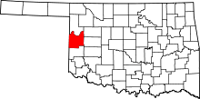 | |
| Unincorporated communities | ||
| Footnotes | ‡This populated place also has portions in an adjacent county or counties | |