Tullahassee, Oklahoma
| Tullahassee, Oklahoma | |
|---|---|
| Town | |
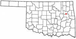 Location of Tullahassee, Oklahoma | |
| Coordinates: 35°50′16″N 95°26′21″W / 35.83778°N 95.43917°WCoordinates: 35°50′16″N 95°26′21″W / 35.83778°N 95.43917°W | |
| Country | United States |
| State | Oklahoma |
| County | Wagoner |
| Area | |
| • Total | 0.5 sq mi (1.4 km2) |
| • Land | 0.5 sq mi (1.4 km2) |
| • Water | 0.0 sq mi (0.0 km2) |
| Elevation | 620 ft (189 m) |
| Population (2000) | |
| • Total | 106 |
| • Density | 200.4/sq mi (77.4/km2) |
| Time zone | Central (CST) (UTC-6) |
| • Summer (DST) | CDT (UTC-5) |
| ZIP code | 74454 |
| Area code(s) | 539/918 |
| FIPS code | 40-74650[1] |
| GNIS feature ID | 1099007[2] |
Tullahassee is a town in Wagoner County, Oklahoma, United States. The population was 106 in both the 2010 and the 2000 census.[3] It was also the location of Tullahassee Mission. It is considered the oldest of the all-Black towns in Oklahoma.[4]
History
The town began in 1850, when the Creek Nation constructed a school at this site on the Texas Road. By 1881, the population of freedmen had increased in the area, while the number of Native Americans had declined. The Creek Council then transferred the Creek children to another school and gave the town of Tullahassee to the freedmen. A post office opened in 1899, and the town was incorporated in 1902. It is now the oldest of the 13 remaining all-Black towns in the state.[4]
In 1916, the African Methodist Episcopal Church (AME) opened Flipper Davis College in the old Tullahassee Mission building. The college was the only private higher level education institution for African Americans in Oklahoma. This school closed in 1935.[4]
Geography
Tullahassee is located at 35°50′16″N 95°26′21″W / 35.83778°N 95.43917°W (35.837758, -95.439295).[5] It is 5 miles (8.0 km) northwest of Muskogee, Oklahoma.
According to the United States Census Bureau, the town has a total area of 0.5 square miles (1.3 km2), all of it land.
Demographics
| Historical population | |||
|---|---|---|---|
| Census | Pop. | %± | |
| 1920 | 189 | — | |
| 1930 | 164 | −13.2% | |
| 1940 | 200 | 22.0% | |
| 1950 | 209 | 4.5% | |
| 1960 | 199 | −4.8% | |
| 1970 | 183 | −8.0% | |
| 1980 | 145 | −20.8% | |
| 1990 | 92 | −36.6% | |
| 2000 | 448 | 387.0% | |
| 2010 | 106 | −76.3% | |
| Est. 2015 | 107 | [6] | 0.9% |
As of the census[1] of 2000, there were 106 people, 39 households, and 24 families residing in the town. The population density was 200.4 people per square mile (77.2/km²). There were 49 housing units at an average density of 92.6 per square mile (35.7/km²). The racial makeup of the town was 66.98% African American, 28.30% White, 0.94% Native American, and 3.77% from two or more races.
There were 39 households out of which 17.9% had children under the age of 18 living with them, 38.5% were married couples living together, 20.5% had a female householder with no husband present, and 35.9% were non-families. 30.8% of all households were made up of individuals and 15.4% had someone living alone who was 65 years of age or older. The average household size was 2.72 and the average family size was 3.40.
In the town the population was spread out with 25.5% under the age of 18, 9.4% from 18 to 24, 22.6% from 25 to 44, 27.4% from 45 to 64, and 15.1% who were 65 years of age or older. The median age was 38 years. For every 100 females there were 116.3 males. For every 100 females age 18 and over, there were 92.7 males.
The median income for a household in the town was $14,750, and the median income for a family was $13,750. Males had a median income of $21,875 versus $12,500 for females. The per capita income for the town was $8,537. There were 42.3% of families and 58.9% of the population living below the poverty line, including 94.0% of under eighteens and 22.2% of those over 64.
Education
Students are zoned to Porter Consolidated Schools.[8]
See also
- Boley, Brooksville, Clearview, Grayson, Langston, Lima, Redbird, Rentiesville, Summit, Taft, Tatums, and Vernon, other "All-Black" settlements that were part of the Land Run of 1889.[9]
References
- 1 2 "American FactFinder". United States Census Bureau. Retrieved 2008-01-31.
- ↑ "US Board on Geographic Names". United States Geological Survey. 2007-10-25. Retrieved 2008-01-31.
- ↑ CensusViewer:Population of the City of Tullahassee, Oklahoma
- 1 2 3 O'Dell, Larry. Encyclopedia of Oklahoma History and Culture. "Tullahassee."
- ↑ "US Gazetteer files: 2010, 2000, and 1990". United States Census Bureau. 2011-02-12. Retrieved 2011-04-23.
- ↑ "Annual Estimates of the Resident Population for Incorporated Places: April 1, 2010 to July 1, 2015". Retrieved July 2, 2016.
- ↑ "Census of Population and Housing". Census.gov. Retrieved June 4, 2015.
- ↑ "SCHOOL DISTRICT REFERENCE MAP (2010 CENSUS): Wagoner County, OK" (Archive). U.S. Census Bureau. Retrieved on September 11, 2015.
- ↑ O'Dell, Larry. "All-Black Towns". Encyclopedia of Oklahoma History & Culture. Oklahoma Historical Society. Retrieved 2012-08-19.
Municipalities and communities of Wagoner County, Oklahoma, United States | ||
|---|---|---|
| Cities | 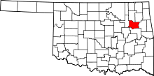 | |
| Towns | ||
| Unincorporated communities |
| |
| Footnotes | ‡This populated place also has portions in an adjacent county or counties | |
| Coweta | ||
|---|---|---|
| Okay |
| |
| Porter |
| |
| Redbird |
| |
| Tullahassee | ||
| Wagoner |
| |