Bristow, Oklahoma
| Bristow, Oklahoma | |
|---|---|
| City | |
|
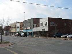
Main Street in Bristow | |
| Nickname(s): The Woodland Queen | |
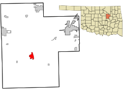 Location within Creek County, and the state of Oklahoma | |
| Coordinates: 35°49′51″N 96°23′26″W / 35.83083°N 96.39056°WCoordinates: 35°49′51″N 96°23′26″W / 35.83083°N 96.39056°W | |
| Country | United States |
| State | Oklahoma |
| County | Creek |
| Area | |
| • Total | 3.6 sq mi (9.3 km2) |
| • Land | 3.6 sq mi (9.2 km2) |
| • Water | 0.08 sq mi (0.2 km2) |
| Elevation | 810 ft (247 m) |
| Population (2010) | |
| • Total | 4,222 |
| • Density | 1,194/sq mi (460.9/km2) |
| Time zone | Central (CST) (UTC-6) |
| • Summer (DST) | CDT (UTC-5) |
| ZIP code | 74010 |
| Area code(s) | 539/918 |
| FIPS code | 40-08900[1] |
| GNIS feature ID | 1090502[2] |
| Website |
www |
Bristow is a city in Creek County, Oklahoma, United States. The population was 4,222 at the 2010 census,[3] down 2.4 percent from 4,325 at the 2000 census.
History
Bristow began in 1898, when the St. Louis–San Francisco Railway ("Frisco") built a track between Sapulpa and Oklahoma City. The town was named for Joseph L. Bristow, a U.S. senator from Kansas. A post office was established April 25, 1898. By the 1900 census, the population was 626.[4]
Bristow was designated as the county seat for Creek County at statehood, when its population was 1,134. However, the county held a special election on August 20, 1908, to decide whether the seat would remain in Bristow or move to Sapulpa, which claimed to be more centrally located. Bristow had a larger population and claimed to have better railroad connections. Sapulpa won the election, but Bristow claimed voting irregularities. The election was voided and a new vote was held November 20, 1912. Again, Sapulpa won the election and the title of county seat.[4]
The local economy depended heavily on cotton. Bristow had seven cotton gins and two cottonseed oil mills in the early 20th century. Other farms in the surrounding area produced corn, peanuts, potatoes and fruit. Oil and gas were discovered in the area around 1915. The discovery led to the construction of three refineries and four pipeline companies by 1930. The Oklahoma-Southwestern Railway Company built a short line from the oilfields to Bristow in 1920. The peak census population was 6,619 in 1930[4]
Historic buildings
Several sites in Bristow are listed on the National Register of Historic Places, including the Beard Motor Company, Bristow Chrysler Plymouth, Bristow Motor Company Building, Bristow Presbyterian Church, Bristow Tire Shop, Little Deep Fork Creek Bridge, and Texaco Service Station.[5]
Geography
Bristow is located in northern Oklahoma, just south of the geographic center of Creek County. According to the United States Census Bureau, the city has a total area of 3.6 square miles (9.3 km2), of which 3.6 square miles (9.2 km2) is land and 0.08 square miles (0.2 km2), or 1.66%, is water.[3] The geographic coordinates of Bristow are 35°49′51″N 96°23′26″W / 35.83083°N 96.39056°W (35.830720, -96.390675).[6]
Interstate 44, the Turner Turnpike, passes through the northern part of the city, with access from Exit 196. I-44 leads northeast 20 miles (32 km) to Sapulpa and 33 miles (53 km) to downtown Tulsa, and southwest 76 miles (122 km) to Oklahoma City. Oklahoma State Highway 66, formerly U.S. Route 66, passes through the center of Bristow and generally parallels I-44.
Climate
| Climate data for Bristow, Oklahoma | |||||||||||||
|---|---|---|---|---|---|---|---|---|---|---|---|---|---|
| Month | Jan | Feb | Mar | Apr | May | Jun | Jul | Aug | Sep | Oct | Nov | Dec | Year |
| Average high °F (°C) | 49.5 (9.7) |
55.3 (12.9) |
65.3 (18.5) |
75.4 (24.1) |
81.3 (27.4) |
88.5 (31.4) |
94.9 (34.9) |
94.2 (34.6) |
86.0 (30) |
76.8 (24.9) |
63.0 (17.2) |
52.3 (11.3) |
73.5 (23.1) |
| Average low °F (°C) | 23.9 (−4.5) |
28.6 (−1.9) |
38.0 (3.3) |
49.1 (9.5) |
57.0 (13.9) |
65.2 (18.4) |
69.2 (20.7) |
67.5 (19.7) |
60.0 (15.6) |
49.2 (9.6) |
38.0 (3.3) |
27.8 (−2.3) |
47.8 (8.8) |
| Average precipitation inches (mm) | 1.4 (36) |
1.9 (48) |
3.0 (76) |
3.3 (84) |
5.5 (140) |
3.9 (99) |
2.7 (69) |
2.7 (69) |
4.6 (117) |
3.2 (81) |
2.9 (74) |
2.1 (53) |
37.2 (945) |
| Source: Weatherbase.com [7] | |||||||||||||
Demographics
| Historical population | |||
|---|---|---|---|
| Census | Pop. | %± | |
| 1900 | 626 | — | |
| 1910 | 1,667 | 166.3% | |
| 1920 | 3,460 | 107.6% | |
| 1930 | 6,630 | 91.6% | |
| 1940 | 6,050 | −8.7% | |
| 1950 | 5,400 | −10.7% | |
| 1960 | 4,795 | −11.2% | |
| 1970 | 4,653 | −3.0% | |
| 1980 | 4,702 | 1.1% | |
| 1990 | 4,062 | −13.6% | |
| 2000 | 4,325 | 6.5% | |
| 2010 | 4,222 | −2.4% | |
| Est. 2015 | 4,248 | [8] | 0.6% |
| U.S. Decennial Census | |||
As of the census[1] of 2000, there were 4,325 people, 1,793 households, and 1,161 families residing in the city. The population density was 1,299.2 people per square mile (501.5/km²). There were 2,019 housing units at an average density of 606.5 per square mile (234.1/km²). The racial makeup of the city was 75.42% White, 8.51% African American, 10.64% Native American, 0.16% Asian, 0.44% from other races, and 4.83% from two or more races. Hispanic or Latino of any race were 2.01% of the population.
There were 1,793 households out of which 31.5% had children under the age of 18 living with them, 41.7% were married couples living together, 17.8% had a female householder with no husband present, and 35.2% were non-families. 32.1% of all households were made up of individuals and 16.3% had someone living alone who was 65 years of age or older. The average household size was 2.37 and the average family size was 2.98.
In the city the population was spread out with 27.9% under the age of 18, 9.2% from 18 to 24, 24.4% from 25 to 44, 20.1% from 45 to 64, and 18.4% who were 65 years of age or older. The median age was 36 years. For every 100 females there were 83.0 males. For every 100 females age 18 and over, there were 79.1 males.
The median income for a household in the city was $24,351, and the median income for a family was $31,618. Males had a median income of $28,475 versus $21,711 for females. The per capita income for the city was $13,819. About 15.8% of families and 20.9% of the population were below the poverty line, including 34.5% of those under age 18 and 14.3% of those age 65 or over.
Economy
From its inception, Bristow's economy centered on agriculture, and specifically on growing and processing cotton. By the early 1900s, Bristow had seven cotton gins and two cotton-seed oil mills. Additionally, other farmers in the area produced corn, peanuts, Irish potatoes, and fruits.[4]
Oil and natural gas were discovered nearby in 1914 - 1915, producing an economic boom lasting until 1923. The boom also caused a population spike. According to the Encyclopedia of Oklahoma History and Culture, nearly 31,000 people lived within a few miles radius of Bristol in 1920.[4]
Although the boom cooled by 1925, by 1930 the city was the site of three oil refineries, four pipeline facilities and offices for several petroleum-related companies. KFRU, one of Oklahoma's first radio stations, started broadcasting from Bristow in January 1925.[4]
Some manufacturing facilities were added during the 1960s, including Bristow Mattress Factory, the Glassmarc Corporation (manufacturer of fiberglass boats and other items), Artemis Incorporated (manufacturer of women's garments), and the U.S. Carpet Company.[4]
Government
Bristow has a home-rule charter form of government.[4]
Notable people
- Gene Autry was a telegrapher in the 1920s at the Frisco Depot, which now houses the Bristow Chamber of Commerce.
- Josiah Henson, bronze medalist at the 1952 Summer Olympics[9]
- Clovis Maksoud, diplomat, writer, and journalist
- Tom Paxton, influential American folk singer, moved to Bristow with his parents in 1948
- Robert Symonds, actor
References
- 1 2 "American FactFinder". United States Census Bureau. Archived from the original on 2013-09-11. Retrieved 2008-01-31.
- ↑ "US Board on Geographic Names". United States Geological Survey. 2007-10-25. Retrieved 2008-01-31.
- 1 2 "Geographic Identifiers: 2010 Demographic Profile Data (G001): Bristow city, Oklahoma". U.S. Census Bureau, American Factfinder. Retrieved March 5, 2015.
- 1 2 3 4 5 6 7 8 Wilson, Linda D. "Bristow". Oklahoma Historical Society. Retrieved December 2013. Check date values in:
|access-date=(help) - ↑ "OKLAHOMA - Creek County". National Register of Historic Places.com. Retrieved December 2013. Check date values in:
|access-date=(help) - ↑ "US Gazetteer files: 2010, 2000, and 1990". United States Census Bureau. 2011-02-12. Retrieved 2011-04-23.
- ↑ "Historical Weather for Bristow, Oklahoma, United States".
- ↑ "Annual Estimates of the Resident Population for Incorporated Places: April 1, 2010 to July 1, 2015". Retrieved July 2, 2016.
- ↑ "Josiah "Joe" Henson". Sports Reference. Retrieved December 2013. Check date values in:
|access-date=(help)
External links
| Counties |  | |
|---|---|---|
| Principal city | ||
| Cities over 20k | ||
| Cities 10k-20k | ||
| Cities 5k-10k | ||
| Cities and towns 1k-5k | ||
Municipalities and communities of Creek County, Oklahoma, United States | ||
|---|---|---|
| Cities | 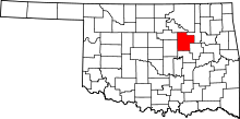 | |
| Towns | ||
| CDP | ||
| Unincorporated communities | ||
| Ghost town | ||
| Footnotes | ‡This populated place also has portions in an adjacent county or counties | |