Cleveland, Oklahoma
| Cleveland, Oklahoma | |
|---|---|
| City | |
|
Panoramic view of Cleveland in 1905, a year after the discovery of oil | |
| Nickname(s): Oklahoma's Pioneer Oil City | |
 Location within Pawnee County and Oklahoma | |
| Coordinates: 36°18′23″N 96°27′53″W / 36.30639°N 96.46472°WCoordinates: 36°18′23″N 96°27′53″W / 36.30639°N 96.46472°W | |
| Country | United States |
| State | Oklahoma |
| County | Pawnee |
| Area | |
| • Total | 2.6 sq mi (6.7 km2) |
| • Land | 2.6 sq mi (6.7 km2) |
| • Water | 0.0 sq mi (0.0 km2) |
| Elevation | 778 ft (237 m) |
| Population (2009) | |
| • Total | 3,251 |
| • Density | 1,250.4/sq mi (485.2/km2) |
| Time zone | Central (CST) (UTC-6) |
| • Summer (DST) | CDT (UTC-5) |
| ZIP code | 74020 |
| Area code(s) | 539/918 |
| FIPS code | 40-15350[1] |
| GNIS feature ID | 1091455[2] |

Cleveland is a city in Pawnee County, Oklahoma. The 2010 census population was 3,251, a decrease of 0.9 percent from 3,282 at the 2000 census.[3]
History
After the Cherokee Outlet opening, a homesteader by the name of Willis H. Herbert established a town named Herbert by opening a post office on the current townsite of Cleveland on October 28, 1893. The Post Office department subsequently withdrew the approval of the Herbert post office. The post office was then moved 100 feet, and reestablished under the name Cleveland, named in honor of then President Grover Cleveland on April 19, 1894. By 1900, the town's population was 211. Before the discovery of oil in the area, the town served as a trade center between the local farmers and the Osage Tribe who lived on the reservation on the other side of the Arkansas river.[4]
In 1904, a railroad line owned by the Missouri, Kansas and Oklahoma Railroad (later known as Missouri, Kansas and Texas Railway or Katy) from Oklahoma City reached Cleveland and crossed the Arkansas River into Osage County. On May 27, 1904, the first oil well was spudded near the community, and it caused an influx of oil workers and other people. At the time of statehood in 1907, Cleveland had 1,441 residents.[4]
Geography
According to the United States Census Bureau, the city has a total area of 2.6 square miles (6.7 km2), of which 2.6 square miles (6.7 km2) is land and 0.38% is water.
Demographics
| Historical population | |||
|---|---|---|---|
| Census | Pop. | %± | |
| 1900 | 211 | — | |
| 1910 | 1,310 | 520.9% | |
| 1920 | 2,717 | 107.4% | |
| 1930 | 2,959 | 8.9% | |
| 1940 | 2,510 | −15.2% | |
| 1950 | 2,464 | −1.8% | |
| 1960 | 2,519 | 2.2% | |
| 1970 | 2,573 | 2.1% | |
| 1980 | 2,972 | 15.5% | |
| 1990 | 3,156 | 6.2% | |
| 2000 | 3,282 | 4.0% | |
| 2010 | 3,251 | −0.9% | |
| Est. 2015 | 3,216 | [5] | −1.1% |
As of the census[1] of 2000, there were 3,282 people, 1,322 households, and 913 families residing in the city. The population density was 1,264.1 people per square mile (487.4/km²). There were 1,483 housing units at an average density of 571.2 per square mile (220.2/km²). The racial makeup of the city was 85.19% White, 0.21% African American, 8.96% Native American, 0.46% Asian, 0.06% Pacific Islander, 0.34% from other races, and 4.78% from two or more races. Hispanic or Latino of any race were 1.04% of the population.
There were 1,322 households out of which 30.9% had children under the age of 18 living with them, 54.2% were married couples living together, 10.2% had a female householder with no husband present, and 30.9% were non-families. 28.7% of all households were made up of individuals and 16.6% had someone living alone who was 65 years of age or older. The average household size was 2.43 and the average family size was 2.97.
In the city the population was spread out with 25.9% under the age of 18, 8.8% from 18 to 24, 25.1% from 25 to 44, 20.5% from 45 to 64, and 19.7% who were 65 years of age or older. The median age was 38 years. For every 100 females there were 87.7 males. For every 100 females age 18 and over, there were 83.8 males.
The median income for a household in the city was $28,861, and the median income for a family was $36,585. Males had a median income of $30,099 versus $19,122 for females. The per capita income for the city was $14,996. About 10.3% of families and 14.1% of the population were below the poverty line, including 17.3% of those under age 18 and 12.2% of those age 65 or over.
Notable people
- David Bivin - author
- Tony Perkins - president of the Family Research Council and a former Republican member of the Louisiana House of Representatives graduated from Cleveland High School in 1981.
- Billy Vessels was born in Cleveland in 1931 and played football for the Tigers before graduating and becoming a star back at the University of Oklahoma. He was the 1952 Heisman Trophy winner.
References
- 1 2 "American FactFinder". United States Census Bureau. Archived from the original on 2013-09-11. Retrieved 2008-01-31.
- ↑ "US Board on Geographic Names". United States Geological Survey. 2007-10-25. Retrieved 2008-01-31.
- ↑ CensusViewer:Population of the City of Cleveland, Oklahoma..
- 1 2 Encyclopedia of Oklahoma History and Culture - Cleveland Retrieved 2/26/2011
- ↑ "Annual Estimates of the Resident Population for Incorporated Places: April 1, 2010 to July 1, 2015". Retrieved July 2, 2016.
- ↑ "Census of Population and Housing". Census.gov. Archived from the original on May 11, 2015. Retrieved June 4, 2015.
External links
Municipalities and communities of Pawnee County, Oklahoma, United States | ||
|---|---|---|
| Cities | 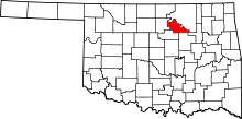 | |
| Towns | ||
| Unincorporated communities |
| |
| Footnotes | ‡This populated place also has portions in an adjacent county or counties | |
| Counties |  | |
|---|---|---|
| Principal city | ||
| Cities over 20k | ||
| Cities 10k-20k | ||
| Cities 5k-10k | ||
| Cities and towns 1k-5k | ||