Ripley, Oklahoma
| Ripley, Oklahoma | |
|---|---|
| Town | |
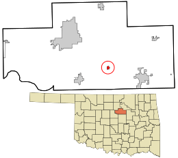 Location within Payne County and Oklahoma | |
| Coordinates: 36°1′3″N 96°54′14″W / 36.01750°N 96.90389°WCoordinates: 36°1′3″N 96°54′14″W / 36.01750°N 96.90389°W | |
| Country | United States |
| State | Oklahoma |
| County | Payne |
| Area | |
| • Total | 0.4 sq mi (1.0 km2) |
| • Land | 0.4 sq mi (1.0 km2) |
| • Water | 0.0 sq mi (0.0 km2) |
| Elevation | 846 ft (258 m) |
| Population (2010) | |
| • Total | 423 |
| • Density | 1,100/sq mi (420/km2) |
| Time zone | Central (CST) (UTC-6) |
| • Summer (DST) | CDT (UTC-5) |
| ZIP code | 74062 |
| Area code(s) | 539/918 |
| FIPS code | 40-63500 [1] |
| GNIS feature ID | 1097217 [2] |

Ripley is a town in southeastern Payne County, Oklahoma, United States.[3] The population was 423 at the 2010 census, a decline of 9.2 percent from 444 at the 2000 census.[4] The town was named after William P. Ripley, the fourteenth president of the Atchison, Topeka and Santa Fe Railway.[5]
History
The Atchison, Topeka and Santa Fe Railway (often called simply the Santa Fe) developed Ripley and auctioned the first lots on January 13, 1900. The first wagon bridge across the Cimarron River was completed July 31, 1900, which was the excuse for a big party that lasted until the wee hours of the next morning.[3]
Agriculture became the main source of income besides the railroad. A large farm named Morehead Plantation hired many African-American laborers to produce cotton. The cotton business declined sharply after World War I, but oil discoveries in the county offset the cotton decline for a while. However, oil markets declined in the late 1920s and the beginning of the Great Depression caused the town economy to decline. Ripley's population declined from a peak of 487 in 1930 to 292 in 1950 and 263 in 1960. The population rebounded to 451 in 1980 and 376 in 1990.[3]
Geography
Ripley is located at 36°01′03″N 96°54′14″W / 36.017531°N 96.903876°W.[6] According to the United States Census Bureau, the town has a total area of 0.4 square miles (1.0 km2), all land. Ripley is located on the Cimarron River, 8 miles (13 km) east of Stillwater on State Highway 51 and 7 miles (11 km) south on State Highway 108.[3]
Demographics
| Historical population | |||
|---|---|---|---|
| Census | Pop. | %± | |
| 1900 | 474 | — | |
| 1910 | 368 | −22.4% | |
| 1920 | 406 | 10.3% | |
| 1930 | 487 | 20.0% | |
| 1940 | 415 | −14.8% | |
| 1950 | 292 | −29.6% | |
| 1960 | 263 | −9.9% | |
| 1970 | 307 | 16.7% | |
| 1980 | 451 | 46.9% | |
| 1990 | 376 | −16.6% | |
| 2000 | 444 | 18.1% | |
| 2010 | 403 | −9.2% | |
| Est. 2015 | 406 | [7] | 0.7% |
As of the census[1] of 2000, there were 444 people, 158 households, and 118 families residing in the town. The population density was 1,189.9 people per square mile (463.3/km2). There were 180 housing units at an average density of 482.4 per square mile (187.8/km2). The racial makeup of the town was 89.64% White, 0.00% African American, 4.95% Native American, 0.00% Asian, 0.00% Pacific Islander, 0.00% from other races, and 5.41% from two or more races. 1.35% of the population were Hispanic or Latino of any race.
There were 158 households out of which 40.5% had children under the age of 18 living with them, 51.3% were married couples living together, 15.8% had a female householder with no husband present, and 24.7% were non-families. 23.4% of all households were made up of individuals and 10.8% had someone living alone who was 65 years of age or older. The average household size was 2.81 and the average family size was 3.21.
In the town the population was spread out with 32.9% under the age of 18, 9.5% from 18 to 24, 26.1% from 25 to 44, 19.6% from 45 to 64, and 11.9% who were 65 years of age or older. The median age was 32 years. For every 100 females there were 88.1 males. For every 100 females age 18 and over, there were 86.3 males.
The median income for a household in the town was $24,643, and the median income for a family was $36,250. Males had a median income of $26,500 versus $15,250 for females. The per capita income for the town was $10,030. 18.9% of the population and 18.0% of families were below the poverty line. 19.7% of those under the age of 18 and 9.1% of those 65 and older were living below the poverty line.
Landmarks
- Allen Williamson Bridge - Memorial bridge near Ripley, named after the Oklahoma Representative Allen Williamson.
References
- 1 2 "American FactFinder". United States Census Bureau. Retrieved 2008-01-31.
- ↑ "US Board on Geographic Names". United States Geological Survey. 2007-10-25. Retrieved 2008-01-31.
- 1 2 3 4 Carla S. Chlouber, "Ripley," Encyclopedia of Oklahoma History and Culture. Accessed May 31, 2015.
- ↑ CensusViewer: Population of the City of Ripley, Oklahoma
- ↑ "Ripley, OKlahoma Town Information". ePodunk. Retrieved 6 February 2015.
- ↑ "US Gazetteer files: 2010, 2000, and 1990". United States Census Bureau. 2011-02-12. Retrieved 2011-04-23.
- ↑ "Annual Estimates of the Resident Population for Incorporated Places: April 1, 2010 to July 1, 2015". Retrieved July 2, 2016.
- ↑ "Census of Population and Housing". Census.gov. Retrieved June 4, 2015.
Municipalities and communities of Payne County, Oklahoma, United States | ||
|---|---|---|
| Cities | 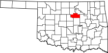 | |
| Towns | ||
| Unincorporated communities | ||
| Ghost town | ||
| Footnotes | ‡This populated place also has portions in an adjacent county or counties | |