Arnett, Oklahoma
| Arnett, Oklahoma | |
|---|---|
| Town | |
|
Ellis County courthouse | |
 Location of Arnett within Oklahoma | |
| Coordinates: 36°8′4″N 99°46′15″W / 36.13444°N 99.77083°WCoordinates: 36°8′4″N 99°46′15″W / 36.13444°N 99.77083°W | |
| Country | United States |
| State | Oklahoma |
| County | Ellis |
| Founded | 1900 |
| Incorporated | 1909 |
| Area | |
| • Total | 0.4 sq mi (1.1 km2) |
| • Land | 0.4 sq mi (1.1 km2) |
| • Water | 0.0 sq mi (0.0 km2) |
| Elevation | 2,447 ft (746 m) |
| Population (2010)[1] | |
| • Total | 524 |
| • Density | 1,300/sq mi (480/km2) |
| Time zone | Central (CST) (UTC-6) |
| • Summer (DST) | CDT (UTC-5) |
| ZIP code | 73832 |
| Area code(s) | 580 |
| FIPS code | 40-02800 [2] |
| GNIS feature ID | 1089707 [3] |

Arnett is a town in and the county seat of Ellis County, Oklahoma, United States.[4] The population was 524 at the 2010 census, an 0.77 percent increase from 520 at the 2000 census.[5]
History
The townsite came about at the junction of local trading routes. A post office was established at the townsite in 1902, with William G. Brown as the postmaster. Brown is said to have named the post office Arnett after A. S. Arnett, Brown's minister from Fayetteville, West Virginia.[6][7][8]
Geography
Arnett is located at 36°8′4″N 99°46′15″W / 36.13444°N 99.77083°W (36.134368, −99.770826)[9] at an elevation of 2,447 feet (746 m).[3] It lies approximately 9 miles (14 km) north-northeast of the Canadian River in the rolling Red Plains region of the Great Plains. Located in northwestern Oklahoma at the junction of U.S. Route 60 and U.S. Route 283, Arnett is 131 mi (211 km) west-northwest of Oklahoma City, 135 mi (217 km) northeast of Amarillo, and 172 mi (277 km) southwest of Wichita.[10]
According to the United States Census Bureau, the town has a total area of 0.4 square miles (1.0 km2), all of it land.
Climate
Arnett has a humid subtropical climate (Köppen Cfa) with hot, humid summers and cold, dry winters. The average temperature in Arnett is 57 °F (13 °C),[11] and the average yearly precipitation is 25.4 inches (644 mm). On average, January is the coolest month, July is the warmest month, and May is the wettest month. The hottest temperature recorded in Arnett was 110 °F (43 °C) in 1951; the coldest temperature recorded was -12 °F (-24 °C) in 1959.[12]
| Climate data for Arnett, Oklahoma, United States | |||||||||||||
|---|---|---|---|---|---|---|---|---|---|---|---|---|---|
| Month | Jan | Feb | Mar | Apr | May | Jun | Jul | Aug | Sep | Oct | Nov | Dec | Year |
| Record high °F (°C) | 85 (29) |
88 (31) |
93 (34) |
98 (37) |
102 (39) |
110 (43) |
109 (43) |
110 (43) |
105 (41) |
99 (37) |
88 (31) |
87 (31) |
110 (43) |
| Average high °F (°C) | 45 (7) |
51 (11) |
59 (15) |
69 (21) |
77 (25) |
86 (30) |
91 (33) |
90 (32) |
82 (28) |
71 (22) |
57 (14) |
47 (8) |
68.8 (20.5) |
| Daily mean °F (°C) | 33 (1) |
37 (3) |
46 (8) |
57 (14) |
66 (19) |
75 (24) |
80 (27) |
79 (26) |
70 (21) |
59 (15) |
46 (8) |
35 (2) |
56.9 (14) |
| Average low °F (°C) | 20 (−7) |
25 (−4) |
33 (1) |
42 (6) |
52 (11) |
62 (17) |
66 (19) |
65 (18) |
57 (14) |
45 (7) |
32 (0) |
23 (−5) |
43.5 (6.4) |
| Record low °F (°C) | −12 (−24) |
−9 (−23) |
−6 (−21) |
18 (−8) |
28 (−2) |
43 (6) |
52 (11) |
49 (9) |
30 (−1) |
14 (−10) |
5 (−15) |
−11 (−24) |
−12 (−24) |
| Average precipitation inches (mm) | 0.63 (16) |
0.95 (24.1) |
1.95 (49.5) |
2.23 (56.6) |
4.54 (115.3) |
3.50 (88.9) |
2.08 (52.8) |
2.41 (61.2) |
2.47 (62.7) |
2.15 (54.6) |
1.44 (36.6) |
1.01 (25.7) |
25.36 (644) |
| Source: The Weather Channel;[12] Weatherbase[11] | |||||||||||||
Demographics
| Historical population | |||
|---|---|---|---|
| Census | Pop. | %± | |
| 1910 | 511 | — | |
| 1920 | 404 | −20.9% | |
| 1930 | 426 | 5.4% | |
| 1940 | 529 | 24.2% | |
| 1950 | 690 | 30.4% | |
| 1960 | 547 | −20.7% | |
| 1970 | 711 | 30.0% | |
| 1980 | 714 | 0.4% | |
| 1990 | 547 | −23.4% | |
| 2000 | 520 | −4.9% | |
| 2010 | 524 | 0.8% | |
| Est. 2015 | 532 | [13] | 1.5% |
As of the census of 2010, there were 524 people residing in the town.[1] The population density was 1,300 people per square mile (478/km²). There were 281 housing units at an average density of 666.4 per square mile (258.3/km²). The racial makeup of the town was 96.35% White, 0.38% African American, 0.96% Native American, 1.15% from other races, and 1.15% from two or more races. Hispanic or Latino of any race were 1.35% of the population.
There were 238 households out of which 23.1% had children under the age of 18 living with them, 51.3% were married couples living together, 5.9% had a female householder with no husband present, and 40.8% were non-families. 39.1% of all households were made up of individuals and 19.3% had someone living alone who was 65 years of age or older. The average household size was 2.13 and the average family size was 2.81.
In the town the population was spread out with 21.3% under the age of 18, 6.3% from 18 to 24, 23.3% from 25 to 44, 25.8% from 45 to 64, and 23.3% who were 65 years of age or older. The median age was 44 years. For every 100 females there were 97.0 males. For every 100 females age 18 and over, there were 94.8 males.
The median income for a household in the town was $26,618, and the median income for a family was $29,861. Males had a median income of $24,250 versus $13,438 for females. The per capita income for the town was $14,512. About 12.8% of families and 18.9% of the population were below the poverty line, including 27.4% of those under age 18 and 20.0% of those age 65 or over.
Education
Arnett Public Schools operates one school in the town, Arnett School (Grades Pre-K-12).[15]
Transportation
U.S. Route 60 and SH-51 run concurrently east-west through Arnett. U.S. Route 283, a north-south highway which meets U.S. 60 and SH-51 roughly one-half mile east of town, runs concurrently east-west with U.S. 60 and SH-51 through town. Arnett is also the southern terminus of SH-46 which runs north-south.
Media
Arnett has a weekly newspaper, The Ellis County Capital.[16]
Notable people
Notable individuals who were born in and/or have lived in Arnett include:
*Rodney Knowles
- Donald J. Gott (1923-1944), U.S. Army 1st Lieutenant, Medal of Honor recipient[17]
References
- 1 2 "2010 City Population and Housing Occupancy Status". U.S. Census Bureau. Archived from the original on July 26, 2011. Retrieved October 18, 2013.
- ↑ "American FactFinder". United States Census Bureau. Archived from the original on 2013-09-11. Retrieved 2008-01-31.
- 1 2 "US Board on Geographic Names". United States Geological Survey. 2007-10-25. Retrieved 2008-01-31.
- ↑ "Find a County". National Association of Counties. Archived from the original on 2011-05-31. Retrieved 2011-06-07.
- ↑ CensusViewer:Arnett, Oklahoma Population.
- ↑ "Ellis County" Towns. - USGenNet
- ↑ Arnett Archived October 15, 2008, at the Wayback Machine.. - Encyclopedia of Oklahoma History and Culture. - Oklahoma Historical Society
- ↑ Shirk, George H., (1987). - Oklahoma Place Names. - Norman: University of Oklahoma Press. - p.12. - ISBN 978-0-8061-2028-7
- ↑ "US Gazetteer files: 2010, 2000, and 1990". United States Census Bureau. 2011-02-12. Retrieved 2011-04-23.
- ↑ "City Distance Tool". Geobytes. Archived from the original on 5 October 2010. Retrieved 2010-08-29.
- 1 2 "Historical Weather for Arnett, Oklahoma, United States of America". Weatherbase. Retrieved 2010-08-29.
- 1 2 "Average weather for Arnett, OK". The Weather Channel. Retrieved 2010-08-29.
- ↑ "Annual Estimates of the Resident Population for Incorporated Places: April 1, 2010 to July 1, 2015". Retrieved July 2, 2016.
- ↑ "Census of Population and Housing". Census.gov. Archived from the original on May 11, 2015. Retrieved June 4, 2015.
- ↑ "Arnett Wildcats". Arnett Public Schools. Archived from the original on 24 August 2010. Retrieved 2010-09-07.
- ↑ "About this Newspaper: Ellis County capital.". Chronicling America. Library of Congress. Retrieved 2010-08-29.
- ↑ "Donald Joseph Gott". Hall of Valor. Military Times. Retrieved 2016-06-16.
External links
Municipalities and communities of Ellis County, Oklahoma, United States | ||
|---|---|---|
| Towns | 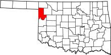 | |
| Unincorporated communities | ||