Seven Mile, Ohio
| Seven Mile, Ohio | |
|---|---|
| Village | |
|
Houses on Main Street | |
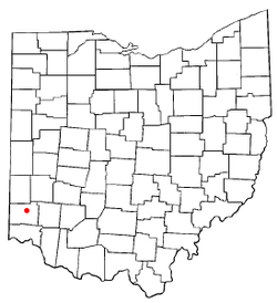 Location of Seven Mile, Ohio | |
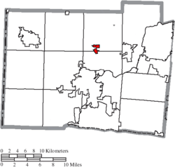 Location of Seven Mile in Butler County | |
| Coordinates: 39°28′56″N 84°33′13″W / 39.48222°N 84.55361°WCoordinates: 39°28′56″N 84°33′13″W / 39.48222°N 84.55361°W | |
| Country | United States |
| State | Ohio |
| County | Butler |
| Area[1] | |
| • Total | 0.72 sq mi (1.86 km2) |
| • Land | 0.72 sq mi (1.86 km2) |
| • Water | 0 sq mi (0 km2) |
| Elevation[2] | 653 ft (199 m) |
| Population (2010)[3] | |
| • Total | 751 |
| • Estimate (2012[4]) | 752 |
| • Density | 1,043.1/sq mi (402.7/km2) |
| Time zone | Eastern (EST) (UTC-5) |
| • Summer (DST) | EDT (UTC-4) |
| ZIP code | 45062 |
| Area code(s) | 513 |
| FIPS code | 39-71444[5] |
| GNIS feature ID | 1065300[2] |

Seven Mile is a village in Butler County, Ohio, United States. The population was 751 at the 2010 census.
Seven Mile is served by Edgewood Local School District. Seven Mile Elementary School is the only school located within the village limits.
History
Seven Mile was laid out on a turnpike in 1841. It took its name from nearby Sevenmile Creek.[6] Seven Mile was incorporated as a village in 1875.[7]
In 1905, Seven Mile contained a hotel, a harness shop, a tin shop, meat store, and a mill.[7] The village was spared during the Great Dayton Flood due to the elevated railroad grade separating it from Sevenmile Creek.[8]
At the turn of the 20th century, the village celebrated a peculiar type of parade called the "Rag'n Fads" where all the children dressed up in the most tattered clothes they owned, according to the April 6, 1901, issue of Leslie's Weekly.[9]
Geography
Seven Mile is located at 39°28′56″N 84°33′13″W / 39.48222°N 84.55361°W (39.482356, -84.553544).[10]
According to the United States Census Bureau, the village has a total area of 0.72 square miles (1.86 km2), all land.[1]
Demographics
| Historical population | |||
|---|---|---|---|
| Census | Pop. | %± | |
| 1860 | 193 | — | |
| 1870 | 220 | 14.0% | |
| 1880 | 251 | 14.1% | |
| 1890 | 268 | 6.8% | |
| 1900 | 351 | 31.0% | |
| 1910 | 340 | −3.1% | |
| 1920 | 369 | 8.5% | |
| 1930 | 455 | 23.3% | |
| 1940 | 549 | 20.7% | |
| 1950 | 569 | 3.6% | |
| 1960 | 690 | 21.3% | |
| 1970 | 699 | 1.3% | |
| 1980 | 841 | 20.3% | |
| 1990 | 804 | −4.4% | |
| 2000 | 678 | −15.7% | |
| 2010 | 751 | 10.8% | |
| Est. 2015 | 768 | [11] | 2.3% |
2010 census
As of the census[3] of 2010, there were 751 people, 295 households, and 206 families residing in the village. The population density was 1,043.1 inhabitants per square mile (402.7/km2). There were 317 housing units at an average density of 440.3 per square mile (170.0/km2). The racial makeup of the village was 97.6% White, 0.1% African American, 0.1% Native American, 0.3% Asian, 0.7% from other races, and 1.2% from two or more races. Hispanic or Latino of any race were 1.3% of the population.
There were 295 households of which 35.6% had children under the age of 18 living with them, 51.5% were married couples living together, 12.9% had a female householder with no husband present, 5.4% had a male householder with no wife present, and 30.2% were non-families. 22.4% of all households were made up of individuals and 11.2% had someone living alone who was 65 years of age or older. The average household size was 2.55 and the average family size was 2.97.
The median age in the village was 40.3 years. 23.3% of residents were under the age of 18; 8.3% were between the ages of 18 and 24; 24.4% were from 25 to 44; 29.8% were from 45 to 64; and 14.4% were 65 years of age or older. The gender makeup of the village was 48.5% male and 51.5% female.
2000 census
As of the census[5] of 2000, there were 678 people, 254 households, and 197 families residing in the village. The population density was 894.6 people per square mile (344.4/km²). There were 259 housing units at an average density of 341.7 per square mile (131.6/km²). The racial makeup of the village was 98.53% White, 0.29% African American, 0.74% Asian, and 0.44% from two or more races. Hispanic or Latino of any race were 0.74% of the population.
There were 254 households out of which 36.2% had children under the age of 18 living with them, 63.8% were married couples living together, 10.6% had a female householder with no husband present, and 22.4% were non-families. 18.5% of all households were made up of individuals and 7.9% had someone living alone who was 65 years of age or older. The average household size was 2.65 and the average family size was 3.04.
In the village the population was spread out with 27.5% under the age of 18, 6.8% from 18 to 24, 29.1% from 25 to 44, 21.8% from 45 to 64, and 15.8% who were 65 years of age or older. The median age was 38 years. For every 100 females there were 91.0 males. For every 100 females age 18 and over, there were 88.6 males.
The median income for a household in the village was $41,705, and the median income for a family was $49,000. Males had a median income of $37,917 versus $21,806 for females. The per capita income for the village was $18,092. About 4.5% of families and 4.1% of the population were below the poverty line, including 1.6% of those under age 18 and 4.9% of those age 65 or over.
References
- 1 2 "US Gazetteer files 2010". United States Census Bureau. Retrieved 2013-01-06.
- 1 2 "US Board on Geographic Names". United States Geological Survey. 2007-10-25. Retrieved 2008-01-31.
- 1 2 "American FactFinder". United States Census Bureau. Retrieved 2013-01-06.
- ↑ "Population Estimates". United States Census Bureau. Retrieved 2013-06-17.
- 1 2 "American FactFinder". United States Census Bureau. Retrieved 2008-01-31.
- ↑ Mangus, Michael; Herman, Jennifer L. (2008). Ohio Encyclopedia. North American Book Dist LLC. p. 530. ISBN 978-1-878592-68-2.
- 1 2 Bartlow, Bert Surene (1905). Centennial History of Butler County, Ohio. B. F. Bowen. p. 349.
- ↑ Jones, Richard (March 29, 2013). "Flood ravaged some small towns, left others alone". Journal-News. Retrieved 24 December 2015.
- ↑ Leslie, Frank. "Leslie's". Volume 92. p. 336. Retrieved 22 November 2013.
- ↑ "US Gazetteer files: 2010, 2000, and 1990". United States Census Bureau. 2011-02-12. Retrieved 2011-04-23.
- ↑ "Annual Estimates of the Resident Population for Incorporated Places: April 1, 2010 to July 1, 2015". Retrieved July 2, 2016.
- ↑ "Census of Population and Housing". Census.gov. Retrieved June 4, 2015.
Municipalities and communities of Butler County, Ohio, United States | ||
|---|---|---|
| Cities | 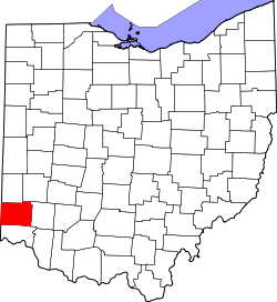 | |
| Villages | ||
| Townships | ||
| CDPs | ||
| Unincorporated communities | ||
| Footnotes | ‡This populated place also has portions in an adjacent county or counties | |