National Register of Historic Places listings in Pickaway County, Ohio

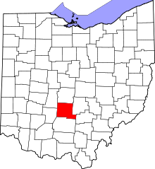
Location of Pickaway County in Ohio

This is a list of the National Register of Historic Places listings in Pickaway County, Ohio.

This is intended to be a complete list of the properties and districts on the National Register of Historic Places in Pickaway County, Ohio, United States. The locations of National Register properties and districts for which the latitude and longitude coordinates are included below, may be seen in a Google map.[1]

There are 30 properties and districts listed on the National Register in the county.

This National Park Service list is complete through NPS recent listings posted December 2, 2016.[2]
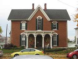
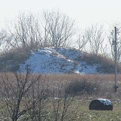
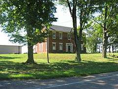
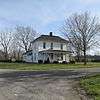
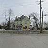
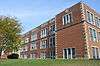
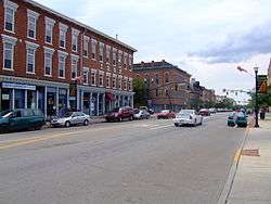
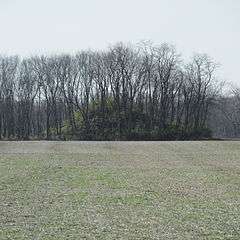
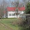
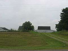
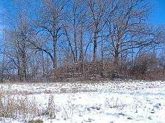
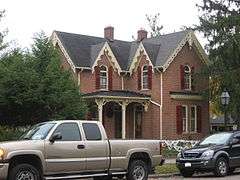
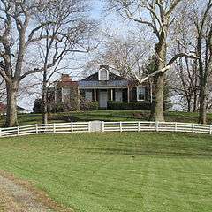
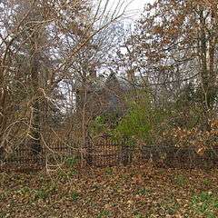
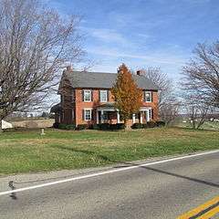
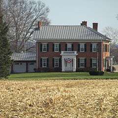
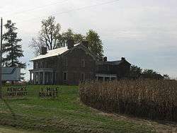
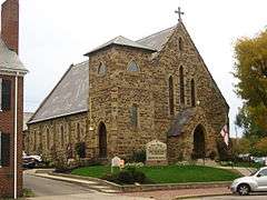
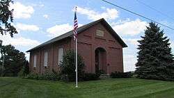
Current listings

[3] Name on the Register[4] Image Date listed[5] Location City or town Description
1 William Marshall Anderson House
William Marshall Anderson House
November 29, 1979
(#79001925)
131 W. Union St.
39°35′57″N 82°56′50″W / 39.599167°N 82.947222°W / 39.599167; -82.947222 (William Marshall Anderson House)
Circleville
2 Arledge Mounds I and II
Arledge Mounds I and II
July 30, 1974
(#74001591)
Off State Route 56 southeast of Circleville[6]
39°33′00″N 82°52′27″W / 39.550000°N 82.874167°W / 39.550000; -82.874167 (Arledge Mounds I and II)
Pickaway Township Not along any road[7]
3 Ashville Depot
Ashville Depot
February 25, 1980
(#80003209)
Madison and Cromley Sts.
39°42′54″N 82°57′20″W / 39.715°N 82.955556°W / 39.715; -82.955556 (Ashville Depot)
Ashville
4 Bazore Mill
Bazore Mill
December 19, 1978
(#78002172)
South of Williamsport on State Route 138 at Deer Creek
39°33′04″N 83°06′31″W / 39.551111°N 83.108611°W / 39.551111; -83.108611 (Bazore Mill)
Deer Creek Township
5 Bellevue
Bellevue
March 17, 1976
(#76001508)
North of Kingston on State Route 159
39°29′01″N 82°54′07″W / 39.483611°N 82.901944°W / 39.483611; -82.901944 (Bellevue)
Pickaway Township
6 Joseph Black Farmhouse
Joseph Black Farmhouse
August 9, 1982
(#02001459)
9862 Heffner Rd.
39°30′51″N 82°50′47″W / 39.514047°N 82.846325°W / 39.514047; -82.846325 (Joseph Black Farmhouse)
Pickaway Township
7 Granville M. Bulen House and Farm Complex
Granville M. Bulen House and Farm Complex
February 24, 2014
(#14000028)
10001 Bulen-Pierce Rd., south of Lockbourne
39°47′14″N 82°58′34″W / 39.787333°N 82.976111°W / 39.787333; -82.976111 (Granville M. Bulen House and Farm Complex)
Harrison Township
8 Circleville High School
Circleville High School
August 31, 2015
(#15000576)
520 S. Court St.
39°35′48″N 82°56′49″W / 39.596667°N 82.946944°W / 39.596667; -82.946944 (Circleville High School)
Circleville
9 Circleville Historic District
Circleville Historic District
May 16, 1978
(#78002171)
Main and Court Sts.
39°36′07″N 82°56′42″W / 39.601903°N 82.945097°W / 39.601903; -82.945097 (Circleville Historic District)
Circleville
10 W.C. Clemmons Mound
W.C. Clemmons Mound
May 2, 1974
(#74001594)
Southern side of Florence Chapel Rd., northwest of Fox[8]
39°38′57″N 83°01′44″W / 39.649167°N 83.028889°W / 39.649167; -83.028889 (W.C. Clemmons Mound)
Jackson Township Near Fox
11 Fridley-Oman Farm
Fridley-Oman Farm
December 6, 1975
(#75001517)
West of Marcy in Slate Run Metropolitan Park
39°45′13″N 82°50′54″W / 39.753611°N 82.848333°W / 39.753611; -82.848333 (Fridley-Oman Farm)
Madison Township
12 Gill-Morris Farm
Gill-Morris Farm
August 14, 1986
(#86001658)
10104 State Route 56, southeast of Circleville
39°32′19″N 82°50′36″W / 39.538611°N 82.843333°W / 39.538611; -82.843333 (Gill-Morris Farm)
Salt Creek Township
13 Horn Mound
Horn Mound
August 7, 1974
(#74001595)
Dead end of Armstrong Road, southeast of Tarlton[9]
39°31′20″N 82°44′22″W / 39.522222°N 82.739444°W / 39.522222; -82.739444 (Horn Mound)
Salt Creek Township Near Tarlton
14 Horsey-Barthelmas Farm
Horsey-Barthelmas Farm
July 24, 1980
(#80003210)
West of Circleville on State Route 104
39°33′18″N 83°00′32″W / 39.555°N 83.008889°W / 39.555; -83.008889 (Horsey-Barthelmas Farm)
Wayne Township
15 Lawndale Farm Complex
Lawndale Farm Complex
April 19, 1984
(#84003795)
26476 Gay Dreisbach Rd., south of Circleville
39°32′49″N 82°55′10″W / 39.546944°N 82.919444°W / 39.546944; -82.919444 (Lawndale Farm Complex)
Pickaway Township
16 Luthor List Mound
Luthor List Mound
October 16, 1974
(#74001592)
Along the Kingston Pike, southeast of Circleville[10]
39°34′31″N 82°55′29″W / 39.5753°N 82.9247°W / 39.5753; -82.9247 (Luthor List Mound)
Circleville Township Also known as the Burning Mound[4]
17 Matthew McCrea House
Matthew McCrea House
September 29, 1988
(#88001714)
428 E. Main St.
39°35′58″N 82°56′12″W / 39.599444°N 82.936597°W / 39.599444; -82.936597 (Matthew McCrea House)
Circleville
18 Memorial Hall
Memorial Hall
November 21, 1980
(#80003211)
165 E. Main St.
39°36′03″N 82°56′34″W / 39.600944°N 82.942761°W / 39.600944; -82.942761 (Memorial Hall)
Circleville
19 Morris House
Morris House
August 3, 1979
(#79001926)
149 W. Union St.
39°35′58″N 82°56′56″W / 39.599306°N 82.948942°W / 39.599306; -82.948942 (Morris House)
Circleville
20 Mount Oval
Mount Oval
July 25, 1974
(#74001593)
Off U.S. Route 23, south of Circleville
39°31′42″N 82°57′59″W / 39.528333°N 82.966389°W / 39.528333; -82.966389 (Mount Oval)
Pickaway Township
21 Perrill-Goodman Farm House
Perrill-Goodman Farm House
March 14, 1985
(#85000565)
Goodman Rd., south of Groveport
39°47′18″N 82°52′56″W / 39.788333°N 82.882222°W / 39.788333; -82.882222 (Perrill-Goodman Farm House)
Madison Township
22 Stevenson Peters House
Stevenson Peters House
February 9, 1984
(#84003797)
9860 State Route 188, northeast of Circleville
39°40′29″N 82°50′17″W / 39.674722°N 82.838056°W / 39.674722; -82.838056 (Stevenson Peters House)
Walnut Township
23 Redlands
Redlands
May 14, 1982
(#82003630)
1960 N. Court St., north of Circleville
39°38′06″N 82°56′31″W / 39.635°N 82.941944°W / 39.635; -82.941944 (Redlands)
Circleville Township
24 Renick Farm
Renick Farm
March 5, 1982
(#82003631)
North of South Bloomfield on U.S. Route 23
39°45′01″N 82°59′28″W / 39.750278°N 82.991111°W / 39.750278; -82.991111 (Renick Farm)
Harrison Township
25 Saint Philip's Episcopal Church
Saint Philip's Episcopal Church
May 15, 1986
(#86001064)
129 W. Mound St.
39°35′59″N 82°56′50″W / 39.599722°N 82.947222°W / 39.599722; -82.947222 (Saint Philip's Episcopal Church)
Circleville
26 Scioto Township District No. 2 Schoolhouse
Scioto Township District No. 2 Schoolhouse
May 6, 1987
(#87000634)
8143 Snyder Rd., east of Orient
39°47′45″N 83°05′38″W / 39.795833°N 83.093889°W / 39.795833; -83.093889 (Scioto Township District No. 2 Schoolhouse)
Scioto Township
27 The Shack
The Shack
May 23, 1974
(#74001596)
Northwest of Williamsport
39°38′07″N 83°13′47″W / 39.635278°N 83.229722°W / 39.635278; -83.229722 (The Shack)
Monroe Township
28 Tick Ridge Mound District
Tick Ridge Mound District
June 11, 1975
(#75001518)
Tick Ridge Peninsula in Deer Creek State Park[11]
39°36′56″N 83°14′15″W / 39.615556°N 83.237500°W / 39.615556; -83.237500 (Tick Ridge Mound District)
Monroe Township
29 Ansel T. Walling House
Ansel T. Walling House
December 14, 1987
(#87002145)
146 W. Union St.
39°35′58″N 82°56′55″W / 39.599444°N 82.948611°W / 39.599444; -82.948611 (Ansel T. Walling House)
Circleville
30 Watt-Groce-Fickhardt House
Watt-Groce-Fickhardt House
August 23, 1985
(#85001804)
360 E. Main St.
39°36′00″N 82°56′20″W / 39.6°N 82.938889°W / 39.6; -82.938889 (Watt-Groce-Fickhardt House)
Circleville

See also

Wikimedia Commons has media related to National Register of Historic Places in Pickaway County, Ohio.

References

  1. The latitude and longitude information provided in this table was derived originally from the National Register Information System, which has been found to be fairly accurate for about 99% of listings. For about 1% of NRIS original coordinates, experience has shown that one or both coordinates are typos or otherwise extremely far off; some corrections may have been made. A more subtle problem causes many locations to be off by up to 150 yards, depending on location in the country: most NRIS coordinates were derived from tracing out latitude and longitudes off of USGS topographical quadrant maps created under the North American Datum of 1927, which differs from the current, highly accurate WGS84 GPS system used by most on-line maps. Chicago is about right, but NRIS longitudes in Washington are higher by about 4.5 seconds, and are lower by about 2.0 seconds in Maine. Latitudes differ by about 1.0 second in Florida. Some locations in this table may have been corrected to current GPS standards.
  2. "National Register of Historic Places: Weekly List Actions". National Park Service, United States Department of the Interior. Retrieved on December 2, 2016.
  3. Numbers represent an ordering by significant words. Various colorings, defined here, differentiate National Historic Landmarks and historic districts from other NRHP buildings, structures, sites or objects.
  4. 1 2 National Park Service (2008-04-24). "National Register Information System". National Register of Historic Places. National Park Service.
  5. The eight-digit number below each date is the number assigned to each location in the National Register Information System database, which can be viewed by clicking the number.
  6. "Front Cover". Ohio Archaeologist 34.2 (1984): 3.
  7. Meeting minutes for Monday, 18 December 2006, Pickaway County Commissioners, 2006. Accessed 2009-10-14.
  8. Location derived from Mills, William C. Archeological Atlas of Ohio. Columbus: Ohio State Archeological and Historical Society, 1914, page 65 and plate 65. The NRIS lists the site as "Address Restricted".
  9. Location derived from the parcel report from the Pickaway County Auditor's Office; the NRIS lists the site as "Address Restricted".
  10. Location derived from its GNIS feature record; the NRIS lists the site as "Address Restricted"
  11. "Deer Creek Park", Record Herald, 2010-08-17. Accessed 2013-03-14.
This article is issued from Wikipedia - version of the 1/26/2016. The text is available under the Creative Commons Attribution/Share Alike but additional terms may apply for the media files.