College Corner, Ohio
| College Corner, Ohio | |
|---|---|
| Village | |
|
College Corner Union Elementary School: Indiana is on the left, and Ohio on the right | |
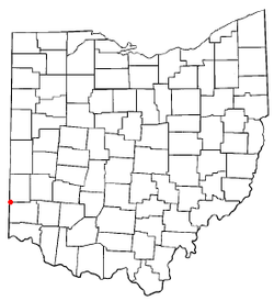 Location of College Corner, Ohio | |
 Location of College Corner in Preble County | |
| Coordinates: 39°34′4″N 84°48′45″W / 39.56778°N 84.81250°WCoordinates: 39°34′4″N 84°48′45″W / 39.56778°N 84.81250°W | |
| Country | United States |
| State | Ohio |
| Counties | Preble, Butler |
| Area[1] | |
| • Total | 0.26 sq mi (0.67 km2) |
| • Land | 0.25 sq mi (0.65 km2) |
| • Water | 0.01 sq mi (0.03 km2) |
| Elevation[2] | 981 ft (299 m) |
| Population (2010)[3] | |
| • Total | 407 |
| • Estimate (2012[4]) | 406 |
| • Density | 1,628.0/sq mi (628.6/km2) |
| Time zone | Eastern (EST) (UTC-5) |
| • Summer (DST) | EDT (UTC-4) |
| ZIP code | 45003 |
| Area code(s) | 513 |
| FIPS code | 39-16700[5] |
| GNIS feature ID | 1060986[2] |

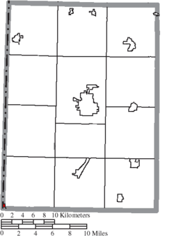
College Corner is a village in Butler and Preble counties in the southwestern part of the U.S. state of Ohio, 5 miles (8 km) northwest of Oxford. The population was 407 at the 2010 census.
The village lies on the state line with Indiana, where it borders the town of West College Corner, Indiana. The public school, part of the Union County–College Corner Joint School District, is bisected by the state line and is operated jointly with the Indiana authorities.
The Preble County portion of College Corner is part of the Dayton Metropolitan Statistical Area, while the Butler County portion is part of the Cincinnati–Middletown, OH-KY-IN Metropolitan Statistical Area.
History
It was settled in 1811 and takes its name from its position in the northwestern corner of the "College Township", the survey township designated the previous year by the Ohio General Assembly as the site of the state college that became Miami University. This survey township was later organized as a civil township, Oxford Township.
College Corner was laid out in 1837.[6]
Geography
College Corner is located at 39°34′4″N 84°48′45″W / 39.56778°N 84.81250°W (39.567851, -84.812537).[7]
According to the United States Census Bureau, the village has a total area of 0.26 square miles (0.67 km2), of which 0.25 square miles (0.65 km2) is land and 0.01 square miles (0.03 km2) is water.[1]
Demographics
| Historical population | |||
|---|---|---|---|
| Census | Pop. | %± | |
| 1900 | 378 | — | |
| 1910 | 379 | 0.3% | |
| 1920 | 348 | −8.2% | |
| 1930 | 375 | 7.8% | |
| 1940 | 379 | 1.1% | |
| 1950 | 468 | 23.5% | |
| 1960 | 439 | −6.2% | |
| 1970 | 408 | −7.1% | |
| 1980 | 364 | −10.8% | |
| 1990 | 379 | 4.1% | |
| 2000 | 424 | 11.9% | |
| 2010 | 407 | −4.0% | |
| Est. 2015 | 410 | [8] | 0.7% |
2010 census
As of the census[3] of 2010, there were 407 people, 172 households, and 107 families residing in the village. The population density was 1,628.0 inhabitants per square mile (628.6/km2). There were 209 housing units at an average density of 836.0 per square mile (322.8/km2). The racial makeup of the village was 97.1% White, 1.0% African American, 0.5% Native American, 0.2% Asian, and 1.2% from two or more races. Hispanic or Latino of any race were 0.2% of the population.
There were 172 households of which 30.8% had children under the age of 18 living with them, 46.5% were married couples living together, 12.2% had a female householder with no husband present, 3.5% had a male householder with no wife present, and 37.8% were non-families. 33.1% of all households were made up of individuals and 7.5% had someone living alone who was 65 years of age or older. The average household size was 2.37 and the average family size was 3.02.
The median age in the village was 38.1 years. 23.6% of residents were under the age of 18; 8.6% were between the ages of 18 and 24; 29% were from 25 to 44; 27.1% were from 45 to 64; and 11.8% were 65 years of age or older. The gender makeup of the village was 50.4% male and 49.6% female.
2000 census
As of the census[5] of 2000, there were 424 people, 203 households, and 106 families residing in the village. The population density was 1,592.5 people per square mile (606.3/km²). There were 225 housing units at an average density of 845.1 per square mile (321.8/km²). The racial makeup of the village was 98.82% White, 0.24% African American, and 0.94% from two or more races.
There were 203 households out of which 27.1% had children under the age of 18 living with them, 42.4% were married couples living together, 6.9% had a female householder with no husband present, and 47.3% were non-families. 40.4% of all households were made up of individuals and 11.3% had someone living alone who was 65 years of age or older. The average household size was 2.09 and the average family size was 2.82.
In the village the population was spread out with 23.8% under the age of 18, 11.6% from 18 to 24, 32.1% from 25 to 44, 22.6% from 45 to 64, and 9.9% who were 65 years of age or older. The median age was 32 years. For every 100 females there were 104.8 males. For every 100 females age 18 and over, there were 99.4 males.
The median income for a household in the village was $33,611, and the median income for a family was $40,833. Males had a median income of $31,406 versus $21,964 for females. The per capita income for the village was $14,568. About 6.3% of families and 8.8% of the population were below the poverty line, including 12.5% of those under age 18 and none of those age 65 or over.
Historic population figures
- 1900—378
- 1910—181
- 1920—162
- 1930—375
- 1940—379
- 1950—458
- 1960—676
- 1970—697
- 1980—809
- 1990—755
References
- 1 2 "US Gazetteer files 2010". United States Census Bureau. Archived from the original on 2012-06-26. Retrieved 2013-01-06.
- 1 2 "US Board on Geographic Names". United States Geological Survey. 2007-10-25. Retrieved 2008-01-31.
- 1 2 "American FactFinder". United States Census Bureau. Retrieved 2013-01-06.
- ↑ "Population Estimates". United States Census Bureau. Archived from the original on 2013-06-17. Retrieved 2013-06-17.
- 1 2 "American FactFinder". United States Census Bureau. Archived from the original on 2013-09-11. Retrieved 2008-01-31.
- ↑ Bartlow, Bert Surene (1905). Centennial History of Butler County, Ohio. B. F. Bowen. p. 362.
- ↑ "US Gazetteer files: 2010, 2000, and 1990". United States Census Bureau. 2011-02-12. Retrieved 2011-04-23.
- ↑ "Annual Estimates of the Resident Population for Incorporated Places: April 1, 2010 to July 1, 2015". Retrieved July 2, 2016.
- ↑ "Census of Population and Housing". Census.gov. Archived from the original on May 11, 2015. Retrieved June 4, 2015.
Further reading
- Bert S. Barlow, W.H. Todhunter, Stephen D. Cone, Joseph J. Pater, and Frederick Schneider, eds. Centennial History of Butler County, Ohio. Hamilton, Ohio: B.F. Bowen, 1905.
- Jim Blount. The 1900s: 100 Years In the History of Butler County, Ohio. Hamilton, Ohio: Past Present Press, 2000.
- Butler County Engineer's Office. Butler County Official Transportation Map, 2003. Fairfield Township, Butler County, Ohio: The Office, 2003.
- Bill Geist, reporter, and Amy Rosner, producer. "Time Line". CBS Sunday Morning. CBS Television. April 10, 2005.
- A History and Biographical Cyclopaedia of Butler County, Ohio with Illustrations and Sketches of Its Representative Men and Pioneers. Cincinnati, Ohio: Western Biographical Publishing Company, 1882.
- Ohio. Secretary of State. The Ohio municipal and township roster, 2002-2003. Columbus, Ohio: The Secretary, 2003.
External links
Municipalities and communities of Butler County, Ohio, United States | ||
|---|---|---|
| Cities | 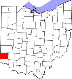 | |
| Villages | ||
| Townships | ||
| CDPs | ||
| Unincorporated communities | ||
| Footnotes | ‡This populated place also has portions in an adjacent county or counties | |
Municipalities and communities of Preble County, Ohio, United States | ||
|---|---|---|
| City | 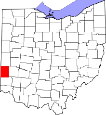 | |
| Villages | ||
| Townships | ||
| CDP | ||
| Unincorporated communities | ||
| Ghost towns | ||
| Footnotes | ‡This populated place also has portions in an adjacent county or counties | |