National Register of Historic Places listings in Mahoning County, Ohio
Location of Mahoning County in Ohio
This is a list of the National Register of Historic Places listings in Mahoning County, Ohio.
This is intended to be a complete list of the properties and districts on the National Register of Historic Places in Mahoning County, Ohio, United States. The locations of National Register properties and districts for which the latitude and longitude coordinates are included below, may be seen in a Google map.[1]
There are 70 properties and districts listed on the National Register in the county, including 1 National Historic Landmark. Another property was once listed but has been removed.
- This National Park Service list is complete through NPS recent listings posted December 2, 2016.[2]
Current listings
| [3] | Name on the Register[4] | Image | Date listed[5] | Location | City or town | Description |
|---|---|---|---|---|---|---|
| 1 | Alliance Clay Product Company | 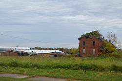 |
(#78002130) |
1500 S. Mahoning Ave., east of Alliance 40°54′13″N 81°04′57″W / 40.903611°N 81.0825°W |
Smith Township | |
| 2 | Judge William Shaw Anderson House | 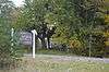 |
(#76001479) |
7171 Mahoning Ave. 41°05′55″N 80°48′14″W / 41.098611°N 80.803889°W |
Austintown Township | |
| 3 | Arlington Avenue District | 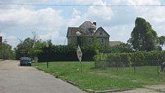 |
(#74001565) |
304-373 Arlington Ave. 41°06′29″N 80°39′14″W / 41.108056°N 80.653889°W |
Youngstown | |
| 4 | Austintown Log House | 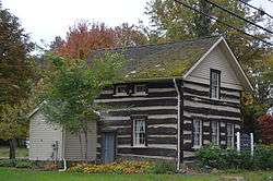 |
(#74001566) |
West of Youngstown on Raccoon Rd. 41°03′42″N 80°43′56″W / 41.061667°N 80.732222°W |
Austintown Township | |
| 5 | Baltimore & Ohio Railroad Terminal | 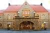 |
(#86001565) |
530 Mahoning Ave. 41°06′10″N 80°39′31″W / 41.102778°N 80.658611°W |
Youngstown | Served Amtrak's Three Rivers line until March 8, 2005[6] |
| 6 | Burt Building |  |
(#08000588) |
325-327 West Federal St. 41°06′08″N 80°39′15″W / 41.102211°N 80.654156°W |
Youngstown | Commercial building with terra cotta facade, constructed ca. 1919. Original owner Harry Burt is credited with inventing the Good Humor Bar at this location.[7] |
| 7 | Butler Institute Of American Art |  |
(#74001567) |
524 Wick Ave. 41°06′20″N 80°38′46″W / 41.105556°N 80.646111°W |
Youngstown | |
| 8 | Central Tower Building | 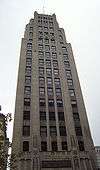 |
(#80003146) |
1 Federal Plaza West 41°06′00″N 80°39′01″W / 41.1°N 80.650278°W |
Youngstown | Designed by Morris Scheibel. Part of "Seven Early Buildings of Central Square" Thematic Resource. |
| 9 | City Hall Annex | 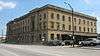 |
(#86001918) |
9 W. Front St. 41°05′54″N 80°39′05″W / 41.098333°N 80.651389°W |
Youngstown | |
| 10 | Crandall Park-Fifth Avenue Historic District |  |
(#90000474) |
Roughly bounded by Tod Ln., Ohio Ave., Redondo Rd., Catallina, and Guadalupe Ave., and 5th Ave. from Gypsy to Fairgreen 41°07′35″N 80°39′14″W / 41.126389°N 80.653889°W |
Youngstown | |
| 11 | Damascus Grade School |  |
(#89001456) |
14923 Morris St. in Damascus 40°54′09″N 80°57′16″W / 40.902500°N 80.954444°W |
Goshen Township | |
| 12 | Erie Terminal Building-Commerce Plaza Building |  |
(#86001914) |
112 W. Commerce St. 41°06′06″N 80°39′00″W / 41.1017°N 80.6501°W |
Youngstown | |
| 13 | Federal Building |  |
(#80003147) |
18 N. Phelps St. 41°06′03″N 80°39′03″W / 41.100833°N 80.650833°W |
Youngstown | Designed by Daniel Burnham. Part of "Seven Early Buildings of Central Square" Thematic Resource |
| 14 | First National Bank Building |  |
(#80003148) |
6 Federal Plaza West 41°06′02″N 80°39′00″W / 41.100556°N 80.650000°W |
Youngstown | Designed by Walker and Weeks. Part of "Seven Early Buildings of Central Square" Thematic Resource. |
| 15 | Forest Glen Estates Historic District |  |
(#98000565) |
Roughly bounded by Homestead Dr., Glenwood Ave., Alburn Dr., and Market St. 41°03′15″N 80°40′00″W / 41.054167°N 80.666667°W |
Boardman Township | |
| 16 | Gallagher Building |  |
(#14000295) |
23 N. Hazel and 131 Commerce Sts. 41°06′06″N 80°39′04″W / 41.101667°N 80.651111°W |
Youngstown | |
| 17 | Helen Chapel |  |
(#86001923) |
Northwestern corner of E. Wood and Champion Sts. 41°06′06″N 80°38′49″W / 41.101667°N 80.646944°W |
Youngstown | |
| 18 | Hopewell Furnace Site |  |
(#75001481) |
Along Yellow Creek below Lake Hamilton, northeast of the Lake Hamilton Dam[8] 41°02′14″N 80°35′26″W / 41.037222°N 80.590556°W |
Poland Township | The first blast furnace west of the Appalachians and the first industrial operation in the Connecticut Western Reserve; also an archeological site[8] |
| 19 | Idora Park |  |
(#93000895) |
Southeast of the junction of McFarland and Parkview Aves. 41°04′20″N 80°41′06″W / 41.072222°N 80.685°W |
Youngstown | Park was demolished and has been vacant land since 2001.[9] Wooden carousel was relocated to Brooklyn, NY, in 1984.[10] |
| 20 | Jay's Lunch |  |
(#86001925) |
258 Federal Plaza West 41°06′06″N 80°39′11″W / 41.101667°N 80.653056°W |
Youngstown | |
| 21 | Jones Hall, Youngstown State University |  |
(#84000151) |
410 Wick Ave. 41°06′14″N 80°38′47″W / 41.103939°N 80.646478°W |
Youngstown | |
| 22 | Jared P. Kirtland House | 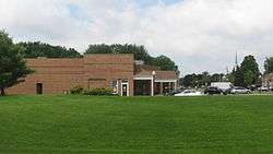 |
(#76001481) |
113 W. McKinley Way 41°01′26″N 80°37′06″W / 41.023889°N 80.618333°W |
Poland | |
| 23 | Kress Building | 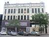 |
(#86001926) |
111-121 Federal Plaza West 41°06′02″N 80°39′04″W / 41.100556°N 80.651111°W |
Youngstown | Local outpost of Samuel H. Kress' 5-, 10-, and 25-cent store chain. |
| 24 | Lake Hamilton Dam | 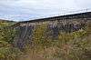 |
(#84003774) |
1.5 miles (2.4 km) northeast of Poland off State Route 616 41°02′13″N 80°35′31″W / 41.036944°N 80.591944°W |
Poland Township | |
| 25 | Lanterman Mill | 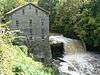 |
(#74001568) |
Canfield Rd. (U.S. Route 62) in Mill Creek Park 41°04′00″N 80°40′56″W / 41.066667°N 80.682222°W |
Youngstown | |
| 26 | Liberty Theatre | 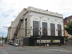 |
(#84003776) |
142 Federal Plaza West 41°06′05″N 80°39′05″W / 41.101389°N 80.651389°W |
Youngstown | |
| 27 | Lowellville Railroad Station | 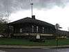 |
(#76001480) |
Along the former Penn Central Railroad line 41°02′07″N 80°32′14″W / 41.035278°N 80.537222°W |
Lowellville | |
| 28 | Mahoning County Courthouse | 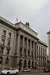 |
(#74001569) |
120 Market St. 41°05′56″N 80°39′03″W / 41.098889°N 80.650833°W |
Youngstown | Designed by local architect Charles Owsley. |
| 29 | Mahoning National Bank Building | 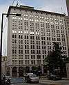 |
(#80003149) |
23 Federal Plaza West 41°05′58″N 80°39′01″W / 41.099444°N 80.650278°W |
Youngstown | Designed by Albert Kahn. Part of "Seven Early Buildings of Central Square" Thematic Resource. |
| 30 | Maple-Dell | 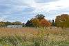 |
(#90001821) |
14737 Garfield Rd., northwest of Salem 40°54′46″N 80°55′39″W / 40.912778°N 80.927500°W |
Goshen Township | |
| 31 | Masonic Temple | 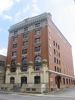 |
(#86003830) |
223-227 Wick Ave. 41°06′08″N 80°38′50″W / 41.102361°N 80.647222°W |
Youngstown | |
| 32 | McCrory Building |  |
(#86001928) |
9-13 Federal Plaza West and 17-19 Central Sq. 41°06′00″N 80°38′08″W / 41.1°N 80.635556°W |
Youngstown | White terra cotta facaded commercial building. |
| 33 | William H. McGuffey Boyhood Home Site |  |
(#66000617) |
McGuffey Rd., near State Route 616 41°06′57″N 80°33′31″W / 41.115833°N 80.558611°W |
Coitsville Township | |
| 34 | McKelvey-Higbee Co. Buildings | 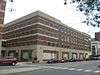 |
(#86001930) |
210-226 Federal Plaza West and 18-26 N. Hazel St. 41°06′06″N 80°39′07″W / 41.101667°N 80.651944°W |
Youngstown | Department store, demolished[11] |
| 35 | Reuben McMillan Free Library | 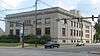 |
(#86000526) |
305 Wick Ave. 41°06′11″N 80°38′47″W / 41.103056°N 80.646389°W |
Youngstown | |
| 36 | Mill Creek Park Historic District |  |
(#05000178) |
Mahoning Ave. to Boardman-Canfield Rd., Mill Creek, 960 Bears Den Rd. 41°03′28″N 80°38′46″W / 41.057778°N 80.646111°W |
Boardman Township and Youngstown | |
| 37 | Mill Creek Park Suspension Bridge | 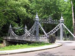 |
(#76001482) |
Mill Creek Park 41°04′24″N 80°41′21″W / 41.073333°N 80.689167°W |
Youngstown | |
| 38 | Conrad Neff House | 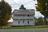 |
(#74001561) |
3967 Boardman-Canfield Rd., east of Canfield 41°01′28″N 80°43′14″W / 41.024306°N 80.720694°W |
Canfield Township | |
| 39 | Newport Village Allotment Historic District | 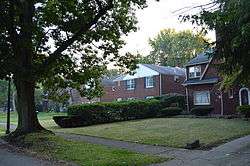 |
(#06000483) |
Parts of Market St., Chester Dr., Jennette Dr., and Overhill Rd. 41°03′25″N 80°39′52″W / 41.056944°N 80.664444°W |
Boardman Township | |
| 40 | Judge Eben Newton House | 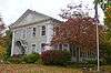 |
(#74001562) |
105 N. Broad St. 41°01′39″N 80°45′37″W / 41.0275°N 80.760278°W |
Canfield | |
| 41 | Ohio One-Ohio Edison |  |
(#86001931) |
25 E. Boardman and 102-112 S. Champion 41°05′55″N 80°38′58″W / 41.098611°N 80.649444°W |
Youngstown | |
| 42 | Old Mahoning County Courthouse | 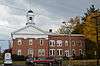 |
(#74001563) |
7 Court St. 41°01′18″N 80°45′40″W / 41.021667°N 80.761111°W |
Canfield | |
| 43 | Our Lady of Mount Carmel Church | 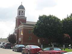 |
(#79001893) |
Off State Route 289 41°05′59″N 80°38′31″W / 41.099722°N 80.641944°W |
Youngstown | |
| 44 | Peggy Ann Building | 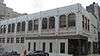 |
(#86001937) |
101 Federal Plaza West and 2-10 S. Phelps 41°06′00″N 80°39′03″W / 41.100056°N 80.650833°W |
Youngstown | |
| 45 | Poland Center School | 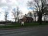 |
(#84003779) |
U.S. Route 224 and Struthers Rd. at Poland Center 41°01′25″N 80°34′01″W / 41.023611°N 80.566944°W |
Poland Township | |
| 46 | Rayen School |  |
(#74001570) |
222 Wick Ave. 41°06′09″N 80°38′52″W / 41.102500°N 80.647778°W |
Youngstown | Public school building founded by Judge William Rayen. |
| 47 | Realty Building |  |
(#80003150) |
47 Federal Plaza 41°05′58″N 80°38′57″W / 41.099444°N 80.649167°W |
Youngstown | Designed by local architects Morris Scheibel and Edgar Stanley. Part of "Seven Early Buildings of Central Square" Thematic Resource. |
| 48 | George J. Renner, Jr. House | 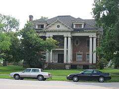 |
(#76001483) |
277 Park Ave. 41°06′47″N 80°38′58″W / 41.113056°N 80.649444°W |
Youngstown | |
| 49 | Republic Iron and Steel Office Building |  |
(#86001940) |
415 S. Market St. 41°05′48″N 80°39′05″W / 41.096667°N 80.651389°W |
Youngstown | |
| 50 | Charles Ruggles House |  |
(#75001480) |
17 Court St. 41°01′19″N 80°45′42″W / 41.021806°N 80.761667°W |
Canfield | |
| 51 | St. James Episcopal Church | 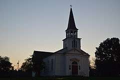 |
(#79001892) |
375 Boardman-Poland Rd. 41°01′24″N 80°38′59″W / 41.023472°N 80.649722°W |
Boardman Township | |
| 52 | St. John's Episcopal Church | 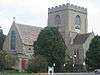 |
(#11001093) |
323 Wick Ave. 41°06′13″N 80°38′46″W / 41.103611°N 80.646111°W |
Youngstown | |
| 53 | Frank Sebring House |  |
(#88000545) |
385 W. Ohio Ave. 40°55′22″N 81°01′30″W / 40.922778°N 81.025°W |
Sebring | |
| 54 | South Main Street District | 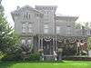 |
(#74001564) |
Both sides of S. Main St.; also 101 and 111 S. Main St. 41°01′16″N 80°36′32″W / 41.021111°N 80.608889°W |
Poland | Second set of addresses represents a boundary increase of October 18, 1984 |
| 55 | Southern Park Stable |  |
(#86001564) |
126 Washington Boulevard 41°00′04″N 80°39′28″W / 41.001111°N 80.657778°W |
Boardman Township | |
| 56 | Stambaugh Building | 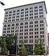 |
(#80003151) |
44 Federal Plaza 41°05′59″N 80°38′56″W / 41.099722°N 80.648889°W |
Youngstown | Designed by Albert Kahn. Part of "Seven Early Buildings of Central Square" Thematic Resource. |
| 57 | Henry H. Stambaugh Memorial Auditorium | 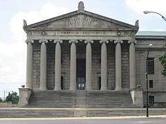 |
(#84003781) |
1000 5th Ave. 41°06′49″N 80°39′07″W / 41.113611°N 80.651944°W |
Youngstown | Beaux-Arts auditorium designed by Helme & Corbett in 1926. |
| 58 | State Theater |  |
(#86001942) |
213 Federal Plaza West 41°06′04″N 80°39′08″W / 41.101111°N 80.652222°W |
Youngstown | |
| 59 | Strouss-Hirschberg Company | 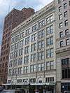 |
(#86001944) |
14-28 Federal Plaza West 41°06′02″N 80°39′01″W / 41.100556°N 80.650278°W |
Youngstown | |
| 60 | Tod Homestead Cemetery Gate |  |
(#76001484) |
Belmont Ave. 41°07′43″N 80°39′57″W / 41.128611°N 80.665833°W |
Youngstown | |
| 61 | Daniel Vaughn Homestead | 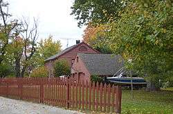 |
(#80003145) |
694 Pine Dr., west of Lake Milton 41°06′04″N 80°59′07″W / 41.101111°N 80.985278°W |
Milton Township | |
| 62 | Warner Theater | 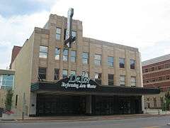 |
(#80003152) |
260 Federal Plaza West 41°06′07″N 80°39′12″W / 41.101944°N 80.653333°W |
Youngstown | Now the Powers Auditorium at the DeYors Center |
| 63 | Wells Building | 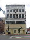 |
(#86001946) |
201-205 Federal Plaza West 41°06′03″N 80°39′08″W / 41.100833°N 80.652222°W |
Youngstown | |
| 64 | Welsh Congregational Church | 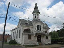 |
(#86001947) |
220 N. Elm St. 41°06′14″N 80°39′04″W / 41.103889°N 80.651111°W |
Youngstown | |
| 65 | White Bridge |  |
(#83004319) |
Over Yellow Creek, 0.07 miles east of State Route 616 41°01′39″N 80°36′33″W / 41.027403°N 80.609097°W |
Poland | |
| 66 | Wick Avenue Historic District | |
(#74001571) |
Bounded by Wick, Bryson, expressway, Spring, and Wick Oval 41°06′24″N 80°38′40″W / 41.106667°N 80.644444°W |
Youngstown | |
| 67 | Wick Building | 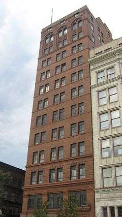 |
(#80003153) |
34 Federal Plaza West 41°06′03″N 80°39′01″W / 41.100833°N 80.650378°W |
Youngstown | Designed by Daniel Burnham. Part of "Seven Early Buildings of Central Square" Thematic Resource. |
| 68 | Wick Park Historic District | 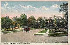 |
(#90000601) |
Roughly bounded by 5th and Elm Aves., Elm St. and Broadway; also roughly bounded by Broadway Ave., Wick Ave., Madison Ave., and Elm St. 41°06′54″N 80°38′53″W / 41.115°N 80.648056°W |
Youngstown | Second set of boundaries represents a boundary increase of September 24, 2001 |
| 69 | Youngstown Sheet and Tube Company Housing | 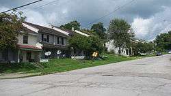 |
(#82003611) |
Jackson and Chambers St. 41°04′09″N 80°35′09″W / 41.069167°N 80.585833°W |
Campbell | |
| 70 | YWCA Building | 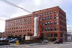 |
(#86001949) |
25 W. Rayen Ave. 41°06′13″N 80°38′55″W / 41.103611°N 80.648611°W |
Youngstown |
Former listing
| [3] | Name on the Register | Image | Date listed | Date removed | Location | City or town | Summary |
|---|---|---|---|---|---|---|---|
| 1 | Idora Park Merry-Go-Round | 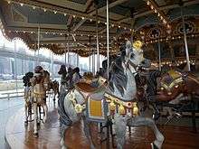 |
(#75001482) | Idora Park on Canfield Rd. |
Youngstown | Wooden carousel designed by Daniel C. Muller, built in 1899. Formerly located at Idora Park on Canfield Rd., Youngstown, bought and moved to Brooklyn, New York in 1984.[12] |
See also
| Wikimedia Commons has media related to National Register of Historic Places in Mahoning County, Ohio. |
References
- ↑ The latitude and longitude information provided in this table was derived originally from the National Register Information System, which has been found to be fairly accurate for about 99% of listings. For about 1% of NRIS original coordinates, experience has shown that one or both coordinates are typos or otherwise extremely far off; some corrections may have been made. A more subtle problem causes many locations to be off by up to 150 yards, depending on location in the country: most NRIS coordinates were derived from tracing out latitude and longitudes off of USGS topographical quadrant maps created under the North American Datum of 1927, which differs from the current, highly accurate WGS84 GPS system used by most on-line maps. Chicago is about right, but NRIS longitudes in Washington are higher by about 4.5 seconds, and are lower by about 2.0 seconds in Maine. Latitudes differ by about 1.0 second in Florida. Some locations in this table may have been corrected to current GPS standards.
- ↑ "National Register of Historic Places: Weekly List Actions". National Park Service, United States Department of the Interior. Retrieved on December 2, 2016.
- 1 2 Numbers represent an ordering by significant words. Various colorings, defined here, differentiate National Historic Landmarks and historic districts from other NRHP buildings, structures, sites or objects.
- ↑ National Park Service (2008-04-24). "National Register Information System". National Register of Historic Places. National Park Service.
- ↑ The eight-digit number below each date is the number assigned to each location in the National Register Information System database, which can be viewed by clicking the number.
- ↑ Youngstown Amtrak Station (USA RailGuide; TrainWeb)
- ↑ Gwin, Harold. "Downtown Treasure," The Youngstown Vindicator. 15 September 2008.
- 1 2 White, John R. Faunal Remains from the Eaton (Hopewell) Furnace Site. Ohio Journal of Science 81 (3): 138, 1981.
- ↑ "Idora Ballroom Burns to Ground," The Youngstown Vindicator, 5 March 2001. See also: Skolnick, David. "Asbestos Cleanup at Idora Begins," The Youngstown Vindicator, 10 April 2001.
- ↑ Now renamed "Jane's Carousel" by owners Jane and David Walentas: http://janescarousel.com/
- ↑ U. S. vs. James A. Traficant, Jr., . See also: Smith, Roger G. "Vindicated, Officials Toast New CSB Building," The Youngstown Vindicator, 7 March 2004.
- ↑ Linonis, Linda M (October 14, 2005). "Merry-go-round leads to Idora ride". The Vindicator. Youngstown, OH. Retrieved April 27, 2009.
| |||||||
| Neighborhoods |
|  | |||||
| History |
| ||||||
| Sports |
| ||||||
| Education |
| ||||||


Municipalities and communities of Mahoning County, Ohio, United States | ||
|---|---|---|
| Cities | | |
| Villages | ||
| Townships | ||
| CDPs | ||
| Unincorporated communities |
| |
| Footnotes | ‡This populated place also has portions in an adjacent county or counties | |
This article is issued from Wikipedia - version of the 9/23/2016. The text is available under the Creative Commons Attribution/Share Alike but additional terms may apply for the media files.