Moreton, Merseyside
| Moreton | |
| — Village — | |
 The clock on Moreton Cross roundabout, at the junction of the A551 and A553 roads |
|
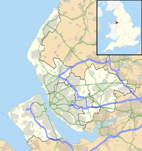 Moreton |
|
| Population | 17,670 (2001 Census)[1] |
|---|---|
| OS grid reference | SJ261899 |
| – London | 181 mi (291 km)[2] SE |
| Metropolitan borough | Metropolitan Borough of Wirral |
| Metropolitan county | Merseyside |
| Region | North West |
| Country | England |
| Sovereign state | United Kingdom |
| Post town | WIRRAL |
| Postcode district | CH46 |
| Dialling code | 0151 67* |
| ISO 3166 code | GB-WRL |
| Police | Merseyside |
| Fire | Merseyside |
| Ambulance | North West |
| EU Parliament | North West England |
| UK Parliament | Wallasey |
|
|
Coordinates: 53°24′04″N 3°06′40″W / 53.401°N 3.111°W
Moreton is a village on the north coast of the Wirral Peninsula, Merseyside, England. In the 2001 Census, it had a population of 17,670 (8,370 males, 9,300 females).[1] From 2004, the village was divided between the Metropolitan Borough of Wirral wards of Leasowe & Moreton East and Moreton West & Saughall Massie.
History
Prior to the Norman conquest, the Lingham area of Moreton was a possible location for Dingesmere, mentioned with regard to the Battle of Brunanburh, in Egil's Saga. At the time of the Domesday Book, the area formed part of the large township of Eastham. In the twelfth century, it formed part of the estates of Hamo de Mascy. The name Moreton was first recorded in 1278, and derives from Anglo-Saxon words meaning a settlement (tun) beside a marsh (more).[3] The village joined with neighbouring Lingham to form the parish of Moreton-cum-Lingham. The area is located between Great Meols to the west and Bidston and Wallasey to the south and east. Before the sea embankment was constructed, the area included 3000 acres of tidal lagoon, at between one and two metres below sea level, with most of the remainder little more than one metre above.
Geography
The coast at Moreton is part of a stretch of sand that runs from Meols to Leasowe known as Mockbeggar Wharf, named after Mockbeggar Hall, otherwise known as Leasowe Castle. 'Mockbeggar Hall' is also the name of Moreton's Wetherspoons pub (The name Mockbeggar apparently being an old sailors' term for a lone house). The North Wirral Coastal Park also runs for four miles along this coast, including public open space, common land, natural foreshore and sand-dunes. The park provides for a wide variety of recreational activities; some of the more popular being sailing, sea angling, swimming, cycling, picnicking, walking, jogging, ball games, bird watching and horse riding.
The low-lying land behind the coast is protected by a large concrete embankment. Some of the coastal land is in the Moreton Conservation Area and provides important natural habitat. The embankment gives a good view at low tide to see a variety of wading birds. There are also good views of Bidston Hill and Caldy Hill. Further afield, Winter Hill is often visible beyond Liverpool and, in the opposite direction, much of North Wales can be seen from the embankment, including Moel Famau, Snowdonia, the Great Orme and Anglesey. On clear days, Black Combe in Cumbria can also be seen.
Arrowe Brook merges with the Birket at Moreton. The Birket then continues towards West Float at the site of the former Wallasey Pool.
 |
Irish Sea (Liverpool Bay) | Leasowe | Leasowe | |
| Meols | |
Bidston and Beechwood | ||
| ||||
| | ||||
| Saughall Massie | Upton | Upton |
Demography
The population was 210 in 1801, 350 in 1851, and 597 in 1901.[4] At the 2001 Census, the population was 12,532 (5,980 males, 6,552 females),[5] although sharing split wards of the Metropolitan Borough of Wirral, encompassing a larger area, it was recorded as 13,735 (6,442 males, 7,293 females) for Leasowe and Moreton East,[6] and 14,423 (6,879 males, 7,544 females) for Moreton West and Saughall Massie.[7] At the 2011 Census, the population is solely recorded as sharing split wards of the Metropolitan Borough of Wirral, encompassing the larger area, being recorded as 14,640 (7,005 males, 7,635 females) for Leasowe and Moreton East,[8] and 13,988 (6,732 males, 7,256 females) for Moreton West and Saughall Massie.[9]
Government
Moreton is part of the Metropolitan Borough of Wirral, in the metropolitan county of Merseyside. Moreton is also part of the parliamentary constituency of Wallasey. The current Member of Parliament is Angela Eagle, a Labour representative who has held the seat since 1992. The previous incumbent of the post was Lynda Chalker, a Conservative MP.
The area is also split amongst two of the local government wards of the Metropolitan Borough of Wirral. These being "Leasowe and Moreton East", and "Moreton West and Saughall Massie". Moreton is represented on Wirral Metropolitan Borough Council by six councillors. These are Ron Abbey, Treena Johnson and Anita Leech, for Leasowe and Moreton East, who are all Labour councillors.[10] Meanwhile, Moreton West and Saughall Massie's councillors are Bruce Berry, Chris Blakely and Steve Williams, who are all Conservative councillors.[10] The most recent local elections took place on 7 May 2015 when Councillor Steve Williams was re-elected.
| Party | Candidate | Votes | % | ± | |
|---|---|---|---|---|---|
| Labour | Treena Ann JOHNSON | 1819 | 45.46 | ||
| Conservative | Ian LEWIS | 1633 | 40.81 | ||
| UKIP | Frank Naylor WHITHAM | 433 | 10.82 | ||
| Green | David Michael DUBOST | 116 | 2.9 | ||
The electorate numbered 10,691, there was a turnout of 37.5% and the majority is 186.[12]
| Party | Candidate | Votes | % | ± | |
|---|---|---|---|---|---|
| Conservative | Bruce BERRY | 1817 | 43.9 | ||
| Labour | Karl Gerard GREANEY | 1484 | 35.85 | ||
| UKIP | Susan Jane WHITHAM | 678 | 16.38 | ||
| Green | Perle Winifred SHELDRICKS | 160 | 3.87 | ||
The electorate numbered 10,885, there was a turnout of 38.1% and the majority is 333.[13]
Economy
Food manufacturing
Moreton is also known for being the home of the Burton's factory, and now owned by Duke Street Capital.[14] This factory was also the producer of Cadbury's biscuits. Manor Bakeries, the former Cadbury's cakes department, (now owned by Premier Foods Group) is located in the town at Reeds Lane, near to Leasowe railway station.
Moreton is also home to Typhoo Tea, with the factory which manufactures Typhoo, being located next to the Burton's factory.
Pharmaceuticals

Until the 1990s, Bristol-Myers Squibb was also a major employer to the local workforce, with a large factory located on the opposite side of Reeds Lane to Burton's, next to Leasowe Station. However, in the mid-90s, manufacturing was moved out of Moreton which led to the closure of the factory. At the same time, there was actually heavy investment into modern drug development and research labs on the site, which are still operated by Bristol-Myers Squibb. In 2009, the company provided further investment into the site.[15]
Tarran Way Industrial Estate
The Tarran Way Industrial Estate is mainly home to various car repair facilities, and other light industry businesses.
Dantec is the UK's biggest manufacturer of composite hoses, which are used in the transfer of petrochemicals. The company was established in 1969,[16] and the business is situated on Tarran Way.[17]
Former brickworks
Della Robbia Pottery used local red clay from Moreton. Barker and Briscoe Brickworks[18] was situated on Carr Lane, 1 mile (1.6 km) west of the centre of the village.
Community
Schools
Moreton Christ Church CofE Primary School, located on Upton Road, is a Church of England school that educates around 400 pupils in ages 4–11. It was opened, as the 'Moreton Church of England School', in 1861 in the centre of Moreton. It was established in its current location in 1974.
Other schools include Lingham Primary School, Eastway Primary School, Sandbrook Primary School, Foxfield School, Orrets Meadow Special School and Clare Mount Specialist Sports College.
Churches

Moreton has various religious establishments, though all of Christian denominations. The most substantial building is the Church of England's Christ Church[19] on Upton Road, which was built in 1863 and replaced an earlier building known as a chapel-of-ease. This earlier building had been pulled down by 1690, and was then within the parish of Bidston.[20] The church, vicarage and school were built at a cost of £8,000, paid for by a donation from William Inman,[21][22] with the church being designed by Cunningham and Audsley.[23][24] The church has a spire, and used to have a rectory which was demolished in 1922.[21] Christ Church became a Grade II listed building in 1987.[24]
The other significant churches include Sacred Heart Catholic Church and the Moreton Methodist Church. The smaller establishments include the Moreton Presbyterian Church, the Moreton Christian Assembly, the Moreton Baptist Church and a building belonging to The Church of Jesus Christ of Latter-day Saints.
Leisure
Moreton Library is situated on Pasture Road,[25] with a nearby Royal British Legion premises and a youth club.[26][27] A dance club is further along Pasture Road,[26] near to Moreton Shore and the lighthouse. The 4th Moreton Scout Group is situated on Upton Road.
Public Houses

Public houses include the Coach & Horses Inn which opened in 1928,[26] The Grange, The Mockbeggar Hall, which is a branch of JD Wetherspoon, The Farmers Arms, The Sandbrook and The Armchair. Former pubs included the Morton Arms, noted for its incorrect spelling, the Millhouse and the Plough Inn.[26]
Parks and Commons
Parks include Lingham Park and Upton Park. Meanwhile, Ditton Lane Nature Reserve is towards the coast, along with the North Wirral Coastal Park. In the North Wirral Coastal Park, Leasowe Lighthouse was built in 1763 and is the oldest brick-built lighthouse in Britain.[28][29] The lighthouse was built because of the sandbanks just offshore. It has been restored and is open to the public at times.
Sport
The Moreton Hills Golf Centre has a driving range which is situated adjacent to the Tarran Way Industrial Estate.[30] Moreton Football Club was on Upton Road, and is now based at Sandbrook Lane, as Sandbrook FC.[26][31]
Transport
Road
Moreton is situated at the roundabout junction of roads from Bidston (the A553), Leasowe (the A551), Meols (the A553) and Upton (the A551). The A5027 Upton bypass continues into Junction 2a of the M53 motorway, known as Moreton Spur, to the south of Moreton.[32][33][34]
Boat
Moreton witnessed the world's first commercial passenger and mail hovercraft service. A Vickers-Armstrong VA-3 hovercraft was operated by British United Airways and ran from Leasowe embankment to Rhyl in North Wales.[35] The service commenced on 20 July 1962.[35] However, due to varying reasons including bad weather and technical difficulties the service was cancelled after its final journey on 14 September 1962.[35]
Rail
There are two stations serving Moreton, these are Moreton and Leasowe. Both stations are on the West Kirby branch of the Wirral Line and have direct electric services, operated by Merseyrail, to West Kirby and Liverpool Central via Birkenhead. Both Leasowe and Moreton offer park and ride facilities.
Notable people
- Lottie Dod, English sportswoman, established a ladies' golf club in Moreton, in 1894.
- Daniel Ilabaca, Founder of World Freerunning and Parkour Federation, born in Moreton.
- William Inman, English industrialist, buried in Moreton.
- Paul Rutherford, English footballer, born in Moreton.
- Jonathan Walters, Irish international footballer, born in Moreton.
References
- 1 2 "Wirral 2001 Census: Moreton". Metropolitan Borough of Wirral. Retrieved 14 January 2008.
- ↑ "Coordinate Distance Calculator". boulter.com. Retrieved 6 March 2016.
- ↑ "Wirral Historic Settlement Study - Merseyside Historic Characterisation Project" (PDF). Museum of Liverpool. December 2011. p. 59. Retrieved 4 July 2012.
- ↑ "Cheshire Towns & Parishes: Moreton (near Wallasey)". GENUKI UK & Ireland Genealogy. Retrieved 4 January 2015.
- ↑ "Area: Moreton (Ward) - Key Figures for 2001 Census: Key Statistics". Office for National Statistics. Retrieved 4 January 2015.
- ↑ "Area: Leasowe and Moreton East (Ward) - Key Figures for 2001 Census: Key Statistics". Office for National Statistics. Retrieved 4 January 2015.
- ↑ "Area: Moreton West and Saughall Massie (Ward) - Key Figures for 2001 Census: Key Statistics". Office for National Statistics. Retrieved 4 January 2015.
- ↑ "Area: Leasowe and Moreton East (Ward) - Key Figures for 2011 Census: Key Statistics". Office for National Statistics. Retrieved 4 January 2015.
- ↑ "Area: Moreton West and Saughall Massie (Ward) - Key Figures for 2011 Census: Key Statistics". Office for National Statistics. Retrieved 4 January 2015.
- 1 2 "Your Councillors by Ward". Wirral Borough Council. Retrieved 4 January 2015.
- 1 2 Election Result for 22 May 2014, Metropolitan Borough of Wirral, retrieved 4 January 2015
- ↑ "Election Result for Leasowe and Moreton East ward on 22 May 2014". Metropolitan Borough of Wirral. Retrieved 4 January 2015.
- ↑ "Election Result for Moreton West and Saughall Massie ward on 22 May 2014". Metropolitan Borough of Wirral. Retrieved 5 January 2015.
- ↑ "Burton's Foods". Grace's Guide. Retrieved 3 January 2015.
- ↑ "Pharmaceutical giant Bristol-Myers Squibb to invest £3.5million in its Moreton base". Liverpool Echo. Retrieved 3 January 2015.
- ↑ "Company History". Dantec. Retrieved 31 January 2014.
- ↑ "Contact Dantec". Dantec. Retrieved 31 January 2014.
- ↑ "Barker & Briscoe Brickworks - Moreton June 2012". 28 Days Later. Retrieved 31 January 2014.
- ↑ "MORETON: Christ Church (Church of England)". GENUKI UK & Ireland Genealogy. Retrieved 5 January 2015.
- ↑ Mortimer, William Williams (1847). The History of the Hundred of Wirral. London: Whittaker & Co. p. 206. Retrieved 4 January 2015.
- 1 2 "History of Wallasey Churches". History of Wallasey. Retrieved 4 January 2015.
- ↑ "Moreton and Leasowe". vwlowen.co.uk. Retrieved 4 January 2015.
- ↑ "Basic Site Details - Christ Church". Dictionary of Scottish Architects. Retrieved 4 January 2015.
- 1 2 "Christ Church, Birkenhead". British Listed Buildings. Retrieved 4 January 2015.
- ↑ "Moreton Library". Library Technology Guides. Retrieved 4 January 2014.
- 1 2 3 4 5 "Moreton". wirralhistory.net. Retrieved 3 January 2015.
- ↑ "Moreton Youth Club". wirralhistory.net. Retrieved 4 January 2014.
- ↑ "Leasowe Lighthouse". visitwirral.com. Retrieved 14 January 2008.
- ↑ "Leasowe Lighthouse: A Wirral Highlight". Friends of Leasowe Lighthouse. Retrieved 14 January 2008.
- ↑ "Moreton Hills Golf Centre". Golf Today. Retrieved 3 January 2015.
- ↑ "The Sandbrook FC". Pitchero. Retrieved 3 January 2015.
- ↑ "A551". Sabre. Retrieved 3 January 2015.
- ↑ "A553". Sabre. Retrieved 3 January 2015.
- ↑ "A5027". Sabre. Retrieved 3 January 2015.
- 1 2 3 "World's First Passenger & Mail Hovercraft Service Between Moreton, Wirral and Rhyl, North Wales". wirralhistory.net. Retrieved 3 January 2015.
Further reading
- Appleyard, John (2004). A heritage trail around Moreton and Saughall Massie. Irby: Impact Communication. ISBN 9780954722302. OCLC 62306101.
- Biddle, Frank; Fellowes, Alan (1992). Moreton Wirral: A Pictorial History. 1. Birkenhead: Countryvise. ISBN 9780907768562. OCLC 316151639.
- Biddle, Frank; Fellowes, Alan (1995). Moreton Wirral: A Pictorial History. 2. Birkenhead: Countryvise. ISBN 9780907768593. OCLC 264892270.
- Biddle, Frank; Fellowes, Alan (1995). Moreton Wirral: A Pictorial History. 3. Birkenhead: Countryvise. ISBN 9780907768784. OCLC 264892270.
- Biddle, Frank; Fellowes, Alan (2001). Moreton Wirral: A Pictorial History. 4. Birkenhead: Countryvise. ISBN 9781901231229. OCLC 51234222.
- Boumphrey, Ian (1988). Yesterday's Wirral 5: Wallasey, New Brighton & Moreton. Ian & Marilyn Boumphrey. ISBN 9780950725543. OCLC 655904123.
- Mortimer, William Williams (1847). The History of the Hundred of Wirral. London: Whittaker & Co. pp205-206.
External links
| Wikimedia Commons has media related to Moreton, Merseyside. |
- Metropolitan Borough of Wirral: North Wirral Coastal Park
- Photos and details of Leasowe Castle
- Photos and details of Leasowe Lighthouse
- History, Reminiscences and photos
- North Wirral Railways
- Merseytravel
- Live local weather