M53 motorway
| |
|---|---|
_map.svg.png) | |
| Route information | |
| Length: | 18.9 mi (30.4 km) |
| Existed: | 1972 – present |
| History: | Constructed 1972–1982 |
| Major junctions | |
| North end: |
Wallasey 53°24′41″N 3°04′49″W / 53.4114°N 3.0802°W |
|
J11 → M56 motorway | |
| South end: |
Chester 53°12′52″N 2°51′24″W / 53.2144°N 2.8567°W |
| Location | |
| Primary destinations: | Liverpool, Birkenhead, Ellesmere Port, All Docks, North Wales, Wallasey |
| Road network | |

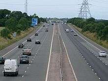
The M53 is an 18.9-mile (30.4 km) motorway in the Metropolitan Borough of Wirral and Cheshire on the Wirral Peninsula in England.[1] It can also be referred to as the Mid Wirral Motorway.[2] It runs between the Kingsway Tunnel, at Wallasey in the north, and the A55 at Chester.[1]
The main reason for the motorway was to provide a through route to the new Mersey Road Tunnel, Kingsway, which was built at the same time. Part of this motorway was originally the M531.
Route
Starting at the northern end, the motorway starts in Wallasey at the exit slip roads from the Kingsway Tunnel from Liverpool. It loops round the north west of Birkenhead and then runs south as a dual 3-lane route between Upton, Woodchurch in the west and Prenton. From junctions 1 to 3 it runs parallel to the Borderlands railway line. It crosses this line south of junction 3. From this junction it proceeds south to the west of Bebington through junction 4 and then further south for 4 miles (6.4 km) (where it crosses the Wirral railway line), before narrowing to dual 2 lanes[3] and turning sharply to the east. At junction 5, traffic for Wales can take the A41, A550 & A494 to join the A55 near Ewloe. The road passes north and then east of Hooton, then to the east of Overpool and Wolverham and with Ellesmere Port to the west.
South of junction 10 the route enters a more rural setting, passing under the M56 motorway at junction 11. Finally it heads south and becomes the A55 North Wales Expressway at junction 12.
History
This motorway was originally two separate projects, the M53 and M531. The M53 was originally proposed to run from the Kingsway Tunnel to Backford.[4] The M531 would have run from between the current junctions 4 & 5 and provided a connection with the M56 for eastbound travel.
When the M53 was first planned in the early 1960s, it was designed as a route to connect the two Mersey road tunnels with the A55 trunk road on the Welsh border, giving Liverpool and the rest of Merseyside a direct link with Chester and the towns on the North Wales coast.
In the event, the A55 link was never built and instead the M531 (by-passing the eastern side of Chester) was incorporated into the M53.[5]
M531
The first section of the M531 was built to improve access to the Vauxhall Motors factory near Ellesmere Port. It was opened in 1968 as a non-designated road.[4] Subsequently this road was extended further south to meet the A5117 and was designated as the M531. In March 1981 the M531 was lengthened to meet the M56 and at this stage the whole route was redesignated as the M53.
M53
Construction on the M53 started in 1969. It was to be built in stages as part of a strategic route to North Wales for traffic from Merseyside. The route to North Wales was unresolved as there was even an option to run due west from south of junction 4 and cross the River Dee on a barrage. In 1972 this first section from the tunnel to junction 5 where it connected straight into the Vauxhall Motors road was opened. A junction was partially built to allow extension of the motorway further south west, around 1 mile (1.6 km) west of junction 5. The unbuilt motorway would have provided a bypass of the A41 and would likely have terminated on the M56,[6] though exactly where is unknown. The unfinished junction for this extension has now been demolished.
The final section of the M53 provided a link to Chester from the M56 and was opened in 1982. No plans are known to exist to complete the originally planned M53.[5]
Dates
- Junctions 1 to 5 were opened in 1972
- Junctions 5 to 8 were redesignated as motorway in 1974 as part of the M531 [7]
- Junctions 8 to 10 opened in 1975 as part of the M531
- Junctions 10 to 11 were opened in 1981
- Junctions 11 to 12 were opened in 1982
Junctions
Data[8] from driver location signs are used to provide distance and carriageway identifier information.
| M53 motorway junctions | |||||
| mile | km | Northbound exits (B carriageway) | Junction | Southbound exits (A carriageway) | |
|---|---|---|---|---|---|
| 0.0 | 0.0 | Road continues as A5139 towards Kingsway Tunnel and Liverpool | J1 | Bidston, Wallasey A554 Non-motorway traffic | |
| Claughton, Wallasey A554 | Start of motorway | ||||
| 6.5 | 10.5 | West Kirby, Hoylake, Upton A5027 | J2 | West Kirby, Hoylake, Upton A5027 | |
| 8.6 | 13.8 | Tranmere, Heswall, Woodchurch, Prenton A552 | J3 | Tranmere, Heswall, Woodchurch, Prenton A552 | |
| 11.7 | 18.8 | Heswall A5137 Bebington, Port Sunlight B5137 |
J4 | Heswall A5137 Bebington, Port Sunlight B5137 | |
| 15.8 | 25.4 | Eastham, Hooton A41 Queensferry (A550) |
J5 | Bebington, Eastham, Hooton A41 Queensferry (A550) | |
| 16.2 | 26.1 | Eastham Oil Terminal B5132 | J6 | Eastham Oil Terminal B5132 | |
| 17.5 | 28.2 | Overpool, Vauxhall Motors B5132 | J7 | Overpool, Vauxhall Motors B5132 | |
| 18.3 | 29.5 | Overpool B5132 Industrial Estate A5032 |
J8 | Industrial Estate A5032 | |
| 19.1 | 30.7 | Ellesmere Port A5032 Stanlow Refinery |
J9 | Ellesmere Port A5032 | |
| 20.9 | 33.7 | Elton, Whitbyheath, Cheshire Oaks A5117 Queensferry (A550) |
J10 | Elton, Whitbyheath, Cheshire Oaks A5117 Queensferry (A550) | |
| 21.6 | 34.8 | Runcorn, Warrington, Manchester M56 | J11 | Runcorn, Warrington, Manchester M56 | |
| 24.5 | 39.5 | Start of motorway | J12 | Chester A56 | |
| 24.9 | 40.1 | Chester, Helsby A56 Non-motorway traffic |
Road continues as A55 to North Wales | ||
| 1.000 mi = 1.609 km; 1.000 km = 0.621 mi | |||||
See also
References
- 1 2 "Motorway Database: M53". CBRD. Retrieved 12 August 2008.
- ↑ "The Mid-Wirral Motorway M53 and A55 Extension to the Welsh Border". The Motorway Archive. Retrieved 12 August 2008.
- ↑ "CBRD Motorway Database – M53 Exit List". Chris Marshall.
- 1 2 "The Motorway Archive – M53 Scheme Page". Institution of Highways and Transportation.
- 1 2 Marshall, Chris. "CBRD » Histories » The M53". CBRD. Retrieved 26 February 2011.
- ↑ "Written Answers to Questions". Parliamentary Debates (Hansard). House of Commons. 23 July 1993. col. 403.
- ↑ "The Motorway Archive – M53 Opening Dates". Institution of Highways and Transportation.
- ↑ "Traffic England Live Traffic Condition Map (selected Popups)". Highways Agency. Retrieved 11 November 2009.
External links
- CBRD Motorway Database – M53
- CBRD History of the M53/M531
- Pathetic Motorways – M531
- The Motorway Archive – M53
| Great Britain | .svg.png) | |||||||
|---|---|---|---|---|---|---|---|---|
| Northern Ireland | ||||||||
| Former | ||||||||
| Unbuilt | ||||||||
| Proposed | ||||||||
| Related articles | ||||||||
| ||||||||