Claughton, Merseyside
| Claughton | |
| — Village — | |
 The A5027 Upton Road seen from the junction with Shrewsbury Road. St Bede's Chapel and Community Centre is across the road. |
|
 Claughton |
|
| Population | 14,705 (2011 Census) |
|---|---|
| OS grid reference | SJ297891 |
| – London | 180 mi (290 km)[1] SE |
| Metropolitan borough | Wirral |
| Metropolitan county | Merseyside |
| Region | North West |
| Country | England |
| Sovereign state | United Kingdom |
| Post town | BIRKENHEAD |
| Postcode district | CH41 |
| Dialling code | 0151 |
| ISO 3166 code | GB-WRL |
| Police | Merseyside |
| Fire | Merseyside |
| Ambulance | North West |
| EU Parliament | North West England |
| UK Parliament | Birkenhead |
|
|
Coordinates: 53°23′41″N 3°03′28″W / 53.3947°N 3.0577°W
Claughton /ˈklɔːtən/ is a residential district in Birkenhead, on the Wirral Peninsula, England. It is close to the main shopping area of Birkenhead town centre, and Birkenhead Park is partly located within its boundaries. Administratively, Claughton is a ward of the Metropolitan Borough of Wirral. Before local government reorganisation on 1 April 1974, it was part of the County Borough of Birkenhead, within the geographical county of Cheshire. At the 2001 Census, the population of Claughton was 13,723, consisting of 6,498 males and 7,225 females.[2] As of the 2011 Census, the population of Claughton is 14,705, consisting of 7,065 males and 7,640 females.[3]
History
The name is of Viking origin, deriving from the Old Norse Klakkr-tun, meaning "hamlet on a hillock".[4]
Claughton Manor House was built in about 1850 by local benefactor Sir William Jackson, with its gardens designed by Sir Joseph Paxton. It occupied a site between Egerton Road and Manor Hill until it was pulled down in the 1930s.[5]
The Birkenhead Institute was founded in 1889 by a local philanthropist, George Atkin, who established the school as a commercial company with shareholders and directors.[6] Originally situated in Whetstone Lane, Birkenhead, it was later relocated to premises on Tollemache Road, Claughton until its closure and subsequent demolition in the 1990s. Wilfred Owen, the World War I poet attended the school at its original location.[7] A residential road has been named after him on the Tollemache Road site.
Geography
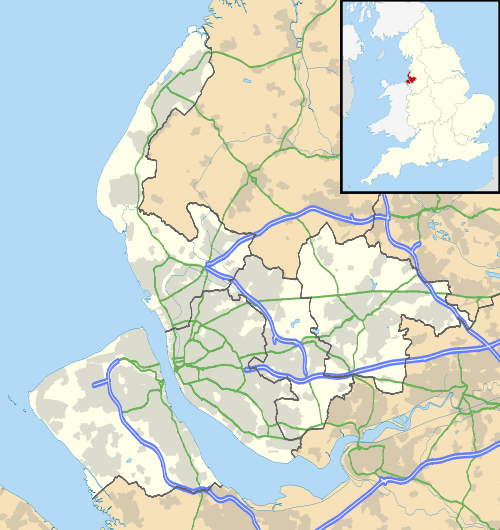
Claughton is in the north-eastern part of the Wirral Peninsula, approximately 4 km (2.5 mi) south-south-east of the Irish Sea at Wallasey, 8.5 km (5.3 mi) east-north-east of the Dee Estuary at Caldy and 3 km (1.9 mi) west of the River Mersey at Woodside. Claughton is situated on the eastern side of Bidston Hill, with the shops and college on the A5027 road at an elevation of between 25–36 m (82–118 ft) above sea level.[8]
 |
Bidston | Birkenhead | Birkenhead | |
| Bidston Hill | |
Birkenhead | ||
| ||||
| | ||||
| Noctorum | Oxton | Oxton |
Economy
The village has a large number of shops, as well as cafes, a bank, bakery, florist, post office, and local pubs such as the 'Claughton Hotel', the 'Heather Brow' and 'Houlihan's Variety Club'.
Education
Claughton is also the location of Birkenhead Sixth Form College, which was established by the local education authority in 1988.[9]
Transport
Claughton Village lies on the A5027 road, which continues on westbound to Saughall Massie and joins the A553 road towards Birkenhead. Map
Notable people
War artist Edgar Downs was born in Claughton in 1876, as was Cecil Arthur Lewis, the World War I fighter ace and co-founder of the BBC, in 1898.
Others
- Charles Alford, church minister, incumbent at Christ Church, Claughton
- John Blakeney, priest, curate of Christ Church, Claughton
- Cecil Holden, cricketer, died in Claughton
- Stephen Ladyman, politician, educated in Claughton
- Charles Reed, architect, died in Claughton
- John Taylor, church minister, vicar of Christ Church, Claughton
- William Taylor, church minister, curate in Claughton
- Harry Verelst, cricketer, born in Claughton
- Frederick Smeeton Williams, church minister, worked in Claughton
See also
References
- ↑ "Coordinate Distance Calculator". boulter.com. Retrieved 6 March 2016.
- ↑ 2001 Census: Claughton, Office for National Statistics, retrieved 2 July 2007
- ↑ "Ward population 2011". Retrieved 1 June 2015.
- ↑ Sulley, Philip (1889), The Wirral Hundred
- ↑ Bidston, Carol E (1985), Birkenhead... Of Yesteryear, Metropolitan Borough of Wirral, ISBN 0-904582-07-8
- ↑ Edwardian Notes, retrieved 30 March 2007
- ↑ Wilfred Owen Biography, Britain Unlimited, retrieved 30 March 2007
- ↑ "SRTM & Ordnance Survey Elevation Data in PHP". Retrieved 31 October 2016.
- ↑ Birkenhead Sixth Form College, retrieved 30 March 2007
Bibliography
- Mortimer, William Williams (1847). The History of the Hundred of Wirral. London: Whittaker & Co. pp305-306.
External links
| Wikimedia Commons has media related to Claughton, Birkenhead. |