Storeton
| Storeton | |
 Cottages on Red Hill Road, Storeton |
|
 Storeton |
|
| Population | 150 (2001 Census)[1] |
|---|---|
| OS grid reference | SJ304849 |
| – London | 177 mi (285 km)[2] SE |
| Metropolitan borough | Wirral |
| Metropolitan county | Merseyside |
| Region | North West |
| Country | England |
| Sovereign state | United Kingdom |
| Post town | WIRRAL |
| Postcode district | CH63 |
| Dialling code | 0151 |
| ISO 3166 code | GB-WRL |
| Police | Merseyside |
| Fire | Merseyside |
| Ambulance | North West |
| EU Parliament | North West England |
| UK Parliament | Wirral South |
|
|
Coordinates: 53°21′23″N 3°02′48″W / 53.3564°N 3.0467°W
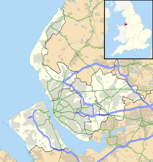
Storeton is a small village on the Wirral Peninsula, England. It is situated to the west of the town of Bebington and is made up of Great Storeton and Little Storeton, which is classified as a hamlet. At the 2001 Census the population of Storeton was recorded as 150.[1]
History
There are Viking connections with Storeton, with the name deriving from the Old Norse Stor-tún, meaning "great farmstead".[3]
The village is mentioned in the Domesday Book of 1085 as Stortone.[4]
It has been thought that the poem Sir Gawain and the Green Knight refers to Storeton Hall. Storeton Hall, itself, dates from the 14th century.[5]
Storeton was a township in Bebington Parish of the Wirral Hundred. The population was 180 in 1801, 233 in 1851, 265 in 1901 and 325 in 1951.[6]
In October 1944 an USAAF Liberator Bomber number 42-50347 from the 445th Bomb Group exploded without explanation over the fields between Little Storeton and Landican with the loss of all 24 servicemen on board. The loss included 15 commissioned officers who were being taxied back to Tibenham after seeing more than 30 successful combat missions. In recent years a memorial stone has been erected by a local man who witnessed the aftermath of the crash as a teenager. The stone is coloured in the USAAF colours blue and yellow, with 24 yellow bricks each representing a life lost.
Geography
Storeton is in the central part of the Wirral Peninsula, approximately 8.5 km (5.3 mi) south-south-east of the Irish Sea at Leasowe, about 6 km (3.7 mi) east-north-east of the Dee Estuary at Heswall and less than 4 km (2.5 mi) west-south-west of the River Mersey at New Ferry. The village is situated to the west of Storeton Hill, with the village at an elevation of around 52 m (171 ft) above sea level.[7]
 |
Landican | Prenton | Bebington | |
| Barnston | |
Bebington | ||
| ||||
| | ||||
| Heswall | Brimstage | Clatterbridge |
Storeton Woods
On the ridge above the village of Storeton are Storeton Woods that are owned by the Friends of Storeton Woods and cover 31 acres (130,000 m2).The woods were purchased in 1989 after a campaign by the local Green Party as there were concerns about the deteriorating condition of the woods and the possibility that the land might be bought by developers. The trust later also attempted to purchase the adjacent Hancock's Wood to extend the nature reserve by a further 25 acres (100,000 m2) but the deal with the Leverhulme estate fell through at the last minute. Although the offer remains open there is the concern that this could lead to the eventual development of the area of woodland for housing.
Storeton Woods is also the location for Storeton Transmitting Station, a television relay and radio transmitter and mast.[8]
Storeton Quarries and Tramway
The woods have grown up on the site of a quarry that was present since the times of the Roman occupation. The quarries were up to 200 feet (61 m) deep at the beginning of the 20th century and, from the 19th century, a tramway (a single track, standard gauge railway) was used to transport stone to the quayside at Bromborough. A portion of the tramway embankment still exists as footpath and a section of the rails have been re-installed by the Bromborough Society. Some rails were embedded at a former level crossing on Rest Hill Road until 1979 when they were buried under a new layer of tarmac. The tramway ran along the southern border of the current woods, into Hancock's Wood and through a tunnel under Mount Road. It then ran in a sweeping curve to Bromborough.[9] Much of the route of the tramway can no longer be seen as it has been lost under housing development or levelled for the playing fields of Wirral Grammar School but the present Quarry Road and Quarry Road East in Bebington follow the track of Storeton Tramway and the original tunnel under the Chester to Birkenhead railway line is still in use as footpath opposite the end of Quarry Road East.
Most of the village is built from locally quarried stone from Storeton Ridge. The stone is a creamy sandstone and according to the British Geological Survey was also used for Roman tombstones and on Birkenhead Town Hall (located in Hamilton Square), Lime Street Station, Lever House in Port Sunlight, Sankey Viaduct in Cheshire, and for cladding on the Empire State Building in New York City.[10] The quarry was also the site of the discovery of dinosaur footprints. The species was named Chirotherium Storetonese after the site of discovery. Examples of these footprints can be seen in World Museum Liverpool in Liverpool and the Williamson Art Gallery in Birkenhead, and also in Christ Church, Kings Road, Higher Bebington.
The quarry was filled in with spoil from the excavation of the Queensway Tunnel in the 1920s and the site is currently a tranquil nature reserve enjoyed by walkers.
Transport
Bus
Services operating in the Storeton area, as of December 8, 2014:
| Number | Route | Operator | Days of Operation |
|---|---|---|---|
| 77/77A | Heswall-Woodside | Avon Buses | Monday-Saturday |
Railway
The Borderlands Line passes between Storeton and Barnston, to the west. Storeton railway station opened in 1896.[11] However, due to its isolation, the station was closed to passengers in 1951, closed completely in 1964 and later demolished.[11]
See also
References
- 1 2 Wirral 2001 Census: Storeton, Metropolitan Borough of Wirral, retrieved 1 September 2007
- ↑ "Coordinate Distance Calculator". boulter.com. Retrieved 6 March 2016.
- ↑ Sulley, Philip (1889), The Hundred Of Wirral
- ↑ Cheshire L-Z, The Domesday Book Online, retrieved 1 September 2007
- ↑ Randall 1984, pp. 86–88
- ↑ Cheshire Towns & Parishes: Storeton, GENUKI UK & Ireland Genealogy, retrieved 1 September 2007
- ↑ "SRTM & Ordnance Survey Elevation Data in PHP". Retrieved 1 November 2016.
- ↑ Storeton transmitting station
- ↑ Storeton Tramway, Friends of Storeton Woods, retrieved 1 September 2007
- ↑ Merseyside Stones, British Geological Survey. Accessed 25 July 2015
- 1 2 "Station Name: STORETON". Disused Stations. Retrieved 24 June 2015.
Sources
Bibliography
- Jermy, Roger C. (1981). Storeton Tramway. Avon-Anglia Publications. ISBN 9780905466439.
- Mortimer, William Williams (1847). The History of the Hundred of Wirral. London: Whittaker & Co. pp192-194.
External links
| Wikimedia Commons has media related to Storeton. |