Heswall
| Heswall | |
 Telegraph Road |
|
 Heswall |
|
| Population | 13,401 (2011 Census.Ward) |
|---|---|
| OS grid reference | SJ269818 |
| – London | 178 mi (286 km)[1] SE |
| Metropolitan borough | Wirral |
| Metropolitan county | Merseyside |
| Region | North West |
| Country | England |
| Sovereign state | United Kingdom |
| Post town | WIRRAL |
| Postcode district | CH60 |
| Dialling code | 0151 |
| ISO 3166 code | GB-WRL |
| Police | Merseyside |
| Fire | Merseyside |
| Ambulance | North West |
| EU Parliament | North West England |
| UK Parliament | Wirral South |
|
|
Coordinates: 53°19′41″N 3°05′56″W / 53.328°N 3.099°W
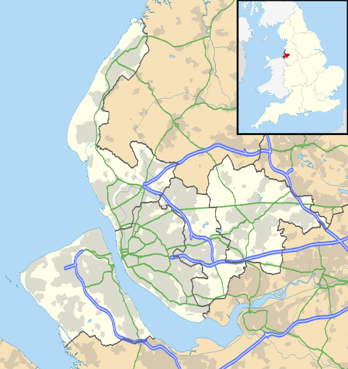
Heswall is a town on the Wirral, in the county of Merseyside, England. Administratively, it is a ward of the Metropolitan Borough of Wirral. At the time of the 2001 Census, the total population of the ward was 16,012 (male: 7,474; female: 8,538),[2] which included the nearby villages of Barnston and Gayton. The population of the town of Heswall itself was 7,750.[3] By the time of the census 2011 population details for Heswall town were no longer maintained. However the ward's population had decreased to 13,401 (male: 6,400; female: 7,001).[4]
Before local government reorganisation on 1 April 1974 it was part of the county of Cheshire.
Geography
Located on the eastern side of the Dee Estuary, with views across the river to North Wales, Heswall is about 20 minutes' drive from the Roman city of Chester and about 20 minutes' drive from Liverpool. The towers of Liverpool's cathedrals can be seen on the horizon from high ground.
 |
Thurstaston | Pensby | Barnston | |
| Mostyn (across Dee Estuary) | |
Brimstage | ||
| ||||
| | ||||
| Bagillt (across Dee Estuary) | Gayton | Raby and Thornton Hough |
History
Before the Norman conquest, Heswall has been cited as a possible location for Dingesmere, mentioned with regard to the Battle of Brunanburh, in Egil's Saga. Heswall was recorded in the Domesday Book as Eswelle and owned by Robert de Rodelent, who also owned much of the land on the eastern side of the River Dee. In 1277, it became the property of Patrick de Haselwall, who was Sheriff of Cheshire.
In 1801, the population was recorded as 168. By the census in 1841, it had only grown to 398. Before 1897 it was known as Hestlewelle or Hesselwelle. Its growth was started by wealthy merchants from Liverpool who had originally chosen it as a retreat but the arrival of two railway connections allowed them to commute. One line is the Borderlands Line from Wrexham Central to Bidston which opened in 1896. This line is still active and has Heswall railway station on the eastern edge of the town. The station was formerly called Heswall Hills to distinguish it from the older, now demolished, Heswall Station. The old station was in Station Road in the Lower Village on another line from West Kirby to Hooton. This opened in 1886 but the line closed to passengers in 1956. The track of the old railway became a footpath, the Wirral Way.
The speedy development of Heswall has seen the once separate villages of Gayton, Heswall, Pensby and Thingwall become joined by continuous housing, although the (original) Lower Village has managed to retain much of its original character.
The oldest structure is the tower of St. Peter's Parish Church, which is about 500 years old. The present church building itself, the third to have been erected on the site, was built in 1879. The previous church had been destroyed by a violent thunderstorm on 19 September 1875, during which the organist and the boy who pumped the bellows for the organ were both killed.
The remains of Gayton's windmill, which stopped operating in 1860 and which is now converted into a house, can be seen close to the Devon Doorway Restaurant on Gayton Roundabout, a short distance back up Telegraph Road towards Heswall.
The Royal Liverpool Children's Hospital originally opened in Heswall as Liverpool Country Hospital for Children in 1909.[5] The hospital was situated on a 3.6 ha (9-acre) site purchased in 1900.[6] It stood on the opposite side of Telegraph Road from the 'Puddydale', and had a tall square clock tower and extensive grounds with views over the Dee estuary. The hospital closed in 1985[5][6] and the site is now occupied by a Tesco supermarket. The supermarket was extended in the early 2000s, then refurbished during 2011.
In 2001 Heswall was listed as being the 7th richest neighbourhood in the UK, with an average household income of £46,600.[7]
Open spaces
.jpg)
There are several areas of open space. The largest is the Dales, an area of dry, sandy heathland overlooking the River Dee. It has the status of both Site of Special Scientific Interest (SSSI) and Local Nature Reserve (LNR). Within this SSSI lies 'the Dungeon', a small river valley cut into the hillside. A path connects the Dales to the Wirral Way and the coast. Other open areas also overlooking the Dee are the Beacons, and Poll Hill, which is the highest point on the Wirral Peninsula.
The large grass area near the centre of town is known as the 'Puddydale'. In former years, Heswall County Primary School was situated on the eastern edge of the field, but has since been demolished. The school was rebuilt on the corner of Whitfield lane and Downham Road North where it is still in use.
Whitfield Common, Off Whitfield Lane, Heswall. Natural land with planning fields, tennis courts, wild life native birds and Common Lizards.
Transport
Rail
| Station | Operator | Route | Days of operation |
|---|---|---|---|
| Heswall | Arriva Trains Wales | Borderlands Line (Bidston-Wrexham Central) | Monday-Sunday |
Bus

Heswall Bus Station serves the town of Heswall is owned and managed by Merseytravel.
The bus station consists of four stands. The main bus operators at Heswall are Arriva North West, Avon Buses, A1A Travel, Stagecoach, Eazibus, A2B Travel and Helms Coaches.
Notable people
- Christian Furr, the youngest artist to have officially painted Queen Elizabeth II, was born in Heswall.[8]
- In 1964, Paul McCartney bought "Rembrandt", a detached mock-Tudor house in Baskervyle Road, Heswall, for his father, Jim McCartney at a cost of £8,750. McCartney Snr later moved to a bungalow nearby, and lived there until his death on 18 March 1976.[9]
- The singer Ian Astbury, most famous for fronting the rock band The Cult, was born in Heswall.[10]
- Cricketer Sir Ian Botham was also born in Heswall.[11]
- TV presenter Jim Bowen was also born in Heswall.[12]
- TV presenter Fiona Bruce was educated at Gayton Primary School in Heswall on the Wirral.[13]
- Pianist Stephen Hough CBE is from Heswall.[14]
- Bill Steer (born William Geoffrey Steer, 3 December 1969) is a British guitar player, and co-founder of the extreme metal band Carcass. Steer spent his teenage years living in Heswall,[15] and went to Heswall Primary School on Whitfield Lane.
- Disc jockey and broadcaster John Peel was also born in Heswall.[16]
Cultural references
Heswall Flower Club is mentioned in the song "This One's For Now" by the band Half Man Half Biscuit on their 2014 album Urge For Offal.
Sport
Heswall F.C. competes in the West Cheshire Association Football League.
See also
References
- ↑ "Coordinate Distance Calculator". boulter.com. Retrieved 6 March 2016.
- ↑ 2001 Census: Heswall, Office for National Statistics, retrieved 16 July 2007
- ↑ Wirral 2001 Census: Heswall, Metropolitan Borough of Wirral, archived from the original on 29 September 2007, retrieved 16 July 2007
- ↑ "Ward population 2011". Retrieved 1 June 2015.
- 1 2 Children's Hospitals: Liverpool Infirmary for Children, E. Chambré Hardman Archive, retrieved 23 February 2008
- 1 2 "Hospitals in Heswall". Heswall Magazine. April 2010. p.24. Retrieved 31 October 2015.
- ↑ Dodd, Vikram (15 January 2001). "South's rich areas get richer". The Guardian. London.
- ↑ Brief Biographical Information, christianfurr.com, archived from the original on 8 June 2007, retrieved 12 August 2007
- ↑ Miles, Barry (1997). Many Years From Now. Vintage-Random House. p. 210. ISBN 0-8050-5249-6.
- ↑ "Interview: Ian Astbury – The Cult". Live4Ever. 10 May 2010. Retrieved 25 October 2016.
- ↑ Barratt, Nick (15 December 2007). "Family detective: Sir Ian Botham". Daily Telegraph. UK. Retrieved 28 August 2009.
- ↑ "Jim Bowen". British Classic Commedy. 27 April 2014. Retrieved 25 October 2016.
- ↑ King, Ray (5 November 2013). "Heswall - why we love this part of the Wirral". Cheshire Life. Retrieved 25 October 2016.
- ↑ Rigby, Emma (16 May 2014). "Wirral's most famous: You might be surprised who's on our list". Wirral Globe. Retrieved 4 November 2016.
- ↑ "The Hotseat – Bill Steer of Carcass". bombshellzine.com. 12 April 2015. Retrieved 25 October 2016.
- ↑ Heatley, Michael (2004). John Peel: A Life in Music. Michael O'Mara Books Limited. ISBN 1-84317-151-1.
Further reading
- Boumphrey, Ian (1991). Yesterday's Wirral No. 6: Neston, Parkgate and Heswall Including Thurstaston, Irby and Greasby. Ian & Marilyn Boumphrey. ISBN 9780950725550. OCLC 656102143.
- Heswall W.E.A. (1989). Memories of Heswall: 1935–85. Countyvise Ltd. ISBN 9780907768272. OCLC 21872503.
- Lee, Rev. Canon Kenneth (1994). St. Peter's Church & Parish Heswall – A Short History and Guide. Leeman Ltd. ASIN B01AX0MOP0.
- McRonald, Jenny (2015). Heswall Through Time. Amberley Publishing. ISBN 9781445636337. OCLC 919299143.
- Mortimer, William Williams (1847). The History of the Hundred of Wirral. London: Whittaker & Co. pp233-235.
- O'Brien, Pat (1996). Burton to Heswall. NPI Media Group. ISBN 9780752406282. OCLC 37132972.
External links
| Wikimedia Commons has media related to Heswall. |
- Town website
- LowerVillage.co.uk
- Heswall Dales SSSI
- Merseytravel
- Wirral community magazine
- Heswall Magazine