|
|
| Route |
From |
To |
Years |
Former routes |
 U.S. Route 1 U.S. Route 1 |
North Carolina |
District of Columbia |
1926–present |
SR 1: 1918 - 1923 |

|
Business routes of US 1: Fredericksburg |
 State Route 2 State Route 2 |
Richmond |
Fredericksburg |
1933–present |
1918 - 1923 |
 State Route 3 State Route 3 |
Culpeper |
Gloucester |
1933–present |
1918 - 1923 |
|
Business routes of SR 3: Fredericksburg and Warsaw |
 State Route 4 State Route 4 |
North Carolina |
east of Boydton |
1952–present |
1918 - 1923, 1933 - 1938, 1940 - mid-1940s |
 State Route 5 State Route 5 |
Richmond |
Williamsburg |
1933–present |
1918 - 1923 |
 State Route 6 State Route 6 |
Afton |
Richmond |
1933–present |
1918 - 1923 |
 State Route 7 State Route 7 |
Winchester |
Alexandria |
1933–present |
1918 - 1923 |
|
Business routes of SR 7: Berryville, Leesburg, Purcellville-Hamilton |
 State Route 8 State Route 8 |
North Carolina |
Christiansburg |
1933–present |
1918 - 1923 |
 State Route 9 State Route 9 |
West Virginia |
west of Leesburg |
1940–present |
1918 - 1923, 1933 - 1940 |
 State Route 10 State Route 10 |
Richmond |
Suffolk |
1918–present |
|
Business routes of SR 10: Smithfield |
 U.S. Route 11 U.S. Route 11 |
Tennessee |
West Virginia |
1926–present |
SR 11: 1918 - 1933 |
|
Note: US 11 is split into  US 11E and US 11E and  US 11W from Tennessee into Bristol. US 11W from Tennessee into Bristol. |
|
Business routes of US 11: Lexington, Staunton |

U.S. Route 11 Alternate |
Salem |
Roanoke |
late 1950s - present |
 State Route 12 State Route 12 |
no current route |
1918 - 1933, 1933 - mid-1930s, 1935 - 1953 |
 U.S. Route 13 U.S. Route 13 |
North Carolina |
Maryland |
1926–present |
|
Business routes of US 13: Eastville, Exmore, Tasley-Accomac |
 State Route 13 State Route 13 |
east of Cumberland |
east of Powhatan |
1918–present |
late 1930s - early 1940s |
 State Route 14 State Route 14 |
St. Stephens Church |
Bayside |
1933–present |
1918 - 1933 |
 U.S. Route 15 U.S. Route 15 |
North Carolina |
Maryland |
1926–present |
SR 15: 1918 - 1923, 1923 - 1933 |
|
Business routes of US 15: Keysville, Farmville, Culpeper, Remington, Warrenton, Leesburg |
 State Route 16 State Route 16 |
North Carolina |
West Virginia |
1940–present |
1918 - 1940 |
State Route 16 Alternate |
Tazewell |
1953–present |
 U.S. Route 17 U.S. Route 17 |
North Carolina |
Winchester |
1926–present |
SR 17: 1918 - 1933, 1933 - mid-1960s
U.S. Route 17-1 (1926 - early 1930s) |
|
Business routes of US 17: Chesapeake, Gloucester, Saluda, Fredericksburg, Warrenton, Marshall |
 State Route 18 State Route 18 |
Paint Bank |
Covington |
1933–present |
1918 - 1933 |
 U.S. Route 19 U.S. Route 19 |
Tennessee |
West Virginia |
late 1920s - present |
SR 19: 1918 - 1933 |
|
Business routes of US 19: Lebanon, Tazewell |
 State Route 20 State Route 20 |
Dillwyn |
Wilderness |
1933–present |
1918 - 1933 |
|
Business routes of SR 20: Orange |
 U.S. Route 21 U.S. Route 21 |
North Carolina |
Wytheville |
1926–present |
SR 21: 1918 - 1933 |
 State Route 22 State Route 22 |
Shadwell |
Mineral |
1933–present |
1918 - 1933 |
 U.S. Route 23 U.S. Route 23 |
Tennessee |
Kentucky |
early 1930s - present |
SR 23: 1918 - 1933 |
|
Business routes of US 23: Gate City, Big Stone Gap-Appalachia-Norton, Wise, Pound |
 State Route 24 State Route 24 |
Roanoke |
west of Buckingham |
1933–present |
1918 - 1933 |
 U.S. Route 25E U.S. Route 25E |
no current route |
1926 - 1996 |
 State Route 25 State Route 25 |
no current route |
1918 - 1933 |
 State Route 26 State Route 26 |
Appomattox |
Bent Creek |
1933–present |
1918 - 1933 |
 State Route 27 State Route 27 |
Arlington |
District of Columbia |
1964–present |
1918 - 1940, 1940 - 1953 |
 State Route 28 State Route 28 |
north of Remington |
Sterling |
1918–present |
 U.S. Route 29 U.S. Route 29 |
North Carolina |
District of Columbia |
1931–present |
SR 29: 1923 - 1933, 1933 - 1947 |
|
Business routes of US 29: Danville, Chatham, Gretna, Hurt-Altavista, Lynchburg-Madison Heights-Amherst, Lovingston, Charlottesville, Madison, Culpeper, Remington, Warrenton |
 State Route 30 State Route 30 |
south of Doswell |
north of Norge |
1923–present |
 State Route 31 State Route 31 |
Wakefield |
west of Williamsburg |
1933–present |
1923 - 1933 |
 State Route 32 State Route 32 |
North Carolina |
Newport News |
1940–present |
1923 - 1933, 1933 - 1940 |
 U.S. Route 33 U.S. Route 33 |
West Virginia |
Richmond |
1938–present |
|
Business routes of US 33: Elkton |
 State Route 33 State Route 33 |
Richmond |
Stingray Point |
1938–present |
1923 - 1933, 1933 - 1938 |
 State Route 34 State Route 34 |
South Boston |
1942–present |
1923 - 1933, 1933 - 1940 |
 State Route 35 State Route 35 |
North Carolina |
south of Petersburg |
1923–present |
 State Route 36 State Route 36 |
west of Petersburg |
Hopewell |
1933–present |
1923 - 1933 |
 State Route 37 State Route 37 |
Winchester |
ca. 1970–present |
1923 - 1933, 1933 - mid-1930s, mid-1930s - 1940, 1940 - early 1950s |
 State Route 38 State Route 38 |
Amelia |
Scotts Fork |
1933–present |
1923 - 1933 |
 State Route 39 State Route 39 |
West Virginia |
Lexington |
1940–present |
1923 - 1933, 1933 - 1940 |
State Route 39 Alternate |
Goshen |
1940–present |
 State Route 40 State Route 40 |
Woolwine |
Spring Grove |
1933–present |
1923 - 1933 |
|
Business route of SR 40 in Stony Creek: Truck route of SR 40 in Victoria |
 State Route 41 State Route 41 |
Danville |
Callands |
1933–present |
1923 - 1933 |
 State Route 42 State Route 42 |
Broadford
south of Newport
east of Clifton Forge |
Poplar Hill
New Castle
Woodstock |
1928–present |
|
Business routes of SR 42: Dayton |
 State Route 43 State Route 43 |
Altavista |
north of Eagle Rock |
1933–present |
1928 - 1933 |
 State Route 44 State Route 44 |
no current route |
1928 - 1933, 1933 - 1952, late 1960s - ca. 2000 |
 State Route 45 State Route 45 |
Farmville |
Georges Tavern |
1928–present |
 State Route 46 State Route 46 |
North Carolina |
west of Blackstone |
1940–present |
1928 - 1933, 1933 - 1940 |
|
Truck route of SR 46 in Lawrenceville |
 State Route 47 State Route 47 |
South Hill |
Pamplin City |
1933–present |
1928 - ca. 1930, 1930 - 1933 |
 U.S. Route 48 U.S. Route 48 |
West Virginia |
Strasburg |
early 2000s - present |
 State Route 48 State Route 48 |
unsigned designation for the Blue Ridge Parkway and Skyline Drive from North Carolina to Front Royal |
1930s - present |
1928 - mid-1930s |
 State Route 49 State Route 49 |
North Carolina |
east of Burkeville |
1928–present |
|
Truck route of SR 49 in Victoria |
 U.S. Route 50 U.S. Route 50 |
West Virginia |
District of Columbia |
1926–present |
SR 50: 1928 - 1933 |
 State Route 51 State Route 51 |
west of Danville |
Danville |
1954–present |
1928 - 1950 |
 U.S. Route 52 U.S. Route 52 |
North Carolina |
West Virginia |
mid-1930s - present |
SR 52: 1928 - 1933, 1933 - mid-1930s |
 State Route 53 State Route 53 |
south of Charlottesville |
Palmyra |
1947–present |
1928 - 1933, 1933 - 1940 |
 State Route 54 State Route 54 |
east of Montpelier |
north of Hanover |
1933–present |
1928 - 1933 |
 State Route 55 State Route 55 |
West Virginia |
Gainesville |
1928–present |
 State Route 56 State Route 56 |
Steeles Tavern |
west of Buckingham |
1930–present |
 State Route 57 State Route 57 |
north of Stuart |
west of Halifax |
1930–present |
State Route 57 Alternate |
west of Bassett |
west of Martinsville |
late 1950s - present |
 U.S. Route 58 U.S. Route 58 |
Tennessee |
Virginia Beach |
early 1930s - present |
SR 58: 1930 - 1933 |
|
Business routes of US 58: Rose Hill, Gate City, Meadows of Dan, Stuart, Martinsville, Danville, Clarksville, Boydton, South Hill, Lawrenceville, Emporia, Courtland, Franklin-Holland, Suffolk, Virginia Beach |
U.S. Route 58 Alternate |
Jonesville |
Abingdon |
early 1950s - present |
|
Business routes of US 58 Alternate: Norton |
 State Route 59 State Route 59 |
Drakes Branch |
Keysville |
1957–present |
1931 - 1933, 1933 - 1940, 1940 - 1949 |
 U.S. Route 60 U.S. Route 60 |
West Virginia |
Virginia Beach |
1926–present |
|
Business routes of US 60: Clifton Forge |
 State Route 61 State Route 61 |
Tazewell |
Narrows |
1933–present |
 State Route 62 State Route 62 |
North Carolina |
east of Danville |
1946–present |
1933 - 1942, 1942 - 1946 |
 State Route 63 State Route 63 |
St. Paul |
Haysi |
1958–present |
1933 - 1946 |
 Interstate 64 Interstate 64 |
West Virginia |
Chesapeake |
1957–present |
SR 64: 1933 - 1940, 1940 - 1958 |
 State Route 65 State Route 65 |
south of Clinchport |
east of St. Paul |
1958–present |
1933 - 1940, 1940 - 1943 |
 Interstate 66 Interstate 66 |
north of Strasburg |
District of Columbia |
1957–present |
SR 66: 1933 - 1940, 1940 - 1958 |
 State Route 67 State Route 67 |
east of Honaker |
Jewell Ridge |
1940–present |
1933 - 1940 |
 State Route 68 State Route 68 |
east of Keokee |
Appalachia |
1933–present |
 State Route 69 State Route 69 |
east of Austinville |
Poplar Camp |
1958–present |
1933 - 1951 |
 State Route 70 State Route 70 |
Tennessee |
Jonesville |
1940–1954, 1962–present |
1933 - 1940 |
 State Route 71 State Route 71 |
Gate City |
Lebanon |
1933–present |
 State Route 72 State Route 72 |
north of Gate City |
west of Clintwood |
1933–present |
 Interstate 73 Interstate 73 |
North Carolina |
West Virginia |
proposed |
 State Route 73 State Route 73 |
north of Richmond |
1958–present |
1933 - 1948 |
 Interstate 74 Interstate 74 |
North Carolina |
West Virginia |
proposed |
 State Route 74 State Route 74 |
Norton |
east of Norton |
1958–present |
1933 - 1942 |
 State Route 75 State Route 75 |
Tennessee |
Abingdon |
1940–present |
1933 - 1940 |
 State Route 76 State Route 76 |
west of Richmond |
Richmond |
1973–present |
1933 - 1970 |
 Interstate 77 Interstate 77 |
North Carolina |
West Virginia |
late 1950s - present |
SR 77: 1933 - 1940, 1940 - 1942 |
 State Route 78 State Route 78 |
Appalachia |
south of Stonega |
1946–present |
1933 - 1940, 1940 - 1944 |
 State Route 79 State Route 79 |
west of Linden |
ca. 1980–present |
1933 - 1953, mid-1960s - early 1970s |
 State Route 80 State Route 80 |
Kentucky |
Cedarville |
1933–present |
 Interstate 81 Interstate 81 |
Tennessee |
West Virginia |
1957–present |
SR 81: 1933 - 1940, 1940 - 1958 |
 State Route 82 State Route 82 |
Cleveland |
Lebanon |
1933–present |
 State Route 83 State Route 83 |
Pound |
West Virginia |
1940–present |
1933 - 1940 |
 State Route 84 State Route 84 |
West Virginia |
Vanderpool |
1940–present |
1933 - 1940 |
 Interstate 85 Interstate 85 |
North Carolina |
Petersburg |
1957–present |
1933 - 1958 |
 State Route 86 State Route 86 |
North Carolina |
Danville |
1933–present |
 State Route 87 State Route 87 |
North Carolina |
Ridgeway |
1940–present |
1933 - 1940 |
 State Route 88 State Route 88 |
no current route |
1933 - 1940, 1940 - 1948 |
 State Route 89 State Route 89 |
North Carolina |
Galax |
1940–present |
1933 - 1938 |
 State Route 90 State Route 90 |
west of Rural Retreat |
Rural Retreat |
1933–present |
 State Route 91 State Route 91 |
Tennessee |
west of Tazewell |
1940–present |
1933 - 1940 |
|
Business routes of SR 91: Glade Spring |
 State Route 92 State Route 92 |
west of Clover |
Boydton |
1940–present |
1933 - 1940 |
 State Route 93 State Route 93 |
North Carolina |
east of Mouth of Wilson |
1933–present |
 State Route 94 State Route 94 |
west of Galax |
south of Fort Chiswell |
1933–present |
 Interstate 95 Interstate 95 |
North Carolina |
District of Columbia |
1957–present |
SR 95: 1933 - 1953 |
 State Route 96 State Route 96 |
south of South Boston |
North Carolina |
1940–present |
1933 - 1940 |
 State Route 97 State Route 97 |
Galax |
Blue Ridge Parkway |
1933–present |
 State Route 98 State Route 98 |
Bland |
1933–present |
 State Route 99 State Route 99 |
Pulaski |
east of Pulaski |
1933–present |
|
|
| Route |
From |
To |
Years |
Former routes |
 State Route 100 State Route 100 |
east of Hillsville |
Narrows |
1933–present |
 State Route 101 State Route 101 |
Roanoke |
1969–present |
1933 - ca. 1960 |
 State Route 102 State Route 102 |
Pocahontas |
Bluefield |
1958–present |
1933 - 1954 |
 State Route 103 State Route 103 |
south of Stuart |
North Carolina |
1933–present |
 State Route 104 State Route 104 |
no current route |
mid-1960s - 2001, now part of U.S. Route 17
1933-1949, now State Route 773
1928-1933, now part of U.S. Route 421
1923-1928 |
 State Route 105 State Route 105 |
Newport News |
south of Yorktown |
1950s - present |
1933 - early 1940s |
 State Route 106 State Route 106 |
Petersburg |
Talleysville |
1940–present |
1933 - 1940 |
 State Route 107 State Route 107 |
Chilhowie |
Saltville |
1961–present |
1933 - 1953 |
 State Route 108 State Route 108 |
north of Martinsville |
Figsboro |
1933–present |
 State Route 109 State Route 109 |
Petersburg |
Fort Lee |
1956–present |
1933 - 1946 |
 State Route 110 State Route 110 |
Arlington |
1964–present |
1933 - 1946, 1947 - 1956 |
 State Route 111 State Route 111 |
Christiansburg |
1933–present |
 State Route 112 State Route 112 |
Salem |
1960s - present |
1933 - 1943 |
 State Route 113 State Route 113 |
Bristol |
1966–present |
1933 - 1942 |
 State Route 114 State Route 114 |
northwest of Radford |
Christiansburg |
1933–present |
1923 - 1928, 1928 - 1933 |
 State Route 115 State Route 115 |
Roanoke |
north of Roanoke |
1933–present |
 State Route 116 State Route 116 |
Burnt Chimney |
Roanoke |
1933–present |
 State Route 117 State Route 117 |
Roanoke |
Hollins |
1933–present |
 U.S. Route 117 U.S. Route 117 |
no current route |
1926 - early 1930s |
 State Route 118 State Route 118 |
Roanoke |
Hollins |
1933–present |
 State Route 119 State Route 119 |
North Carolina |
Delila |
1964–present |
1933 - 1964 |
 State Route 120 State Route 120 |
Arlington |
1940–present |
1933 - 1940 |
 U.S. Route 121 U.S. Route 121 |
Pound |
West Virginia |
ca. 2000–present |
1926 - mid-1930s |
 State Route 121 State Route 121 |
Fort Chiswell |
Max Meadows |
1933–present |
 State Route 122 State Route 122 |
east of Rocky Mount |
Big Island |
1933–present |
 State Route 123 State Route 123 |
Woodbridge |
District of Columbia |
1940–present |
1933 - 1940 |
 State Route 124 State Route 124 |
Arlington |
1948–present |
1933 - late 1930s, late 1930s - 1943 |
 State Route 125 State Route 125 |
Chuckatuck |
Driver |
1963–present |
1933 - unknown |
 State Route 126 State Route 126 |
Onancock |
Tasley |
mid-1990s - present |
1933 - 1944, 1948 - 1979 |
 State Route 127 State Route 127 |
West Virginia |
north of Winchester |
1964–present |
1933 - 1948 |
 State Route 128 State Route 128 |
Lynchburg |
1933–present |
 State Route 129 State Route 129 |
South Boston |
south of Halifax |
1933–present |
 State Route 130 State Route 130 |
Natural Bridge |
northeast of Madison Heights |
1933–present |
 State Route 131 State Route 131 |
Appomattox |
1933–present |
 State Route 132 State Route 132 |
Williamsburg |
north of Williamsburg |
mid-1950s - present |
1933 - 1943 |
 State Route 133 State Route 133 |
Hampden-Sydney |
south of Farmville |
1933–present |
 State Route 134 State Route 134 |
Hampton |
Tabb |
early 1940s - present |
1933 - early 1940s |
 State Route 135 State Route 135 |
Suffolk |
1950s - present |
1933 - 1945 |
 State Route 136 State Route 136 |
Alberta |
1950s - present |
1933 - 1948 |
 State Route 137 State Route 137 |
Kenbridge |
Danieltown |
1933–present |
 State Route 138 State Route 138 |
north of South Hill |
Kenbridge |
1933–present |
 State Route 139 State Route 139 |
Jarratt |
1940s - present |
1933 - 1942 |
 State Route 140 State Route 140 |
Abingdon |
1960–present |
1933 - 1949 |
 State Route 141 State Route 141 |
Portsmouth |
ca. 1970–present |
1933 - 1943 |
 State Route 142 State Route 142 |
southwest of Petersburg |
Petersburg |
1933–present |
 State Route 143 State Route 143 |
Norfolk |
north of Williamsburg |
mid-1940s - present |
1933 - 1942 |
 State Route 144 State Route 144 |
Centralia |
west of Hopewell |
1933–present |
 State Route 145 State Route 145 |
Chesterfield |
south of Bensley |
1933–present |
 State Route 146 State Route 146 |
Richmond |
1976–present |
1933 - 1949, 1949 - 1966 |
 State Route 147 State Route 147 |
east of Midlothian |
Richmond |
1933–present |
 State Route 148 State Route 148 |
north of Fancy Gap |
1980–present |
1933 - 1951 |
 State Route 149 State Route 149 |
Virginia Beach |
1940s - present |
1933 - 1942 |
 State Route 150 State Route 150 |
south of Richmond |
west of Richmond |
1967–present |
1933 - 1950s, 1961 - 1962 |
 State Route 151 State Route 151 |
north of Amherst |
east of Afton |
1933–present |
 State Route 152 State Route 152 |
Newport News |
Hampton |
1946–present |
1933 - 1942, early 1940s - 1944 |
 State Route 153 State Route 153 |
east of Blackstone |
east of Amelia |
1933–present |
 State Route 154 State Route 154 |
Covington |
1962–present |
1933 - early 1940s, early 1940s - late 1950s |
 State Route 155 State Route 155 |
Charles City |
Carps Corner |
1933–present |
 State Route 156 State Route 156 |
south of Petersburg |
Mechanicsville |
1933–present |

|
Bypass routes of SR 156: Hopewell |
 State Route 157 State Route 157 |
west of Richmond |
north of Laurel |
1933–present |
 U.S. Route 158 U.S. Route 158 |
no current route |
early 1930s - 1940 |
 State Route 158 State Route 158 |
Coeburn |
east of Coeburn |
1999–present |
1933 - 1940, 1940 - 1943, 1947 - 1970 |
 State Route 159 State Route 159 |
Crows |
Callaghan |
1947–present |
1933 - 1945 |
 State Route 160 State Route 160 |
Kentucky |
Appalachia |
1940–present |
1933 - 1940 |
 State Route 161 State Route 161 |
Richmond |
north of Richmond |
1933–present |
 State Route 162 State Route 162 |
east of Williamsburg |
1945–present |
1933 - 1943 |
 State Route 163 State Route 163 |
Lynchburg |
Madison Heights |
2000s - present |
1933 - 1942, 1950s - 1990s |
 State Route 164 State Route 164 |
Suffolk |
Portsmouth |
late 1960s |
1933 - 1950s |
 State Route 165 State Route 165 |
Chesapeake |
Norfolk |
1933–present |
 State Route 166 State Route 166 |
Chesapeake |
Virginia Beach |
1933–present |
 State Route 167 State Route 167 |
no current route |
1933 - 1995 |
 State Route 168 State Route 168 |
North Carolina |
Norfolk |
1933–present |
|
Business routes of SR 168: Chesapeake |
 State Route 169 State Route 169 |
Hampton |
1933–present |
 U.S. Route 170 U.S. Route 170 |
no current route |
1926 - 1931 |
 State Route 170 State Route 170 |
Norfolk |
1957–present |
1933 - 1940, 1940 - 1957 |
 State Route 171 State Route 171 |
Newport News |
Poquoson |
1933–present |
 State Route 172 State Route 172 |
Hampton |
Poquoson |
1933–present |
 State Route 173 State Route 173 |
Newport News
Suffolk (future) |
near Seaford |
1933–present |
 State Route 174 State Route 174 |
Martinsville |
1978–present |
1933 - 1966 |
 State Route 175 State Route 175 |
north of Oak Hall |
Chincoteague |
1933–present |
 State Route 176 State Route 176 |
Parksley |
Nelsonia |
1933–present |
 State Route 177 State Route 177 |
south of Radford |
Radford |
1962–present |
1933 - 1959 |
 State Route 178 State Route 178 |
Exmore |
north of Pungoteague |
1933–present |
 State Route 179 State Route 179 |
Onancock |
Onley |
1933–present |
 State Route 180 State Route 180 |
near Harborton |
Wachapreague |
1933–present |
 State Route 181 State Route 181 |
Belle Haven |
east of Belle Haven |
1933–present |
 State Route 182 State Route 182 |
Painter |
Quinby |
1933–present |
 State Route 183 State Route 183 |
east of Silver Beach |
Exmore |
1933–present |
 State Route 184 State Route 184 |
Cape Charles |
south of Cheriton |
1957–present |
1933 - 1953 |
 State Route 185 State Route 185 |
west of Edinburg |
Edinburg |
1964–present |
1933 - 1952 |
 State Route 186 State Route 186 |
North Carolina |
Boykins |
ca. 1970–present |
1933 - early 1950s |
 State Route 187 State Route 187 |
north of Guilford |
Modest Town |
1933–present |
 State Route 188 State Route 188 |
Clifton Forge |
unknown - present |
1933 - 1944 |
 State Route 189 State Route 189 |
south of Franklin |
west of Holland |
1933–present |
 State Route 190 State Route 190 |
Chesapeake |
Virginia Beach |
1950s - present |
1933 - 1952 |
 State Route 191 State Route 191 |
Chesapeake |
1933–present |
 State Route 192 State Route 192 |
Norfolk |
1952–present |
1933 - 1947, 1951 - 1952 |
 State Route 193 State Route 193 |
Dranesville |
Langley |
1948–present |
1933 - 1945 |
 State Route 194 State Route 194 |
Norfolk |
1947–present |
1933 - 1946 |
 Interstate 195 Interstate 195 |
Richmond |
ca. 1970–present |
 State Route 195 State Route 195 |
Richmond |
1976–present |
1933 - ca. 1970 |
 State Route 196 State Route 196 |
Chesapeake |
1942–present |
1933 - 1942 |
 State Route 197 State Route 197 |
Richmond |
1962–present |
1933 - 1966 |
 State Route 198 State Route 198 |
Glenns |
near Mathews |
1933–present |
 State Route 199 State Route 199 |
northwest of Williamsburg |
east of Williamsburg |
late 1960s - present |
1933 - 1950s |
|
|
| Route |
From |
To |
Years |
Former routes |
 State Route 200 State Route 200 |
White Stone |
Burgess |
1933–present |
 State Route 201 State Route 201 |
south of Lively |
Heathsville |
1933 - presest |
 State Route 202 State Route 202 |
Templeman |
Callao |
1933–present |
 State Route 203 State Route 203 |
Lyells |
near Kinsale |
1933–present |
 State Route 204 State Route 204 |
George Washington Birthplace National Monument |
1933–present |
 State Route 205 State Route 205 |
east of King George |
Oak Grove |
1933–present |
 State Route 206 State Route 206 |
west of King George |
Dahlgren |
1933–present |
 State Route 207 State Route 207 |
Carmel Church |
south of Bowling Green |
1933–present |
|
Business routes of SR 207: Bowling Green |
 State Route 208 State Route 208 |
Ferncliff |
Four Mile Fork |
1950–present |
1933 - 1945 |
 State Route 209 State Route 209 |
Virginia's Center for Innovative Technology |
1990–present |
1933 - 1948, 1957 - ca. 1970 |
 State Route 210 State Route 210 |
Madison Heights |
east of Madison Heights |
ca. 1960–present |
1933 - 1952 |
 U.S. Route 211 U.S. Route 211 |
New Market |
Warrenton |
1926–present |
|
Business routes of US 211: Luray, Washington, Warrenton |
 State Route 211 State Route 211 |
Timberville |
New Market |
1977–present |
 State Route 212 State Route 212 |
Fredericksburg |
east of Fredericksburg |
2004–present |
1933 - 1948, 1975 - 1979, 1985 - 2004 |
 State Route 213 State Route 213 |
Manassas Park |
mid-1970s - present |
1933 - 1943 |
 State Route 214 State Route 214 |
Lerty |
east of Stratford |
1933–present |
 State Route 215 State Route 215 |
east of Warrenton |
west of Manassas |
1961–present |
1933 - 1944 |
 State Route 216 State Route 216 |
north of Gloucester Point |
Achilles |
1933–present |
 State Route 217 State Route 217 |
Southwestern Virginia Mental Health Institute |
1954–present |
1933 - 1942 |
 State Route 218 State Route 218 |
Falmouth |
west of Colonial Beach |
1933–present |
 U.S. Route 219 U.S. Route 219 |
Rich Creek |
West Virginia |
late 1930s - present |
SR 219: 1933 - late 1930s |
 U.S. Route 220 U.S. Route 220 |
North Carolina |
West Virginia |
mid-1930s - present |
SR 220: 1933 - mid-1930s |
|
Business routes of US 220: Ridgeway, Martinsville, Rocky Mount, Roanoke, Clifton Forge |
 State Route 220 Alternate State Route 220 Alternate |
Roanoke |
south of Fincastle |
1978–present |
 U.S. Route 221 U.S. Route 221 |
North Carolina |
Lynchburg |
early 1930s - present |
 State Route 222 State Route 222 |
south of Weems |
north of Irvington |
1933–present |
 State Route 223 State Route 223 |
Hudgins |
Gwynn's Island |
1933–present |
 State Route 224 State Route 224 |
Tennessee |
east of Weber City |
1991–present |
1933 - 1951, ca. 1980 - 1989 |
 State Route 225 State Route 225 |
Virginia Beach |
mid-1960s - present |
1933 - mid-1950s |
 State Route 226 State Route 226 |
west of Petersburg |
ca. 1970–present |
1933 - 1942, 1942 - 1943 |
 State Route 227 State Route 227 |
east of Saluda |
Urbanna |
1933–present |
 State Route 228 State Route 228 |
Herndon |
north of Herndon |
1966–present |
1933 - 1951 |
 State Route 229 State Route 229 |
Culpeper |
west of Warrenton |
1947–present |
1933 - mid-1930s, mid-1930s - 1942 |
 State Route 230 State Route 230 |
Stanardsville |
north of Madison Mills |
1933–present |
 State Route 231 State Route 231 |
south of Cismont |
south of Sperryville |
1933–present |
 State Route 232 State Route 232 |
Radford |
1968–present |
1933 - 1943 |
 State Route 233 State Route 233 |
Arlington |
1964–present |
1933 - 1949 |
 State Route 234 State Route 234 |
Dumfries |
near Woolsey |
1933–present |
|
Business routes of SR 234: Manassas |
 State Route 235 State Route 235 |
south of Alexandria |
1933–present |
 State Route 236 State Route 236 |
Fairfax |
Alexandria |
mid-1930s - present |
1933 - mid-1930s |
 State Route 237 State Route 237 |
Fairfax |
Arlington |
1933–present |
 State Route 238 State Route 238 |
Lee Hall |
Yorktown |
1940–present |
1933 - 1940 |
 State Route 239 State Route 239 |
Portsmouth |
late 1960s - present |
1933 - 1941, 1942 - mid-1940s |
 U.S. Route 240 U.S. Route 240 |
no current route |
1930s |
 State Route 240 State Route 240 |
near Crozet |
1942–present |
1933 - 1942 |
 State Route 241 State Route 241 |
south of Alexandria |
Alexandria |
1933–present |
 State Route 242 State Route 242 |
Gunston Hall |
1950–present |
1933 - 1948 |
 State Route 243 State Route 243 |
south of Vienna |
Vienna |
1960–present |
1933 - 1943 |
 State Route 244 State Route 244 |
Annandale |
Arlington |
1933–present |
 State Route 245 State Route 245 |
north of Warrenton |
The Plains |
1944–present |
1933 - 1940, 1940 - 1942, 1942 - 1944 |
 State Route 246 State Route 246 |
Chesapeake |
1942–present |
1933 - 1942 |
 State Route 247 State Route 247 |
Norfolk |
1959–present |
1933 - 1943 |
 State Route 248 State Route 248 |
Courtland |
North Carolina |
1933 - 1943, 1943 - mid-1940s, 2010-future. will be completion on August 2010. |
 State Route 249 State Route 249 |
northeast of Bottoms Bridge |
Angelview Church |
early 1970s - present |
1933 - 1952 |
 U.S. Route 250 U.S. Route 250 |
West Virginia |
Richmond |
mid-1930s - present |
SR 250: 1933 - mid-1930s |
|
Business routes of US 250: Charlottesville |
 State Route 251 State Route 251 |
near Collierstown |
Lexington |
1933–present |
 State Route 252 State Route 252 |
east of Rockbridge Baths |
Staunton |
1933–present |
 State Route 253 State Route 253 |
Harrisonburg |
near Port Republic |
2005–present |
1933 - mid-1940s, 1967 - 1998 |
 State Route 254 State Route 254 |
Christian |
Waynesboro |
1933–present |
 State Route 255 State Route 255 |
south of Millwood |
Briggs |
1933–present |
 State Route 256 State Route 256 |
south of Burketown |
Grottoes |
1933–present |
 State Route 257 State Route 257 |
near West Virginia |
east of Mount Crawford |
1933–present |
 U.S. Route 258 U.S. Route 258 |
North Carolina |
Fort Monroe |
1940–present |
SR 258: 1933 - 1940, 1940 - mid-1940s |
|
Business routes of US 258: Franklin, Smithfield |
 State Route 258 Alternate State Route 258 Alternate |
Smithfield |
unknown - present |
 State Route 259 State Route 259 |
Mauzy
West Virginia |
West Virginia
west of Gore |
1933–present |
State Route 259 Alternate |
Broadway |
unknown - present |
 State Route 260 State Route 260 |
no current route |
1933 - 1947, 1952 - 1977, 1987 - early 2000s |
 State Route 261 State Route 261 |
Staunton |
ca. 1980–present |
1933 - 1940, 1940 - 1951 |
 State Route 262 State Route 262 |
south of Staunton |
east of Staunton |
1970s - present |
1933 - 1947 |
 State Route 263 State Route 263 |
west of Orkney Springs |
Mount Jackson |
1933–present |
 Interstate 264 Interstate 264 |
Bowers Hill |
Virginia Beach |
late 1950s - present |
SR 264: 1933 - 1953 |
 State Route 265 State Route 265 |
no current route |
1933 - 1943, ca. 1970 - 1996 |
 Interstate 266 Interstate 266 |
no current route |
late 1950s - unknown (proposed) |
 State Route 266 State Route 266 |
no current route |
1933 - 1952 |
 State Route 267 State Route 267 |
Leesburg |
west of Arlington |
1982–present |
1933 - 1951 |
 State Route 268 State Route 268 |
no current route |
1933 - 1951 |
 State Route 269 State Route 269 |
east of Clifton Forge |
Longdale Furnace |
1983–present |
1933 - 1953 |
 State Route 270 State Route 270 |
Saint Paul |
mid-1990s - present |
1933 - 1948 |
 State Route 271 State Route 271 |
Short Pump |
Rockville |
1940–present |
1933 - 1940 |
 State Route 272 State Route 272 |
west of Holland |
ca. 1990–present |
1933 - 1947 |
 State Route 273 State Route 273 |
Barhamsville |
Eltham |
mid-1980s - present |
1933 - 1947 |
 State Route 274 State Route 274 |
east of Independence |
south of Fries |
ca. 1980 |
1933 - mid-1950s |
 State Route 275 State Route 275 |
no current route |
1933 - 1940, early 1940s - 1954, 1960s - 2006 |
 State Route 276 State Route 276 |
Weyers Cave |
east of Harrisonburg |
1943–present |
1933 - 1943 |
 State Route 277 State Route 277 |
Stephens City |
Double Toll Gate |
1933–present |
 State Route 278 State Route 278 |
Langley Air Force Base |
1942–present |
1933 - ca. 1940 |
 State Route 279 State Route 279 |
Virginia Beach |
ca. 1980–present |
1933 - 1943 |
 State Route 280 State Route 280 |
no current route |
1933 - 1944, 1978 - early 1980s |
 State Route 281 State Route 281 |
no current route |
1933 - 1945 |
 State Route 282 State Route 282 |
no current route |
1933 - 1943 |
 State Route 283 State Route 283 |
Norton |
1991–present |
1933 - 1943 |
 State Route 284 State Route 284 |
no current route |
1930s - 1946 |
 State Route 285 State Route 285 |
South of Fishersville |
Fishersville |
late 1990s - present |
1933 - 1943 |
 State Route 286 State Route 286 |
Fort Belvoir |
Herndon |
2012–present |
1933 - 1942 |
 State Route 287 State Route 287 |
Purcellville |
Maryland |
1944–present |
1933 - early 1940s |
 State Route 288 State Route 288 |
south of Richmond |
west of Richmond |
unknown - present |
1933 - 1947 |
 State Route 289 State Route 289 |
West Springfield |
Franconia |
2012–present |
1934 - 1942 |
 State Route 290 State Route 290 |
Dayton |
1934–present |
 State Route 291 State Route 291 |
no current route |
1935 - 1989 |
 State Route 292 State Route 292 |
west of Mount Jackson |
Mount Jackson |
1986–present |
1930s - 1951 |
 State Route 293 State Route 293 |
Danville |
1996–present |
1930s - 1944 |
 State Route 294 State Route 294 |
Woodbridge |
Lake Jackson |
2012–present |
1935 - 1942 |
 Interstate 295 Interstate 295 |
south of Petersburg |
west of Richmond |
late 1950s - present |
SR 295: 1935 - 1940, 1940 - 1961 |
 State Route 296 State Route 296 |
West Point |
1935–present |
 State Route 297 State Route 297 |
no current route |
1935 - 1942, 1942 - 1970 |
 State Route 298 State Route 298 |
West Point |
1935–present |
 State Route 299 State Route 299 |
south of Culpeper |
1999–present |
1935 - ca. 1940, 1941 - 1951 |
|
|
| Route |
From |
To |
Years |
Former routes |
 State Route 300 State Route 300 |
Powhatan |
north of Powhatan |
1935–present |
 U.S. Route 301 U.S. Route 301 |
North Carolina |
Maryland |
early 1930s - present |
|
Business routes of US 301: Bowling Green |
U.S. Route 301 Alternate |
Petersburg |
early 1950s - present |
 State Route 302 State Route 302 |
University of Virginia |
1932–present |
 State Route 303 State Route 303 |
Virginia Military Institute |
1932–present |
 State Route 304 State Route 304 |
South Boston |
1936–present |
 State Route 305 State Route 305 |
New Market Battlefield State Historical Park |
1968–present |
1936 - 1940, 1941 - 1960 |
 State Route 306 State Route 306 |
Newport News |
1941–present |
1936 - 1941 |
 State Route 307 State Route 307 |
Rice |
west of Jetersville |
1936–present |
 State Route 308 State Route 308 |
Southampton Correctional Center |
1938–present |
 State Route 309 State Route 309 |
McLean |
Arlington |
1937–present |
 State Route 310 State Route 310 |
James River Correctional Center |
1991–present |
1932 - 1990? |
 U.S. Route 311 U.S. Route 311 |
no current route |
1926 - mid-1930s |
 State Route 311 State Route 311 |
Salem
West Virginia |
West Virginia
West Virginia |
|
|
 State Route 312 State Route 312 |
Newport News |
1950s - present |
1938 - 1951 |
 State Route 313 State Route 313 |
Beaumont Learning Center |
1932? - present |
 State Route 314 State Route 314 |
Virginia Polytechnic Institute and State University |
1932? - present |
 State Route 315 State Route 315 |
Virginia Museum of Fine Arts and R. E. Lee Memorial Park |
1946–present |
1937 - 1943 |
 State Route 316 State Route 316 |
Tasley |
Hallwood |
1937–present |
 State Route 317 State Route 317 |
no current route |
1932 - 2002 |
 State Route 318 State Route 318 |
Capitol Square |
1932–present |
 State Route 319 State Route 319 |
Central State Hospital |
1942? - present |
 State Route 320 State Route 320 |
Catawba Hospital |
1941–present |
 U.S. Route 321 U.S. Route 321 |
no current route |
early 1930s |
 State Route 321 State Route 321 |
College of William and Mary |
1930s? - present |
 State Route 322 State Route 322 |
Eastern State Hospital |
1932–present |
 State Route 323 State Route 323 |
Piedmont Geriatric Hospital |
1932–present |
 State Route 324 State Route 324 |
Bon Air Learning Center |
1932–present |
 State Route 325 State Route 325 |
Barrett Learning Center |
1932–present |
 State Route 326 State Route 326 |
Hanover Learning Center |
1932–present |
 State Route 327 State Route 327 |
Virginia State University |
1932–present |
 State Route 328 State Route 328 |
Longwood University |
1958–present |
1932 - 1939 |
 State Route 329 State Route 329 |
Virginia Correctional Center for Women |
1932–present |
 State Route 330 State Route 330 |
Keen Mountain Correctional Center |
1990? - present |
1932 - 1980 |
 State Route 331 State Route 331 |
James Madison University |
1932–present |
 State Route 332 State Route 332 |
Hampton Roads Agricultural Experimental Station |
1932–present |
 State Route 333 State Route 333 |
Staunton Correctional Center |
1932–present |
 State Route 334 State Route 334 |
Lynchburg Training School and Hospital |
1932–present |
 State Route 335 State Route 335 |
Eastern Shore Experimental Station |
1959–present |
late 1930s - 1949 |
 State Route 336 State Route 336 |
State Police Headquarters, Wythe County |
1960–present |
1938 - 1941? |
 State Route 337 State Route 337 |
Suffolk |
Norfolk |
late 1930s - present |
State Route 337 Alternate |
Portsmouth |
1968–present |
State Route 337 Alternate |
Norfolk |
unknown - present |
 State Route 338 State Route 338 |
Falls Church |
late 1930s - present |
 State Route 339 State Route 339 |
State Police and Radio Headquarters, Chesterfield County |
1939–present |
 U.S. Route 340 U.S. Route 340 |
north of Greenville
West Virginia |
West Virginia
Maryland |
1926–present |
 SR 340: 1933 - 1935 SR 340: 1933 - 1935 |
|
Business routes of US 340: Luray-Stanley |
 State Route 341 State Route 341 |
State Police and Radio Station, Appomattox County |
1940–present |
 State Route 342 State Route 342 |
State Police and Radio Station, Culpeper County |
1940–present |
 State Route 343 State Route 343 |
First Landing State Park |
1940–present |
 State Route 344 State Route 344 |
Staunton River State Park |
1940–present |
 State Route 345 State Route 345 |
Richard Bland College |
1962–present |
1941 - 1944 |
 State Route 346 State Route 346 |
Fairy Stone State Park |
1940–present |
 State Route 347 State Route 347 |
Westmoreland State Park |
1940–present |
 State Route 348 State Route 348 |
Hungry Mother State Park |
1940–present |
 State Route 349 State Route 349 |
Halifax |
early 1940s - present |
 State Route 350 State Route 350 |
Tidewater Community College, Virginia Beach Campus |
1971–present |
early 1940s - 1960s |
 State Route 351 State Route 351 |
Newport News |
Hampton |
mid-1940s - present |
1942 - mid-1940s |
 State Route 352 State Route 352 |
north of Pennington Gap |
Saint Charles |
1942–present |
 State Route 353 State Route 353 |
Virginia Commonwealth University Medical College Campus |
1942–present |
 State Route 354 State Route 354 |
Corrotoman River |
north of Litwalton |
1942–present |
 State Route 355 State Route 355 |
Lord Fairfax Community College |
2001? - present |
1947 - 1983 |
 State Route 356 State Route 356 |
northwest of Richmond |
1940s - present |
 State Route 357 State Route 357 |
Southside Virginia Training Center |
1965–present |
1949 - 1953? |
 State Route 358 State Route 358 |
Woodrow Wilson Rehabilitation Center |
1953? - present |
 State Route 359 State Route 359 |
southwest of Williamsburg |
1959–present |
 U.S. Route 360 U.S. Route 360 |
Danville |
Reedville |
early 1930s - present |
|
Business routes of US 360: Keysville, Burkeville, Amelia, Mechanicsville |
 State Route 360 State Route 360 |
Danville |
east of South Boston |
1982–present |
 State Route 361 State Route 361 |
Red Onion State Prison |
1997–present |
1966 - 1980 |
 State Route 362 State Route 362 |
Grayson Highlands State Park |
1976? - present |
 State Route 363 State Route 363 |
Blue Ridge Community College |
1967? - present |
 State Route 364 State Route 364 |
Occoneechee State Park |
1968–present |
 State Route 365 State Route 365 |
Wytheville Community College |
1965–present |
 State Route 366 State Route 366 |
John Tyler Community College |
1969–present |
 State Route 367 State Route 367 |
Tidewater Community College, Portsmouth Campus |
1969–present |
 State Route 368 State Route 368 |
Central Virginia Community College |
1968–present |
 State Route 369 State Route 369 |
Southwest Virginia Community College |
1968–present |
 State Route 370 State Route 370 |
Natural Tunnel State Park |
1970–present |
 State Route 371 State Route 371 |
Patrick Henry Community College |
1971–present |
 State Route 372 State Route 372 |
Virginia Highlands Community College |
1970–present |
 State Route 373 State Route 373 |
New River Community College |
1971–present |
 State Route 374 State Route 374 |
Rappahannock Community College, South Campus |
1971–present |
 State Route 375 State Route 375 |
Germanna Community College |
1970–present |
 State Route 376 State Route 376 |
Northern Virginia Community College, Annandale Campus |
1971–present |
 State Route 377 State Route 377 |
Lord Fairfax Community College |
1971–present |
 State Route 378 State Route 378 |
Southside Virginia Community College, Christiana Campus |
1970–present |
 State Route 379 State Route 379 |
Paul D. Camp Community College |
1972? - present |
 State Route 380 State Route 380 |
Elko Tract |
unknown - present |
 Interstate 381 Interstate 381 |
Bristol |
late 1950s - present |
 State Route 381 State Route 381 |
Bristol |
1960–present |
 State Route 382 State Route 382 |
University of Virginia's College at Wise |
1964–present |
 State Route 383 State Route 383 |
George Mason University |
1964–present |
 State Route 384 State Route 384 |
Dabney S. Lancaster Community College |
1965–present |
 State Route 385 State Route 385 |
Southside Virginia Community College, John H. Daniel Campus |
1970? - present |
 State Route 386 State Route 386 |
Mecklenburg Correctional Center |
1976? - present |
 State Route 387 State Route 387 |
Mountain Empire Community College |
1974–present |
 State Route 388 State Route 388 |
Piedmont Virginia Community College |
1974–present |
 State Route 389 State Route 389 |
Eastern Shore Community College, Melfa Campus |
1979? - present |
 State Route 390 State Route 390 |
Tidewater Research and Continuing Education Center |
1978–present |
 State Route 391 State Route 391 |
Northern Virginia Community College, Loudoun Campus |
1976? - present |
 State Route 392 State Route 392 |
Southwestern Virginia Training Center |
1976? - present |
 State Route 393 State Route 393 |
Northern Virginia Community College, Manassas Campus |
1976? - present |
 State Route 394 State Route 394 |
Northern Virginia Community College, Woodbridge Campus |
1977? - present |
 Interstate 395 Interstate 395 |
Springfield |
District of Columbia |
1975–present |
 State Route 396 State Route 396 |
J. Sargeant Reynolds Community College, Western Campus |
1978? - present |
 State Route 397 State Route 397 |
Greensville Correctional Center |
1990–present |
 State Route 398 State Route 398 |
Danville Community College |
1967? - present |
 State Route 399 State Route 399 |
Science Museum of Virginia |
1980? - present |
|
|
| Route |
From |
To |
Years |
Former routes |
 State Route 400 State Route 400 |
Alexandria |
early 1980s - present |
 U.S. Route 401 U.S. Route 401 |
no current route |
1927 - early 1930s |
 State Route 401 State Route 401 |
Alexandria |
early 1980s - present |
 State Route 402 State Route 402 |
Alexandria |
early 1980s - present |
 State Route 403 State Route 403 |
Norfolk |
early 1980s - present |
 State Route 404 State Route 404 |
Norfolk |
early 1980s - present |
 State Route 405 State Route 405 |
Norfolk |
early 1980s - present |
 State Route 406 State Route 406 |
Norfolk |
early 1980s - present |
 State Route 407 State Route 407 |
Norfolk |
Chesapeake |
early 1980s - present |
 State Route 408 State Route 408 |
no current route |
early 1980s - 2001 |
 State Route 409 State Route 409 |
no current route |
early 1980s - 2001 |
 State Route 410 State Route 410 |
no current route |
early 1980s - 2001 |
 U.S. Route 411 U.S. Route 411 |
no current route |
1926 - early 1930s, mid-1930s to late 1970s |
 State Route 411 State Route 411 |
proposed Tri-County Parkway in Northern Virginia |
|
early 1980s - 2001 |
 State Route 412 State Route 412 |
Blacksburg |
early 1980s - present |
 State Route 413 State Route 413 |
Danville |
early 1980s - present |
 State Route 414 State Route 414 |
no current route |
early 1980s - 2001 |
 State Route 415 State Route 415 |
Hampton |
early 1980s - present |
 State Route 416 State Route 416 |
no current route |
early 1980s - ca. 1990 |
 State Route 417 State Route 417 |
no current route |
early 1980s - ca. 1990 |
 State Route 418 State Route 418 |
no current route |
early 1980s - ca. 1990 |
 State Route 419 State Route 419 |
Roanoke |
Hanging Rock |
mid-1960s - present |
 State Route 420 State Route 420 |
Alexandria |
mid-1980s - present |
 U.S. Route 421 U.S. Route 421 |
Tennessee |
Kentucky |
ca. 1950–present |
1930s - late 1940s |
|
Business routes of US 421: Gate City |
 State Route 457 State Route 457 |
Martinsville |
east of Martinsville |
early 1990s - present |
 U.S. Route 460 U.S. Route 460 |
Kentucky
West Virginia |
West Virginia
Norfolk |
early 1930s - present |
|
Business routes of US 460: Richlands-Cedar Bluff, Tazewell, Pearisburg, Blacksburg, Christiansburg, Bedford, Lynchburg, Appomattox, Pamplin City, Farmville, Burkeville, Blackstone, Petersburg, Suffolk |
U.S. Route 460 Alternate |
Salem |
early 1960s - present |
U.S. Route 460 Alternate |
Chesapeake |
Norfolk |
1952–present |
 Interstate 464 Interstate 464 |
Chesapeake |
Norfolk |
late 1950s - present |
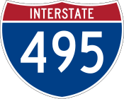 Interstate 495 Interstate 495 |
District of Columbia |
Maryland |
late 1950s - present |
|
|
| Route |
From |
To |
Years |
Former routes |
 U.S. Route 501 U.S. Route 501 |
North Carolina |
Buena Vista |
1926–present |
SR 501: 1933 - 1940 |
|
Business routes of US 501: Lynchburg |
 State Route 510 State Route 510 |
proposed route in Norfolk |
 U.S. Route 511 U.S. Route 511 |
no current route |
1926 - late 1920s |
 U.S. Route 522 U.S. Route 522 |
west of Powhatan |
West Virginia |
early 1940s - present |
SR 522: 1940 - 1940s |
|
Business routes of US 522: Washington |
 Interstate 564 Interstate 564 |
Norfolk |
late 1950s - present |
 Interstate 581 Interstate 581 |
Roanoke |
north of Roanoke |
late 1950s - present |
 Interstate 595 Interstate 595 |
never-built route in Arlington |
early 1970s - early 1980s |
 State Route 598 State Route 598 |
Rocky Gap |
West Virginia |
ca. 1980–present |
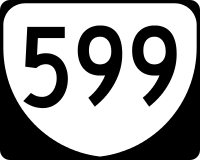 State Route 599 State Route 599 |
temporary number sometimes assigned to construction projects |
 Interstate 664 Interstate 664 |
Chesapeake |
Hampton |
1971–present |
 State Route 785 State Route 785 |
North Carolina |
Danville |
ca. 2000–present |
 State Route 895 State Route 895 |
south of Richmond |
southeast of Richmond |
1990s - present |
