Langley, Virginia
| Langley, Virginia | |
|---|---|
| Unincorporated community | |
 Langley  Langley  Langley | |
| Coordinates: 38°56′47″N 77°9′32″W / 38.94639°N 77.15889°WCoordinates: 38°56′47″N 77°9′32″W / 38.94639°N 77.15889°W | |
| Country | United States |
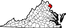
| State | Virginia |
| County | Fairfax |
| Time zone | Eastern (EST) (UTC-5) |
| • Summer (DST) | EDT (UTC-4) |
| ZIP codes | 22101, 22102 |
| GNIS feature ID | 1495816[1] |
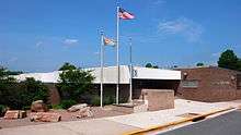
Langley is an unincorporated community in the census-designated place of McLean in Fairfax County, Virginia, United States. Langley is often used as a metonym for the CIA. The land which makes up Langley today once belonged to Thomas Lee, former Crown Governor of the Colony of Virginia from 1749 to 1750. Lee’s land was named Langley in honor of Langley Hall, which was part of the Lee home estate in Shropshire, England. In 1839, 700 acres (283 ha) of land was purchased by Benjamin Mackall from the Lee family, while keeping the name.
The community was essentially absorbed into McLean many years ago, although there is still a Langley High School.[2] In addition to being a bedroom community for Washington, D.C., the area is the site of the headquarters for the Central Intelligence Agency (CIA), the Turner-Fairbank Highway Research Center of the Federal Highway Administration, and the Claude Moore Colonial Farm of the National Park Service.
In popular culture
- The animated TV show American Dad!, created by Seth MacFarlane, is set in Langley Falls, Virginia. Langley Falls is the fictional community where the Smith family reside. Langley Falls is in Virginia in the Washington, D.C. metropolitan area. The town name is a portmanteau of Langley and Great Falls, which are unincorporated communities located in Fairfax County.
- The Emmy Award-winning show Homeland takes place in Langley.
- In the later games of the Syphon Filter series, the Agency, known as the International Presidential Consulting Agency, is headquartered in Langley. Gabe Logan, the lead character of the series and head of the Agency, is shown to also live in Langley.
- The TV show Covert Affairs is set in the city of Langley.
- The "Weird" Al Yankovic song "Party in the CIA" refers to Langley.
- Langley is mentioned in the song "Watch the World" by Box Car Racer.
- Singer-songwriter Tori Amos mentions Langley in her song "Gold Dust", which is included in her 2002 released album Scarlet's Walk.
- In the Clutch song "50,000 Unstoppable Watts" Neil Fallon states "Your friends from Langley are back again!"
- In the song "Payback," the rapper Immortal Technique states "Langley, Virginia, where my connect for cocaine is."[3]
- Eda, a character from the anime series Black Lagoon, admits before killing a foe that her hometown is actually Langley, Virginia, thus implying that she is a sleeper agent for the CIA.
See also
External links
- Why Is It Named Langley, Virginia? - Ghosts of DC history blog
References
- ↑ U.S. Geological Survey Geographic Names Information System: Langley, Virginia
- ↑ "Langley HS Map" (PDF). Fairfax County Public Schools. 2008. Retrieved 2008-10-06.
- ↑ "Payback - Immortal Technique lyrics".
| Geographic activities |
|  |
|---|---|---|
| Transnational activities | ||
| Divisions | ||