Springfield, Virginia
| Springfield, Virginia | ||
|---|---|---|
| Census-designated place (CDP) | ||
|
Central Springfield Business District, seen from Springfield Town Center | ||
| ||
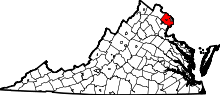
 Location of Springfield in Fairfax County, Virginia | ||
 Springfield, Virginia  Springfield, Virginia  Springfield, Virginia Location of Springfield in Fairfax County, Virginia | ||
| Coordinates: 38°47′19″N 77°10′46″W / 38.78861°N 77.17944°WCoordinates: 38°47′19″N 77°10′46″W / 38.78861°N 77.17944°W | ||
| Country | United States | |
| State | Virginia | |
| County | Fairfax | |
| Area | ||
| • Total | 7.9 sq mi (20.4 km2) | |
| • Land | 7.9 sq mi (20.3 km2) | |
| • Water | 0.0 sq mi (0.1 km2) | |
| Elevation | 246 ft (75 m) | |
| Population (2010) | ||
| • Total | 30,484 | |
| • Density | 3,869.5/sq mi (1,494.3/km2) | |
| Time zone | Eastern (EST) (UTC-5) | |
| • Summer (DST) | EDT (UTC-4) | |
| Area code(s) | 703, 571 | |
| FIPS code | 51-74592[1] | |
| GNIS feature ID | 1493642[2] | |


Springfield is a census-designated place (CDP) in Fairfax County, Virginia, United States. The Springfield CDP is recognized by the U.S. Census Bureau with a population of 30,484 as of the 2010 census. Homes and businesses in bordering CDPs including North Springfield, West Springfield, and Newington are usually given a "Springfield" mailing address. The population of the collective areas with Springfield addresses is estimated to exceed 100,000. The CDP is a part of Northern Virginia, the most populous region of the Washington Metropolitan Area.
Geography
Springfield is located at 38°46′45″N 77°11′4″W / 38.77917°N 77.18444°W (38.779238, −77.184636).[3]
According to the United States Census Bureau, the CDP has a total area of 7.9 square miles (20.4 km²), of which, 7.9 square miles (20.3 km²) of it is land and 0.04 square miles (0.1 km²) of it (0.49%) is water.
The area is dominated by the interchange of I-95, I-395, and the Capital Beltway (I-495), known as the Springfield Interchange. The center of the town is at the intersection of Route 644 (Old Keene Mill Road / Franconia Road) and Route 617 (Backlick Road) adjacent to the interchange. A significant commercial district exists around the interchange area, but the rest of the community is primarily residential in character.
According to the U.S. Postal Service, Springfield collectively has four ZIP codes:
- 22150 (often unofficially referred to as "Central Springfield", this is the zip code for the actual Springfield CDP itself.)
- 22151 ("North Springfield")
- 22152 ("West Springfield")
- 22153 ("Newington")
The following are total area, water area, and land area statistics (in square miles) for the four Springfield zip codes:[4]
| Zip code | Total area | Water area | Land area |
|---|---|---|---|
| 22150 | 7.88 sq mi. | 0.01 sq mi. | 7.87 sq mi. |
| 22151 | 5.28 sq mi. | 0.17 sq mi. | 5.11 sq mi. |
| 22152 | 6.16 sq mi. | 0.00 sq mi. | 6.16 sq mi. |
| 22153 | 8.36 sq mi. | 0.06 sq mi. | 8.30 sq mi. |
| Total | 28.50 sq mi. | 0.24 sq mi. | 28.27 sq mi. |
History
A saw and grist mill was constructed in the vicinity of what is today Springfield between 1796 and 1800. Owned by James Keene, it gave its name to today's Old Keene Mill Road. The mill served farms in the area for around sixty years before its discontinuation. Nothing remains of it today save for two mill races.[5]

.jpg)
Springfield was founded in 1847 around the Orange and Alexandria Railroad's Daingerfield Station; this is today the Backlick Road Virginia Railway Express station, located off Backlick Road. The station was named for "Springfield Farm", owned by Henry Daingerfield, an Alexandria businessman who sat on the railroad's board of directors. The post office was completed sometime after 1851. It was in existence at the time of the American Civil War, being the site of a skirmish on October 3, 1861 and a Confederate raid on August 3, 1863. The station served as the first Springfield Post Office from 1866 to 1868.[6]
In 1877, Richard Moore petitioned for a post office, which he named Moor; it was located about a little over a mile south of the station, near the intersection of Fairfax (now Old Keene Mill) and Backlick roads. The post office name was changed in 1881 to Garfield to honor the late President James A. Garfield, who had been assassinated that year. In 1907, the Garfield post office closed and a new postal station named Corbett (after the then-landowner) opened back at the railroad station.[6] The name "Springfield" was reinstated for good on June 27, 1910,[7] although the name Garfield continued to appear on maps at least through the 1930s.[8] The post office was moved to a new site in 1933.[6]
Springfield remained a rural crossroads until 1946, when realtor Edward Carr decided to subdivide the area for suburban development along the recently opened Henry Shirley Highway (now I-95/I-395). Carr believed this to be the last easily accessible tract within 12 miles (19 km) of Washington, D.C., and indeed, the newly developed area grew quickly.[9] In 1950, the area had an estimated population of 1,000; Robert E. Lee High School was built in 1957. By 1960, the population was reported as over 10,000; it grew past 25,000 by 1970 with the North and West Springfield neighborhoods.[10]
Springfield became a major retail destination with the opening of the Springfield Mall (now Springfield Town Center) in 1973–75[11] (the second regional shopping center in Northern Virginia after Tysons Corner), as well as the Springfield and Brookfield shopping centers. The 1980s and 1990s saw the expansion of retail and high-density housing in the area, at least until the opening of the Franconia-Springfield Parkway in 1996, and the Franconia-Springfield Metro and Virginia Rail Express Station in 1997. The mall was renovated from an indoor facility into a town center with a mixture of shopping, office, and residential development; its first phase opened in 2014.[12]

The center of Springfield is at Route 644 (Old Keene Mill Road / Franconia Road) and Route 617. The old "Garfield" name still survives in the nearby Garfield Elementary School.
The Sydenstricker School, completed in 1928, was listed on the National Register of Historic Places in 2012.[13]
Demographics
As of the census[1] of 2010, there were 30,484 people, 12,431 houses, and 7,472 families residing in the Springfield CDP. The population density was 3,869.5 people per square mile (1,494.3/km²). There were 10,630 housing units at an average density of 1,345.6/sq mi (521.1/km²). The racial makeup of the CDP was 48.7% White, 9.0% African American, 0.7% Native American, 24.3% Asian, 0.1% Pacific Islander, 12.5% from other races, and 4.7% from two or more races. Hispanic or Latino of any race were 25.5% of the population.
As of 2000, there were 10,495 households out of which 32.9% had children under the age of 18 living with them, 58.0% were married couples living together, 8.9% had a female householder with no husband present, and 28.8% were non-families. 22.1% of all households were made up of individuals and 7.7% had someone living alone who was 65 years of age or older. The average household size was 2.88 and the average family size was 3.37. As of 2010, the average household size was 2.82.
In the Springfield CDP, the population was spread out with 22.5% under the age of 18, 8.0% from 18 to 24, 34.2% from 25 to 44, 23.2% from 45 to 64, and 11.2% who were 65 years of age or older. The median age was 36 years. For every 100 females there were 99.2 males. For every 100 females age 18 and over, there were 96.5 males.
The median income for a household in the Springfield CDP as of 2010 is $84,309, and the median income for a family is $95,158. In 2000, males had a median income of $45,679 versus $36,075 for females. The per capita income for the CDP is $36,405.
The zip code population totals for the entire Springfield community (as defined by USPS) are as follows:
- 22150: 22,208
- 22151: 16,587
- 22152: 28,236
- 22153: 33,177
- Total: 100,208
Public safety
The Greater Springfield Volunteer Fire Department's fire station at 7011 Backlick Road provides fire and EMS services to Springfield.[14]
The West Springfield District Police Station of the Fairfax County Police Department is at 6140 Rolling Road.[15]
Shopping

Springfield Mall was a large indoor shopping mall near the Springfield Interchange, the intersection of Interstate highways I-95 and I-495. It contained several anchor stores and a food court. In 2001, two of the hijackers in the September 11 attacks, Hani Hanjour and Khalid al-Mihdhar, illegally obtained state identification at the mall's DMV office.[16] In 2005, gang members stabbed two people at the mall.[17] and a fatal shooting occurred in December 2007.[18]
In 2005, the mall was purchased by Vornado Realty Trust, which closed the structure, renovated it to add housing and office space, and reopened it in 2014 as "Springfield Town Center".[19][20]
Transportation
Roads
Central Springfield is dominated by the Springfield Interchange, popularly known as the "Mixing Bowl" or the "Melting Pot", a name taken from an earlier interchange near the Pentagon. The interchange includes three Interstates (I-95, I-395, and I-495), with two exits less than a half mile apart, with two roads (Commerce Street and Route 644 (Old Keene Mill Road / Franconia Road)) going over or under I-95 within less than a half mile, and is further complicated by the presence of a separate, reversible high-occupancy vehicle lane passing through the center of two of the interstates.
Built between 1999 and 2007 at a cost of $676 million, the Springfield Interchange Improvement Project was finished on time and on budget, according to the Virginia Department of Transportation, and dedicated on July 18, 2007, by Virginia Governor Timothy M. Kaine.
Mass transit
Rail

- Virginia Railway Express commuter rail at the Backlick Road station
- Washington Metro's Blue Line at the Franconia-Springfield station
Bus
Airports
The closest airport to Springfield is the Ronald Reagan Washington National Airport, in Arlington, Virginia. Other airports include the busiest airport in the Washington Metropolitan Area, Washington Dulles International Airport, located in Chantilly and Sterling, Virginia, as well as Baltimore-Washington International Thurgood Marshall Airport in Linthicum, Maryland.
Education
Public schools in Springfield are run by Fairfax County Public Schools.[21]
Some Springfield neighborhoods feed schools outside the city limits, such as the Lake Braddock, South County, and Hayfield districts. Likewise, some Springfield schools are fed by neighborhoods outside the city limits.[22]
Elementary schools serving Springfield include: Cardinal Forest Elementary School,[23] Crestwood Elementary School,[24] Garfield Elementary School,[25] Forestdale Elementary School,[26] Hunt Valley Elementary School,[27] Keene Mill Elementary School,[28] Kings Glen Elementary School,[29] Kings Park Elementary School,[30] Lynbrook Elementary School,[31] Newington Forest Elementary School,[32] North Springfield Elementary School,[33] Orange Hunt Elementary School,[34] Ravensworth Elementary School,[35] Rolling Valley Elementary School,[36] Sangster Elementary School,[37] Springfield Estates Elementary School,[38] Saratoga Elementary School,[39] and West Springfield Elementary School.[40]
Middle schools serving Springfield include Francis Scott Key Middle School[41] and Washington Irving Middle School.[42]
High schools serving Springfield include Robert E. Lee High School[43] and West Springfield High School;[44] the latter is home to the West Springfield Dance Team, which appeared on the television show America's Got Talent.[45]
Private schools in the vicinity of Springfield include St. Bernadette School,[46] Springfield Academy,[47] and the Word of Life Christian Academy.[48]
The medical campus of Northern Virginia Community College is located in Springfield. It offers a variety of associates degrees and certificates. [49]
Library
The Fairfax County Public Library system operates the Richard Byrd Library.[50][51]
References
- 1 2 "American FactFinder". United States Census Bureau. Retrieved 2008-01-31.
- ↑ "US Board on Geographic Names". United States Geological Survey. 2007-10-25. Retrieved 2008-01-31.
- ↑ "Fairfax County Road Map." Virginia Department of Transportation. 2004.
- ↑ "US Census". Factfinder.census.gov. Retrieved 2012-05-14.
- ↑ "Keene Mill Marker". hmdb.org. Retrieved 13 March 2015.
- 1 2 3 "Springfield Station Marker". hmdb.org. Retrieved 13 March 2015.
- ↑ Yearbook, The Historical Society of Fairfax County, Volume 29, 2003–2004, Jack Hiller
- ↑ Map of Fairfax County. Commonwealth of Virginia Department of Highways. Richmond, VA: June 1, 1932. Revised July 1, 1936. Library of Virginia Digital Collections. Retrieved 25 October 2012.
- ↑ "Alexandria, Kingstowne and Springfield Virginia real estate listings, home buying, selling and relocation information – NUMBER1EXPERT(tm)". Hellovirginia.com. Retrieved 2012-05-14.
- ↑ Number of Inhabitants, Bureau of the Census 1960 and 1970
- ↑ Fairfax County Department of Taxation, DTA Property Search profile
- ↑ "Springfield Town Center reopens Oct. 17. Here's what it looks like now.". Washington Post. Retrieved 13 March 2015.
- ↑ "Virginia Landmarks Register". Virginia Department of Historic Resources. Retrieved 5 June 2013.
- ↑ "Welcome to : Greater Springfield Volunteer Fire Department". gsvfd.org. Retrieved 13 March 2015.
- ↑ "West Springfield District Police Station". fairfaxcounty.gov. Retrieved 13 March 2015.
- ↑ "Hijackers' helper faces two years max", Timothy P. Carney, Human Events, December 24, 2001
- ↑ "Police Make Arrest In Springfield Mall Stabbing Incident", December 1, 2005
- ↑ Jackman, Tom (April 26, 2008). "2 Indicted in Alleged Gang Killing at Springfield Mall". The Washington Post. Retrieved May 23, 2010.
- ↑ "Springfield Town Center". Springfield Town Center. Retrieved 13 March 2015.
- ↑ "Vornado Develops Town Center at Springfield Mall", Divaris Real Estate, Inc.
- ↑ "Fairfax County Public School Directory" as of April 5, 2012.
- ↑ http://www.fcps.edu/fts/planning/maps/boundary2014-15/regions.pdf
- ↑ "Cardinal Forest Elementary School". fcps.edu. Retrieved 13 March 2015.
- ↑ "Crestwood Elementary School". fcps.edu. Retrieved 13 March 2015.
- ↑ "Garfield Elementary School". fcps.edu. Retrieved 13 March 2015.
- ↑ "Forestdale Elementary". fcps.edu. Retrieved 13 March 2015.
- ↑ "FCPS School". fcps.edu. Retrieved 13 March 2015.
- ↑ "Keene Mill Elementary School". fcps.edu. Retrieved 13 March 2015.
- ↑ "Kings Glen Elementary School". fcps.edu. Retrieved 13 March 2015.
- ↑ "Kings Park Elementary School". fcps.edu. Retrieved 13 March 2015.
- ↑ "Lynbrook Elementary School". fcps.edu. Retrieved 13 March 2015.
- ↑ "Newington Forest Elementary School". fcps.edu. Retrieved 13 March 2015.
- ↑ "North Springfield Elementary School". fcps.edu. Retrieved 13 March 2015.
- ↑ "Orange Hunt Elementary School". fcps.edu. Retrieved 13 March 2015.
- ↑ "Ravensworth ES". fcps.edu. Retrieved 13 March 2015.
- ↑ "Rolling Valley Elementary". fcps.edu. Retrieved 13 March 2015.
- ↑ "Sangster Elementary School". fcps.edu. Retrieved 13 March 2015.
- ↑ "Springfield Estates Elementary School". fcps.edu. Retrieved 13 March 2015.
- ↑ "Saratoga Elementary School". fcps.edu. Retrieved 13 March 2015.
- ↑ "West Springfield Elementary". fcps.edu. Retrieved 13 March 2015.
- ↑ "Key Middle School". fcps.edu. Retrieved 13 March 2015.
- ↑ "Irving Middle School". fcps.edu. Retrieved 13 March 2015.
- ↑ "Welcome to Robert E. Lee High School". fcps.edu. Retrieved 13 March 2015.
- ↑ "West Springfield High School". fcps.edu. Retrieved 13 March 2015.
- ↑ "West Springfield dance team returns from 'America's Got Talent' stint". Washington Post. Retrieved 13 March 2015.
- ↑ "St. Bernadette School". stbernpar.org. Retrieved 13 March 2015.
- ↑ "Private School, Nondenominational Christian School – North Springfield, VA". springfieldacademy.org. Retrieved 13 March 2015.
- ↑ "Private Christian School in Springfield VA, Northern Virginia, Alexandria – Word of Life Christian Academy". wolca.org. Retrieved 13 March 2015.
- ↑ http://www.nvcc.edu/campuses-and-centers/medical/
- ↑ "Library Branches." Fairfax County Public Library. Retrieved on October 21, 2009.
- ↑ "Springfield CDP, Virginia." U.S. Census Bureau. Retrieved on October 21, 2009.
External links
| Wikimedia Commons has media related to Springfield, Virginia. |
| Wikivoyage has a travel guide for Springfield (Virginia). |
- Springfield District-Fairfax County, Virginia
- Springfield Town Center
- Springfield Then and Now, Jack Lewis Hiller, Chronicle Newspapers, August 2005
- William Fairfax Will Transcript, Recorded in Fairfax County Deed Book B1 page 177, Fairfax County Circuit court