Hanging Rock, Virginia
| Hanging Rock | |
|---|---|
| Unincorporated community | |
  Location within the Commonwealth of Virginia | |
| Coordinates: 37°19′41″N 080°02′24″W / 37.32806°N 80.04000°WCoordinates: 37°19′41″N 080°02′24″W / 37.32806°N 80.04000°W | |
| Country | United States |
| State | Virginia |
| County | Roanoke |
| Elevation[1] | 1,115 ft (340 m) |
| Time zone | Eastern (EST) (UTC-5) |
| • Summer (DST) | EDT (UTC-4) |
| ZIP code | 24019 |
| Area code | 540 |
| FIPS code[2] | 51-35144 |
| GNIS feature ID[1][2] | 1499521 |
Hanging Rock is an unincorporated community in Roanoke County, Virginia, United States located directly north of Salem. The community is named for a prominent rock outcrop. The intersection of Virginia State Route 311 and Virginia State Route 419 is in Hanging Rock.[3] In the Battle of Hanging Rock in the Civil War, a retreat to West Virginia by Union General David Hunter was briefly disrupted by the forces of Confederate Generals Jubal A. Early and John McCausland. Hunter and his men were seeking refuge after failing to capture Lynchburg, 60 miles to the east. About 100 union soldiers were killed partly because their way was blocked by trees that had been felled across the road.
References
- 1 2 "Feature Detail Report: Hanging Rock (Roanoke County, Virginia)". Geographic Names Information System. United States Geological Survey. Retrieved August 6, 2008.
- 1 2 "FIPS55 Data: Virginia". United States Geological Survey. February 23, 2006. Archived from the original on June 18, 2006.
- ↑ "Hanging Rock, VA 24019". Google Maps. Retrieved August 6, 2008.
Municipalities and communities of Roanoke County, Virginia, United States | ||
|---|---|---|
| Town | 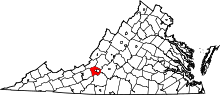 | |
| CDPs | ||
| Unincorporated communities | ||
| Footnotes | ‡This populated place also has portions in an adjacent county or counties | |
http://www.salemmuseum.org/guide_archives/HSV5N3.aspx