List of municipalities in British Columbia
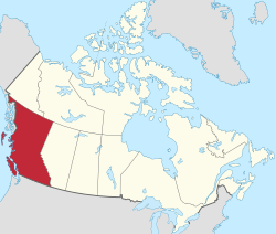
British Columbia is the third-most populous province in Canada with 4,400,057 residents as of 2011 and is the second-largest in land area[lower-alpha 1] at approximately 922,500 km2 (356,200 sq mi).[2] British Columbia's 162 municipalities cover only 11% of the province's land mass yet are home to 89% of its population. A municipality is a local government incorporated by the province allowing a community to govern itself and to provide and regulate local services. These services typically include, but are not limited to, the provision of drinking water, sewers, roads, fire protection, street lights, garbage/recycling collection, land use planning, building inspection, and parks.
Within their limited jurisdictions, municipalities are autonomous, responsible and accountable to their citizens, to the province and their future residents in the case for the unpopulated Jumbo Glacier Mountain Resort Municipality.[3] Their powers and responsibilities are regulated through the Local Government Act of British Columbia,[4] the Community Charter, and, in the case of Vancouver, the Vancouver Charter. They have the power of a natural person, the power to expropriate, and the power to establish and enforce bylaws. They are able to raise funds through property taxes and user fees, and borrow a limited amount through the Municipal Finance Authority of British Columbia to pay for capital costs.[5]
Municipalities are governed by a mayor and council who are democratically elected every 4 years on the third Saturday in October or appointed by the province such as the council for Jumbo Glacier.[3] The most recent election most recent election took place on November 15; the next election will take place on October 20, 2018.[6] Each municipality is a member of a regional district to which their councils elect representatives. The board of directors of the regional district is used as a forum to discuss regional issues.[5]
To become a municipality, a community, with the assistance of the provincial Ministry of Community, Sport and Cultural Development, defines its borders and holds a referendum on the issue. In the case of Jumbo Glacier, a request to incorporate the unpopulated municipality was submitted by the Regional District of East Kootenay.[3] If successful the Cabinet of British Columbia issues a letters patent incorporating the community. Part 2 of the Local Government Act sets out a classification scheme that gives each new municipality a designation. If the population is less than 2,500 people the new municipality is designated a village, if between 2,500 and 5,000 a town, and if greater than 5,000 a city. If the new municipality has an area greater than 800 hectares (2,000 acres) and an average population density of less than 5 persons per hectare then is it designated a district municipality. The municipality must request change in designation but is not compelled to do so, despite population growth or loss - Greenwood has retained its city status, for example, rather than relinquishing it as other boomtowns of its era have done. There is no longer any legal difference between the designations.[5]
Municipal status types

Cities
A city is a classification of municipalities used in the Canadian Province of British Columbia. British Columbia's Lieutenant Governor in Council may incorporate a community as a city by letters patent, under the recommendation of the Minister of Communities, Sport and Cultural Development, if its population is greater than 5,000 and the outcome of a vote involving affected residents was that greater than 50% voted in favour of the proposed incorporation.[7]
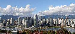
British Columbia has 51 cities,[8][9][10] had a cumulative population of 3,033,046 and an average population of 59,471 in the 2011 Census. British Columbia's largest and smallest cities are Vancouver and Greenwood with populations of 603,502 and 708 respectively.[11] The largest city by land area is Abbotsford, which spans 375.55 km2 (145.00 sq mi), while the smallest is Duncan, at 2.07 km2 (0.80 sq mi).[11] The first community to incorporate as a city was New Westminster on July 16, 1860,[8] while the most recent community to incorporate as a city was West Kelowna on June 26, 2015.[10]
District municipalities
A district municipality is a classification of municipalities used in the Canadian Province of British Columbia. British Columbia's Lieutenant Governor in Council may incorporate a community as a district municipality by letters patent, under the recommendation of the Minister of Communities, Sport and Cultural Development, if the area is greater than 800 ha (2,000 acres) and has a population density of less than 5 people per hectare, and the outcome of a vote involving affected residents was that greater than 50% voted in favour of the proposed incorporation.[7]
British Columbia has 50 district municipalities[8][10][12] that had a cumulative population of 746,125 and an average population of 14,923 in the 2011 Census.[11] British Columbia's largest and smallest district municipalities are Saanich and Wells with populations of 109,752 and 245 respectively.[11]
Of British Columbia's current 50 district municipalities, the first to incorporate as a district municipality was North Cowichan on June 18, 1873, while the most recent community to incorporate as a district municipality was the Northern Rockies Regional Municipality (NRRM) on February 6, 2009.[8][12] Although portrayed as a regional municipality in its official name, the NRRM is actually classified as a district municipality.[12]
Indian government districts
The lone Indian government district was granted by the federal Sechelt Indian Band Self-Government Act and provincial Sechelt Indian Government District Enabling Act to the Sechelt Indian Government District which governs the Sechelt Indian Band lands consisting of 33 former Indian reserves.[13][14][15]
Island municipalities
If the community wishing to incorporate is located within a trust area under the Island Trust Act, it must incorporate as an island municipality.[16] A single island municipality designation has been granted to Bowen Island.
Mountain resort municipalities
A mountain resort municipality designation is granted by the Minister of Community, Sport and Cultural Development through the Local Government Act if there exists alpine ski lift operations, year-round recreational facilities, and commercial overnight accommodations. There are two mountain resort municipalities in British Columbia: Sun Peaks and Jumbo Glacier.
Resort municipalities
A single resort municipality designation has been granted to Whistler by the Resort Municipality of Whistler Act.[17]
Towns
A town is a classification of municipalities used in the Canadian Province of British Columbia. British Columbia's Lieutenant Governor in Council may incorporate a community as a town by letters patent, under the recommendation of the Minister of Communities, Sport and Cultural Development, if its population is greater than 2,500 but not greater than 5,000 and the outcome of a vote involving affected residents was that greater than 50% voted in favour of the proposed incorporation.[7]
British Columbia has 14 towns[8] that had a cumulative population of 87,514 and an average population of 6,251 in the 2011 Census.[11] British Columbia's largest and smallest towns are Comox and Port McNeill with populations of 13,627 and 2,505 respectively.[11] Of British Columbia's current 14 towns, the first to incorporate as a town was Ladysmith on June 3, 1904, while the most recent community to incorporate as a town was View Royal on December 5, 1988.[8]
Villages
A village is a classification of municipalities used in the Canadian Province of British Columbia. British Columbia's Lieutenant Governor in Council may incorporate a community as a village by letters patent, under the recommendation of the Minister of Communities, Sport and Cultural Development, if its population is not greater than 2,500 and the outcome of a vote involving affected residents was that greater than 50% voted in favour of the proposed incorporation.[7]
British Columbia has 42 villages[8] that had a cumulative population of 44,962 and an average population of 1,070 in the 2011 Census.[11] British Columbia's largest and smallest villages are Cumberland and Zeballos with populations of 3,398 and 125 respectively.[11] Of British Columbia's current 42 villages, the first to incorporate as a village was Kaslo on August 14, 1893, while the most recent community to incorporate as a village was Queen Charlotte on December 5, 2005.[8]
List of municipalities
Former municipalities
Communities in British Columbia that once held their own municipal status include Aennofield, Alberni, Brocklehurst, Chapman Camp, Chilliwhack, Columbia, Cranberry Lake, Dewdney, Dufferin, Fort Nelson, Fraser Mills, Glenmore, Guisachan, Kinnaird, Marysville, Matsqui, Mission City, Natal, Nicomen Island, North Kamloops, Phoenix, Point Grey, Sandon, South Fort George, South Vancouver, Sumas, Tadanac, Valleyview and Westview.[18][19][20][21][22][23][24] The majority of these former municipalities ceased to exist as a result of amalgamation with or annexation by another municipality.[18][19][20] Others, such as Phoenix and Sandon,[23][24] were dissolved from their municipal status as a result of population decline, while Dewdney dissolved due to financial reasons.[21]
See also
- List of designated places in British Columbia
- List of Haida villages
- List of population centres in British Columbia
External links
- Managing Changes to Local Government Structure in British Columbia: A Review and Program Guide
- Ministry of Community, Sport and Cultural Development
Notes
References
- ↑ "Land and freshwater area, by province and territory". Statistics Canada. February 1, 2005. Retrieved December 18, 2014.
- ↑ "Population and dwelling counts, for Canada, provinces and territories, 2011 and 2006 censuses". Statistics Canada. January 30, 2013. Retrieved December 4, 2013.
- 1 2 3
- ↑ British Columbia Queens Printer (1996). "Local Government Act". Retrieved 2007-07-07.
- 1 2 3 Union of British Columbia Municipalities. "Local Government in British Columbia: A Community Effort" (PDF). 2006 Edition. Retrieved 2007-07-01.
- ↑ "Municipal Election Schedule in Canada". Intergovernmental Committee on Urban and Regional Research. December 15, 2014. Retrieved July 11, 2015.
- 1 2 3 4 "Local Government Act: Part 2 — Incorporation of Municipalities". Government of British Columbia Queen's Printer. November 12, 2012. Retrieved December 8, 2012.
- 1 2 3 4 5 6 7 8 "British Columbia Regional Districts, Municipalities, Corporate Name, Date of Incorporation and Postal Address" (XLS). British Columbia Ministry of Communities, Sport and Cultural Development. Retrieved December 8, 2012.
- ↑
- 1 2 3 "Order in Council No. 357". Province of British Columbia. June 26, 2015. Retrieved July 1, 2015.
- 1 2 3 4 5 6 7 8
- 1 2 3
- ↑ "Statistics Relating to Regional and Municipal Governments in BC 2011" (PDF). Ministry of Community, Sport and Cultural Development. Retrieved June 14, 2013.
- ↑ "Sechelt Indian Band Self-Government Act" (PDF). Minister of Justice. Retrieved September 20, 2014.
- ↑ "Sechelt Indian Government District Enabling Act". Ministry of Community, Sport and Cultural Development. Retrieved September 20, 2014.
- ↑ "Island Trust Act". Ministry of Community, Sport and Cultural Development. Retrieved September 27, 2014.
- ↑ "Resort Municipality of Whistler Act". Ministry of Community, Sport and Cultural Development. Retrieved September 20, 2014.
- 1 2 "Municipal Census Populations (1921-2011)". BC Stats. Retrieved June 26, 2013.
- 1 2 "Name Details: Brocklehurst (Community)". GeoBC. Retrieved June 27, 2013.
- 1 2 "Name Details: Grand Forks (City)". GeoBC. Retrieved May 4, 2014.
- 1 2 "Profiles of Historic Sites: Dewdney Community". Mission District Historical Society, Heritage Places Branch. March 14, 2014. Retrieved November 23, 2014.
- ↑ "Profiles of Historic Sites: Nicomen Island Community". Mission District Historical Society, Heritage Places Branch. December 6, 2013. Retrieved November 23, 2014.
- 1 2 "Name Details: Phoenix (Abandoned Locality)". GeoBC. Retrieved June 27, 2013.
- 1 2 "From Boom to Bust in 20 Years: Sandon's History as an Incorporated City". Sandon Museum. Retrieved June 26, 2013.
