Stewart, British Columbia
| Stewart | |
|---|---|
| District municipality | |
| District of Stewart[1] | |
 | |
_location_map.svg.png) Stewart | |
| Coordinates: 55°56′09″N 129°59′27″W / 55.93583°N 129.99083°WCoordinates: 55°56′09″N 129°59′27″W / 55.93583°N 129.99083°W | |
| Country |
|
| Province |
|
| Regional District | Kitimat-Stikine |
| Incorporated | 1930 |
| Government | |
| • Mayor | Galina Durant |
| Area | |
| • Total | 552.08 km2 (213.16 sq mi) |
| Elevation | 0 m (0 ft) |
| Population (2011) | |
| • Total | 494 |
| • Density | 0.89/km2 (2.3/sq mi) |
| Time zone | PST (UTC−8) |
| Postal Code | V0T 1W0 |
| Area code(s) | 250, 778, 236 |
| Highways |
|
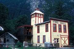
Stewart is a district municipality at the head of the Portland Canal in northwestern British Columbia, Canada[2] on the Canada–US border. In 2011, its population was about 494.

History
The Nisga'a, who lived around the Nass River, called the head of Portland Canal Skam-A-Kounst, meaning "safe house" or "strong house", probably because it served them as a retreat from the harassment of the Haida and Tlingit from the outer coast.[2][3] They travelled in the area seasonally to pick berries and hunt birds. It and the rest of the Portland Canal had been the domain of the Tsetsaut people, also called the Skam-a-Kounst Indians, or Jits'aawit in Nisga'a, an Athapaskan people who became decimated by war and disease and were driven out of the Stewart area by either Haida or Nisga'a in 1856-57.
The Portland Canal was first explored and named in July 1793 by Captain George Vancouver in honour of William Henry Cavendish Bentinck, 3rd Duke of Portland (1738-1808), Home Secretary from 1794 to 1801. Vancouver met two friendly native people at the current site of Stewart, BC (Voyage Of Discovery To The North Pacific Ocean, And Round The World In The Years 1791–95, by George Vancouver). The area around the Portland Canal was again explored in 1896 by Captain D.D. Gaillard of the United States Army Corps of Engineers (after whom the Gaillard Cut in the Panama Canal was later named). Two years after Gaillard's visit, the first prospectors and settlers arrived. Among them was D. J. Raine, for whom a creek and a mountain in the area are named. The Stewart brothers arrived in 1902. In 1905, Robert M. Stewart, the first postmaster, named the town Stewart.
Gold and silver mining dominated the early economy. Nearby Hyder, Alaska, boomed with the discovery of rich silver veins in the upper Salmon River basin in 1917 and 1918. Hyder became an access and supply point for the mines, while Stewart served as the port for Canadian mining activity, which was centred on the town of Premier, which was accessed by a 14 miles (23 km) road from Hyder. Other mines in the area were the Jumbo, BC Silver, Red Cliff, and Porter-Idaho. More large camps were south of Stewart at Anyox and Maple Bay.
Stewart had a population of about 10,000 prior to World War I, which then declined to about 700 in 2000. As of 2005, its population had reduced to less than 500.
Disney's Eight Below, starring Paul Walker and Jason Biggs, was partially filmed here. The exterior shots from John Carpenter's science fiction classic The Thing (1982 film) were filmed in the nearby glacial mountains.
Transportation
Stewart is accessible by highway from the British Columbia highway system, via Highway 37A, or by air through Stewart Airport.
Location
West of Stewart is Hyder, Alaska, which is only 3 kilometres (2 mi) from the town. East of the town is Meziadin Junction, which is 61 kilometres (38 mi) from the town. Also east is Kitwanga, British Columbia, which is located 218 kilometres (135 mi) from the town, and Dease Lake, British Columbia, which is located 392 kilometres (244 mi) north of Stewart.
Climate
Stewart has a continental climate (Dfb), with about 1,866.8 mm (73.5 in) per year of precipitation, much of it as snow, and an average yearly temperature of 6.1 °C (43.0 °F), according to Environment Canada.[4] Stewart is Canada's most northerly ice-free port.
| Climate data for Stewart Airport, 1981–2010 normals, extremes 1910–present | |||||||||||||
|---|---|---|---|---|---|---|---|---|---|---|---|---|---|
| Month | Jan | Feb | Mar | Apr | May | Jun | Jul | Aug | Sep | Oct | Nov | Dec | Year |
| Record high °C (°F) | 13.3 (55.9) |
11.7 (53.1) |
17.1 (62.8) |
25.5 (77.9) |
31.7 (89.1) |
35.0 (95) |
33.4 (92.1) |
32.7 (90.9) |
30.6 (87.1) |
20.6 (69.1) |
14.4 (57.9) |
11.2 (52.2) |
35.0 (95) |
| Average high °C (°F) | −0.5 (31.1) |
2.3 (36.1) |
5.8 (42.4) |
11.0 (51.8) |
15.8 (60.4) |
18.9 (66) |
19.8 (67.6) |
18.8 (65.8) |
14.7 (58.5) |
8.9 (48) |
2.7 (36.9) |
0.1 (32.2) |
9.9 (49.8) |
| Daily mean °C (°F) | −3.0 (26.6) |
−1.1 (30) |
1.9 (35.4) |
6.1 (43) |
10.7 (51.3) |
13.9 (57) |
15.1 (59.2) |
14.3 (57.7) |
11.1 (52) |
6.3 (43.3) |
0.6 (33.1) |
−2.1 (28.2) |
6.1 (43) |
| Average low °C (°F) | −5.5 (22.1) |
−4.5 (23.9) |
−2.0 (28.4) |
1.1 (34) |
5.5 (41.9) |
8.9 (48) |
10.4 (50.7) |
9.8 (49.6) |
7.4 (45.3) |
3.6 (38.5) |
−1.7 (28.9) |
−4.3 (24.3) |
2.4 (36.3) |
| Record low °C (°F) | −30.0 (−22) |
−28.3 (−18.9) |
−23.3 (−9.9) |
−13.9 (7) |
−4.4 (24.1) |
−2.8 (27) |
0.0 (32) |
−5.0 (23) |
−3.9 (25) |
−12.8 (9) |
−24.8 (−12.6) |
−26.1 (−15) |
−30.0 (−22) |
| Average precipitation mm (inches) | 238.0 (9.37) |
137.0 (5.394) |
121.8 (4.795) |
89.1 (3.508) |
72.3 (2.846) |
65.6 (2.583) |
73.0 (2.874) |
122.4 (4.819) |
217.3 (8.555) |
278.0 (10.945) |
230.1 (9.059) |
222.2 (8.748) |
1,866.8 (73.496) |
| Average rainfall mm (inches) | 88.1 (3.469) |
57.6 (2.268) |
85.6 (3.37) |
73.4 (2.89) |
71.8 (2.827) |
65.6 (2.583) |
73.0 (2.874) |
122.4 (4.819) |
217.3 (8.555) |
268.3 (10.563) |
123.9 (4.878) |
91.9 (3.618) |
1,338.9 (52.713) |
| Average snowfall cm (inches) | 162.8 (64.09) |
85.6 (33.7) |
38.8 (15.28) |
15.8 (6.22) |
0.5 (0.2) |
0.0 (0) |
0.0 (0) |
0.1 (0.04) |
0.0 (0) |
9.7 (3.82) |
112.7 (44.37) |
144.3 (56.81) |
570.2 (224.49) |
| Average precipitation days (≥ 0.2 mm) | 20.0 | 15.1 | 18.2 | 16.6 | 16.1 | 15.4 | 16.4 | 17.4 | 20.2 | 23.3 | 21.4 | 20.5 | 220.5 |
| Average rainy days (≥ 0.2 mm) | 11.4 | 10.3 | 15.8 | 16.4 | 16.1 | 15.4 | 16.4 | 17.4 | 20.2 | 23.2 | 16.1 | 12.0 | 190.6 |
| Average snowy days (≥ 0.2 cm) | 14.3 | 9.2 | 7.2 | 2.5 | 0.08 | 0.0 | 0.0 | 0.04 | 0.0 | 1.7 | 10.8 | 14.7 | 60.6 |
| Average relative humidity (%) | 86.0 | 79.6 | 70.1 | 57.4 | 52.8 | 58.3 | 65.3 | 70.4 | 77.3 | 80.8 | 87.7 | 89.5 | 72.9 |
| Mean monthly sunshine hours | 25.7 | 40.0 | 73.5 | 119.8 | 157.7 | 145.0 | 138.1 | 126.5 | 85.2 | 39.9 | 19.7 | 14.4 | 985.4 |
| Percent possible sunshine | 10.8 | 14.9 | 20.1 | 28.2 | 31.2 | 27.7 | 26.3 | 27.1 | 22.2 | 12.3 | 7.9 | 6.5 | 19.6 |
| Source: Environment Canada[5][2][6][7] | |||||||||||||
See also
References
- ↑ "British Columbia Regional Districts, Municipalities, Corporate Name, Date of Incorporation and Postal Address" (XLS). British Columbia Ministry of Communities, Sport and Cultural Development. Retrieved November 2, 2014.
- 1 2 3 "Stewart (district municipality)". BC Geographical Names.
- ↑ "Sgamagunt (site)". BC Geographical Names.
- ↑ Environment Canada—Canadian Climate Normals 1981–2010, accessed 16 July 2014
- ↑ "Canadian Climate Normals 1981-2010 Station Data". Environment Canada. Retrieved July 16, 2014.
- ↑ "Stewart BCHPA". Environment Canada. Retrieved 13 May 2016.
- ↑ "Stewart A". Environment Canada. Retrieved 13 May 2016.
External links
| Wikimedia Commons has media related to Stewart, British Columbia. |
- Stewart and Hyder International Chamber of Commerce
- Stewart Community Information
- Google Map photo of Stewart
- Stewart Airport
| Subdivisions |  | |
|---|---|---|
| Communities | ||
| Metro areas and agglomerations | ||
| District municipalities |
| |
| ||