Kelowna
| Kelowna | |||
|---|---|---|---|
| City | |||
| City of Kelowna | |||
|
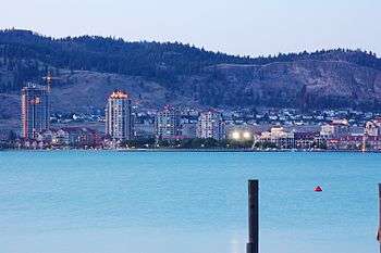
Downtown Kelowna and Cultural District from West Kelowna | |||
| |||
| Nickname(s): Orchard City,[1] K-Town | |||
| Motto: "Fruitful in Unity" | |||
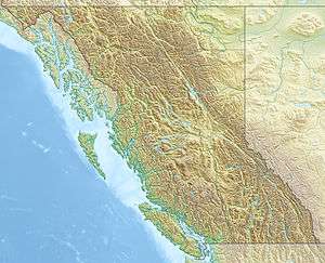 Kelowna Location of Kelowna in British Columbia | |||
| Coordinates: 49°53′01″N 119°29′36″W / 49.88361°N 119.49333°W | |||
| Country |
| ||
| Province |
| ||
| Region | Okanagan | ||
| Regional District | Central Okanagan | ||
| Settled | 1879 | ||
| Incorporated | 5 May 1905 | ||
| Government | |||
| • Type | Elected city council | ||
| • Body | Kelowna City Council | ||
| • Mayor | Colin Basran | ||
| • MP | Stephen Fuhr (Liberal) | ||
| • MLAs |
Steve Thomson (BC Liberal) Norm Letnick (BC Liberal) Christy Clark (BC Liberal) | ||
| Area | |||
| • City | 211.82 km2 (81.78 sq mi) | ||
| • Metro | 2,904.86 km2 (1,121.57 sq mi) | ||
| Elevation | 344 m (1,129 ft) | ||
| Population (2011) | |||
| • City | 117,312 | ||
| • Density | 553.8/km2 (1,434/sq mi) | ||
| • Urban | 141,767 | ||
| • Metro | 179,839 | ||
| • Metro density | 62/km2 (160/sq mi) | ||
| Time zone | Pacific Time Zone (UTC-8) | ||
| • Summer (DST) | Pacific Daylight Time (UTC-7) | ||
| Postal code span | V1P, V1V – V1Z | ||
| Area code(s) | (250), (778) | ||
| Highways |
| ||
| Website | Official website | ||


Kelowna (![]() i/kəˈloʊnə/) is a city on Okanagan Lake in the Okanagan Valley, in the southern interior of British Columbia, Canada. It serves as the head office of the Regional District of Central Okanagan. Its name derives from an Okanagan language term for "grizzly bear".[2] Kelowna is the third largest metropolitan area in the province[3] and ranks as the 22nd largest in Canada, with a population of 179,839 in 2011. Nearby communities include the City of West Kelowna (also referred to as Westbank, Westside) to the west across Okanagan Lake, Lake Country and Vernon to the north, as well as Peachland to the southwest and, further to the south, Summerland and Penticton.
i/kəˈloʊnə/) is a city on Okanagan Lake in the Okanagan Valley, in the southern interior of British Columbia, Canada. It serves as the head office of the Regional District of Central Okanagan. Its name derives from an Okanagan language term for "grizzly bear".[2] Kelowna is the third largest metropolitan area in the province[3] and ranks as the 22nd largest in Canada, with a population of 179,839 in 2011. Nearby communities include the City of West Kelowna (also referred to as Westbank, Westside) to the west across Okanagan Lake, Lake Country and Vernon to the north, as well as Peachland to the southwest and, further to the south, Summerland and Penticton.
History
 Kelowna, 1909
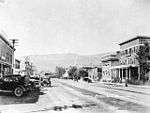 Kelowna, 1920
So far exact dates of first settlement are unknown, but a northern migration led to the peopling of this area some 9000 years ago.[4]
Father Charles M. Pandosy, a French Roman Catholic Oblate missionary, arriving in 1859 was the first European to settle at Kelowna, a place named "L'anse au sable" (Bay of Sand) in reference to the sandy shoreline. Kelowna was officially incorporated on 4 May 1905.[5]
In May 2005, Kelowna celebrated its Centennial. In the same year, new five lane William R. Bennett Bridge began construction to replace the three lane Okanagan Lake Bridge. It was part of a plan to alleviate traffic problems experienced during the summer tourist season, when the influx of tourists adds to the commuters between West Kelowna and Kelowna. The new bridge was completed in 2008. The bridge has done little to alleviate traffic problems.
Events of significance
- On July 3, 1877, George Mercer Dawson was the first geologist to visit Kelowna.[6]
- On 6 August 1969 a sonic boom from a nearby air show produced an expensive broken glass bill of a quarter million dollars while at least 6 people were injured. The incident was caused by a member of America's Blue Angels during a practice routine for the Kelowna Regatta festival: He accidentally went through the sound barrier while flying too low.[7]
- Winter 1986 was the last time that the Lake completely froze over. The Royal Canadian Mounted Police helicopter successfully rescued an SUV that had tried to drive across the Lake and fell through the ice.
- 2000s, Kelowna builds the tallest building in between the Lower Mainland and Calgary: Skye at Waterscapes, which is a 26-floor residential tower.
Area seasonal wildfires
- On 7 May 1992, a forest fire consumed 60 hectares of forest on Mount Boucherie in West Kelowna across Lake Okanagan from Kelowna proper: no homes were damaged, however.
- In August 2003, a nearby wildfire destroyed over 200 homes and forced the temporary evacuation of approx. 30,000 residents.[8] During the 2003 fire, many trestles of the historic Kettle Valley Railway were destroyed. All the trestles have been rebuilt to look like the originals but using smaller dimension beams.
- In late August 2005, a 30 hectare fire caused multiple evacuations in the Rose Valley subdivision across the lake in West Kelowna.
- In July 2009 wildfires destroyed hundreds of hectares of forest and a number of buildings in West Kelowna; 17,000 residents were evacuated.[9]
- In July 2009, a 100 hectare fire near Rose Valley resulted in the evacuation of 7,000 people. No structures were lost.
- In July 2009, a 9,200 hectare fire behind Fintry resulted in the evacuation of 2,500 people. No structures were lost.
- On 12 July 2010, a 30 hectare fire in West Kelowna destroyed one home and caused multiple evacuations.
- September 2011, a 40 hectare fire in West Kelowna's Bear Creek Park caused the evacuation of over 500 people.
- In July 2012, a 30 hectare fire caused the evacuation of the small community of Wilson's Landing just North of West Kelowna.
- In September 2012, a late season, 200 hectare fire destroyed 7 buildings and resulted in the evacuation of 1,500 people in the community of Peachland.
- In July 2014, a 340 hectare fire behind the West Kelowna subdivision of Smith Creek caused the evacuation of 3,000 people.
- In August 2014, a 40 hectare fire above Peachland resulted in the evacuation of one home.
- In July 2015, a 55 hectare fire in the Joe Rich area caused the evacuation of over 100 properties.
- In July 2015, a 560 hectare fire near Shelter Cove caused the evacuation of 70 properties.
- In August 2015, a 130 hectare fire burned near Little White mountain just south of Kelowna.
Geography
Landmarks
- Mission Creek
- Bellevue Canyon
- Layer Cake Hill
- Pinnacle Rock
- Gallagher's Canyon
- Crawford Falls
- Knox Mountain
- Myra Canyon
- Mission Creek Falls
- Black Knight Mountain
- Maude-Roxby Wetlands
- Lake Okanagan
Climate
Kelowna experiences a borderline Oceanic/Humid continental climate (Köppen Cfb/Dfb) due to its coldest month having an average temperature slightly above −3.0 °C (26.6 °F),[10] with dry, hot and sunny summers, cold, cloudy winters and four seasons.[11][12] The official climate station for Kelowna is at the Kelowna International Airport, which is at a higher altitude than the city core with slightly higher precipitation and cooler nighttime temperatures. The moderating effects of Okanagan Lake combined with mountains separating most of BC from the prairies moderates the winter climate, but Arctic air masses do occasionally penetrate the valley during winter, usually for very short periods. The coldest recorded temperature in the city was −36.1 °C (−33.0 °F) recorded on 30 December 1968.
Weather conditions during December and January are the cloudiest in Canada outside of Newfoundland thanks to persistent valley cloud. As Okanagan Lake hardly ever freezes, warmer air rising from the lake climbs above colder atmospheric air, creating a temperature inversion which can cause the valley to be socked in by cloud for weeks on end with no respite. This valley cloud has a low ceiling however, and often bright sunshine can be experienced by driving only 20 minutes or so up into the nearby mountains, above the cloud. Summers in Kelowna are hot (sometimes extremely hot) and sunny, with daytime temperatures often exceeding 32 °C (90 °F). The hottest recorded temperature at the airport was 39.5 °C (103.1 °F) on 24 July 1994, and the highest temperature ever recorded in the city was 41.0 °C (105.8 °F) in August 1998 near but not at the airport.[13] It is not at all unusual for heat waves to occur in July, August and even June and September on occasion, where temperatures above 30 °C persist for weeks. During summer clear, dry air allows night-time temperatures to fall rapidly. The city averages about 380 millimetres (15 in) of precipitation per year, with about 1/5 of the precipitation falling as snow, the bulk in December and January; however, June is the wettest month of the year.
While some smaller communities such as Blue River and Golden get less wind, Kelowna has the greatest percentage of "calm" wind observations for any major city in Canada (39% of the time).[14][15] The four-year average wind measured at the airport has been less than 5 knots on average 10/12 months of the year between 2008 and 2011.[16] As shown in the climate chart below, Kelowna has an average high temperature that is above freezing every month of the year - an exceptionally rare phenomenon for a Canadian city that is located inland. In fact, average high temperatures in January surpass those of St. John's, Newfoundland, which experiences heavy moderation from the warm Atlantic current. Kelowna's average year-round high temperature of about 14.6 degrees is also one of the highest in Canada - largely thanks to the rare combination of high summer temperatures typical of continental climates, along with relatively mild winters - a very rare feature of a continental climate.
Weather facts:
- Driest Year (1952) = 186 mm (7 in)
- Wettest Year (1996) = 541 mm (21 in)
- Warmest Year (1998) = 11.4 °C (53 °F); 9.2 °C (49 °F) at the Airport
- Coldest Year (1955) = 5.6 °C (42 °F)
- Highest Extreme Temperature (August 1998) = 41.0 °C (106 °F)
- Lowest Extreme Temperature (December 1968) = −36.1 °C (−33 °F)
| Climate data for Kelowna International Airport, 1981–2010 normals, extremes 1899–present[lower-alpha 1] | |||||||||||||
|---|---|---|---|---|---|---|---|---|---|---|---|---|---|
| Month | Jan | Feb | Mar | Apr | May | Jun | Jul | Aug | Sep | Oct | Nov | Dec | Year |
| Record high humidex | 13.0 | 14.5 | 21.1 | 28.0 | 37.0 | 42.3 | 46.4 | 45.6 | 34.9 | 26.7 | 20.6 | 13.9 | 46.4 |
| Record high °C (°F) | 14.8 (58.6) |
17.2 (63) |
20.8 (69.4) |
28.1 (82.6) |
34.4 (93.9) |
39.5 (103.1) |
39.5 (103.1) |
39.3 (102.7) |
35.0 (95) |
26.8 (80.2) |
20.6 (69.1) |
14.5 (58.1) |
39.5 (103.1) |
| Average high °C (°F) | 0.8 (33.4) |
3.6 (38.5) |
10.1 (50.2) |
15.5 (59.9) |
20.2 (68.4) |
24.2 (75.6) |
27.9 (82.2) |
27.6 (81.7) |
21.7 (71.1) |
13.4 (56.1) |
5.6 (42.1) |
0.7 (33.3) |
14.3 (57.7) |
| Daily mean °C (°F) | −2.5 (27.5) |
−0.9 (30.4) |
4.1 (39.4) |
8.4 (47.1) |
12.8 (55) |
16.6 (61.9) |
19.5 (67.1) |
19.1 (66.4) |
13.9 (57) |
7.3 (45.1) |
1.6 (34.9) |
−2.6 (27.3) |
8.1 (46.6) |
| Average low °C (°F) | −5.8 (21.6) |
−5.3 (22.5) |
−2.0 (28.4) |
1.3 (34.3) |
5.4 (41.7) |
9.1 (48.4) |
11.1 (52) |
10.6 (51.1) |
5.9 (42.6) |
1.3 (34.3) |
−2.4 (27.7) |
−5.9 (21.4) |
1.9 (35.4) |
| Record low °C (°F) | −31.7 (−25.1) |
−28.3 (−18.9) |
−22.2 (−8) |
−9.4 (15.1) |
−4.2 (24.4) |
−1.1 (30) |
2.6 (36.7) |
0.6 (33.1) |
−6.1 (21) |
−15.7 (3.7) |
−28.4 (−19.1) |
−36.1 (−33) |
−36.1 (−33) |
| Record low wind chill | −39.7 | −33.0 | −20.4 | −9.8 | −5.4 | −0.6 | 0.0 | 0.0 | −7.3 | −18.2 | −36.3 | −37.6 | −39.7 |
| Average precipitation mm (inches) | 31.0 (1.22) |
19.0 (0.748) |
21.6 (0.85) |
29.1 (1.146) |
40.2 (1.583) |
45.9 (1.807) |
37.2 (1.465) |
32.1 (1.264) |
32.4 (1.276) |
29.2 (1.15) |
36.7 (1.445) |
32.6 (1.283) |
386.9 (15.232) |
| Average rainfall mm (inches) | 8.9 (0.35) |
10.0 (0.394) |
16.9 (0.665) |
28.3 (1.114) |
39.2 (1.543) |
45.9 (1.807) |
37.2 (1.465) |
32.1 (1.264) |
31.7 (1.248) |
29.1 (1.146) |
24.4 (0.961) |
7.6 (0.299) |
311.3 (12.256) |
| Average snowfall cm (inches) | 26.9 (10.59) |
10.8 (4.25) |
4.8 (1.89) |
0.8 (0.31) |
0.0 (0) |
0.0 (0) |
0.0 (0) |
0.0 (0) |
0.0 (0) |
0.1 (0.04) |
13.6 (5.35) |
32.0 (12.6) |
89.0 (35.04) |
| Average precipitation days (≥ 0.2 mm) | 13.9 | 10.3 | 10.5 | 10.9 | 12.9 | 12.0 | 9.2 | 8.5 | 8.7 | 11.3 | 14.4 | 14.1 | 136.6 |
| Average rainy days (≥ 0.2 mm) | 5.6 | 6.2 | 8.8 | 10.7 | 12.2 | 12.0 | 9.2 | 8.5 | 8.3 | 11.3 | 11.0 | 4.2 | 107.8 |
| Average snowy days (≥ 0.2 cm) | 10.0 | 5.6 | 2.4 | 0.6 | 0.0 | 0.0 | 0.0 | 0.0 | 0.0 | 0.2 | 4.7 | 11.0 | 34.5 |
| Average relative humidity (%) | 76.4 | 65.2 | 48.8 | 39.8 | 40.0 | 39.3 | 35.6 | 36.2 | 42.2 | 55.6 | 70.6 | 75.7 | 52.1 |
| Mean monthly sunshine hours | 39.4 | 80.9 | 148.5 | 191.0 | 238.2 | 244.9 | 297.8 | 281.6 | 216.2 | 124.5 | 50.9 | 35.1 | 1,948.9 |
| Percent possible sunshine | 14.8 | 28.5 | 40.4 | 46.3 | 49.9 | 50.2 | 60.5 | 62.8 | 56.9 | 37.2 | 18.6 | 13.9 | 40.0 |
| Source: Environment Canada[14][17][18][19][20] | |||||||||||||
Sectors and neighbourhoods
Kelowna consists of ten sectors with multiple neighbourhoods within the sector boundaries.[21] Despite its moderate population of around 120,000 people living within city limits, Kelowna has significant problems with urban sprawl. This is thought to be due largely to a combination of decades-long building height and zoning restrictions, and an enormous population boom that began in the 1980s. The latter has cemented the Okanagan Valley as the most heavily populated region of the British Columbia mainland outside the greater Vancouver area. Non-intuitively, the greater Kelowna area (2,904.86 square kilometres) is even larger than the greater Vancouver area (2,878.52 square kilometres), despite having only about one tenth its population. Similarly, the area within Kelowna city limits (211.82 square kilometres) is larger than the area of Vancouver, within city limits, as well (114.97 square kilometres). This highlights the difficulties Kelowna is currently facing regarding urban sprawl, severe traffic congestion, general lack of infrastructure, and less-than-optimal city planning.
The city is 211.82 km2 (81.78 mi2), and the metro is 2904.86 km2 (1121.57 mi2).
For comparison, the city of Vancouver is 114.97 km2 (44.39 mi2), and the metro area is 2878.52 km2 (1111.40 mi2).

Neighbourhoods of Kelowna
- Belgo
- Benvoulin
- Black Mountain
- Braeloch
- Central City
- Clifton
- Crawford
- Dilworth
- Downtown
- East Kelowna
- Glenmore
- Kettle Valley
- KLO
- McKinley Landing
- Midtown
- Mission
- Pandosy
- Rutland
- Southeast Kelowna
- Southridge
- Quail Ridge
Central City
Central City is the sector near Harvey Avenue from the Okanagan Lake to Highway 33, comprising the city's major business and commercial centres. These include the Capri Center mall & hotel, the Landmark building, and the Center for Arts and Technology Okanagan (CATO). There are also dozens more businesses, restaurants, hotels and supermarkets in this area of town - particularly concentrated along or very near highway 97 (Harvey). While downtown Kelowna lies adjacent to this area along the Okanagan Lake, it is considered to be a separate part of town and contains most buildings intended for tourists, nightlife and greater pedestrian traffic (such as Prospera Place, Delta Hotel, Lake City Casino, Kelowna Art Gallery, Kelowna Museum, etc.). Most of these buildings compose what is often referred to as the "Cultural Center" - a subset of downtown Kelowna.
Dilworth Mountain
Dilworth Mountain is a relatively low and isolated mountain which is located near the geographic center of the city. It lies across from Knox Mountain to the West, and forms part of the eastern heights between which Glenmore Valley lies. While technically a mountain, it rises about one thousand feet or so above the rest of the Okanagan Valley (just over 2000 feet elevation). It has been very extensively developed in recent years; decades of blasting and construction work have resulted in a scenic collection of neighborhoods with suburban character, but located only minutes from Central City. Like many other Kelowna residential districts, Dilworth has gone from relative isolation and wilderness, to hosting many residential roads with hundreds of homes - many of which are considered to be fairly expensive and high-end.
Downtown
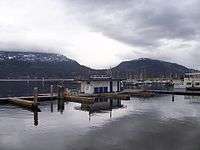
Downtown Kelowna is the heart of the city as well as the hub of the tourist district. It is located alongside Okanagan Lake, and its area is officially defined as all land north of highway 97, south of Clement Avenue, east of Okanagan Lake, and west of Richter Street. There are two main routes through the downtown core along which various attractions and commerce are concentrated. These include several parks and beaches along the lake, boardwalks and other walking trails, Kelowna Marina and Yacht Club, Delta Grand hotel and casino, and Prospera Place arena. The other main route through downtown is Bernard Avenue from Richter street to the lake. It has more shops and restaurants designed both for locals and tourists alike. Although Bernard ave. continues east well past the downtown area, it is not part of downtown and is zoned residentially. The commercial segment lies within its downtown section between Richter & Abbott streets, the latter of which is lake-adjacent.
There is currently a movement (as of 2016) to re-develop downtown with taller commercial, government, and apartment buildings including several skyscrapers. Some of these are being developed, while more are in planning stages. A 29 storey hotel owned by Westcorp Canada has been approved, and is scheduled to begin construction in early 2016.[22]
Glenmore
Glenmore is a relatively affluent suburb that lies mostly within Glenmore Valley - a subsection of the Okanagan Valley in the Kelowna area. It has experienced extremely rapid housing development within the past two decades - changing from a small suburb with a relatively rural character to extensive suburban neighborhoods, including several elementary schools and a rapidly growing commercial hub. While most of the homes in this part of town lie on the relatively flat valley bottom, there are several large and more recent neighborhoods being built into the adjacent mountains; the community of Wilden is an example of this.
Midtown
The Midtown area bordered by Enterprise Way on the north, and Springfield and Baron Road at the south, is a popular shopping destination for the locals; the largest shopping mall in the interior, Orchard Park, is located in this area. Since most of the Midtown area consists of large, car-oriented big-box stores, Midtown is often criticized for its plainness, urban sprawl and the decline of pedestrian-oriented Downtown. There is also a lack of green space; particularly since the whole area used to be a linear park and golf course.
Mission
Known colloquially as "The Mission" or "Okanagan Mission" in order to differentiate itself from Mission, BC, a city in the Lower Mainland near Abbotsford, the Mission used to be a separate jurisdiction before being amalgamated with the City of Kelowna in the mid to late 20th century. This has caused a fairly vibrant secondary commercial centre to emerge which is entirely separate from Downtown, with low to moderate density residential areas in between. It is often differentiated as the "Lower Mission" and "Upper Mission", the former of which contains most of the aforementioned commercial areas such as shopping malls, grocery stores, coffee shops and boutiques. The Upper Mission begins to extend into the foothills and higher terrain, and many parts of this area boast magnificent views of the city, mountains and Okanagan Lake. As a result, this part of town is widely regarded as luxurious and is indeed one of the most expensive neighborhoods of Kelowna. It is not unusual to see homes worth one million dollars or more; the most expensive of which can reach 5 million or even slightly above.
Rutland
Rutland is Kelowna's largest neighborhood by far. Although the majority of the area sits on the valley bottom and is therefore relatively flat, the fringes continue up into the hills and are therefore built at higher elevations and possess more expansive views than the rest of the neighborhood; these homes are correspondingly more expensive. This is the exception, however, as the majority of Rutland is among the most affordable of Kelowna housing. There are also several low-rise apartment buildings which increase the population density relative to most other parts of town. Rutland was a town until it amalgamated with Kelowna in 1973.,[23] this has resulted in Rutland having a distinct commercial center with many shops and restaurants. An improvement and gentrification effort has been ongoing for the past decade, with new parks, widened sidewalks, bike lanes, a renovated YMCA, a rebuilt high school, and many new shops and condo buildings being added.
Economy
The service industry employs the most people in Kelowna, the largest city in the tourist-oriented Okanagan Valley. In summer, boating, golf, hiking and biking are popular, and in winter, both Alpine skiing and Nordic skiing are favourite activities at the nearby Big White and Silver Star ski resorts.
Kelowna produces wines that have received international recognition.[24][25] Vineyards are common around and south of the city where the climate is ideal for the many wineries. At least two major wineries were damaged or destroyed (now rebuilt) in 2003 due to the Okanagan Mountain Park Fire. Kelowna is also the home of Sun-Rype, a popular manufacturer of fruit bars and juices.
Okanagan College and University of British Columbia are the predominant centres for post-secondary education. Over 5000 full-time students attend Okanagan College. In addition to vocational training and adult basic education, the college offers a highly regarded university transfer program. University of British Columbia's Okanagan campus has a student population of over 8000 full-time students, enrolled in diverse undergraduate and graduate programs.[26]
Kelowna is the seat of the Regional District of the Central Okanagan, the third-largest metropolitan area in British Columbia after Vancouver and Victoria, and the largest in the British Columbia Interior. With scenic lake vistas and a dry, mild climate, Kelowna has become one of the fastest growing cities in North America. The appropriate management of such rapid development (and its attendant consequences) is a source of significant debate within the community. Kelowna is the fourth least affordable housing market in Canada, currently maintaining the classification of "Severely Unaffordable".[27] Because of the Okanagan's climate and vineyard-filled scenery, it is often compared to Napa Valley, California.[28]
Kelowna's use as a film locale
- Fido, a comedy/horror/thriller movie about zombies, was filmed in Kelowna and debuted on 7 September 2006 at the Toronto International Film Festival.
- Part of the movie Mee Shee: The Water Giant was filmed in Kelowna.
- The movies Shred, and Shred 2 were partially filmed at Big White, a ski hill near Kelowna.
- Flicka: Country Pride, released in 2012, was filmed in Kelowna in several locations, such as Mission Creek Ranch, Kelowna Secondary School and Gemstone Equestrian Centre.[29]
Kelowna's use as a market trial location
Due to its moderate population, Kelowna is often used as a market trial area where national businesses and organizations can test a new product. Examples include:
- The Canadian Air Transport Security Authority piloted new whole body imaging technology for passenger screening at the Kelowna International Airport from 2008 to 2009.[30][31]
- Telus Mobility re-launched its Clearnet discount mobile phone brand in Kelowna and Red Deer, Alberta in 2011.
- Carl's Jr. opened its first Canadian store in Kelowna in 2011[32]
- Kelowna was the first city in Canada to have a permanent Flow-Rider, located at the H20 Facility.[33]
- Peachwave opened its first Canadian store in Kelowna in 2013.
- Overwaitea Food Group opened its first Urban Fare location outside of downtown Vancouver in Kelowna.
Demographics
| Historical population | ||
|---|---|---|
| Year | Pop. | ±% |
| 1901 | 261 | — |
| 1911 | 1,661 | +536.4% |
| 1921 | 2,520 | +51.7% |
| 1931 | 4,655 | +84.7% |
| 1941 | 5,118 | +9.9% |
| 1951 | 8,517 | +66.4% |
| 1956 | 9,181 | +7.8% |
| 1961 | 13,188 | +43.6% |
| 1966 | 17,006 | +29.0% |
| 1971 | 19,412 | +14.1% |
| 1976 | 51,955 | +167.6% |
| 1981 | 59,196 | +13.9% |
| 1986 | 61,213 | +3.4% |
| 1991 | 75,950 | +24.1% |
| 1996 | 89,442 | +17.8% |
| 2001 | 96,288 | +7.7% |
| 2006 | 106,707 | +10.8% |
| 2011 | 117,312 | +9.9% |
According to the Statistics Canada 2011 census,[34] the population estimates there were 117,312 people residing in Kelowna proper, and 147,739 people residing in the Greater Kelowna Area. 48.4% of residents were male and 51.6% were female. Children under five accounted for approximately 4.8% of the resident population of Kelowna. This compares with 5.2% in British Columbia, and 5.6% for Canada overall. As Kelowna has one of the most rapidly growing populations in Canada, its population statistics generally become out-of-date quite rapidly. More recent population estimates (as of 2014) give the Greater Kelowna Area a population of just under 200,000.[35] The most recent (2014) estimate of the population of Kelowna proper is 122,000 - slightly behind expectations.[36]
In mid-2001, 18.4% of the resident population in Kelowna were of retirement age (65 and over for males and females) compared with 13.2% in Canada; the average age is 41.1 years of age, compared to an average age of 37.6 years in Canada.
In the five years between 1996 and 2001, the population of Kelowna grew by 7.7%, compared with an increase of 4.9% for British Columbia as a whole. Population density of Kelowna averaged 50.9 people per square kilometre, compared with Vancouver at 5335 people per square kilometre, and with all of British Columbia with an average of 4.2 people/km2.
Visible minorities make up about 6.2% of the population of Kelowna. The largest group of visible minorities are, in order of size, South Asian, Chinese, Japanese, Southeast Asian, Filipino and other Asian, Black, Latin American, multiple/other, and Arab.[37]
Kelowna's population growth has been driven primarily by the movement of Canadians from BC and other provinces into this region, not by international immigration.[37] Only 15.1% of the population is foreign born.[37]
In 2012, Kelowna had the highest crime rate of any metropolitan area in Canada, mainly because of its property crime.[38] This increase has, however, been attributed mainly to the actions of a relative few known, prolific offenders. As of 2015, the crime rate has declined.[39]
Religious groups
| Population | % of Total | |
|---|---|---|
| Catholic | 18,195 | 19.2 |
| Protestant | 38,215 | 40.3 |
| Christian Orthodox | 795 | 0.8 |
| Christian, n.i.e. | 5,735 | 6.1 |
| Muslim | 250 | 0.2 |
| Jewish | 215 | 0.2 |
| Buddhist | 505 | 0.5 |
| Hindu | 140 | 0.1 |
| Sikh | 855 | 0.9 |
| Eastern religions | 110 | 0.1 |
| No religious affiliation | 29,435 | 31.1 |
| Total | 94,760 | 100 |
- Source: Statistics Canada 2001 Census[34]
| Canada 2006 Census | Population | % of Total Population | |
|---|---|---|---|
| Visible minority group Source:[40] | South Asian | 1,875 | 1.8% |
| Chinese | 1,235 | 1.2% | |
| Black | 485 | 0.5% | |
| Filipino | 380 | 0.4% | |
| Latin American | 420 | 0.4% | |
| Arab | 50 | 0% | |
| Southeast Asian | 620 | 0.6% | |
| West Asian | 100 | 0.1% | |
| Korean | 215 | 0.2% | |
| Japanese | 885 | 0.8% | |
| Other visible minority | 70 | 0.1% | |
| Mixed visible minority | 190 | 0.2% | |
| Total visible minority population | 6,520 | 6.2% | |
| Aboriginal group Source:[41] | First Nations | 3,600 | 3.4% |
| Métis | 0 | 0% | |
| Inuit | 0 | 0% | |
| Total Aboriginal population | 3,600 | 3.4% | |
| White | 95,050 | 90.4% | |
| Total population | 105,170 | 100% | |
Ethnic Chinese
Kelowna had a historic Chinatown in the area between Harvey Avenue and Leon Avenue, east of Abbott and west of Highway 97/Harvey Avenue.[42] Historically most residents of this Chinatown were males.[43] In 1909 15% of Kelowna's population was ethnic Chinese.[42] In 1911 the percentage was the same. That year Sun Yat-sen visited Kelowna for fundraising purposes.[44] In 1978 the final remaining traditional Chinese business ceased operations.[42] By 2010 less than 1% of Kelowna's population was ethnic Chinese.[44] A section of the façade of the rebuilt "Chinese Store" that was in Chinatown is now housed at the Kelowna Museum.[45]
Transportation
Kelowna faces severe suburbanization and urban sprawl promoted by the popularity of low-density car-oriented developments. As of 2007, Kelowna has the highest car dependency rate in Canada and has the second highest per-capita road transportation carbon footprint in British Columbia.[46] Despite having a metro population of about 200,000,[47] the greater Kelowna area is slightly bigger than that of Metro Vancouver. Road transportation accounts for more than 65% of total greenhouse gas emission in the city.[48]
Roads and highways
For years, only one major highway passed through the city of Kelowna: Highway 97. The road itself is good, but its connections to all points east and west in the province were only managed by using the slow, curving Trans Canada Highway and the Crowsnest Highway.
In 1986, in time for the opening of Expo 86, a new freeway was built into the BC interior, eliminating over two hours of travel time between the Coast and the interior. This freeway, starting in Hope, is known as the Coquihalla Highway (Hwy 5), and terminates in Kamloops. At Merritt another newer (1989) highway, the Okanagan Connector, BC Highway 97C, heads eastward to Highway 97, which it joins at the West Kelowna-Peachland boundary. This new freeway system allows one to drive the 395 kilometres from Vancouver to Kelowna in less than four hours.
Kelowna is connected to West Kelowna by the new five lane William R. Bennett Bridge which officially opened 25 May 2008. This new bridge links Highway 97 to the southern Okanagan and to the Coquihalla Highway via Hwy 97C. The old floating bridge has been dismantled as it has outlived its usefulness and was incapable of supporting the current traffic levels. A small park area on the Kelowna side of the bridge has a dedication to the old bridge, and artwork made of pieces of it.
Highway 33, which connects with Highway 97 in Rutland, provides an alternate way to enter and exit the city, towards the southeast; it also is the route to the Big White Ski area.
Kelowna's road network has sometimes been a source of criticism by local residents especially regarding Highway 97 and its high traffic volumes. Highway 97 runs right through the centre of the city along Harvey Avenue, which has 6 lanes and is the busiest road in the BC interior. There are many big box stores and shopping centres along Harvey, including Orchard Park Shopping Centre. Plans have been in place for several decades for a limited access bypass to run through the North End and across Okanagan Lake via a second bridge. So far, only a 3 kilometre section of this future roadway has been constructed alongside the rail line, known as part of Clement Avenue today.
Public transport
Kelowna Regional Transit System is operated by FirstGroup, providing public bus transportation services in Kelowna and its vicinity. Funding for the transit system is shared between the City of Kelowna, Central Okanagan Regional District, District of Lake Country and BC Transit.[49]
Air travel
Kelowna International Airport (IATA: YLW), north of the city core, is one of the busiest airports in Canada. There are regular flights to and from Calgary, Edmonton, Toronto, Vancouver, Victoria, Cranbrook, Whitehorse and Seattle, as well as seasonal service to Las Vegas, Phoenix, and Mexico.
Local services
Emergency services are provided by the Kelowna General Hospital, the British Columbia Ambulance Service, Kelowna Fire Department, Central Okanagan Search and Rescue and the Royal Canadian Mounted Police.
Venues and attractions

- Prospera Place, a 6,800-seat arena
- Apple Bowl, a 2,314 seat outdoor stadium
- Kelowna Art Gallery
- Kelowna Hydrofest on Okanagan Lake
- Center of Gravity Festival in City Park
- sncewipsmuseum.org
- Summerhill Pyramid Winery
- Kettle Valley Railway (Myra Canyon Trestles)
- Big White Ski Resort
- Golf courses
- Wineries
- Beaches
Culture and sport
- Westbank First Nation
- Kelowna Rockets – Western Hockey League (Winners of the 2004 Memorial Cup)
- Okanagan Sun – Canadian Junior Football League (Winners of the 1988 and 2000 Canadian Bowl)
- Okanagan Challenge – Pacific Coast Soccer League
- Kelowna Falcons – West Coast Collegiate Baseball League
- Center of Gravity Festival
- Kelowna Hydrofest- American Boat Racing Association (Largest professional boat racing series in Canada)
- Okanagan All Stars Hockey Club[50]
Education
Post-secondary
- University of British Columbia, Okanagan Campus
- Okanagan College
- Justice Institute of British Columbia (Okanagan Campus)
- Sprott Shaw College (privately owned)
- The Centre for Arts and Technology (privately owned)
Primary and secondary schools
Public schools in the Kelowna area are part of School District 23 Central Okanagan
- Secondary (Grades 10–12 or 8–12):
- Kelowna Secondary School (offers French immersion)
- Rutland Senior Secondary School
- Mount Boucherie Senior Secondary School
- Okanagan Mission Secondary School
- George Elliot Secondary School
- Central School - Central Programs & Services: Alternative High School
- Middle (Grades 7–9):
- KLO Middle School (offers French immersion)
- Dr. Knox Middle School
- Constable Neil Bruce Middle School
- Rutland Middle School
- Springvalley Middle School
- Glenrosa Middle School
- Elementary Schools (Grades K-6 or K-7):
- About 20 elementary schools are located throughout the city. (See the school directory list for district 23)
The Conseil scolaire francophone de la Colombie-Britannique operates one Francophone school: école de l'Anse-au-sable primary and secondary school.[51]
Private schools
- Aberdeen Hall Preparatory School Preparatory School (Pre-school, K-11)
- Kelowna Christian School (Pre-12)
- Heritage Christian School (K-12)
- Studio 9 School of The Arts (Preschool-11)
- Okanagan Adventist Academy (Pre-12)
- Immaculata Regional High School (8–12)
- St. Joseph Elementary (K-7)
- Kelowna Waldorf School (Pre-8)
- Okanagan Montessori School (Preschool & Kindergarten)
- Okanagan Montessori Preschool-grade 6, after school care
Public libraries
- The Okanagan Regional Library has three branches in Kelowna[52]
- Kelowna Branch (Downtown)
- Rutland Branch
- Mission Branch
Crime
In both 1986 and 1987, alcohol-fueled riots erupted during summer Regatta festivities.[53]
In July 2007 general rowdiness during the annual "Wakefest" wakeboarding competition and music festival led to the decision by Kelowna City Council to ban the event for the following year. Expected to return for the summer 2009 tour after organizers/promoters agreed to changes in the festival (including renaming it, introducing restricted beer garden hours and moving the date to later in the summer), conflicting dates with the national tour forced the festival to be withheld for another year.[54]
In February 2009 an RCMP gang task unit was approved to help deal with gang violence.[55]
In 2012, Kelowna had the highest reported crime rate in Canada, 8,875 per 100,000, although the majority of this is attributable to gangs more prominent in the Greater Vancouver Area. Most crime in Kelowna is non-violent property crime and it has been in general decline since.[56][57]
In 2014, Kelowna, there were 251 marijuana charges per 100,000 population, the highest per capita rate in Canada.[58]
Notable people
Politicians
- W. A. C. Bennett, late Premier of British Columbia
- William R. Bennett, served as Premier of the province
Military
Athletes
- Jason Crumb, professional football player
- Mike Crumb, professional football player
- Byron Dafoe, professional ice hockey player
- Scott Frandsen, Olympic rower
- Rob Friend, professional footballer
- Josh Gorges, professional ice hockey player
- Darren Jensen, professional ice hockey player
- Conrad Leinemann, Olympic beach volleyball player
- Rory MacDonald, professional UFC fighter
- Heather Mandoli, Olympic rower
- Axel Merckx, professional road cyclist
- Kees Nierop, professional Racecar driver
- Justin Schultz, professional ice hockey player
- Kelsey Serwa, professional freestyle skier
- Tyler Shelast, professional ice hockey player
- Kierra Smith, Olympic swimmer
- Paul Spoljaric, professional baseball player
- Christie Van Hees, professional racquetball player, former US Open & World Champion
- Danny Watkins, professional football player
- Jerod Zaleski, professional football player
- Jeff Zimmerman, professional baseball player
- Jordan Zimmerman, professional baseball player
Entertainers
- Bend Sinister
- Chad Brownlee, country music artist
- Datsik
- Ryan Ellsworth, actor
- Excision
- The Grapes of Wrath
- Janyse Jaud, actress/singer
- Jillian Harris, television personality
- Paul Johansson, actor
- Taylor Kitsch, actor
- Evangeline Lilly, actress/model
- Secret & Whisper
- We Are the City
- Yukon Blonde
Authors
Accolade
On November 4, 2015, The Canadian Institute of Planners announced winners of its fifth annual Great Places in Canada contest. A jury of seven professional planners named Stuart Park as the Great Public Space. "The jury was won over by the multiple strengths of the park — its everyday use, community focus, unique reflection of local character and natural environment, accessibility for multi-generational activities, and the significant role it already plays as a Great Space in Kelowna."[59]
Sister cities
Kelowna has "sister city" agreements with the following cities:[60]
See also
References
- ↑ Hall, Neal (27 August 2005). "Fruit drove Kelowna's early economy". Vancouver Sun.
- ↑ Geographical Names of British Columbia
- ↑ "Population and dwelling counts, for census metropolitan areas and census agglomerations, 2011 and 2006 censuses". www12.statcan.gc.ca. Retrieved 2016-11-12.
- ↑ George Ewonus, Paul Ewonus, James Baker (2004). "Chapter 8: Ancient Peoples of the Okanagan". In John D. Greenough, Murray A. Roed. Okanagan Geology. Kelowna Geology Committee. pp. 67–78. ISBN 0-9699795-2-5.
- ↑ "City of Kelowna" (PDF). Government of British Columbia. 2006. Retrieved 2013-03-10.
- ↑ John D. Greenough, Murray A. Roed, ed. (2004). "Chapter 1: History of Geological Studies in the Okanagan Valley". Okanagan Geology. Kelowna Geology Committee. pp. 11–14. ISBN 0-9699795-2-5.
- ↑ Sonic boom smashes Kelowna's windows, Archival news footage after the sonic boom, CBC Digital Archives, Broadcast Date: 7 August 1969
- ↑ "Okanagan Mountain Park Fire 2003". Castanet.firewatch.net. 1 April 2004. Retrieved 2011-05-05.
- ↑ Canadian wildfires force thousands to flee homes | Canada | Reuters. Ca.reuters.com (19 July 2009). Retrieved on 2011-02-20.
- ↑ "Canadian Climate Normals or Averages 1981-2010". Environment Canada. Retrieved 2014-04-24.
- ↑ Kottek, M.; J. Grieser; C. Beck; B. Rudolf; F. Rubel (2006). "World Map of the Köppen-Geiger climate classification updated" (PDF). Meteorol. Z. 15 (3): 259–263. doi:10.1127/0941-2948/2006/0130. Retrieved 2012-08-28.
- ↑ "Castanet • Kelowna IS Semi-Arid? - View topic". forums.castanet.net. Retrieved 2016-11-12.
- ↑ "Daily Data Report for August 1998". Environment Canada. Retrieved 2013-02-13.
- 1 2 "Canadian Climate Normals 1981-2010 Station Data, Kelowna Airport". Environment Canada. Retrieved 2015-07-15.
- ↑ Phillips, D. 1990. The Climate of Canada. Catalogue No. En56-1/1990E. Ottawa: Minister of Supply and Services of Canada
- ↑ "Wind & weather statistics Kelowna Airport/Okanagan Lake - Windfinder". windfinder.com. Retrieved 2016-11-12.
- ↑ "Canadian Climate Information 1981-2010 KELOWNA A". Environment Canada. Retrieved 2015-07-15.
- ↑ "Canadian Climate Data". Environment Canada. Retrieved 2016-07-13.
- ↑ "Canadian Climate Data". Environment Canada. Retrieved 2016-07-13.
- ↑ "Canadian Climate Data". Environment Canada. Retrieved 2016-07-13.
- ↑ "Sector Boundaries, Open Data Catalogue - City of Kelowna". City of Kelowna. City of Kelowna. Retrieved 2015-10-31.
- ↑ http://www.westcorp.net/kelowna-downtown-hotel.php Retrieved on September 25th, 2015.
- ↑ http://www.learnforestry.com/lessons/grade3/2007/timeline_kelowna.pdf Retrieved on September 25th, 2015.
- ↑ "Example: Calona Vineyards – Awards – Artist Series Reserve VQA". Calonavineyards.ca. 6 January 1990. Retrieved 2011-05-05.
- ↑ Calona Private Reserve. Calonavineyards.ca (6 January 1990). Retrieved on 2011-02-20.
- ↑ University of British Columbia, Okanagan Campus (23 October 2012). Facts and Figures. Retrieved on: 2013-02-07 UTC.
- ↑ "6th Annual Demographia International Housing Affordability Survey: 2010" (PDF). Retrieved 2011-05-05.
- ↑ The Okanagan, a Napa of the North, New York Times, 6 October 2006
- ↑ "Flicka: Country Pride (Video 2012) - IMDb". imdb.com. Retrieved 2016-11-12.
- ↑ http://www.catsa-acsta.gc.ca/PressRelease.aspx?id=43&pname=PressReleases_CommuniquesPresse&pr=6&yr=2008&lang=en
- ↑ http://ccla.org/wordpress/wp-content/uploads/2010/01/CATSA-Report-ProTech-Integrated-Checkpoint-Trial-Kelowna-Airport.PDF
- ↑ "Carl's Jr. Canada on Twitter: "Carl's Jr.'s first Canadian Location coming to Kelowna, BC! Give us a follow for updates on opening and further information!"". twitter.com. Retrieved 2016-11-12.
- ↑ http://www.waveloch.com/attraction/flowrider-double l
- 1 2 Kelowna Community Profile – Statistics Canada. 2002. 2001 Community Profiles. Released 27 June 2002. Last modified: 2005-11-30. Statistics Canada Catalogue no. 93F0053XIE.
- ↑ http://www.kelowna.ca/cm/page130.aspx (City of Kelowna Population Statistics and Trends) Retrieved on September 15th, 2015.
- ↑ http://apps.kelowna.ca/CityPage/Docs/PDFs/Communications/2014-Community-Trends-Report-OnlineDisplay.pdf. Retrieved on September 25th, 2015.
- 1 2 3 The Changing Face of Kelowna: Report on Ethnicity and Ethnic Relations. (PDF) . Retrieved on 2011-02-20.
- ↑ "Crime rate spikes in Kelowna". The Globe and Mail. 25 July 2013. Retrieved 2013-08-26.
- ↑ http://apps.kelowna.ca/CityPage/Docs/PDFs/Communications/2014-Community-Trends-Report-OnlineDisplay.pdf. Retrieved on September 15th, 2015.
- ↑ "Community Profiles from the 2006 Census, Statistics Canada - Census Subdivision". 2.statcan.gc.ca. 6 December 2010. Retrieved 2013-04-13.
- ↑ "Aboriginal Peoples - Data table". 2.statcan.ca. 6 October 2010. Retrieved 2013-04-13.
- 1 2 3 "UBC students partner with City of Kelowna to recognize heritage sites" (Archive). University of British Columbia. 5 August 2010. Retrieved on 27 January 2015.
- ↑ Hayes, Robert M. "Lum Lock and Quon Ho" (Archive). Kelowna Daily Courier. Circa March 2014. Retrieved on 27 January 2015.
- 1 2 Macauley, Thomas. "Old Kelowna Chinatown recognized as historic" (Archive). The Phoenix News. 18 October 2010. Retrieved on 26 January 2015.
- ↑ "Heritage Building 1435 Water St - Chinese Store (Kelowna Museum, 470 Queensway)." City of Kelowna. Retrieved on 27 January 2015.
- ↑ Memo 2030 draft 20-year Servicing Plan and Financial Strategy Transportation Network - R. Cleveland & J. Behl, City of Kelowna
- ↑ "Population of census metropolitan areas". statcan.gc.ca. Retrieved 2016-11-12.
- ↑ TAC Sustainable Urban Transportation Award Submission - Mahesh Tripathi
- ↑ "Central Okanagan i-go, Transit". kelowna.ca. Retrieved 2016-11-12.
- ↑ "TeamPages: Okanagan All Stars - Okanagan All Stars". okanaganallstars.com. Retrieved 2016-11-12.
- ↑ "Carte des écoles." Conseil scolaire francophone de la Colombie-Britannique. Retrieved on 22 January 2015.
- ↑ Branches - Okanagan Regional Library
- ↑ "The Spokesman-Review - Google News Archive Search". news.google.com. Retrieved 2016-11-12.
- ↑ Wakefest 2009 not happening, Kelowna News, Castanet.net
- ↑ Special unit needed to fight Kelowna gang war: RCMP – British Columbia – CBC News. Cbc.ca (28 January 2009). Retrieved on 2011-02-20.
- ↑ Police-reported crime statistics, 2012
- ↑ http://apps.kelowna.ca/CityPage/Docs/PDFs/Communications/2014-Community-Trends-Report-OnlineDisplay.pdf Retrieved on September 25th, 2015.
- ↑ Police report a pot possession incident every 9 minutes in Canada – CBC News. Cbc.ca (Sep 30, 2015). Retrieved on 2016-05-17.
- ↑ "And the Winners of Great Places in Canada 2015 are … | CIP". cip-icu.ca. Retrieved 2016-11-12.
- ↑ "Sister Cities". City of Kelowna. Retrieved 2007-09-26.
- ↑ Extreme high and low temperatures were recorded near downtown Kelowna from March 1899 to September 1962, at Kelowna CDA from October 1962 to September 1968, at Kelowna International Airport from October 1968 to December 2013, and at University of British Columbia Okanagan from December 2013 to present.
External links
| Wikimedia Commons has media related to Kelowna. |
| Wikivoyage has a travel guide for Kelowna. |
Coordinates: 49°52′48″N 119°26′37″W / 49.8801°N 119.4436°W
 |
Lake Country | | ||
| West Kelowna | |
|||
| ||||
| | ||||
| Peachland | Naramata |
| Communities |
|
|---|---|
| Electoral areas | |
| Education | |
| Transportation | |
| |
| Subdivisions |  | |
|---|---|---|
| Communities | ||
| Metro areas and agglomerations | ||
| Cities |
| |
| ||
Municipalities and communities of Okanagan, British Columbia, Canada | ||
|---|---|---|
| Cities | 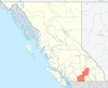 | |
| Towns | ||
| Districts | ||
| Villages | ||
| Designated places |
| |
| Unincorporated communities | ||
| Indian reservations | ||
| Ghost towns | ||
| Footnotes | ‡This populated place also has portions in an adjacent region | |