Warfield, British Columbia
| Warfield | |
|---|---|
| Village | |
| The Corporation of the Village of Warfield[1] | |
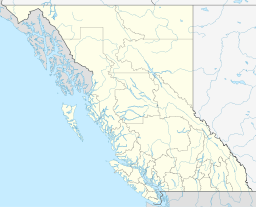
 Warfield Location of Warfield in British Columbia | |
| Coordinates: 49°05′43″N 117°44′42″W / 49.09528°N 117.74500°W | |
| Country |
|
| Province |
|
| Region | West Kootenay |
| Regional district | Kootenay-Boundary |
| Incorporated | 1952 |
| Government | |
| • Governing body | Warfield Village Council |
| Area | |
| • Total | 1.9 km2 (0.7 sq mi) |
| Elevation | 600 m (2,000 ft) |
| Population (2006) | |
| • Total | 1,729 |
| Time zone | PST (UTC-8) |
| Highways | 3B, 22 |
Warfield is a village located in southern British Columbia in the West Kootenay region. It is located at the west end of Trail at the bottom of the Rossland hill.
Climate
| Climate data for Warfield | |||||||||||||
|---|---|---|---|---|---|---|---|---|---|---|---|---|---|
| Month | Jan | Feb | Mar | Apr | May | Jun | Jul | Aug | Sep | Oct | Nov | Dec | Year |
| Record high °C (°F) | 11.1 (52) |
14.0 (57.2) |
22.0 (71.6) |
30.6 (87.1) |
35.6 (96.1) |
37.2 (99) |
41.1 (106) |
38.9 (102) |
36.0 (96.8) |
26.1 (79) |
18.3 (64.9) |
14.4 (57.9) |
41.1 (106) |
| Average high °C (°F) | 0.5 (32.9) |
3.3 (37.9) |
9.2 (48.6) |
15.0 (59) |
19.8 (67.6) |
23.3 (73.9) |
27.8 (82) |
28.1 (82.6) |
22.1 (71.8) |
12.8 (55) |
4.5 (40.1) |
−0.2 (31.6) |
13.8 (56.8) |
| Daily mean °C (°F) | −1.8 (28.8) |
0.1 (32.2) |
4.6 (40.3) |
9.1 (48.4) |
13.5 (56.3) |
16.9 (62.4) |
20.4 (68.7) |
20.4 (68.7) |
15.2 (59.4) |
8.1 (46.6) |
2.0 (35.6) |
−2.4 (27.7) |
8.9 (48) |
| Average low °C (°F) | −4.0 (24.8) |
−3.1 (26.4) |
0.0 (32) |
3.2 (37.8) |
7.1 (44.8) |
10.5 (50.9) |
12.9 (55.2) |
12.7 (54.9) |
8.4 (47.1) |
3.4 (38.1) |
−0.5 (31.1) |
−4.5 (23.9) |
3.8 (38.8) |
| Record low °C (°F) | −27.8 (−18) |
−27.2 (−17) |
−21.1 (−6) |
−11.1 (12) |
−4.5 (23.9) |
2.8 (37) |
0.6 (33.1) |
4.0 (39.2) |
−3.0 (26.6) |
−13.3 (8.1) |
−20.5 (−4.9) |
−31.1 (−24) |
−31.1 (−24) |
| Average precipitation mm (inches) | 78.4 (3.087) |
60.6 (2.386) |
66.1 (2.602) |
62.0 (2.441) |
74.0 (2.913) |
74.4 (2.929) |
48.2 (1.898) |
35.5 (1.398) |
39.7 (1.563) |
51.4 (2.024) |
96.5 (3.799) |
92.4 (3.638) |
779.0 (30.669) |
| Average rainfall mm (inches) | 27.8 (1.094) |
35.2 (1.386) |
55.8 (2.197) |
60.7 (2.39) |
73.9 (2.909) |
74.4 (2.929) |
48.2 (1.898) |
35.5 (1.398) |
39.7 (1.563) |
49.7 (1.957) |
64.4 (2.535) |
34.7 (1.366) |
599.9 (23.618) |
| Average snowfall cm (inches) | 50.6 (19.92) |
25.4 (10) |
10.3 (4.06) |
1.4 (0.55) |
0.1 (0.04) |
0.0 (0) |
0.0 (0) |
0.0 (0) |
0.0 (0) |
1.7 (0.67) |
32.0 (12.6) |
57.7 (22.72) |
179.1 (70.51) |
| Average precipitation days (≥ 0.2 mm) | 15.2 | 13.6 | 14.5 | 14.4 | 15.7 | 15.1 | 9.0 | 7.7 | 7.6 | 11.4 | 17.0 | 16.1 | 157.2 |
| Average rainy days (≥ 0.2 mm) | 6.7 | 8.1 | 12.9 | 14.4 | 15.7 | 15.1 | 9.0 | 7.7 | 7.6 | 11.3 | 13.1 | 5.1 | 126.6 |
| Average snowy days (≥ 0.2 cm) | 10.6 | 7.3 | 3.0 | 0.6 | 0.1 | 0.0 | 0.0 | 0.0 | 0.0 | 0.5 | 6.5 | 12.8 | 41.3 |
| Source: [2] | |||||||||||||
References
- ↑ "British Columbia Regional Districts, Municipalities, Corporate Name, Date of Incorporation and Postal Address" (XLS). British Columbia Ministry of Communities, Sport and Cultural Development. Retrieved November 2, 2014.
- ↑ "Calculation Information for 1981 to 2010 Canadian Normals Data". Environment Canada. Retrieved July 9, 2013.
Coordinates: 49°05′43″N 117°44′04″W / 49.09528°N 117.73444°W
This article is issued from Wikipedia - version of the 11/2/2014. The text is available under the Creative Commons Attribution/Share Alike but additional terms may apply for the media files.
