Layhill, Maryland
| Layhill, Maryland | |
|---|---|
| Census-designated place | |
 | |
| Coordinates: 39°05′32″N 77°02′40″W / 39.09222°N 77.04444°WCoordinates: 39°05′32″N 77°02′40″W / 39.09222°N 77.04444°W[1] | |
| Country | United States |
| State | Maryland |
| County | Montgomery |
| Area[2] | |
| • Total | 1.57 sq mi (4.1 km2) |
| Elevation[1] | 440 ft (130 m) |
| Population (2010)[2] | |
| • Total | 5,169 |
| • Density | 3,300/sq mi (1,300/km2) |
| ZIP code | 20906 |
| Area code(s) | 301 |
| FIPS code | 24-46150 |
| GNIS feature ID | 590644 |
Layhill is an unincorporated community and census-designated place in Montgomery County, Maryland. According to the United States Census Bureau, Layhill had a population of 5,169 in 2010.[2]
Geography
Due to its unincorporated nature, the boundaries are difficult to define precisely, but the center of the community is located at the intersection of Layhill Road and Bonifant Road/Bel Pre Road.
History
Argyle Country Club was originally located on Georgia Avenue in Petworth in the District of Columbia beginning in 1921.[3] After selling its land to a developer, the club moved to Four Corners, Maryland, on September 30, 1923.[4] The club operated in Four Corners until selling its land to be used for housing in 1945.[5] Argyle Country Club reopened at its present Layhill location on June 28, 1947.[6]
A drive-in move theater was planned at the corner of Layhill Road and Bel Pre Road in 1955.[7] The planned 54-acre (0.22 km2) drive-in would have had the capacity for 1,300 cars.[8] After opposition from some residents of the neighboring Manor Club Estates,[7] the Montgomery County Board of Appeals denied the zoning exception for the drive-in.[8]
The Layhill South neighborhood was developed in 1963.[9] Layhill Village[10] and Layhill Forest were built in 1965.[11] The Strathmore at Bel Pre neighborhood was built in 1968.[12] Chaddsford was developed in 1969.[13] Parker Farm was developed in 1994.[14]
Plaza del Mercado, a shopping center built by Ziegler Corporation,[15] opened in October 1969.[16] Original stores included Giant Food, Peoples Drug, McDonald's, and Hallmark Card Shop.[16] Federal Realty Investment Trust bought Plaza del Mercado in October 2003.[17] An Aldi grocery store opened there on December 1, 2016.[18]
In 1988, Layhill Road was widened, destroying a 225-year-old 67-foot-tall oak tree that was a neighborhood landmark at the northwest corner of Layhill Road and Bel Pre Road.[19][20]
Education
Bel Pre Elementary School, Strathmore Elementary School, and Glenallen Elementary School serve Layhill's elementary school-aged children.
Argyle Middle School is located in Layhill; some of Layhill's students are zoned to Colonel E. Brooke Lee Middle School.
High school-aged students living in Layhill are generally zoned to John F. Kennedy High School.
Alternatively, through the Downcounty Consortium, students who live in Layhill may apply to attend Montgomery Blair High School, Albert Einstein High School, John F. Kennedy High School, Northwood High School, or Wheaton High School.[21][22]
Barrie School, a private school, has been located in Layhill since September 8, 1958.[23]
Transportation
The Intercounty Connector crosses through Layhill.[24]
The Glenmont Metro station is a few miles south of the area.[25] This underground station, which opened on July 25, 1998,[26] is at the east end of the Red Line, and it has two large parking garages. From Glenmont, the Red Line heads south to downtown Silver Spring and to the District of Columbia before reentering Montgomery County and ending at Shady Grove.[27]
Demographics
As of the 2010 census, there were 5,169 people and 1,659 households residing in the Layhill CDP.[2] There were 1,775 housing units. The racial makeup of the community was 38.2% White, 34.9% African American, 0.2% Native American, 15.5% Asian, 0.0% Pacific Islander, and 3.6% from two or more races.[2] Hispanic or Latino people of any race consist of 17.6% of the population.[2]
There were 1,659 households out of which 40.8% had children under the age of 18 living with them, 65.8% were married couples living together, 14.5% had a female householder with no husband present, 3.4% had a male householder with no wife present, and 16.3% were non-families.[28] 12.4% of all households are made up of individuals living alone, and 6.4% had someone living alone who was 65 years of age or older.[28] The average household size was 3.28, and the average family size was 3.56.[28]
Of adults age 25 or older, 86% have a high school degree, 53% have a bachelor's degree, and 28% have a graduate degree.[28] Civilian veterans were 8% of the population.[28]
22% of residents were born in Maryland, 40% were born elsewhere in the United States, and 38% were born abroad.[28] Of foreign-born residents, 58% are naturalized citizens of the United States.[28] Of foreign-born residents, 37% were born in Latin American, 36% were born in Asia, 24% were born in Africa, and 3% were born in Europe.[28]
Residents' ancestry includes Subsaharan African (10%), Irish (8%), English (7%), German (6%), American (4%), West Indian (3%), Polish (2%), Arab (2%), Swiss (2%), and Italian (1%).[28]
Residents' method of commuting to work included driving alone (64%), carpooling (11%), and public transportation (20%); 4% worked from home.[29] Residents' mean travel time to work is 38 minutes.[29]
The median income for a household in the census area was $120,184, and the median income for a family was $123,832.[29] 6.2% of the population and 5.0% of families were below the poverty line.[29] 8.4% of those under the age of 18 and 1.3% of those 65 and older were living below the poverty line.[29]
Points of interest
The Matthew Henson Trail starts at Layhill and continues for 4.2 miles (6.8 km) to Rock Creek in Rockville.[30]
The National Capital Trolley Museum, which opened in 1969, is nearby.[31]
Wat Thai Temple, a Buddhist temple, has been located in Layhill since 1995.[32][33]
References
- 1 2 "Layhill, Maryland". Geographic Names Information System. United States Geological Survey. September 12, 1979. Retrieved September 7, 2014.
- 1 2 3 4 5 6 "Layhill CDP QuickFacts". United States Census Bureau. Retrieved July 3, 2014.
- ↑ McCallum, Walter (August 27, 1945). "Argyle Club Soon May Be Sold: Two Get Aces at That Course". Washington Evening Star. p. 9.
- ↑ "Argyle Club Opens New Course Sunday". Washington Evening Star. September 29, 1923. p. 10.
- ↑ McCallum, Walter (January 20, 1946). "Layout of 6,241 Yards Mapped for Argyle: Manor Picks Board". Washington Evening Star. p. 20.
- ↑ "Argyle's New Golf Course to Open for Play Saturday". Washington Evening Star. June 26, 1967. p. 45.
- 1 2 "Theater Plan at Norbeck Draws Fire". The Washington Post. March 13, 1955. p. A10.
- 1 2 "Zone Permit For Drive-in Is Refused". The Washington Post. April 16, 1955. p. 38.
- ↑ "Wagman Building on Layhill". The Washington Post. May 18, 1963. p. C2.
- ↑ "Notes on Area Realty and Construction". The Washington Post. February 20, 1965. p. D10.
- ↑ "Two Models at Layhill Forest". The Washington Post. September 25, 1965. p. D2.
- ↑ "Levitt Offering". The Washington Post. March 16, 1968. p. C1.
- ↑ "Chaddsford to Open Today". The Washington Post. June 28, 1969. p. D35.
- ↑ D.R. Horton (January 8, 1994). "It's Standard". The Washington Post. p. F3.
- ↑ "Area Realty and Building Notes". The Washington Post. June 22, 1968. p. C24.
- 1 2 "New Shopping Center Opens". The Washington Post. October 21, 1969. p. D9.
- ↑ "Q3 2003 FRT Earnings Release Conference Call - Final". Federal Document Clearing House. November 4, 2003.
- ↑ "Montgomery County Councilmember Nancy Navarro celebrates opening of new grocery store in Silver Spring". Montgomery County Council. December 1, 2016.
- ↑ Cytrynbaum, Pam (June 30, 1988). "Rallying Around Layhill Tree: Road Plan Threatens Md. Community's Roots". The Washington Post. p. D1.
- ↑ Cytrynbaum, Pam (August 19, 1988). "Montgomery to Lose a Living Landmark: 225-Year-Old Oak Will Be Cut Down for Layhill Road Widening". The Washington Post. p. D3.
- ↑ "Choice Process in Detail for the Downcounty Consortium". Montgomery County Public Schools. Retrieved July 13, 2014.
- ↑ "Downcounty Consortium: Schools and Feeder Schools". Montgomery County Public Schools. Retrieved July 13, 2014.
- ↑ Austern, Helen (September 14, 1958). "Landon School Is on the Beam With Television". The Washington Post. p. F7.
- ↑ Thomson, Robert (November 20, 2011). "A driver's guide to using the ICC". The Washington Post. p. C2.
- ↑ "Metro – Rail – Glenmont". Washington Metropolitan Area Trasit Authority. Retrieved July 3, 2014.
- ↑ "Checking Out Metro's Newest". The Washington Post. July 26, 1998. p. B3.
- ↑ "Metro – Rail – Maps – Rail/Google Map". Washington Metropolitan Area Transit Authority. Retrieved July 3, 2014.
- 1 2 3 4 5 6 7 8 9 "Elected Social Characteristics in the United States 2008–2012 American Community Survey 5-Year Estimates: Layhill CDP, Maryland". United States Census Bureau. Retrieved July 4, 2014.
- 1 2 3 4 5 "Elected Economic Characteristics in the United States 2008–2012 American Community Survey 5-Year Estimates: Layhill CDP, Maryland". United States Census Bureau. Retrieved July 4, 2014.
- ↑ Levine, Susan (April 10, 2003). "Planners Looking To Pave New Trail; Recommendation For Henson Path Splits Residents". The Washington Post. p. ME3.
- ↑ Eisen, Jack (October 16, 1969). "A Desire Named Streetcars: Something 'New' in Transit". Washington Post. p. B3.
- ↑ Ilustre, Jennie L. (April 30, 2003). "All Roads Lead to Temples To Celebrate the New Year". Asian Fortune.
- ↑ "About Us". Wat Thai, Washington, D.C. Archived from the original on September 15, 2014.
External links
- "Census Block Map – Layhill CDP, MD" (PDF). 2010 Census. United States Census Bureau. 2010.
 |
Norbeck | Norwood | Ednor | |
| Aspen Hill | |
Cloverly | ||
| ||||
| | ||||
| Aspen Hill | Glenmont | Colesville |
Municipalities and communities of Montgomery County, Maryland, United States | ||
|---|---|---|
| Cities | 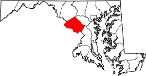 | |
| Towns | ||
| Villages & Special Tax Districts | ||
| CDPs |
| |
| Unincorporated communities | ||
| Footnotes | ‡This populated place also has portions in an adjacent county or counties | |