Forest Glen, Maryland
| Forest Glen, Maryland | |
|---|---|
| census-designated place | |
 Location of Forest Glen, Maryland | |
| Coordinates: 39°1′8″N 77°2′48″W / 39.01889°N 77.04667°WCoordinates: 39°1′8″N 77°2′48″W / 39.01889°N 77.04667°W | |
| Country |
|
| State |
|
| County |
|
| Area | |
| • Total | 1.3 sq mi (3.3 km2) |
| • Land | 1.3 sq mi (3.3 km2) |
| • Water | 0.0 sq mi (0.0 km2) |
| Elevation | 315 ft (96 m) |
| Population (2000) | |
| • Total | 7,344 |
| • Density | 5,698.9/sq mi (2,200.4/km2) |
| Time zone | Eastern (EST) (UTC-5) |
| • Summer (DST) | EDT (UTC-4) |
| FIPS code | 24-28640 |
| GNIS feature ID | 0584443 |
Forest Glen is a census-designated place (CDP) in Montgomery County, Maryland, United States. Its bounds include a 113-acre (0.46 km2) U.S. Army installation, the Forest Glen Annex and a historic district, the National Park Seminary.
Geography
As an unincorporated area within Silver Spring, Forest Glen's boundaries are not officially defined. Forest Glen is, however, recognized by the United States Census Bureau as a census-designated place, and by the United States Geological Survey as a populated place located at 39°1′8″N 77°2′48″W / 39.01889°N 77.04667°W (39.018909, -77.046797).[1] It is located just north of central Silver Spring which it is a part of, and just north of the Capital Beltway around Georgia Avenue. It is home of the Forest Glen Metro Stop, which is towards the end of the red line, found on the corner of Georgia Ave and Forest Glen Road.
According to the United States Census Bureau, the place has a total area of 1.3 square miles (3.4 km2), all land, although Sligo Creek and several drainage ponds are located in the area.
Demographics
As of the census[2] of 2000, there were 7,344 people, 3,003 households, and 1,792 families residing in the area. The population density was 5,698.9 people per square mile (2,198.1/km²). There were 3,091 housing units at an average density of 2,398.6/sq mi (925.1/km²). The racial makeup of the area was 65.32% White, 17.46% African American, 0.41% Native American, 7.76% Asian, 0.05% Pacific Islander, 4.98% from other races, and 4.02% from two or more races. Hispanics or Latinos of any race constituted 14.26% of the population.
There were 3,003 households out of which 28.1% had children under the age of 18 living with them, 45.9% were married couples living together, 10.3% had a female householder with no husband present, and 40.3% were non-families. Households made up of individuals constituted 33.1% and 14.0% had someone living alone who was 65 years of age or older. The average household size was 2.41 and the average family size was 3.09.
In the area, the population was spread out with 21.7% under the age of 18, 5.8% from 18 to 24, 33.0% from 25 to 44, 23.8% from 45 to 64, and 15.6% who were 65 years of age or older. The median age was 39 years. For every 100 females there were 87.3 males. For every 100 females age 18 and over, there were 82.6 males.
The median income for a household in the area was $59,844, and the median income for a family was $74,607. Males had a median income of $45,613 versus $38,975 for females. The per capita income for the area was $28,536. 3.8% of the population and 1.4% of families were below the poverty line. 1.1% of those under the age of 18 and 7.9% of those 65 and older were living below the poverty line.
References
- ↑ "US Gazetteer files: 2010, 2000, and 1990". United States Census Bureau. 2011-02-12. Retrieved 2011-04-23.
- ↑ "American FactFinder". United States Census Bureau. Retrieved 2008-01-31.
Municipalities and communities of Montgomery County, Maryland, United States | ||
|---|---|---|
| Cities | 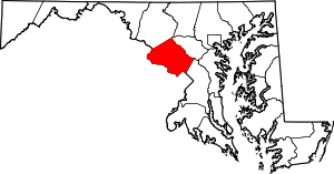 | |
| Towns | ||
| Villages & Special Tax Districts | ||
| CDPs |
| |
| Unincorporated communities | ||
| Footnotes | ‡This populated place also has portions in an adjacent county or counties | |