Chevy Chase, Maryland
| Chevy Chase, Maryland | |
|---|---|
| Unincorporated community | |
 Chevy Chase, Maryland Location of Chevy Chase in the U.S. state of Maryland | |
| Coordinates: 38°58′16″N 77°04′35″W / 38.97111°N 77.07639°WCoordinates: 38°58′16″N 77°04′35″W / 38.97111°N 77.07639°W | |
| Country |
|
| State |
|
| County |
|
Chevy Chase is the name of both a town and an unincorporated census-designated place (CDP) in Montgomery County, Maryland. In addition, a number of villages in the same area of Montgomery County include "Chevy Chase" in their names. These villages, the town, and the CDP share a common history and together form a larger community colloquially referred to as "Chevy Chase". This community is roughly centered on Connecticut Avenue north of the District of Columbia and also includes a neighborhood of Washington, D.C., called Chevy Chase.
Primarily a residential suburb, Chevy Chase also borders a popular shopping district, Friendship Heights, featuring several malls and a variety of shops and restaurants. Chevy Chase is home to the National 4-H Youth Conference Center,[1] where the National Science Bowl is held annually in either late April or early May.[2]
Chevy Chase is served by the Montgomery County Public School system.
History
Chevy Chase was unincorporated farmland in the years before 1890, during which time Senator Francis G. Newlands of Nevada and his partners began the aggressive acquisition of land in northwestern Washington, D.C., and southern Montgomery County, Maryland, for the purpose of developing a residential streetcar suburb for Washington, D.C. (See Washington streetcars) The Chevy Chase Land Company was founded in 1890, and its eventual holdings of more than 1,700 acres (6.9 km2) would extend along the present-day Connecticut Avenue from Florida Avenue north to Jones Bridge Road. The Chevy Chase Land Company would build houses for no less than $5,000 on Connecticut Avenue or less than $3,000 on a side street.[3]
The name "Chevy Chase" was taken from one of the absorbed plots of land. Its name in turn, according to the Village of Chevy Chase's official history, can be traced to the larger tract of land called "Cheivy Chace" that was patented to Colonel Joseph Belt from Lord Baltimore on July 10, 1725. It has historic associations to a 1388 battle between Lord Percy of England and Earl Douglas of Scotland, the subject of the ballad entitled "The Ballad of Chevy Chase". At issue in this "chevauchée" (a French word describing a border raid) were hunting grounds or a "chace" in the Cheviot Hills of Northumberland and Otterburn.[4]
Leon E. Dessez was Chevy Chase's first resident. He and Lindley Johnson of Philadelphia designed the first four houses in the area.[5]
As with many suburban towns throughout the United States during the first half of the 20th century, Chevy Chase excluded individuals based on race and religion. Founder Francis G. Newlands was an "avowed racist"[6] who in 1912 mounted his presidential campaign on a platform that called for a constitutional amendment to disenfranchise black men and limit immigration to whites only. Three years earlier, the Chevy Chase Land Company had brought suit against a developer who had begun to sell lots to black people in a planned subdivision called "Belmont" on the grounds that the developer had committed fraud by proposing "to sell lots...to negroes."[6]
By the 1920s, exclusionary language had begun to appear in Chevy Chase real estate deeds. Some prohibited both the sale or rental of homes to "a Negro or one of the African race."[7] Others prohibited sales or rentals to "any persons of the Semetic [sic] race."[8] By World War II, such restrictive language had largely disappeared from real estate transactions, and all were voided by the 1948 Supreme Court decision in Shelley v. Kraemer.
Subdivisions
- Census-designated place of Chevy Chase
- Incorporated town of Chevy Chase
Villages
- Chevy Chase Village
- Chevy Chase Section Three
- Chevy Chase Section Five
- Martin's Additions
- North Chevy Chase
In addition to the above, the United States Postal Service uses Chevy Chase for postal addresses that lie in the Town of Somerset and the Village of Friendship Heights which lie outside historical Chevy Chase. USPS also employs Chevy Chase addresses for the part of Silver Spring east of Jones Mill Road and Beach Drive and, west of Grubb Road.[9]
Notable people
- Bill Guckeyson, athlete and military aviator
- Hilary Rhoda (born 1987), model[10]
- Danny Rubin (born 1991), American-Israeli basketball player for Bnei Herzliya of the Israeli Basketball Premier League[11]
See also
- Francis G. Newlands
- Chevy Chase (Washington, D.C.)
- List of people from the Washington, D.C. metropolitan area
- Restrictive covenant
Bibliography
- Robinson, Judith Helm. Chevy Chase: A Bold Idea, A Comprehensive Plan in Smith, Kathryn Schneider, ed. Washington at Home: An Illustrated History of Neighborhoods in the Nation's Capital, The Historical Society of Washington, D.C., 1993.
References
- ↑ "National 4-H Youth Conference Center". National 4-H Youth Conference Center. National 4-H Youth Conference Center. Retrieved 30 April 2015.
- ↑ "U.S. Department of Energy, Office of Energy, National Science Bowl®". U.S. Department of Energy, Office of Science. U.S. Department of Energy. Retrieved 30 April 2015.
- ↑ Hoffman,Carl and Moran,Sharon "Origins" [Neighborhood Planning Council 2 and 3]1975
- ↑ http://www.chevychasehistory.org/content/view/3/144/
- ↑ Historical Dictionary of Washington
- 1 2 Fisher, Marc. "Chevy Chase, 1916: For Everyman, a New Lot in Life," Washington Post, February 15, 1999
- ↑ Deed, February 15, 1921, between Harry M. Martin and Francis Regis Noel.
- ↑ Fisher, February 15, 1999
- ↑ Google Maps
- ↑
- ↑ "Danny Rubin goes from Landon to Boston College walk-on to ACC starter", The Washington Post
External links
| Wikimedia Commons has media related to Chevy Chase, Maryland. |
- History of the Chevy Chase Land Company
- Chevy Chase Historical Society "A Streetcar to Home", DVD, 2006, color, 32 minutes
- The Greater Bethesda-Chevy Chase Chamber of Commerce
Municipalities and communities of Montgomery County, Maryland, United States | ||
|---|---|---|
| Cities | 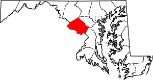 | |
| Towns | ||
| Villages & Special Tax Districts | ||
| CDPs |
| |
| Unincorporated communities | ||
| Footnotes | ‡This populated place also has portions in an adjacent county or counties | |