Chevy Chase Section Five, Maryland
| Chevy Chase Section Five, Maryland | |
|---|---|
| Village | |
 | |
| Coordinates: 38°58′59″N 77°4′29″W / 38.98306°N 77.07472°WCoordinates: 38°58′59″N 77°4′29″W / 38.98306°N 77.07472°W | |
| Country |
|
| State |
|
| County |
|
| Area[1] | |
| • Total | 0.10 sq mi (0.26 km2) |
| • Land | 0.10 sq mi (0.26 km2) |
| • Water | 0 sq mi (0 km2) |
| Elevation | 305 ft (93 m) |
| Population (2010)[2] | |
| • Total | 658 |
| • Estimate (2012[3]) | 675 |
| • Density | 6,580.0/sq mi (2,540.6/km2) |
| Time zone | Eastern (EST) (UTC-5) |
| • Summer (DST) | EDT (UTC-4) |
| FIPS code | 24-16720 |
| GNIS feature ID | 1669432 |
Chevy Chase Section Five is a village in Montgomery County, Maryland, United States. It was founded as a Special Tax District in 1922 and was incorporated as a village in 1982. The population was 658 at the 2010 census.
Geography
Chevy Chase Section Five is located at 38°58′59″N 77°4′29″W / 38.98306°N 77.07472°W (38.983060, -77.074786).[4]
According to the United States Census Bureau, the village has a total area of 0.10 square miles (0.26 km2), all of it land.[1]
Home prices in Chevy Chase Section Five range from just under $1,000,000 to well over $2,000,000.
Demographics
| Historical population | |||
|---|---|---|---|
| Census | Pop. | %± | |
| 1990 | 632 | — | |
| 2000 | 641 | 1.4% | |
| 2010 | 658 | 2.7% | |
| Est. 2015 | 693 | [5] | 5.3% |
2010 census
As of the census[2] of 2010, there were 658 people, 222 households, and 191 families residing in the village. The population density was 6,580.0 inhabitants per square mile (2,540.6/km2). There were 226 housing units at an average density of 2,260.0 per square mile (872.6/km2). The racial makeup of the village was 95.6% White, 0.2% African American, 2.1% Asian, 0.3% from other races, and 1.8% from two or more races. Hispanic or Latino of any race were 3.3% of the population.
There were 222 households of which 45.9% had children under the age of 18 living with them, 78.4% were married couples living together, 4.1% had a female householder with no husband present, 3.6% had a male householder with no wife present, and 14.0% were non-families. 13.1% of all households were made up of individuals and 8.6% had someone living alone who was 65 years of age or older. The average household size was 2.96 and the average family size was 3.24.
The median age in the village was 44 years. 31.2% of residents were under the age of 18; 4.3% were between the ages of 18 and 24; 17% were from 25 to 44; 34.6% were from 45 to 64; and 12.9% were 65 years of age or older. The gender makeup of the village was 46.7% male and 53.3% female.
2000 census
As of the census[7] of 2000, there were 641 people, 224 households, and 189 families residing in the village. The population density was 6,114.6 people per square mile (2,474.9/km²). There were 228 housing units at an average density of 2,174.9 per square mile (880.3/km²). The racial makeup of the village was 95.94% White, 0.16% African American, 1.25% Asian, 2.03% from other races, and 0.62% from two or more races. Hispanic or Latino of any race were 3.90% of the population.
There were 224 households out of which 48.7% had children under the age of 18 living with them, 76.8% were married couples living together, 5.4% had a female householder with no husband present, and 15.6% were non-families. 13.4% of all households were made up of individuals and 9.4% had someone living alone who was 65 years of age or older. The average household size was 2.86 and the average family size was 3.12.
In the village the population was spread out with 30.1% under the age of 18, 3.3% from 18 to 24, 21.8% from 25 to 44, 30.3% from 45 to 64, and 14.5% who were 65 years of age or older. The median age was 42 years. For every 100 females there were 94.2 males. For every 100 females age 18 and over, there were 89.8 males.
The median income for a household in the village was $153,626, and the median income for a family was $168,664. Males had a median income of $100,000 versus $80,000 for females. The per capita income for the village was $70,372. None of the families and 0.5% of the population were living below the poverty line, including no under eighteens and none of those over 64.
Education
Residents are served by schools in the Montgomery County Public Schools.
Zoned schools include Residents are zoned to Rosemary Hills Elementary School (PreK-2), Chevy Chase Elementary School (3-6), Westland Middle School, and Bethesda-Chevy Chase High School.
References
- 1 2 "US Gazetteer files 2010". United States Census Bureau. Archived from the original on 2012-01-24. Retrieved 2013-01-25.
- 1 2 "American FactFinder". United States Census Bureau. Retrieved 2013-01-25.
- ↑ "Population Estimates". United States Census Bureau. Archived from the original on 2013-06-17. Retrieved 2013-06-26.
- ↑ "US Gazetteer files: 2010, 2000, and 1990". United States Census Bureau. 2011-02-12. Retrieved 2011-04-23.
- ↑ "Annual Estimates of the Resident Population for Incorporated Places: April 1, 2010 to July 1, 2015". Retrieved July 2, 2016.
- ↑ "Census of Population and Housing". Census.gov. Archived from the original on May 11, 2015. Retrieved June 4, 2015.
- ↑ "American FactFinder". United States Census Bureau. Archived from the original on 2013-09-11. Retrieved 2008-01-31.
External links
Municipalities and communities of Montgomery County, Maryland, United States | ||
|---|---|---|
| Cities | 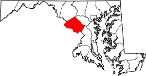 | |
| Towns | ||
| Villages & Special Tax Districts | ||
| CDPs |
| |
| Unincorporated communities | ||
| Footnotes | ‡This populated place also has portions in an adjacent county or counties | |