Grindrod, British Columbia

Location of Grindrod in British Columbia
Grindrod is an unincorporated designated place in the North Okanagan Regional District, British Columbia, Canada. The community is located on the western bank of the Shuswap River, north of Enderby,[1] and is sometimes considered to be part of the Shuswap Country. The population was 1,453 at the 2011 census.[2]
References
- ↑ Google (July 12, 2013). "Grindrod, British Columbia" (Map). Google Maps. Google. Retrieved July 12, 2013.
- ↑ "Census Profile – Grindrod, UNP, British Columbia (Designated place)". Statistics Canada. March 1, 2013. Retrieved July 12, 2013.
Coordinates: 50°37′30″N 119°06′54″W / 50.625°N 119.115°W
Municipalities and communities of Okanagan, British Columbia, Canada | ||
|---|---|---|
| Cities | 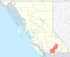 | |
| Towns | ||
| Districts | ||
| Villages | ||
| Designated places |
| |
| Unincorporated communities | ||
| Indian reservations | ||
| Ghost towns | ||
| Footnotes | ‡This populated place also has portions in an adjacent region | |
This article is issued from Wikipedia - version of the 7/12/2013. The text is available under the Creative Commons Attribution/Share Alike but additional terms may apply for the media files.