County of Barrhead No. 11
| County of Barrhead No. 11 | |
|---|---|
| Municipal district | |
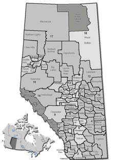 Location of Barrhead County No. 11 in Alberta | |
| Coordinates: 54°07′23″N 114°24′07″W / 54.12306°N 114.40194°WCoordinates: 54°07′23″N 114°24′07″W / 54.12306°N 114.40194°W | |
| Country |
|
| Province |
|
| Region | Central Alberta |
| Census division | No. 13 |
| Established | 1955 |
| Incorporated | 1959 (County) |
| Government[1] | |
| • Reeve | Doug Drozd |
| • Governing body | County of Barrhead Council |
| • Office location | Barrhead |
| Area (2011)[2] | |
| • Total | 2,404.70 km2 (928.46 sq mi) |
| Population (2011)[2] | |
| • Total | 6,096 |
| • Density | 2.5/km2 (6/sq mi) |
| • Dwellings | 2,490 |
| Time zone | MST (UTC-7) |
| Website | Official website |
The County of Barrhead No. 11 is a municipal district in north central Alberta, Canada. It is located northwest of Edmonton and is in Census Division No. 13.
Demographics
| Visible minority and Aboriginal population (Canada 2006 Census) | |||
|---|---|---|---|
| Population group | Population | % of total population | |
| White | 5,520 | 94.4% | |
| Visible minority group Source:[3] | South Asian | 0 | 0% |
| Chinese | 0 | 0% | |
| Black | 0 | 0% | |
| Filipino | 0 | 0% | |
| Latin American | 0 | 0% | |
| Arab | 0 | 0% | |
| Southeast Asian | 0 | 0% | |
| West Asian | 0 | 0% | |
| Korean | 0 | 0% | |
| Japanese | 0 | 0% | |
| Visible minority, n.i.e. | 0 | 0% | |
| Multiple visible minority | 0 | 0% | |
| Total visible minority population | 10 | 0.2% | |
| Aboriginal group Source:[4] | First Nations | 55 | 0.9% |
| Métis | 240 | 4.1% | |
| Inuit | 0 | 0% | |
| Aboriginal, n.i.e. | 15 | 0.3% | |
| Multiple Aboriginal identity | 0 | 0% | |
| Total Aboriginal population | 315 | 5.4% | |
| Total population | 5,845 | 100% | |
In the 2011 Census, the County of Barrhead No. 11 had a population of 6,096 living in 2,206 of its 2,718 total dwellings, a 4.3% change from its 2006 population of 5,845. With a land area of 2,404.7 km2 (928.5 sq mi), it had a population density of 2.5/km2 (6.6/sq mi) in 2011.[2]
In 2006, the County of Barrhead had a population of 5,845 living in 2,490 dwellings, a 1.3% increase from 2001. The county has a land area of 2,404.55 km2 (928.40 sq mi) and a population density of 2.4/km2 (6.2/sq mi).[5]
The Statistics Canada 2001 census showed a population of 5,768 in the 2,404.54 km² county area.[6]
Communities and localities
|
The following urban municipalities are surrounded by the County of Barrhead No. 11:[7]
The following hamlets are located within the County of Barrhead No. 11:[7] |
The following localities are located within the County of Barrhead No. 11:[8]
|
Attractions
- Parks: Thunder Lake Provincial Park, Holmes Crossing Recreation Area, Klondike Ferry Park
- Dolberg Lake Campground, Homesteaders Walking Trail
- Lakes: Clear Lake, Lac la Nonne / Elks Beach, Peanut Lake
- Sport Venues in Barrhead: Swimming Pool, Curling Rink, Rodeo Grounds, Tennis Courts
- Ice hockey: Barrhead Agrena
- Golf: Barrhead Golf Course, Paddle River Golf Course
- Bowling: Blue Heron Bowl
- Ski: Misty Ridge Ski Hill
See also
References
- ↑ "Municipal Officials Search". Alberta Municipal Affairs. November 18, 2016. Retrieved November 21, 2016.
- 1 2 3 "Population and dwelling counts, for Canada, provinces and territories, and census subdivisions (municipalities), 2011 and 2006 censuses (Alberta)". Statistics Canada. 2012-02-08. Retrieved 2012-02-08.
- ↑ Community Profiles from the 2006 Census, Statistics Canada - Census Subdivision
- ↑ Aboriginal Population Profile from the 2006 Census, Statistics Canada - Census Subdivision
- ↑ Statistics Canada. "Canada 2006 Census: County of Barrhead No. 11 - Community Profile". Retrieved 2007-06-10.
- ↑ County of Barrhead Community Profile - Statistics Canada. 2002. 2001 Community Profiles. Released June 27, 2002. Last modified: 2005-11-30. Statistics Canada Catalogue no. 93F0053XIE
- 1 2 "Specialized and Rural Municipalities and Their Communities" (PDF). Alberta Municipal Affairs. 2012-03-01. Retrieved 2012-08-11.
- ↑ "Standard Geographical Classification (SGC) 2006, Economic Regions: 4813018 - Barrhead County No. 11, geographical codes and localities, 2006". Statistics Canada. 2010-03-05. Retrieved 2012-08-11.
External links
 |
Woodlands County | Woodlands County | Municipal District of Lesser Slave River No. 124 | |
| Woodlands County | |
Westlock County | ||
| ||||
| | ||||
| Lac Ste. Anne County | Lac Ste. Anne County | Sturgeon County |