List of ghost towns in Alberta

This list is incomplete; you can help by expanding it.

The province of Alberta has several ghost towns that have been completely or partially abandoned.[1] Many of Alberta's ghost towns exist as a result of a number of failed coal mining operations in the area during the early 20th century.

Ghost towns are towns that once had a considerable population, that have since dwindled in numbers causing some or all its business to close, either due to the rerouting of a highway, train tracks being pulled, or exhaustion of some natural resource.

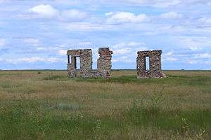
Remains of Flowerdale.
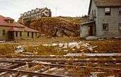
Hotel in Luscar, 1950s
Sun setting on Maybutt
The road into Mountain Park – an early colour photo
Vacant Store Nemiscam
Vacant Store Orion

List of ghost towns

Contents 
Ghost town Municipality Location About Peak Year Peak population Population
Alderson Cypress County 50°17′00″N 111°20′00″W / 50.28335°N 111.3333°W / 50.28335; -111.3333 (Alderson)
Alexo Clearwater County 52°28′00″N 115°48′00″W / 52.46667°N 115.7999°W / 52.46667; -115.7999 (Alexo) Former coal mining community
Allerston County of Warner No. 5 49°08′40″N 111°45′51″W / 49.14458°N 111.7642°W / 49.14458; -111.7642 (Allerston)
Allingham Kneehill County 51°42′00″N 113°36′00″W / 51.69999°N 113.5999°W / 51.69999; -113.5999 (Allingham)
Altorado County of Forty Mile No. 8
Amber Valley Athabasca County 54°44′00″N 112°55′00″W / 54.73333°N 112.9166°W / 54.73333; -112.9166 (Altorado)
Anthracite Improvement District No. 9 (Banff National Park) 51°11′57″N 115°30′01″W / 51.19916°N 115.5003°W / 51.19916; -115.5003 (Anthracite)
Ardenode Wheatland County 51°08′49″N 113°25′23″W / 51.14707°N 113.4231°W / 51.14707; -113.4231 (Ardenode)
Ardley Red Deer County 52°16′00″N 113°14′00″W / 52.26668°N 113.2332°W / 52.26668; -113.2332 (Ardley)
Bankhead Improvement District No. 9 (Banff National Park) 51°12′00″N 115°32′00″W / 51.19998°N 115.5333°W / 51.19998; -115.5333 (Bankhead) Former coal mining community 1,000 [2]
Bardo Beaver County 53°18′06″N 112°41′04″W / 53.30172°N 112.6845°W / 53.30172; -112.6845 (Bardo)
Battle Bend Flagstaff County 52°26′03″N 111°26′39″W / 52.43410°N 111.4442°W / 52.43410; -111.4442 (Battle Bend)
Beazer Cardston County 49°06′57″N 113°28′51″W / 49.11575°N 113.4807°W / 49.11575; -113.4807 (Beazer)
Belloy Birch Hills County 55°45′00″N 118°15′00″W / 55.74995°N 118.24997°W / 55.74995; -118.24997 (Belloy)
Bindloss Special Area No. 2 50°52′43″N 110°16′32″W / 50.87872°N 110.2756°W / 50.87872; -110.2756 (Bindloss)
Bingham County of Forty Mile No. 8 49°28′48″N 111°16′34″W / 49.48000°N 111.27611°W / 49.48000; -111.27611 (Bingham)
Bone Point
Buffalo Special Area No. 2 50°48′00″N 110°40′00″W / 50.80001°N 110.6666°W / 50.80001; -110.6666 (Buffalo)
Bulwark County of Paintearth No. 18 52°15′00″N 111°35′00″W / 52.24999°N 111.5833°W / 52.24999; -111.5833 (Bulwark)
Butte Clearwater County 52°11′00″N 114°44′00″W / 52.18334°N 114.7333°W / 52.18334; -114.7333 (Butte)
Coalspur Yellowhead County 53°11′00″N 117°01′02″W / 53.18340°N 117.0171°W / 53.18340; -117.0171 (Coalspur)
Commerce Lethbridge County 49°55′01″N 112°56′21″W / 49.91691°N 112.9393°W / 49.91691; -112.9393 (Commerce) 1921 360 [3]
Conquerville County of Forty Mile No. 8 49°40′10″N 111°13′25″W / 49.66955°N 111.2237°W / 49.66955; -111.2237 (Conquerville)
Conrad County of Forty Mile No. 8 49°31′00″N 111°58′00″W / 49.51667°N 111.9666°W / 49.51667; -111.9666 (Conrad)
Del Bonita Cardston County 49°01′46″N 112°47′21″W / 49.02945°N 112.7892°W / 49.02945; -112.7892 (Del Bonita)
Dorothy Starland County 51°18′00″N 112°19′00″W / 51.30002°N 112.3166°W / 51.30002; -112.3166 (Dorothy)
East Coulee Town of Drumheller 51°20′11″N 112°29′22″W / 51.33632°N 112.4894°W / 51.33632; -112.4894 (East Coulee) 177 [4]
Embarras Landing Yellowhead County 53°18′00″N 116°54′00″W / 53.30000°N 116.9000°W / 53.30000; -116.9000 (Embarras Landing)
Evarts Red Deer County 52°15′38″N 114°16′18″W / 52.260556°N 114.271667°W / 52.260556; -114.271667 (Evarts) 1915[5] 22[5]
Flowerdale[6] Special Area No. 2 51°21′57″N 111°33′54″W / 51.3658055°N 111.5651312°W / 51.3658055; -111.5651312 (Frankburg) The settlement was abandoned in the early 1920s and destroyed by a prairie fire soon after.[7] Flowerdale had a post office, Flowerdale Holdings, a general store, a schoolhouse and many other businesses.[7]
Frankburg[8] Municipal District of Foothills No. 31 50°31′44″N 113°38′39″W / 50.52880°N 113.6442°W / 50.52880; -113.6442 (Frankburg)
Georgetown Municipal District of Bighorn No. 8 51°06′28″N 115°23′38″W / 51.10774°N 115.39393°W / 51.10774; -115.39393 (Georgetown)
Harrisville[9] Cardston County
Judson Cardston County 49°32′00″N 112°21′00″W / 49.53332°N 112.3499°W / 49.53332; -112.3499 (Judson)
Kimball Cardston County 49°05′00″N 113°12′00″W / 49.08335°N 113.1999°W / 49.08335; -113.1999 (Kimball)
Kovach Kananaskis Improvement District 50°56′00″N 115°12′00″W / 50.93335°N 115.1999°W / 50.93335; -115.1999 (Kovach)
Legend County of Forty Mile No. 8 49°28′55″N 111°35′51″W / 49.48208°N 111.5975°W / 49.48208; -111.5975 (Legend)
Lille Municipality of Crowsnest Pass 49°39′05″N 114°23′52″W / 49.65137°N 114.3977°W / 49.65137; -114.3977 (Lille)
Luscar Yellowhead County 53°04′06″N 117°24′01″W / 53.06821°N 117.4003°W / 53.06821; -117.4003 (Luscar) Former coal mining community
Maybutt County of Warner No. 5 49°31′04″N 112°31′42″W / 49.51788°N 112.5282°W / 49.51788; -112.5282 (Maybutt)
Mercoal Yellowhead County 53°10′00″N 117°05′00″W / 53.16666°N 117.0833°W / 53.16666; -117.0833 (Mercoal) Former coal mining community
Mintlaw Red Deer County 52°13′18″N 113°54′52″W / 52.22179°N 113.9144°W / 52.22179; -113.9144 (Mintlaw)
Mitford Rocky View County 51°12′44″N 114°33′03″W / 51.21212°N 114.5508°W / 51.21212; -114.5508 (Mitford)
Mountain Park Yellowhead County 52°55′00″N 117°16′00″W / 52.91668°N 117.2666°W / 52.91668; -117.2666 (Mountain Park) Former coal mining community
Nordegg Clearwater County 52°28′05″N 116°04′53″W / 52.46800°N 116.0814°W / 52.46800; -116.0814 (Nordegg) Former coal mining community/National Historic Site
Pakowki County of Forty Mile No. 8 49°27′57″N 110°56′52″W / 49.46594°N 110.9477°W / 49.46594; -110.9477 (Pakowki)
Port Cornwall Municipal District of Lesser Slave River No. 124 55°10′01″N 114°03′30″W / 55.166944°N 114.058333°W / 55.166944; -114.058333 (Port Cornwall) 1913[10] 200[10]
Pendant d'Oreille County of Forty Mile No. 8 49°12′10″N 110°52′00″W / 49.20273°N 110.8666°W / 49.20273; -110.8666 (Pendant d'Oreille)
Raley Cardston County 49°17′26″N 113°10′56″W / 49.29059°N 113.1821°W / 49.29059; -113.1821 (Raley)
Retlaw Municipal District of Taber 50°04′00″N 112°16′00″W / 50.06667°N 112.2666°W / 50.06667; -112.2666 (Retlaw)
Rowley Starland County 51°45′55″N 112°47′17″W / 51.76530°N 112.7880°W / 51.76530; -112.7880 (Rowley)
Taylorville Cardston County 49°02′00″N 113°07′00″W / 49.03331°N 113.1166°W / 49.03331; -113.1166 (Taylorville)
Tollerton Yellowhead County 53°32′09″N 116°28′10″W / 53.535833°N 116.469444°W / 53.535833; -116.469444 (Tollerton) 1916[11] 180[11]
Travers Vulcan County 50°15′07″N 112°32′51″W / 50.25198°N 112.5476°W / 50.25198; -112.5476 (Travers)
Twin River Cardston County
Wardlow Special Area No. 2 50°54′23″N 111°33′03″W / 50.90644°N 111.5509°W / 50.90644; -111.5509 (Wardlow)
Whiskey Gap Cardston County 49°01′57″N 113°01′59″W / 49.03250°N 113.0331°W / 49.03250; -113.0331 (Whiskey Gap)
Whitford Lamont County 53°52′00″N 112°13′00″W / 53.86665°N 112.2166°W / 53.86665; -112.2166 (Whitford)
Whitla County of Forty Mile No. 8 49°52′00″N 111°03′00″W / 49.86669°N 111.0499°W / 49.86669; -111.0499 (Whitla)
Wimborne Kneehill County 51°51′55″N 113°35′39″W / 51.86525°N 113.5941°W / 51.86525; -113.5941 (Wimborne)
Windfall Woodlands County 54°11′14″N 116°13′10″W / 54.1872°N 116.2194°W / 54.1872; -116.2194 (Windfall) Former gas plant community founded by Canadian Fina Oil Ltd.[12] 1961 [13] 101 [13]
Winnifred County of Forty Mile No. 8 49°54′00″N 111°12′00″W / 49.89999°N 111.1999°W / 49.89999; -111.1999 (Winnifred)
Woolford Cardston County 49°11′00″N 113°08′00″W / 49.18334°N 113.1333°W / 49.18334; -113.1333 (Woolford)
Wostok Lamont County 53°51′00″N 112°28′00″W / 53.85000°N 112.4666°W / 53.85000; -112.4666 (Wostok)

See also

NB
PE
Ghost towns in Canada by province or territory

References

  1. Ghost towns in Canada. "Alberta Ghost Towns". Archived from the original on 24 October 2007. Retrieved 30 October 2007.
  2. Crag & Canyon 24 June 1922 / Mine Closed Permanently
  3. Census of Canada, 1921. Dominion Bureau of Statistics. 1921.
  4. Statistics Canada (2007). "Population and dwelling counts, for Canada, provinces and territories, and designated places, 2006 and 2001 censuses". Retrieved 11 October 2010.
  5. 1 2 "Population Data 1915" (PDF). Alberta Municipal Affairs. 1915. Retrieved 6 July 2011.
  6. Roads to Rose Lynn: Rose Lynn Book Club (1978). Roads to Rose Lynn.
  7. 1 2 Roads to Rose Lynn: Rose Lynn Book Club (1978). Roads to Rose Lynn. p. 445.
  8. Fencelines and Furrows History Book Society (1971). Fencelines and Furrows. p. 35.
  9. Shaw, Keith (1978). Chief mountain country : a history of Cardston and district. Volume I. Cardston, Alberta: Cardston and District Historical Society. p. 63. ISBN 0-919213-89-8.
  10. 1 2 "Population Data 1913" (PDF). Alberta Municipal Affairs. 1913. Retrieved 6 July 2011.
  11. 1 2 "Population Data 1916" (PDF). Alberta Municipal Affairs. 1916. Retrieved 6 July 2011.
  12. Whitecourt Web (which summarized from Sagitawah Saga by Doreen Olecko, along with other source works). "Oil & Gas – 1950 to 1960s". Retrieved 10 October 2010.
  13. 1 2 1961 Census of Canada, Series SP, Population – Unincorporated Villages, Bulletin SP–4. Dominion Bureau of Statistics. 1961.
This article is issued from Wikipedia - version of the 7/24/2016. The text is available under the Creative Commons Attribution/Share Alike but additional terms may apply for the media files.