Lamont County
| Lamont County | |
|---|---|
| Municipal district | |
|
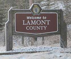
Boundary sign | |
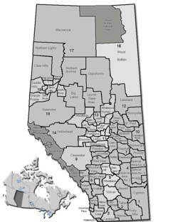 Location of Lamont County in Alberta | |
| Coordinates: 53°45′37″N 112°46′40″W / 53.76028°N 112.77778°WCoordinates: 53°45′37″N 112°46′40″W / 53.76028°N 112.77778°W | |
| Country | Canada |
| Province | Alberta |
| Region | Central Alberta |
| Census division | No. 10 |
| Established | 1944 |
| Incorporated | 1968 |
| Government[1] | |
| • Reeve | Wayne Woldanski |
| • Governing body | Lamont County Council |
| • Office location | Lamont |
| Area (2011)[2] | |
| • Total | 2,385.91 km2 (921.21 sq mi) |
| Population (2011)[2] | |
| • Total | 3,872 |
| • Density | 1.6/km2 (4/sq mi) |
| • Dwellings | 1,676 |
| Time zone | MST (UTC-7) |
| Website |
lamontcounty |
Lamont County is a municipal district in central Alberta, Canada, located in Census Division Number 10, northeast of Edmonton. The county contains 27 Townships. Its municipal office is located in the Town of Lamont.
History
In March 1944, the Municipal District of Lamont No. 516 was incorporated, uniting the three smaller districts of Pines, Wostok, and Leslie. The office was at the town of Lamont and the first council consisted of Peter Moshansky (Reeve), L. Stawnichy, W. Eleniak, M. Cholak and S. Rudko. The first Secretary Treasurer was Michael Nemirsky, who held that position until his death in January 1968. The district was later renamed the Municipal District of Lamont No. 82.
In January 1968, the County of Lamont No. 30 was incorporated, uniting the Lamont School Division No. 18 and the Municipal District of Lamont No. 82.
Demographics
In the 2011 Census, Lamont County had a population of 3,872 living in 1,581 of its 1,817 total dwellings, a -0.8% change from its 2006 adjusted population of 3,905. With a land area of 2,385.91 km2 (921.21 sq mi), it had a population density of 1.6/km2 (4.2/sq mi) in 2011.[2]
In the In the 2006 census, Lamont County had a population of 3,925 living in 1,676 dwellings, a -5.7% change from 4,167 living in 1,869 dwellings in the 2001 federal census.[3] The county has a land area of 2,400.78 km2 (926.95 sq mi) and a population density of 1.6/km2 (4.1/sq mi).[4]
Communities and localities
|
The following urban municipalities are surrounded by Lamont County:[5]
|
The following localities are located within Lamont County:[6]
|
Attractions
Places of interest include Beaverhill Lake, Limestone Creek and Ukalta Sands. The former is popular for the thousands of birds migrating birds around the lake in the months of May and September. Also in Lamont County are the Basilian Fathers Museum and the Skaro Shrine, the site of a spectacular pilgrimage of 5000 people from August 14–15 every year. The Ukrainian Cultural Heritage Village, an open-air museum that depicts the history of east central Alberta, is located on highway 16. Lastly, bordering Lamont county is the Elk Island National Park, Canada's first wildlife sanctuary. The Yellowhead Highway passes through the southern part of the county.
Lamont County has 47 churches - more per capita than anywhere else in North America[7]
The annual Babas and Borshch Ukrainian Festival[8] is held the fourth weekend of August in the Village of Andrew. It honours and celebrates Ukrainian culture – food, history, religion, and arts.
Notable residents
- Ed Stelmach, the 13th Premier of Alberta, was raised in Lamont County
See also
- List of communities in Alberta
- List of municipal districts in Alberta
- List of Canadian place names of Ukrainian origin
References
- ↑ Alberta Municipal Affairs: Municipal Officials Search
- 1 2 3 "Population and dwelling counts, for Canada, provinces and territories, and census subdivisions (municipalities), 2011 and 2006 censuses (Alberta)". Statistics Canada. 2012-02-08. Retrieved 2012-02-08.
- ↑ Statistics Canada - Lamont County Community Profile
- ↑ Statistics Canada. "Canada 2006 Census: Lamont County - Community Profile". Retrieved 2007-06-11.
- 1 2 "Specialized and Rural Municipalities and Their Communities" (PDF). Alberta Municipal Affairs. 2012-03-01. Retrieved 2012-08-11.
- ↑ "Standard Geographical Classification (SGC) 2006, Economic Regions: 4810058 - Lamont County, geographical codes and localities, 2006". Statistics Canada. 2010-03-05. Retrieved 2012-08-11.
- ↑ "Church Capital of North America" (PDF). Retrieved 2014-02-19.
- ↑ "Babas and Borshch Ukrainian Festival". Retrieved 2014-02-19.
External links
 |
Thorhild County | Smoky Lake County | County of Two Hills No. 21 | |
| Sturgeon County | |
County of Minburn No. 27 | ||
| ||||
| | ||||
| Strathcona County | Elk Island National Park | Beaver County |