County of Minburn No. 27
| County of Minburn No. 27 | |
|---|---|
| Municipal district | |
|
Boundary sign | |
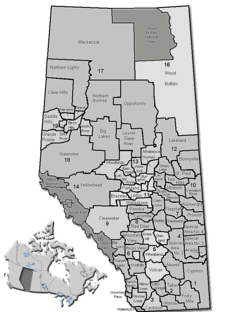 Location of Minburn County No. 27 in Alberta | |
| Coordinates: 53°29′34″N 112°03′8″W / 53.49278°N 112.05222°WCoordinates: 53°29′34″N 112°03′8″W / 53.49278°N 112.05222°W | |
| Country |
|
| Province |
|
| Region | Central Alberta |
| Census division | No. 10 |
| Established | 1942 |
| Incorporated | 1965 (County) |
| Government[1] | |
| • Reeve | Roger Konieczny |
| • Governing body | County of Minburn Council |
| • Office location | Vegreville |
| Area (2011)[2] | |
| • Total | 2,910.71 km2 (1,123.83 sq mi) |
| Population (2011)[2] | |
| • Total | 3,278 |
| • Density | 1.1/km2 (3/sq mi) |
| • Dwellings | 1,270 |
| Time zone | MST (UTC-7) |
| Website |
minburncounty |
The County of Minburn No. 27 is a municipal district in east central Alberta, Canada. Its municipal office is located in the Town of Vegreville. Located in Census Division 10, the County of Minburn No. 27 was formed as a county on January 1, 1965 from the former Municipal District of Minburn No. 72.
Demographics
In the 2011 Census, the County of Minburn No. 27 had a population of 3,278 living in 1,161 of its 1,359 total dwellings, a -1.2% change from its 2006 population of 3,319. With a land area of 2,910.71 km2 (1,123.83 sq mi), it had a population density of 1.1/km2 (2.9/sq mi) in 2011.[2]
In 2006, the County of Minburn No. 27 had a population of 3,319 living in 1,270 dwellings, a 3.4% decrease from 2001. The countyhas a land area of 2,911.14 km2 (1,124.00 sq mi) and a population density of 1.1/km2 (2.8/sq mi).[3]
In 2001, the municipal district had a population of 3,436 in 1,336 dwellings, a 2.6% decrease from 1996. On a surface of 2,910.42 km² it had a density of 1.2 inhabitants/km².[4]
Communities and localities
|
The following urban municipalities are surrounded by the County of Minburn No. 27:[5]
The following hamlets are located within the County of Minburn No. 27:[5] |
The following localities are located within the County of Minburn No. 27:[7]
|
See also
References
- ↑ "Municipal Officials Search". Alberta Municipal Affairs. November 18, 2016. Retrieved November 21, 2016.
- 1 2 3 "Population and dwelling counts, for Canada, provinces and territories, and census subdivisions (municipalities), 2011 and 2006 censuses (Alberta)". Statistics Canada. 2012-02-08. Retrieved 2012-02-08.
- ↑ Statistics Canada. "Canada 2006 Census: County of Minburn No. 27 - Community Profile". Retrieved 2007-06-11.
- ↑ County of Minburn community profile - Statistics Canada. 2002. 2001 Community Profiles. Released June 27, 2002. Last modified: 2005-11-30. Statistics Canada Catalogue no. 93F0053XIE
- 1 2 "Specialized and Rural Municipalities and Their Communities" (PDF). Alberta Municipal Affairs. 2012-03-01. Retrieved 2012-08-11.
- ↑ "O.C. 152/2015". Government of Alberta. June 24, 2015. Retrieved June 30, 2015.
- ↑ "Standard Geographical Classification (SGC) 2006, Economic Regions: 4810026 - Minburn County No. 27, geographical codes and localities, 2006". Statistics Canada. 2010-03-05. Retrieved 2012-08-11.
External links
 |
Lamont County | County of Two Hills No. 21 | | |
| Lamont County | |
County of Vermilion River | ||
| ||||
| | ||||
| Beaver County | Beaver County | Municipal District of Wainwright No. 61 |