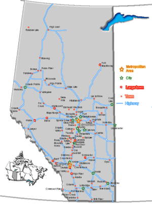
List of communities in Alberta
The Province of Alberta, Canada, is divided into 10 different types of local governments – urban municipalities (including cities, towns, villages and summer villages), specialized municipalities, rural municipalities (including municipal districts/counties, improvement districts and special areas), Métis settlements, and Indian reserves. All types of municipalities are governed by local residents and were incorporated under various provincial acts, with the exception of improvement districts (governed by either the provincial or federal government), and Indian reserves (governed by local First Nations people under federal jurisdiction).
Alberta also has numerous unincorporated communities (including urban service areas, hamlets and a townsite) that are not independent municipalities in their own right. However, they are all recognized as sub-municipal entities by Alberta Municipal Affairs under the jurisdiction of specialized municipalities or rural municipalities, with the exception of the lone townsite (its jurisdiction is shared with an Indian reserve that surrounds it).
With the exception of Métis settlements, Statistics Canada recognizes all of Alberta’s municipalities as census subdivisions and groups them into 19 census divisions based on geography. Within census divisions, Statistics Canada groups some of Alberta’s municipalities/census subdivisions into two census metropolitan areas (CMAs) or 12 census agglomerations (CAs) for enumeration purposes. All CMAs include large urban centres and surrounding census subdivisions. All CAs also include large urban centres and in some cases their surrounding census subdivisions.
With the exception of Indian reserves, the administration of municipalities in Alberta is regulated by the Municipal Government Act,[1] the Special Areas Act[2] and the Metis Settlements Act.[3]
As of 2012, the combined unofficial population of all of Alberta’s municipalities was 3,768,284.[4]
Municipalities
Urban municipalities
Cities
According to Section 82 of the Municipal Government Act (MGA), an area may incorporate as a city if:
- it has a population of 10,000 people or more; and
- the majority of its buildings are on parcels of land smaller than 1,850 m².[1]
Essentially, cities are formed from urban communities with populations of at least 10,000 people.[5]
Alberta currently has a total of 17 cities with a combined population totalling 2,501,817 as of 2012.[4]
| Cities of Alberta | |||||||
|---|---|---|---|---|---|---|---|
| Name | Incorporation date (city)[6] |
Population (2011)[7] |
Population (2006)[7] |
Change (%)[7] |
Land area (km²)[7] |
Population density (per km²)[7] | |
| Airdrie | January 1, 1985 | 42,564 | 28,927 | 47.1 | 33.10 | 1,286.0 | |
| Brooks[AB 1] | September 1, 2005 | 13,676 | 12,508 | 9.3 | 18.19 | 751.9 | |
| Calgary[AB 2] | January 1, 1894 | 1,096,833 | 988,812 | 10.9 | 825.29 | 1,329.0 | |
| Camrose | January 1, 1955 | 17,286 | 15,630 | 10.6 | 42.50 | 406.7 | |
| Chestermere[AB 3] | January 1, 2015[8] | 14,824 | 9,923 | 49.4 | 32.64 | 454.1 | |
| Cold Lake | October 1, 2000 | 13,839 | 11,991 | 15.4 | 59.30 | 233.4 | |
| Edmonton[AB 4] | October 8, 1904 | 812,201 | 730,372 | 11.2 | 684.37 | 1,186.8 | |
| Fort Saskatchewan | July 1, 1985 | 19,051 | 14,957 | 27.4 | 48.12 | 395.9 | |
| Grande Prairie | January 1, 1958 | 55,032 | 47,107 | 16.8 | 72.80 | 755.9 | |
| Lacombe[AB 5] | September 5, 2010 | 11,707 | 10,752 | 8.9 | 20.89 | 560.3 | |
| Leduc | September 1, 1983 | 24,279 | 16,967 | 43.1 | 36.97 | 656.7 | |
| Lethbridge | May 9, 1906 | 83,517 | 74,685 | 11.8 | 122.36 | 682.6 | |
| Lloydminster (part)[AB 6] | January 1, 1958 | 18,032[AB 7] | 15,910 | 13.3 | 24.19[AB 8] | 745.6 | |
| Medicine Hat | May 9, 1906 | 60,005 | 56,997 | 5.3 | 112.01 | 535.7 | |
| Red Deer | March 25, 1913 | 90,564 | 83,154 | 8.9 | 104.29 | 868.4 | |
| Spruce Grove | March 1, 1986 | 26,171 | 19,541 | 33.9 | 32.37 | 808.6 | |
| St. Albert | January 1, 1977 | 61,466 | 57,764 | 6.4 | 48.27 | 1,273.4 | |
| Wetaskiwin | May 9, 1906 | 12,525 | 11,689 | 7.2 | 18.20 | 688.2 | |
| Total cities | — | 2,474,510 | 2,207,686 | 12.1 | 2,335.86 | 1,059.4 | |
Towns
According to Section 81 of the Municipal Government Act (MGA), an area may incorporate as a town if:
- it has a population of 1,000 people or more; and
- the majority of its buildings are on parcels of land smaller than 1,850 m².[1]
Essentially, towns are formed from urban communities with populations of at least 1,000 people. When a town's population exceeds 10,000 people, its council may apply to change its status to that of a city, but the change in incorporated status is not mandatory.[5]
Communities with shrinking populations are allowed to retain town status even if the number of residents falls below the 1,000 limit. Some of Alberta's towns have never reached a population of 1,000 people, but were incorporated as towns before the current requirement to have a population of 1,000 or more.
Alberta currently has a total of 108 towns, with a combined population totalling 458,376 as of 2012.[4]
| Towns of Alberta | |||||||
|---|---|---|---|---|---|---|---|
| Name | Specialized/rural municipality[9] |
Incorporation date (town)[10] |
Population (2011)[7] |
Population (2006)[7] |
Change (%)[7] |
Land area (km²)[7] |
Population density (per km²)[7] |
| Athabasca[N 1] | St. Paul No. 19, County of | December 15, 1936 | 5,400 | 5,106 | 5.8 | 7.89 | 684.7 |
| Stavely | Willow Creek No. 26, M.D. of | May 25, 1912 | 505 | 435 | 16.1 | 1.62 | 311.3 |
| Stettler | Stettler No. 6, County of | November 23, 1906 | 5,748 | 5,445 | 5.6 | 13.12 | 438.2 |
| Stony Plain | Parkland County | December 10, 1908 | 15,051 | 12,363 | 21.7 | 35.61 | 422.7 |
| Strathmore | Wheatland County | July 6, 1911 | 12,305 | 10,280 | 19.7 | 27.28 | 451.0 |
| Sundre | Mountain View County | January 1, 1956 | 2,610 | 2,523 | 3.4 | 11.16 | 233.9 |
| Swan Hills | Big Lakes County | January 1, 1967 | 1,465 | 1,645 | −10.9 | 25.44 | 57.6 |
| Sylvan Lake | Red Deer County | May 20, 1946 | 12,327 | 10,250 | 20.3 | 15.62 | 789.4 |
| Taber | Taber, M.D. of | July 1, 1907 | 8,104 | 7,591 | 6.8 | 15.09 | 537.2 |
| Three Hills | Kneehill County | January 1, 1929 | 3,198 | 3,089 | 3.5 | 5.63 | 567.8 |
| Tofield | Beaver County | September 10, 1909 | 2,182 | 1,876 | 16.3 | 8.17 | 267.1 |
| Trochu | Kneehill County | August 1, 1962 | 1,072 | 1,005 | 6.7 | 2.82 | 380.1 |
| Turner Valley | Foothills No. 31, M.D. of | September 1, 1977 | 2,167 | 1,908 | 13.6 | 5.45 | 397.6 |
| Two Hills | Two Hills No. 21, County of | January 1, 1955 | 1,379 | 1,047 | 31.7 | 3.31 | 416.3 |
| Valleyview | Greenview No. 16, M.D. of | February 5, 1957 | 1,761 | 1,725 | 2.1 | 9.66 | 182.2 |
| Vauxhall | Taber, M.D. of | January 1, 1961 | 1,288 | 1,069 | 20.5 | 2.88 | 447.6 |
| Vegreville | Minburn No. 27, County of | August 15, 1906 | 5,717 | 5,519 | 3.6 | 13.92 | 410.6 |
| Vermilion | Vermilion River, County of | August 27, 1906 | 3,930 | 4,036 | −2.6 | 13.69 | 287.0 |
| Viking | Beaver County | November 10, 1952 | 1,041 | 1,085 | −4.1 | 3.76 | 277.1 |
| Vulcan | Vulcan County | June 15, 1921 | 1,836 | 1,940 | −5.4 | 6.58 | 279.0 |
| Wainwright | Wainwright No. 61, M.D. of | July 14, 1910 | 5,925 | 5,426 | 9.2 | 8.91 | 665.4 |
| Wembley | Grande Prairie No. 1, County of | August 1, 1980 | 1,383 | 1,443 | −4.2 | 4.54 | 304.8 |
| Westlock | Westlock County | January 7, 1947 | 4,823 | 5,008 | −3.7 | 13.57 | 355.3 |
| Whitecourt | Woodlands County | December 20, 1971 | 9,605 | 8,971 | 7.1 | 26.14 | 367.4 |
| Total towns | – | – | 437,006 | 394,739 | 10.7 | 1,241.04 | 352.1 |
Villages
According to Section 80 of the Municipal Government Act (MGA), an area may incorporate as a village if:
- it has a population of 300 people or more; and
- the majority of its buildings are on parcels of land smaller than 1,850 m².[1]
Essentially, villages are formed from urban communities with populations of at least 300 people. When a village's population exceeds 1,000 people, its council may apply to change its status to that of a town, but the change in incorporated status is not mandatory.
Communities with shrinking populations are allowed to retain village status even if the number of residents falls below the 300 limit. Some of Alberta's villages have never reached a population of 300 people, but were incorporated as villages before there was a requirement to have a population of 300 or more.
Alberta currently has a total of 95 villages, with a combined population totalling 39,546 as of 2012.[4] These numbers reflect the recent dissolution of the villages of Derwent and New Sarepta to hamlet status on September 1, 2010.[13][14]
| Villages of Alberta | |||||||
|---|---|---|---|---|---|---|---|
| Name | Rural municipality[9] |
Incorporation date (village)[10] |
Population (2011)[7] |
Population (2006)[7] |
Change (%)[7] |
Land area (km²)[7] |
Population density (per km²)[7] |
| Acme | Kneehill County | July 7, 1910 | 653 | 656 | −0.5 | 2.47 | 263.9 |
| Alberta Beach | Lac Ste. Anne County | January 1, 1999 | 865 | 884 | −2.1 | 1.98 | 436.7 |
| Alix | Lacombe County | June 3, 1907 | 830 | 851 | −2.5 | 3.15 | 263.4 |
| Alliance | Flagstaff County | August 26, 1918 | 174 | 158 | 10.1 | 0.64 | 270.1 |
| Amisk | Provost No. 52, M.D. of | January 1, 1956 | 207 | 172 | 20.3 | 0.76 | 272.2 |
| Andrew | Lamont County | June 24, 1930 | 379 | 465 | −18.5 | 1.23 | 308.7 |
| Arrowwood | Vulcan County | May 13, 1926 | 188 | 221 | −14.9 | 0.66 | 286.1 |
| Barnwell | Taber, M.D. of | January 1, 1980 | 771 | 618 | 24.8 | 1.49 | 517.2 |
| Barons | Lethbridge County | May 6, 1910 | 315 | 276 | 14.1 | 0.68 | 462.2 |
| Bawlf | Camrose County | October 12, 1906 | 403 | 367 | 9.8 | 0.96 | 418.5 |
| Beiseker | Rocky View County | February 23, 1921 | 785 | 804 | −2.4 | 2.84 | 276.8 |
| Berwyn | Peace No. 135, M.D. of | November 28, 1936 | 526 | 516 | 1.9 | 1.66 | 316.7 |
| Big Valley | Stettler No. 6, County of | March 9, 1942 | 364 | 351 | 3.7 | 1.84 | 198.3 |
| Bittern Lake[N 5] | Camrose County | November 2, 1904 | 224 | 225 | −0.4 | 6.64 | 33.7 |
| Botha | Stettler No. 6, County of | September 5, 1911 | 175 | 185 | −5.4 | 1.09 | 160.7 |
| Boyle | Athabasca County | December 31, 1953 | 916 | 854 | 7.3 | 7.28 | 125.8 |
| Breton | Brazeau County | January 1, 1957 | 496 | 550 | −9.8 | 1.73 | 286.5 |
| Carbon | Kneehill County | November 18, 1912 | 592 | 570 | 3.9 | 2.00 | 295.6 |
| Carmangay | Vulcan County | March 4, 1936 | 367 | 336 | 9.2 | 1.86 | 197.1 |
| Caroline | Clearwater County | December 31, 1951 | 501 | 515 | −2.7 | 1.98 | 252.8 |
| Cereal | Special Area No. 3 | August 19, 1914 | 134 | 126 | 6.3 | 0.95 | 141.6 |
| Champion | Vulcan County | May 27, 1911 | 378 | 364 | 3.8 | 0.88 | 429.7 |
| Chauvin | Wainwright No. 61, M.D. of | December 30, 1912 | 334 | 308 | 8.4 | 2.32 | 143.9 |
| Chipman | Lamont County | October 21, 1913 | 284 | 253 | 12.3 | 9.61 | 29.5 |
| Clive | Lacombe County | January 9, 1912 | 675 | 562 | 20.1 | 2.12 | 318.3 |
| Clyde | Westlock County | January 28, 1914 | 503 | 470 | 7.0 | 1.36 | 370.7 |
| Consort | Special Area No. 4 | September 23, 1912 | 689 | 739 | −6.8 | 2.83 | 243.3 |
| Coutts | Warner No. 5, County of | January 1, 1960 | 277 | 305 | −9.2 | 0.98 | 283.3 |
| Cowley | Pincher Creek No. 9, M.D. of | August 16, 1906 | 236 | 219 | 7.8 | 1.40 | 168.8 |
| Cremona | Mountain View County | January 1, 1955 | 457 | 463 | −1.3 | 1.71 | 267.8 |
| Czar | Provost No. 52, M.D. of | November 12, 1917 | 167 | 175 | −4.6 | 1.18 | 141.6 |
| Delburne | Red Deer County | January 17, 1913 | 830 | 765 | 8.5 | 3.92 | 211.5 |
| Delia[N 6] | Starland County | July 20, 1914 | 186 | 207 | −10.1 | 1.31 | 142.5 |
| Dewberry | Vermilion River, County of | January 1, 1957 | 201 | 196 | 2.6 | 0.84 | 238.5 |
| Donalda | Stettler No. 6, County of | December 30, 1912 | 259 | 224 | 15.6 | 0.99 | 262.3 |
| Donnelly | Smoky River No. 130, M.D. of | January 1, 1956 | 305 | 293 | 4.1 | 1.27 | 239.9 |
| Duchess | Newell, County of | May 12, 1921 | 992 | 978 | 1.4 | 1.89 | 526.2 |
| Edberg | Camrose County | February 4, 1930 | 168 | 155 | 8.4 | 0.36 | 470.9 |
| Edgerton | Wainwright No. 61, M.D. of | September 11, 1917 | 317 | 373 | −15.0 | 1.89 | 168.1 |
| Elnora | Red Deer County | July 22, 1929 | 313 | 280 | 11.8 | 1.48 | 210.9 |
| Empress | Special Area No. 2 | February 5, 1914 | 188 | 136 | 38.2 | 1.75 | 107.6 |
| Ferintosh | Camrose County | January 9, 1911 | 181 | 153 | 18.3 | 0.62 | 290.2 |
| Foremost | Forty Mile No. 8, County of | December 31, 1950 | 526 | 524 | 0.4 | 1.89 | 277.8 |
| Forestburg | Flagstaff County | August 21, 1919 | 831 | 895 | −7.2 | 2.75 | 302.0 |
| Gadsby | Stettler No. 6, County of | May 6, 1910 | 25 | 35 | −28.6 | 0.82 | 30.5 |
| Girouxville | Smoky River No. 130, M.D. of | December 31, 1951 | 266 | 282 | −5.7 | 0.58 | 461.2 |
| Glendon | Bonnyville No. 87, M.D. of | January 1, 1956 | 486 | 421 | 15.4 | 1.98 | 245.1 |
| Glenwood | Cardston County | January 1, 1961 | 287 | 280 | 2.5 | 1.46 | 197.2 |
| Halkirk | Paintearth No. 18, County of | February 10, 1912 | 121 | 113 | 7.1 | 0.65 | 185.7 |
| Hay Lakes[N 7] | Camrose County | April 17, 1928 | 425 | 362 | 17.4 | 0.58 | 730.1 |
| Heisler | Flagstaff County | January 1, 1961 | 151 | 153 | −1.3 | 0.76 | 199.9 |
| Hill Spring | Cardston County | January 1, 1961 | 186 | 192 | −3.1 | 1.11 | 167.2 |
| Hines Creek | Clear Hills County | December 31, 1951 | 380 | 430 | −11.6 | 4.37 | 86.9 |
| Holden | Beaver County | April 14, 1909 | 381 | 398 | −4.3 | 1.70 | 224.3 |
| Hughenden | Provost No. 52, M.D. of | December 27, 1917 | 230 | 231 | −0.4 | 0.78 | 296.6 |
| Hussar | Wheatland County | April 20, 1928 | 176 | 187 | −5.9 | 0.99 | 177.8 |
| Hythe | Grande Prairie No. 1, County of | August 31, 1929 | 820 | 821 | −0.1 | 4.12 | 198.8 |
| Innisfree | Minburn No. 27, County of | March 11, 1911 | 220 | 233 | −5.6 | 1.27 | 172.6 |
| Irma | Wainwright No. 61, M.D. of | May 30, 1912 | 457 | 444 | 2.9 | 1.11 | 410.7 |
| Kitscoty | Vermilion River, County of | March 22, 1911 | 846 | 709 | 19.3 | 1.54 | 549.8 |
| Linden | Kneehill County | January 1, 1964 | 725 | 660 | 9.8 | 2.56 | 283.3 |
| Lomond | Vulcan County | February 16, 1916 | 173 | 175 | −1.1 | 1.28 | 134.9 |
| Longview | Foothills No. 31, M.D. of | January 1, 1964 | 307 | 300 | 2.3 | 1.09 | 282.1 |
| Lougheed | Flagstaff County | November 7, 1911 | 233 | 217 | 7.4 | 1.92 | 121.5 |
| Mannville | Minburn No. 27, County of | December 29, 1906 | 803 | 782 | 2.7 | 2.15 | 373.6 |
| Marwayne | Vermilion River, County of | December 31, 1952 | 612 | 521 | 17.5 | 1.68 | 364.5 |
| Milo | Vulcan County | May 7, 1931 | 122 | 100 | 22.0 | 1.04 | 116.9 |
| Morrin | Starland County | April 16, 1920 | 245 | 253 | −3.2 | 0.82 | 298.9 |
| Munson | Starland County | May 5, 1911 | 204 | 217 | −6.0 | 2.60 | 78.5 |
| Myrnam | Two Hills No. 21, County of | August 22, 1930 | 370 | 362 | 2.2 | 2.76 | 134.2 |
| Nampa | Northern Sunrise County | January 1, 1958 | 362 | 360 | 0.6 | 1.86 | 194.9 |
| Nobleford | Lethbridge County | February 28, 1918 | 1,000 | 689 | 45.1 | 1.54 | 647.8 |
| Paradise Valley | Vermilion River, County of | January 1, 1964 | 174 | 183 | −4.9 | 0.57 | 306.9 |
| Rockyford | Wheatland County | March 28, 1919 | 325 | 349 | −6.9 | 1.08 | 300.0 |
| Rosalind | Camrose County | January 1, 1966 | 190 | 190 | 0.0 | 0.59 | 322.2 |
| Rosemary | Newell, County of | December 31, 1951 | 342 | 388 | −11.9 | 0.56 | 607.8 |
| Rycroft | Spirit River No. 133, M.D. of | March 15, 1944 | 628 | 638 | −1.6 | 1.69 | 372.5 |
| Ryley[N 8] | Beaver County | April 2, 1910 | 497 | 458 | 8.5 | 1.97 | 251.9 |
| Spring Lake[N 9] | Parkland County | January 1, 1999 | 533 | 501 | 6.4 | 2.12 | 251.5 |
| Standard | Wheatland County | April 29, 1922 | 379 | 380 | −0.3 | 2.34 | 162.1 |
| Stirling[N 10] | Warner No. 5, County of | September 3, 1901 | 1,090 | 921 | 18.3 | 2.64 | 413.6 |
| Thorsby | Leduc County | December 31, 1949 | 951[19] | 945 | 0.6 | 3.87 | 245.7 |
| Veteran | Special Area No. 4 | June 30, 1914 | 249 | 293 | −15.0 | 0.84 | 297.0 |
| Vilna | Smoky Lake County | June 23, 1923 | 249 | 274 | −9.1 | 0.90 | 277.5 |
| Wabamun | Parkland County | January 1, 1980 | 661 | 601 | 10.0 | 3.24 | 203.8 |
| Warburg | Leduc County | December 31, 1953 | 789 | 621 | 27.1 | 2.70 | 292.6 |
| Warner | Warner No. 5, County of | November 12, 1908 | 331 | 307 | 7.8 | 1.15 | 288.5 |
| Waskatenau | Smoky Lake County | May 19, 1932 | 255 | 278 | −8.3 | 0.60 | 427.6 |
| Willingdon | Two Hills No. 21, County of | August 31, 1928 | 275 | 295 | −6.8 | 0.97 | 283.8 |
| Youngstown | Special Area No. 3 | December 31, 1936 | 178 | 170 | 4.7 | 1.00 | 177.7 |
| Total villages | – | – | 38,223 | 36,837 | 3.8 | 163.87 | 233.3 |
Summer villages
According to former Section 79 of the Municipal Government Act (MGA), a summer village is an area that:
- has at least 60 parcels of land developed with dwelling buildings; and
- has a population of less than 300 persons where the majority of the persons who would be electors do not permanently reside in that area.
As a result of Section 79 being repealed,[1] summer villages can no longer be formed in Alberta.[5]
Essentially, summer villages were once formed from urban communities with populations of less than 300 people and significant non-permanent populations. When a summer village's population exceeds 300 people, its council may apply to change its status to that of a village, but the change in incorporated status is not mandatory.
Alberta currently has a total of 51 summer villages, with a combined population totalling 4,726 as of 2012.[4]
| Summer villages of Alberta | |||||||
|---|---|---|---|---|---|---|---|
| Name | Rural municipality[9] | Incorporation date (summer village)[10] |
Population (2011)[7] |
Population (2006)[7] |
Change (%)[7] |
Land area (km²)[7] |
Population density (per km²)[7] |
| Argentia Beach | Wetaskiwin No. 10, County of | January 1, 1967 | 15 | 52 | −71.2 | 0.69 | 21.6 |
| Betula Beach | Parkland County | January 1, 1960 | 10 | 15 | −33.3 | 0.18 | 54.5 |
| Birch Cove | Lac Ste. Anne County | December 31, 1988 | 45 | 38 | 18.4 | 0.29 | 157.8 |
| Birchcliff | Lacombe County | January 1, 1972 | 112 | 125 | −10.4 | 0.98 | 114.0 |
| Bondiss | Athabasca County | January 1, 1983 | 106 | 131 | −19.1 | 1.33 | 79.9 |
| Bonnyville Beach | Bonnyville No. 87, M.D. of | January 1, 1958 | 95 | 97 | −2.1 | 0.38 | 253.2 |
| Burnstick Lake | Clearwater County | December 31, 1991 | 16 | 43 | −62.8 | 0.18 | 89.9 |
| Castle Island | Lac Ste. Anne County | January 1, 1955 | 19 | 22 | −13.6 | 0.05 | 361.9 |
| Crystal Springs | Wetaskiwin No. 10, County of | January 1, 1957 | 90 | 112 | −19.6 | 0.58 | 156.0 |
| Ghost Lake | Bighorn No. 8, M.D. of | December 31, 1953 | 81 | 78 | 3.8 | 0.63 | 129.4 |
| Golden Days | Leduc County | January 1, 1965 | 141 | 207 | −31.9 | 2.27 | 62.0 |
| Grandview | Wetaskiwin No. 10, County of | January 1, 1967 | 108 | 127 | −15.0 | 0.80 | 135.6 |
| Gull Lake | Lacombe County | September 1, 1993 | 122 | 204 | −40.2 | 0.70 | 174.9 |
| Half Moon Bay | Lacombe County | January 1, 1978 | 38 | 32 | 18.8 | 0.17 | 229.2 |
| Horseshoe Bay | St. Paul No. 19, County of | January 1, 1985 | 37 | 214 | −82.7 | 1.04 | 35.4 |
| Island Lake | Athabasca County | January 1, 1958 | 243 | 351 | −30.8 | 1.45 | 167.8 |
| Island Lake South | Athabasca County | January 1, 1983 | 72 | 105 | −31.4 | 0.63 | 114.3 |
| Itaska Beach | Leduc County | June 30, 1953 | 20 | 35 | −42.9 | 0.28 | 70.8 |
| Jarvis Bay | Red Deer County | January 1, 1986 | 203 | 183 | 10.9 | 0.55 | 371.1 |
| Kapasiwin | Parkland County | September 1, 1993 | 10 | 15[20] | −33.3 | 0.31 | 32.3 |
| Lakeview | Parkland County | October 25, 1913 | 26 | 36 | −27.8 | 0.33 | 78.8 |
| Larkspur | Westlock County | January 1, 1985 | 38 | 56 | −32.1 | 0.22 | 172.0 |
| Ma-Me-O Beach | Wetaskiwin No. 10, County of | December 31, 1948 | 113 | 155 | −27.1 | 0.65 | 173.4 |
| Mewatha Beach | Athabasca County | January 1, 1978 | 79 | 167 | −52.7 | 0.78 | 101.9 |
| Nakamun Park | Lac Ste. Anne County | January 1, 1966 | 36 | 88 | −59.1 | 0.41 | 88.7 |
| Norglenwold | Red Deer County | January 1, 1965 | 232 | 270 | −14.1 | 0.67 | 345.2 |
| Norris Beach | Wetaskiwin No. 10, County of | December 31, 1988 | 46 | 40 | 15.0 | 0.16 | 285.5 |
| Parkland Beach | Ponoka County | January 1, 1984 | 124 | 135 | −8.1 | 0.93 | 133.8 |
| Pelican Narrows | Bonnyville No. 87, M.D. of | July 1, 1979 | 162 | 141 | 14.9 | 0.70 | 230.0 |
| Point Alison | Parkland County | December 31, 1950 | 15 | 15 | 0.0 | 0.16 | 92.9 |
| Poplar Bay | Wetaskiwin No. 10, County of | January 1, 1967 | 80 | 84 | −4.8 | 0.79 | 101.0 |
| Rochon Sands | Stettler No. 6, County of | May 17, 1929 | 65[19] | 66 | −1.5 | 2.32 | 28.0 |
| Ross Haven | Lac Ste. Anne County | January 1, 1962 | 137 | 198 | −30.8 | 0.70 | 194.5 |
| Sandy Beach | Lac Ste. Anne County | January 1, 1956 | 223 | 239 | −6.7 | 2.43 | 91.8 |
| Seba Beach | Parkland County | August 20, 1920 | 143 | 203 | −29.6 | 0.71 | 201.1 |
| Silver Beach | Wetaskiwin No. 10, County of | December 31, 1953 | 52 | 47 | 10.6 | 0.66 | 78.2 |
| Silver Sands | Lac Ste. Anne County | January 1, 1969 | 85 | 173 | −50.9 | 2.35 | 36.2 |
| South Baptiste | Athabasca County | January 1, 1983 | 52 | 69 | −24.6 | 1.05 | 49.6 |
| South View | Lac Ste. Anne County | January 1, 1970 | 35 | 115 | −69.6 | 0.69 | 51.0 |
| Sunbreaker Cove | Lacombe County | December 31, 1990 | 69 | 137 | −49.6 | 0.49 | 140.6 |
| Sundance Beach | Leduc County | January 1, 1970 | 82 | 102 | −19.6 | 0.42 | 196.2 |
| Sunrise Beach | Lac Ste. Anne County | December 31, 1988 | 149 | 170 | −12.4 | 1.72 | 86.4 |
| Sunset Beach | Athabasca County | May 1, 1977 | 44 | 88 | −50.0 | 0.99 | 44.4 |
| Sunset Point | Lac Ste. Anne County | January 1, 1959 | 221 | 242 | −8.7 | 1.11 | 198.6 |
| Val Quentin | Lac Ste. Anne County | January 1, 1966 | 157 | 181 | −13.3 | 0.30 | 522.5 |
| Waiparous | Bighorn No. 8, M.D. of | January 1, 1986 | 42 | 49 | −14.3 | 0.41 | 103.0 |
| West Baptiste | Athabasca County | January 1, 1983 | 52 | 104 | −50.0 | 0.60 | 86.2 |
| West Cove | Lac Ste. Anne County | January 1, 1963 | 121 | 169 | −28.4 | 1.21 | 100.1 |
| Whispering Hills | Athabasca County | January 1, 1983 | 108 | 125 | −13.6 | 1.73 | 62.3 |
| White Sands | Stettler No. 6, County of | January 1, 1980 | 91 | 120 | −24.2 | 1.60 | 57.0 |
| Yellowstone | Lac Ste. Anne County | January 1, 1965 | 124 | 170 | −27.1 | 0.28 | 438.5 |
| Total summer villages | – | – | 4,586 | 6,140 | −25.3 | 41.06 | 111.7 |
Specialized municipalities
According to Section 83 of the Municipal Government Act (MGA), a municipality may incorporate as a specialized municipality under one of the following three scenarios:
- where the Minister of Alberta Municipal Affairs (AMA) is satisfied that the other incorporated statuses under the MGA do not meet the needs of the municipality's residents;
- to form a local government that, in the opinion of the Minister of AMA, will provide for the orderly development of the municipality in a similar fashion to the other incorporated statuses within the MGA; or
- for any other circumstances that are deemed appropriate by the Minister of AMA.[1]
Essentially, specialized municipalities are municipalities that are unconventional in nature compared to other municipalities in Alberta, and they are incorporated under the authority of the existing MGA instead of relying on the creation of their own separate acts (i.e., the Special Areas Act[2] allowed the incorporation of Alberta's three special areas and the Metis Settlements Act[3] allowed the incorporation of Alberta's eight Métis settlements).[5]
Alberta's five specialized municipalities have a combined population totalling 230,625 as of 2012.[4]
| Specialized municipalities of Alberta | ||||||
|---|---|---|---|---|---|---|
| Name | Incorporation date (specialized municipality)[21] |
Population (2011)[22] |
Population (2006)[22] |
Change (%)[22] |
Land area (km²)[22] |
Population density (per km²)[22] |
| Crowsnest Pass, Municipality of | January 16, 2008 | 5,565 | 5,749 | −3.2 | 373.07 | 14.9 |
| Jasper, Municipality of | July 20, 2001 | 4,432[19] | 4,265 | 3.9 | 925.52 | 4.8 |
| Mackenzie County | June 23, 1999 | 10,927 | 10,002 | 9.2 | 80,478.12 | 0.1 |
| Strathcona County | January 1, 1996 | 92,490 | 82,511 | 12.1 | 1,180.56 | 78.3 |
| Wood Buffalo, Regional Municipality of | April 1, 1995 | 65,565 | 51,924[20] | 26.3 | 63,637.47 | 1.0 |
| Total specialized municipalities | — | 178,979 | 154,451 | 15.9 | 146,594.74 | 1.2 |
Rural municipalities
Municipal districts
According to Section 78 of the Municipal Government Act (MGA), a municipal district is an area in which:
- the majority of the buildings used as dwellings are on parcels of land with an area of at least 1,850 m²; and
- there is a population of 1,000 or more.[1]
Essentially, municipal districts are large rural areas in which their citizens reside on farms, country residential subdivisions or unincorporated communities (i.e., hamlets, localities and other settlements).[5]
In Alberta, the term county is synonymous with the term municipal district – it is not its own incorporated municipal status that is different from that of a municipal district. As such, Alberta Municipal Affairs provides municipal districts with the opportunity to brand themselves either as municipal districts or counties in their official names.
Of Alberta's 64 municipal districts, 46 of them brand themselves as counties. Over the past decade, Alberta has observed a trend of numerous municipal districts rebranding themselves as counties through official name changes. Some of the reasons why a municipal district would rebrand itself as a county include that the term county is: more recognizable by the general public; has a more modern and progressive appeal; and is more marketable from an economic development perspective.
The last municipal district (M.D.) to rebrand itself as a county was the M.D. of Northern Lights No. 22, which was renamed as the County of Northern Lights on February 3, 2010.[23]
Alberta's 64 municipal districts have a combined population totalling 453,346 as of 2012.[4]
| Municipal districts of Alberta | |||||||||
|---|---|---|---|---|---|---|---|---|---|
| Name | Incorporation date (municipal district)[24] |
Census division |
Council size[24] |
Municipal census population (year)[25] |
Population (2011)[22] |
Population (2006)[22] |
Change (%)[22] |
Land area (km²)[22] |
Population density (per km2)[22] |
| MD of Acadia No. 34 | December 9, 1913 | 4 | 5 | 495 | 545 | −9.2 | 1,076.26 | 0.5 | |
| Athabasca County | January 1, 1947 | 13 | 9 | 7,662 | 7,572 | 1.2 | 6,122.75 | 1.3 | |
| County of Barrhead No. 11 | January 1, 1955 | 13 | 7 | 6,096 | 5,845 | 4.3 | 2,404.7 | 2.5 | |
| Beaver County | February 1, 1943 | 10 | 5 | 5,689 | 5,676 | 0.2 | 3,315.84 | 1.7 | |
| Big Lakes County | January 1, 1995 | 17 | 9 | 3,861 (2013) | 5,912 | 5,989 | −1.3 | 13,928.13 | 0.4 |
| MD of Bighorn No. 8 | January 1, 1988 | 15 | 5 | 1,341 | 1,264 | 6.1 | 2,767.94 | 0.5 | |
| Birch Hills County | January 1, 1995 | 19 | 7 | 1,582 | 1,470 | 7.6 | 2,856.69 | 0.6 | |
| MD of Bonnyville No. 87 | January 1, 1955 | 12 | 7 | 11,836 (2014) | 11,191 | 10,194 | 9.8 | 6,057.44 | 1.8 |
| Brazeau County | July 1, 1988 | 11 | 7 | 7,201 | 7,040 | 2.3 | 3,020.71 | 2.4 | |
| Camrose County | January 1, 1944 | 10 | 7 | 7,721 | 7,150 | 8 | 3,320.61 | 2.3 | |
| Cardston County | January 1, 1954 | 3 | 7 | 4,167 | 4,037 | 3.2 | 3,414.87 | 1.2 | |
| Clear Hills County | January 1, 1995 | 17 | 7 | 2,829 (2012) | 2,801 | 2,714 | 3.2 | 15,115.03 | 0.2 |
| Clearwater County | January 1, 1985 | 9 | 7 | 12,278 | 11,826 | 3.8 | 18,691.78 | 0.7 | |
| Cypress County | January 1, 1985 | 1 | 9 | 7,214 | 6,709 | 7.5 | 13,160.44 | 0.5 | |
| MD of Fairview No. 136 | December 9, 1914 | 19 | 5 | 1,673 | 1,432 | 16.8 | 1,389.01 | 1.2 | |
| Flagstaff County | January 1, 1944 | 7 | 7 | 3,244 | 3,506 | −7.5 | 4,065.56 | 0.8 | |
| MD of Foothills No. 31 | January 1, 1954 | 6 | 7 | 21,258 | 19,731 | 7.7 | 3,642.9 | 5.8 | |
| County of Forty Mile No. 8 | January 1, 1954 | 1 | 7 | 3,336 | 3,414 | −2.3 | 7,229.68 | 0.5 | |
| County of Grande Prairie No. 1 | December 21, 1943 | 19 | 9 | 20,347 | 17,929 | 13.5 | 5,862.74 | 3.5 | |
| MD of Greenview No. 16 | January 1, 1994 | 18 | 8 | 5,299 | 5,464 | −3 | 32,989.05 | 0.2 | |
| Kneehill County | January 1, 1944 | 5 | 7 | 4,921 | 5,218 | −5.7 | 3,380.04 | 1.5 | |
| Lac La Biche County | August 1, 2007 | 12 | 9 | 9,094 (2013) | 8,402 | 9,123 | −7.9 | 16,300.95 | 0.5 |
| Lac Ste. Anne County | January 1, 1944 | 13 | 7 | 10,260 | 9,880 | 3.8 | 2,845.61 | 3.6 | |
| Lacombe County | January 1, 1944 | 8 | 7 | 10,312 | 10,394 | −0.8 | 2,766.65 | 3.7 | |
| Lamont County | January 1, 1944 | 10 | 5 | 3,872 | 3,905 | −0.8 | 2,385.91 | 1.6 | |
| Leduc County | January 1, 1944 | 11 | 7 | 13,524[19] | 13,135 | 3.0 | 2,607.56 | 5.2 | |
| MD of Lesser Slave River No. 124 | January 1, 1995 | 17 | 7 | 2,929 | 2,820 | 3.9 | 10,075.88 | 0.3 | |
| Lethbridge County | January 1, 1954 | 2 | 7 | 10,061 | 10,254 | −1.9 | 2,837.8 | 3.5 | |
| County of Minburn No. 27 | January 30, 1942 | 10 | 7 | 3,278 | 3,319 | −1.2 | 2,910.71 | 1.1 | |
| Mountain View County | January 1, 1944 | 6 | 7 | 12,359 | 12,308 | 0.4 | 3,779.34 | 3.3 | |
| County of Newell | January 1, 1953 | 2 | 10 | 6,786 | 6,852 | −1 | 5,904.72 | 1.1 | |
| County of Northern Lights | January 1, 1995 | 17 | 7 | 4,117 | 3,772 | 9.1 | 20,744.41 | 0.2 | |
| Northern Sunrise County | April 1, 1994 | 17 | 6 | 1,933 (2013) | 1,791 | 1,747 | 2.5 | 21,141.25 | 0.1 |
| MD of Opportunity No. 17 | August 1, 1995 | 17 | 11 | 3,214 (2015) | 3,074 | 2,847 | 8 | 29,140.78 | 0.1 |
| County of Paintearth No. 18 | January 1, 1944 | 7 | 7 | 2,029 | 2,126 | −4.6 | 3,287.24 | 0.6 | |
| Parkland County | January 1, 1969 | 11 | 7 | 30,568 | 29,220 | 4.6 | 2,387.68 | 12.8 | |
| MD of Peace No. 135 | December 11, 1916 | 19 | 5 | 1,466[19] | 1,487 | −1.4 | 850.88 | 1.7 | |
| MD of Pincher Creek No. 9 | January 1, 1944 | 3 | 5 | 3,158 | 3,309 | −4.6 | 3,480.91 | 0.9 | |
| Ponoka County | January 1, 1952 | 8 | 5 | 8,856 | 8,640 | 2.5 | 2,807.94 | 3.2 | |
| MD of Provost No. 52 | March 1, 1943 | 7 | 7 | 2,288 | 2,547 | −10.2 | 3,625.2 | 0.6 | |
| MD of Ranchland No. 66 | January 1, 1995 | 15 | 3 | 104 (2013) | 79 | 86 | −8.1 | 2,639.16 | 0 |
| Red Deer County | January 1, 1944 | 8 | 7 | 18,351 | 18,649 | −1.6 | 3,949 | 4.6 | |
| Rocky View County | January 1, 1955 | 6 | 9 | 38,055[26] (2013) | 36,461 | 33,173 | 9.9 | 3,885.41 | 9.4 |
| Saddle Hills County | January 1, 1995 | 19 | 7 | 2,288 | 2,458 | −6.9 | 5,836.92 | 0.4 | |
| Smoky Lake County | March 1, 1943 | 12 | 5 | 3,910 | 3,357 | 16.5 | 3,412.81 | 1.1 | |
| MD of Smoky River No. 130 | January 1, 1952 | 19 | 6 | 2,126 | 2,442 | −12.9 | 2,842.59 | 0.7 | |
| MD of Spirit River No. 133 | December 11, 1916 | 19 | 4 | 713 | 662 | 7.7 | 684.14 | 1 | |
| County of St. Paul No. 19 | January 30, 1942 | 12 | 7 | 6,168 (2012) | 5,831 | 5,925 | −1.6 | 3,296.72 | 1.8 |
| Starland County | February 1, 1943 | 5 | 5 | 2,071 (2013) | 2,057 | 2,371 | −13.2 | 2,557.7 | 0.8 |
| County of Stettler No. 6 | March 1, 1943 | 7 | 7 | 5,103[19] | 5,189 | −1.7 | 4,005.1 | 1.3 | |
| Sturgeon County | January 1, 1955 | 11 | 7 | 19,578 | 18,566 | 5.5 | 2,088.55 | 9.4 | |
| MD of Taber | January 1, 1954 | 2 | 7 | 7,116 (2013) | 6,851 | 6,275 | 9.2 | 4,203.79 | 1.6 |
| Thorhild County | January 1, 1955 | 13 | 5 | 3,417 | 3,547 | −3.7 | 2,000.05 | 1.7 | |
| County of Two Hills No. 21 | January 1, 1944 | 10 | 5 | 3,160 | 2,918 | 8.3 | 2,631.33 | 1.2 | |
| County of Vermilion River | January 1, 1944 | 10 | 7 | 8,116 (2015) | 7,905 | 7,462 | 5.9 | 5,518.18 | 1.4 |
| Vulcan County | January 1, 1951 | 5 | 7 | 3,839 (2012) | 3,875 | 3,718 | 4.2 | 5,429.5 | 0.7 |
| MD of Wainwright No. 61 | January 30, 1942 | 7 | 7 | 4,138 | 3,558 | 16.3 | 4,153.72 | 1 | |
| County of Warner No. 5 | January 1, 1954 | 2 | 7 | 3,841 | 3,654 | 5.1 | 4,517.67 | 0.9 | |
| Westlock County | February 1, 1943 | 13 | 7 | 7,644 | 6,910 | 10.6 | 3,170.71 | 2.4 | |
| County of Wetaskiwin No. 10 | February 1, 1943 | 11 | 7 | 10,866 | 10,519 | 3.3 | 3,129.4 | 3.5 | |
| Wheatland County | January 1, 1955 | 5 | 7 | 8,285 | 8,109 | 2.2 | 4,539.26 | 1.8 | |
| MD of Willow Creek No. 26 | January 1, 1954 | 3 | 7 | 5,107 | 5,337 | −4.3 | 4,558.89 | 1.1 | |
| Woodlands County | January 1, 1994 | 13 | 7 | 4,612 (2014) | 4,306 | 4,158 | 3.6 | 7,668.31 | 0.6 |
| Yellowhead County | January 1, 1994 | 14 | 9 | 10,469 | 10,045 | 4.2 | 22,296.26 | 0.5 | |
| Total municipal districts | — | — | 437 | — | 456,899 | 441,498 | 3.5 | 402,708.76 | 1.1 |
Improvement districts
According to Section 581 of the Municipal Government Act (MGA), Alberta's Lieutenant Governor in Council, on the recommendation of the Minister of Municipal Affairs, may form an improvement district. Section 582 of the MGA requires that the order to form an improvement district must describe its boundaries and give it an official name.
Alberta currently has eight improvement districts, which have a combined population totaling 2,146.[22] Five of them are located within national parks, and two are within provincial parks.
| Improvement districts of Alberta | ||||||||
|---|---|---|---|---|---|---|---|---|
| Name | Incorporation date (improvement district)[27] |
Population (2011)[22] |
Population (2006)[22] |
Change (%)[22] | Land area (km²)[22] |
Population density (per km²)[22] |
Remarks | |
| Improvement District No. 4 (Waterton) | January 1, 1944 | 88 | 160 | −45.0 | 480.58 | 0.18 | Coincident with Waterton Lakes National Park | |
| Improvement District No. 9 (Banff) | April 1, 1945 | 1,175 | 938 | 25.3 | 6,782.23 | 0.17 | Coincident with Banff National Park excluding the Town of Banff | |
| Improvement District No. 12 (Jasper National Park) | April 1, 1945 | 34 | 24 | 41.7 | 10,181.58 | 0.003 | Coincident with Jasper National Park excluding the Municipality of Jasper | |
| Improvement District No. 13 (Elk Island) | April 1, 1958 | 10 | 21 | −52.4 | 165.28 | 0.06 | Coincident with Elk Island National Park | |
| Improvement District No. 24 (Wood Buffalo) | January 1, 1967 | 590 | 422 | 39.8 | 33,412.25 | 0.02 | Coincident with the Alberta portion of Wood Buffalo National Park excluding Peace Point 222 | |
| Improvement District No. 25 (Willmore Wilderness) | January 2, 1994 | 0 | 0 | — | 4,604.97 | 0.0 | Coincident with Willmore Wilderness Park | |
| Improvement District No. 349 | January 1, 2012 | 0[28] | — | — | 5,804.56 | 0.0 | Consists mostly of the Alberta portion of the Cold Lake Air Weapons Range | |
| Kananaskis Improvement District | January 1, 1983 | 249 | 429 | −42.0 | 4,210.72 | 0.06 | Consists mostly of Kananaskis Country | |
| Total improvement districts | — | 2,146 | 1,994 | 7.6 | 65,642.17 | 0.03 | — | |
In September 2011, the Province of Alberta approved the formation of a new improvement district named Improvement District No. 349.[29] It is located north of the City of Cold Lake and includes the Cold Lake Air Weapons Range from Lac La Biche County and some adjacent lands further to the north from the Regional Municipality of Wood Buffalo.[29][30][31] The effective incorporation date of Improvement District No. 349 was January 1, 2012.[29]
Special areas
Special areas are rural municipalities created in 1938 under the authority of the Special Areas Act.[2][5] A special area is not to be confused with a specialized municipality, which is a completely different municipal status.
Alberta's three special areas had a combined population totalling 4,499 in 2011.[4]
| Special areas of Alberta | |||||||
|---|---|---|---|---|---|---|---|
| Name | Incorporation date (special area)[32] |
Population (2011)[22] |
Population (2006)[22] |
Change (%)[22] | Area (km²)[22] | Population density (/km²)[22] | |
| Special Area No. 2 | April 7, 1959 | 2,025 | 2,074 | −2.4 | 9,342.42 | 0.22 | |
| Special Area No. 3 | April 7, 1959 | 1,122 | 1,266 | −11.4 | 6,623.96 | 0.17 | |
| Special Area No. 4 | January 1, 1969 | 1,352 | 1,389 | −2.7 | 4,403.03 | 0.31 | |
| Total special areas | — | 4,499 | 4,729 | −4.9 | 20,369.41 | 0.22 | |
Unincorporated communities
Urban service areas
An urban service area is a type of hamlet that is not officially defined under the Municipal Government Act (MGA). However, the Province of Alberta recognizes it as equivalent to a city for the purposes of program delivery and grant eligibility according to the Orders in Council that established the Regional Municipality (R.M.) of Wood Buffalo and Strathcona County as specialized municipalities.[33][34]
These Orders in Council (see Schedule 1, Section 7[33] and Schedule 1, Section 3[34] respectively) also state that:
- the specialized municipalities shall provide to the Province of Alberta any information required to administer programs or to determine the amount of grants which would have been paid if the urban service areas were incorporated cities; and
- for the purposes of enactments affecting roads, culverts, ditches, drains, and highways, the urban service areas are deemed to be cities.
Essentially, urban services areas meet the eligibility requirements of the MGA to incorporate as a city. As such, they are Alberta's largest hamlets.
There are currently two urban services areas in Alberta:
- Fort McMurray; and
- Sherwood Park.
Fort McMurray, within the jurisdiction of the R.M. of Wood Buffalo, was formerly a city prior its amalgamation with Improvement District No. 143 on April 1, 1995. It was designated an urban service area at the time of the amalgamation.[33]
Sherwood Park has always been an unincorporated community under the jurisdiction of Strathcona County. It became an urban service area when Strathcona County changed its status from a municipal district to a specialized municipality on January 1, 1996.[34]
Hamlets
According to Section 59 of the Municipal Government Act (MGA), hamlets are unincorporated communities that:
- consist of five or more buildings used as dwellings, a majority of which are on parcels of land smaller than 1,850 m²;
- have a generally accepted boundary and name; and
- contain parcels of land that are used for non‑residential purposes.[1]
Further, Section 59 of the MGA provides the councils of municipal districts (or counties) and specialized municipalities the authority to designate unincorporated communities within its boundaries as hamlets.[1][5] Hamlets may also be designated within improvement districts and special areas by the Minister of Municipal Affairs pursuant to Section 590 of the MGA and Section 10 of the Special Areas Act respectively.[1][2]
When a hamlet's population reaches 300, it becomes eligible to incorporate as a village under Section 80 of the MGA, so long as the majority of the buildings are still on parcels of land smaller than 1,850 m².[1] However, it is a modern-day rarity for a hamlet to incorporate as a village – Barnwell and Wabamun were the last two to do so both on January 1, 1980. It is much more common these days for villages to revert to hamlet status through the dissolution process instead.
There are currently 389 hamlets in Alberta, two of which are the urban services areas presented above.[35]
Townsites
A townsite is a type of unincorporated community that is not officially defined under the Municipal Government Act (MGA), but it is generally regarded as an independent urban area within an Indian reserve that is comparable in population, land area, services, and built form, to that of Alberta's incorporated towns. Essentially, townsites would meet the eligibility requirements of the MGA to incorporate as a town if they were not located on Indian reserve lands under federal jurisdiction.
Redwood Meadows is Alberta's only townsite at this time and is located within the Tsuu T'ina Nation.
Other unincorporated communities
Métis settlements
Métis settlements are rural areas inhabited by members of Alberta's Métis Nation that were established in 1936 under the Métis Population Betterment Act. The settlements provide an autonomous land base, allow better access to education, health and other social services, and provide economic development opportunities for Alberta's Métis Nation.[3] Métis settlements now operate under the authority of the Metis Settlements Act.[5]
Alberta currently has eight Métis settlements, all of which are located in the northern half of the province. The official names of the eight settlements, and the municipal districts they are within, are as follows:
| Métis settlements of Alberta | ||||||
|---|---|---|---|---|---|---|
| Name | Municipal district[72][73] | Population (2011)[74] |
Population (2006)[74] |
Change (%)[74] |
Land area (km²)[74] |
Population density (per km2)[74] |
| Buffalo Lake | Smoky Lake County | 492 | 248 | 98.4 | 336.97 | 1.5 |
| East Prairie | Big Lakes County | 366 | 352 | 4.0 | 333.87 | 1.1 |
| Elizabeth | MD of Bonnyville No. 87 | 654 | 663 | −1.4 | 250.21 | 2.6 |
| Fishing Lake | MD of Bonnyville No. 87 | 436 | 484 | −9.9 | 355.74 | 1.2 |
| Gift Lake[lower-alpha 1] | Big Lakes County Northern Sunrise County | 662 | 820 | −19.3 | 812.45 | 0.8 |
| Kikino[lower-alpha 2] | Smoky Lake County Lac La Biche County | 964 | 398 | 142.2 | 444.27 | 2.2 |
| Paddle Prairie | County of Northern Lights | 562 | 216 | 160.2 | 1,716.72 | 0.3 |
| Peavine | Big Lakes County | 690 | 822 | −16.1 | 817.13 | 0.8 |
| Total Metis settlements | — | 4,826 | 4,003 | 20.6 | 5,067.36 | 3.7 |
- *Areas generated from provincial Métis settlement boundary data.
Very small portions of the Gift Lake Métis Settlement and the Kikino Métis Settlement are also located within Northern Sunrise County and Lac La Biche County respectively.
Alberta's eight Métis settlements have a combined population totalling 4,858 as of 2012.[4]
Indian reserves
Indian reserves in Alberta cover a total area of 1,622,630 acres (6,566.6 km2) and range in size from 1,089 acres (4.41 km2) to 354,667 acres (1,435.29 km2).[5] Under the Constitution Act, 1982, legislative authority over Indian reserves is allocated to the Parliament of Canada. The Government of Canada exercises executive authority over Indian reserves through the Department of Indian Affairs and Northern Development. Local administration is exercised by Band councils whose members are elected by members of the reserve.
See also

- List of census divisions of Alberta
- List of designated places in Alberta
- List of ghost towns in Alberta
- List of municipalities in Alberta
- List of population centres in Alberta
- List of settlements in Alberta
Notes
- ↑ Brooks is Alberta's smallest city by area.
- ↑ Calgary is Canada's third-largest city, Alberta's largest city by both population and area, and was Alberta's first city, incorporated on January 1, 1894. The Calgary census metropolitan area (CMA) includes the cities of Airdrie, Calgary and Chestermere.
- ↑ Chestermere, known as Chestermere Lake prior to March 1, 1993, is Alberta's newest city, incorporated on January 1, 2015.
- ↑ Edmonton is Canada's fifth-largest city and Alberta's capital. The Edmonton CMA includes the cities of Edmonton, Fort Saskatchewan, Leduc, Spruce Grove and St. Albert.
- ↑ Lacombe is Alberta's smallest city by population.
- ↑ The balance of Lloydminster is located within Saskatchewan.
- ↑ This population does not include 11,637 in the Saskatchewan portion of Lloydminster. The city's total population in 2011 was 27,804.
- ↑ This area does not include 17.34 km2 (6.70 sq mi) in the Saskatchewan portion of Lloydminster. The city's total area in 2011 was 41.53 km2 (16.03 sq mi)
- ↑ Athabasca was formerly known as Athabasca Landing prior to August 4, 1913.[10]</ref> || Athabasca County ||align=center| September 19, 1911 ||align=center| 2,990 ||align=center| 2,580 ||align=center| 15.9 ||align=center| 17.48 ||align=center| 171.1
io
Banff t Improvement District No. 9 (Banff) //www.qp.albert January 1, 1990 l Government Ac 7,584 t>{{cite web | 6,700 03685 | publish 13.2 , 2009}}</ref> 4.88 .qp.alberta.ca/ 1,555.0
en
s Barrhead s Barrhead No. 11, County of combined unoff November 26, 1946 cipalaffairs.al 4,432 itle=Alberta 20 4,209 13}}</ref>
== 5.3 st of cities in 8.10 ), an area may 547.2
*
h Bashaw ar Camrose County smaller than 1 May 1, 1964 10,000 people. 873 pes_of_municipa 796 itle=Types of M 9.7 }}</ref>
Alber 2.84 ,501,817 as of 306.9
an
8 Bassano of Newell, County of
{{main|List of January 16, 1911 wn if:
* it has 1,282 e on parcels of 1,345 from urban com −4.7 tion exceeds 10 5.16 of cities in Al 248.6
ra
e Beaumont n Leduc County mmunities with January 1, 1980 t. Some of Albe 13,284 ated as towns b 8,961 ta]] currently 48.2 2012.<ref name 10.50 f Alberta
|-{{: 1,264.8
er
a Beaverlodge Se Grande Prairie No. 1, County of ate as a villag January 24, 1956 er than 1,850 m 2,365 with populatio 2,264 le, its council 4.5 n]], but the ch 5.58 mandatory.
Com 424.0
if
t Bentley el Lacombe County me of Alberta's January 1, 2001 irement to have 1,073 es, with a comb 1,083 reflect the re −0.9 arepta, Alberta 2.30 ution/><ref nam 466.3
pa
= Black Diamond es Foothills No. 31, M.D. of ages in Alberta January 1, 1956 at least 60 par 2,373 s than 300 pers 1,900 y reside in tha 24.9 villages can no 3.21 ges were once f 740.3
if
c Blackfalds t Lacombe County [[summer villag April 1, 1980 e change in [[I 6,300 [[Alberta]] cur 4,618 g 4,726 as of 2 36.4 pan=8 |Summer v 16.36 zed municipalit 385.0
ct
o Bon Accord ( Sturgeon County may incorporate November 20, 1979 Affairs (AMA) 1,488 he needs of the 1,534 of the Minister −3.0 imilar fashion 2.11 stances that ar 706.2
pe
ia Bonnyville ti Bonnyville No. 87, M.D. of r municipalitie February 3, 1948 of their own se 6,216 poration of Alb 5,832 allowed the inc 6.6 berta]]'s five 14.10 2012.<ref name 440.7
ze
Bow Island f Forty Mile No. 8, County of
|}
=== Rural February 1, 1912 tion 78 of the 2,025
* the majority 1,790 least 1,850 m² 13.1 ly, municipal d 5.92 try residential 342.1
l
c Bowden s) Red Deer County
In Alberta, t September 1, 1981 status that is 1,241 airs provides m 1,210 ipal districts' 2.6 icts, 46 of the 2.73 ved a trend of 454.7
ic
a Bruderheim S Lamont County why a municipal September 17, 1980 public; has a m 1,155 velopment persp 1,215 was the M.D. o −4.9 ts]] on Februar 4.23 ders_in_council 273.2
il
2 Calmar br Leduc County f>
[[Alberta]] January 19, 1954 kitable collaps 1,970 unicipal distri 1,959 of the Municip 0.6 ecommendation o 4.65 on 582 of the M 423.7
ou
d Canmore na Bighorn No. 8, M.D. of
Kananaskis Improvement District[11] berta Municipal June 1, 1966 > !Population<b 12,288 a/census-recens 12,039 RPP=9999&PR=48& 2.1 ritories, and c 68.90 sher=Statistics 178.4 n< r> Cardston e= Cardston County Change (%)<ref July 2, 1901 )<ref name=2011 3,580 04</span>Improv 3,452 gn=center| {{nt 3.7 nter| {{nts|480 8.64 ident with [[Wa 414.1 ve e Carstairs ri Mountain View County =center| {{dts| September 1, 1966 | {{nts|6782.23 3,442 dent with [[Ban 2,699 style="display: 27.5 asper National 11.53 ign=center| {{n 298.4 ce te Castor |k Paintearth No. 18, County of ]] excluding th June 27, 1910 13 (Elk Island) 932 enter| {{nts|21 931 ter| {{Pop dens 0.1 l Park]] |- | < 2.72 o) ||align=cent 343.1 42 } Claresholm | Willow Creek No. 26, M.D. of 590|33412.25|km August 31, 1905 nt 222]] |- | < 3,758 derness) ||alig 3,700 {nts|0}} ||alig 1.6 |4604.97|km2|di 9.08 tyle="display:n 414.0 1, 2 Coaldale re Lethbridge County e web | url=htt January 7, 1952 o Municipal Bou 7,493 Changes to cen 6,177 =[[Statistics C 21.3 }}</ref> ||alig 7.95 | {{Pop density 942.8 th Coalhurst |C Lethbridge County nge]] |- | <spa June 1, 1995 83}} ||align=ce 1,963 |align=center| 1,523 }} || Consists 28.9 ter;" ! style=" 2.39 "| — ! style="t 820.3 st l Cochrane 6} Rocky View County enter;"| {{nts| February 15, 1971 r;"| — |} In S 17,580 ment district n 13,760 .qp.alberta.ca/ 27.8 011 | publisher 30.03 }}</ref> It is 585.5 ak Coronation ch Paintearth No. 18, County of he [[Regional M April 29, 1912 llenouvelle.ca/ 947 vement-district 1,015 under proposed −6.7 r=Great West Ne 3.73 2011}}</ref><re 253.6 .a p Crossfield s Rocky View County range deal | fi August 1, 1980 accessdate=Augu 2,853 No. 349 was Jan 2,668 Board}} Specia 6.9 Special Areas 11.87 sed with a [[#S 240.3 ff r Daysland t Flagstaff County a combined pop April 2, 1907 pecial areas of 807 == Urban servic 818 at is not offic −1.3 ce of Alberta r 1.75 d grant eligibi 461.2 pa i Devon l Leduc County ) of Wood Buffa February 24, 1950 ties]].<ref nam 6,510 rch/pdf/SMUN/05 6,261 rovince of Albe 4.0 specialized mun 11.72 f name=SC_OC>{{ 555.6 03 2/ Didsbury _N Mountain View County e of Alberta | September 27, 1906 accessdate=Feb 4,957 f name=RMWB_OC/ 4,305 *the specialize 15.1 quired to admin 16.08 d if the urban 308.2 fe ti Drayton Valley di Brazeau County ighways, the ur February 1, 1957 the MGA to inco 7,049 urrently two ur 6,893 ort McMurray, w 2.3 or its amalgama 12.27 n urban service 574.3 lw y Drumheller[N 2] 6,315 6.6 25.92 259.6 Penhold Red Deer County September 1, 1980 2,375 1,971 20.5 5.33 445.3 Picture Butte Lethbridge County January 1, 1960 1,650 1,592 3.6 2.90 569.5 Pincher Creek Pincher Creek No. 9, M.D. of May 12, 1906 3,685 3,625 1.7 10.19 361.6 Ponoka Ponoka County October 15, 1904 6,773 6,576 3.0 13.05 519.2 Provost Provost No. 52, M.D. of December 29, 1952 2,041 2,072 −1.5 4.93 413.8 Rainbow Lake Mackenzie County September 1, 1995 870 965 −9.8 11.04 78.8 Raymond Warner No. 5, County of July 1, 1903 3,743 3,225 16.1 6.85 546.1 Redcliff Cypress County August 5, 1912 5,588 5,116 9.2 16.20 344.9 Redwater Sturgeon County December 31, 1950 1,915 2,202 −13.0 20.12 95.2 Rimbey Ponoka County December 13, 1948 2,378 2,252 5.6 11.34 209.7 Rocky Mountain House Clearwater County August 31, 1939 6,933 6,874 0.9 12.99 533.6 Sedgewick Flagstaff County May 1, 1966 857 891 −3.8 2.60 329.1 Sexsmith Grande Prairie No. 1, County of October 15, 1979 2,418 1,969 22.8 13.43 180.1 Slave Lake Lesser Slave River No. 124, M.D. of August 2, 1965 6,782 6,703 1.2 14.18 478.4 Smoky Lake Smoky Lake County February 1, 1962 1,022 1,010 1.2 4.20 243.5 Spirit River Spirit River No. 133, M.D. of September 18, 1951 1,025 1,148 −10.7 2.81 365.4 St. Paul<ref group='N'>St. Paul was formerly known as St. Paul de Métis prior to December 15, 1932. - ↑ Drumheller originally incorporated as a city on April 3, 1930 but reverted from city status as a result of its amalgamation with the M.D. of Badlands No. 7 in 1998.[10]</ref> || Kneehill County
Special Area No. 2
Starland County
Wheatland County[12] ||align=center| March 2, 1916
January 1, 1998 ||align=center| 8,029 ||align=center| 7,932 ||align=center| 1.2 ||align=center| 107.93 ||align=center| 74.4 , o Eckville ld Lacombe County rcels of land s July 1, 1966 llage – Barnwel 1,125 more common th 951 ocess instead. 18.3 ices areas pres 1.58 l/officials/201 710.8 ir ] Edson | Yellowhead County 13}}</ref> {| September 21, 1911 ownsites === A 8,475 s not officiall 8,098 ded as an indep 4.7 , land area, se 29.58 , townsites wou 286.5 ey w Elk Point la St. Paul No. 19, County of berta's only to January 1, 1962 ain|List of uni 1,412 Alberta}} Mét 1,487 that were esta −5.0 nts provide an 4.88 ial services, a 289.1 na e= Fairview e Fairview No. 136, M.D. of urrently has ei April 25, 1949 eight settlemen 3,162 ikitable collap 3,297 berta}} |} :''* −4.1 l portions of t 11.30 d within [[Nort 279.8 e gh Falher le Smoky River No. 130, M.D. of p/> == Indian January 1, 1955 |1622630|acre|k 1,075 onvert|354,667| 941 ], legislative 14.2 liament of Cana 2.87 n reserves thro 374.7 ia Fort Macleod[N 3] December 1, 1919 6,729<ref name='2011censuscorrection'>"Corrections and updates". Statistics Canada. December 30, 2015. Retrieved November 5, 2016. - ↑ Fort Macleod was formerly known as Macleod prior to April 1, 1952.[10]</ref> || Willow Creek No. 26, M.D. of ||align=center| March 29, 1912 ||align=center| 3,117 ||align=center| 3,072 ||align=center| 1.5 ||align=center| 23.34 ||align=center| 133.5
=
Fox Creek te Greenview No. 16, M.D. of l Districts and September 1, 1983 n Municipalitie 1,969 ta]
{{Canada t 2,278 =yes|SV=yes|IR= −13.6 ta| ]]
[[Catego 11.54 ment in Alberta 170.6
Gibbons Sturgeon County April 1, 1977 3,030 2,642 14.7 7.39 409.9
Grande Cache Greenview No. 16, M.D. of September 1, 1983 4,319 3,783 14.2 35.48 121.7
Granum[N 4] Northern Lights, County of
Northern Sunrise County
Peace No. 135, M.D. of<ref name='PeaceRiver'>"Census Profile - Map : Peace River, Town (Census Subdivision), Alberta". Statistics Canada. March 22, 2013. Retrieved May 21, 2013. - ↑ Granum was formerly known as Leavings prior to March 31, 1908.[10]</ref> || Willow Creek No. 26, M.D. of ||align=center| November 7, 1910 ||align=center| 447 ||align=center| 415 ||align=center| 7.7 ||align=center| 1.87 ||align=center| 239.6 Grimshaw Peace No. 135, M.D. of February 2, 1953 2,515 2,537 −0.9 7.21 349.0 Hanna Special Area No. 2 April 14, 1914 2,673 2,847 −6.1 8.56 312.4 Hardisty Flagstaff County November 9, 1910 639 760 −15.9 5.48 116.6 High Level Mackenzie County September 1, 1983 3,641 3,887 −6.3 31.99 113.8 High Prairie Big Lakes County January 10, 1950 2,600 2,785 −6.6 7.92 328.2 High River Foothills No. 31, M.D. of February 12, 1906 12,920 10,716 20.6 14.27 905.5 Hinton Yellowhead County December 29, 1958 9,640 9,738 −1.0 33.77 285.4 Innisfail Red Deer County November 20, 1903 7,876 7,331 7.4 19.53 403.2 Irricana Rocky View County June 9, 2005 1,162 1,243 −6.5 3.18 364.9 Killam Flagstaff County May 1, 1965 981 1,019 −3.7 4.53 216.3 Lamont Lamont County May 31, 1968 1,753 1,669 5.0 9.27 189.2 Legal Sturgeon County January 1, 1998 1,225 1,192 2.8 3.22 381.0 Magrath Cardston County July 24, 1907 2,217 2,081 6.5 4.97 446.2 Manning Northern Lights, County of January 1, 1957 1,164 1,493 −22.0 3.42 340.0 Mayerthorpe Lac Ste. Anne County March 20, 1961 1,398 1,474 −5.2 4.78 292.7 McLennan Smoky River No. 130, M.D. of February 11, 1948 809 824 −1.8 3.58 226.2 Milk River Warner No. 5, County of February 7, 1956 811 816 −0.6 2.39 339.6 Millet Wetaskiwin No. 10, County of September 1, 1983 2,092 2,068 1.2 3.74 558.7 Morinville Sturgeon County April 21, 1911 8,569 6,775 26.5 11.34 755.6 Mundare Lamont County January 4, 1951 855 712 20.1 4.20 203.6 Nanton Willow Creek No. 26, M.D. of August 9, 1907 2,132 2,055 3.7 4.80 443.9 Okotoks Foothills No. 31, M.D. of June 1, 1904 24,511 17,150 42.9 19.24 1,273.8 Olds Mountain View County July 1, 1905 8,235 7,253 13.5 14.87 553.8 Onoway Lac Ste. Anne County September 1, 2005 1,039 875 18.7 3.34 311.5 Oyen Special Area No. 3 September 1, 1965 973 1,015 −4.1 4.93 197.4 Peace River<ref group='N'>Peace River was formerly known as Peace River Crossing prior to May 22, 1916.[10]
- ↑ Bittern Lake was formerly known as Rosenroll prior to December 16, 1911.[15]
- ↑ Delia was formerly known as Highland prior to December 9, 1915.[16]
- ↑ Hay Lakes was formerly known as Hay Lake prior to January 1, 1932.
- ↑ Ryley was also known as Equity in 1909.[17]
- ↑ Spring Lake was formerly known as Edmonton Beach prior to January 1, 1999.[18]
- ↑ Stirling is designated a national historic site.
- ↑ Bellis dissolved from village status on December 31, 1945.
- ↑ Blackie dissolved from village status on August 31, 1997.
- ↑ Burdett dissolved from village status on January 1, 2003.
- ↑ Cadogan dissolved from village status on December 31, 1945.
- ↑ Calling Lake's population includes the designated places of Calling Lake (189) and Centre Calling Lake (180).[50]
- ↑ Cayley dissolved from village status on June 1, 1996.
- ↑ Chinook dissolved from village status on April 1, 1977.
- ↑ Clairmont dissolved from village status on December 31, 1945.
- ↑ Cluny dissolved from village status on September 15, 1995.
- ↑ Cochrane Lake is also known as Cochrane Lake Subdivision.
- ↑ Colinton's population includes the designated places of Colinton (215) and McNabb's (59), as defined by Statistics Canada,[50] which are both included within the hamlet boundary, as defined by Athabasca County.[53][54]
- ↑ Compeer dissolved from village status on December 31, 1936.
- ↑ Craigmyle dissolved from village status on January 1, 1972.
- ↑ Cynthia dissolved from town status on May 1, 1959.
- ↑ Dead Man's Flats is also known as Pigeon Mountain.
- ↑ Derwent dissolved from village status on September 1, 2010.[13]
- ↑ Diamond City dissolved from village status on June 30, 1937.
- ↑ Dunmore dissolved from village status on February 4, 1919.
- ↑ Eaglesham dissolved from village status on December 31, 1996.
- ↑ Enchant dissolved from village status on January 30, 1945.
- ↑ Entwistle dissolved from village status on December 31, 2000.
- ↑ Erskine dissolved from village status on May 20, 1946.
- ↑ Evansburg dissolved from village status on June 30, 1998.
- ↑ For Assiniboine dissolved from village status on December 31, 1991.
- ↑ Fort MacKay's population does not include portion of community on Indian reserve.
- ↑ Fort McMurray is one of two hamlets designated an urban service area.
- ↑ Fort McMurray's population excludes 4,342 non-permanent residents.[57]</ref> Fort Vermilion Mackenzie County 727 Gainford Parkland County 132 Galahad[N 38]
- ↑ Galahad dissolved from village status on January 1, 2016.[37]</ref> || Flagstaff County ||align=center| 119[22] Gem Newell, County of Gleichen[N 39] Wheatland County 336 Glenevis Lac Ste. Anne County Goodfare Grande Prairie No. 1, County of Goose Lake[N 40] Woodlands County Grassland Athabasca County 94 Grassy Lake[N 41] Taber, MD of 815[56] Green Court Lac Ste. Anne County Greenshields Wainwright No. 61, MD of Gregoire Lake Estates Wood Buffalo, RM of 226[42] Grouard[N 42] Big Lakes County 303 Grovedale Greenview No. 16, MD of Gunn Lac Ste. Anne County 0 Guy Smoky River No. 130, MD of Gwynne Wetaskiwin No. 10, County of 88 Hairy Hill[N 43] Two Hills No. 21, County of 30[58][N 44] Half Moon Lake[N 45] Strathcona County 250 Harvie Heights Bighorn No. 8, MD of 175 Hastings Lake Strathcona County 77[44] Haynes Lacombe County 15 Hays Taber, MD of 163[56] Hayter Provost No. 52, MD of 103 Heinsburg St. Paul No. 19, County of Heritage Pointe Foothills No. 31, MD of Herronton Vulcan County Hesketh Kneehill County 15 Hilda Cypress County 37 Hilliard Lamont County Hoadley Ponoka County Huallen Grande Prairie No. 1, County of Huxley Kneehill County 85 Hylo Lac La Biche County Iddesleigh Special Area No. 2 Indus Rocky View County 36[46] Iron Springs Lethbridge County 93 Irvine[N 46] Cypress County 291[55] Islay[N 47] Vermilion River, County of 208 Janet Rocky View County Janvier South[N 48] Wood Buffalo, RM of 155[42] Jarvie Westlock County 113 Jean Cote Smoky River No. 130, MD of Jenner[N 49] Special Area No. 2 Joffre Lacombe County 172 Johnson's Addition Taber, MD of 130[56] Josephburg Strathcona County 142 Joussard Big Lakes County 181 Kathyrn Rocky View County 20[46] Kavanagh Leduc County 38[48] Keephills Parkland County 51[51] Kelsey Camrose County 15 Keoma Rocky View County 85[46] Kimball Cardston County Kingman Camrose County 90 Kinsella Beaver County 40[47] Kinuso[N 50] Big Lakes County 219[49] Kirkcaldy Vulcan County Kirriemuir Special Area No. 4 La Corey Bonnyville No. 87, MD of 59[43] La Crete Mackenzie County 2,408[N 51] La Glace Grande Prairie No. 1, County of 181 Lac des Arcs Bighorn No. 8, MD of 144 Lac La Biche<ref group='N'>Lac La Biche dissolved from town status on August 1, 2007 as a result of its amalgamation with Lakeland County to form Lac La Biche County.<ref name='LLBamalg'>"Order in Council (O.C.) 332-2007". Province of Alberta. August 1, 2007. Retrieved July 10, 2013.
- ↑ Gleichen dissolved from town status on March 31, 1998.
- ↑ Goose Lake is also known as Lone Pine.
- ↑ Grassy Lake dissolved from village status on July 1, 1996.
- ↑ Grouard, also known as Grouard Mission, dissolved from village status on January 18, 1944.
- ↑ Hairy Hill dissolved from village status on December 31, 1996.
- ↑ Hairy Hill's population is from the 2001 federal census (Statistics Canada did not publish its population in the 2006 or 2011 federal censuses).
- ↑ Half Moon Lake is also known as Half Moon Estates.
- ↑ Irvine dissolved from town status on December 31, 1996.
- ↑ Islay dissolved from village status on March 2, 1944.
- ↑ Janvier South is also known as Janvier and Chard.
- ↑ Jenner dissolved from village status on June 22, 1943.
- ↑ Kinuso dissolved from village status on September 1, 2009.
- ↑ La Crete's population includes its population centre (1,885)[59] and designated place (523)[50] populations from the 2011 census (the population centre and designated place boundaries are contiguous with no overlaps).[53]
- ↑ Langdon dissolved from village status on December 31, 1945.
- ↑ Lavoy dissolved from village status on April 30, 1999.
- ↑ Lodgepole dissolved from new town status on March 1, 1970.
- ↑ Minburn dissolved from village status on July 1, 2015.[64]
- ↑ Mirror dissolved from village status on January 1, 2004.
- ↑ Monarch dissolved from village status on December 31, 1938.
- ↑ Monitor dissolved from village status on December 31, 1945.
- ↑ Mountain View dissolved from village status on September 9, 1915.
- ↑ Mulhurst Bay is also known as Mulhurst.
- ↑ Mulhurst Bay's population includes the designated places of Mulhurst part A (295) and Mulhurst part B (0).[50]</ref> Musidora Two Hills No. 21, County of Namaka Wheatland County 71 Namao Sturgeon County 10[41] Neerlandia Barrhead No. 11, County of Nestow Westlock County 10 Nevis Stettler No. 6, County of 25 New Brigden Special Area No. 3 New Dayton Warner No. 5, County of New Norway[N 62]
- ↑ New Norway dissolved from village status on November 1, 2012.<ref name='NewNorwayDissolution'>"Order in Council (O.C.) 328/2012". Province of Alberta. October 17, 2012. Retrieved November 1, 2012.
- ↑ New Sarepta dissolved from village status on September 1, 2010.[14]
- ↑ Ohaton dissolved from village status on December 31, 1945.
- ↑ Plamondon dissolved from village status on May 1, 2002.
- ↑ Radway dissolved from village status on December 31, 1996.
- ↑ Ranfurly dissolved from village status on December 31, 1945.
- ↑ Richdale dissolved from village status on June 2, 1931.
- ↑ Rosebud dissolved from village status on December 31, 1945.
- ↑ Rumsey dissolved from village status on January 1, 1995.
- ↑ Sandy Lake is also known as Pelican Mountain.
- ↑ Sangudo dissolved from village status on September 16, 2007.
- ↑ Sherwood Park is one of two hamlets designated an urban service area.
- ↑ Strome dissolved from village status on January 1, 2016.[38]</ref> || Flagstaff County ||align=center| 228[22] Suffield[N 75] Cypress County 264 Sunnybrook Leduc County 68[48] Sunnynook Special Area No. 2 Sunnyslope Kneehill County 26 Swalwell[N 76] Kneehill County 101 Tangent Birch Hills County Tawatinaw Westlock County 10 Teepee Creek Grande Prairie No. 1, County of Tees Lacombe County 77 Telfordville Leduc County 29[48] Therien Bonnyville No. 87, MD of 71[43] Thorhild[N 77] Thorhild County 488 Thunder Lake Barrhead No. 11, County of Tilley[N 78]
- ↑ Suffield dissolved from village status on January 1, 1930.
- ↑ Swalwell dissolved from village status on December 31, 1945.
- ↑ Thorhild dissolved from village status on March 18, 2009.
- ↑ Tilley dissolved from village status on August 31, 2013.<ref name='Tilleydissolution'>"O.C. 250/2013". Alberta Queen's Printer. August 13, 2013. Retrieved August 18, 2013.
- ↑ Torrington dissolved from village status on January 1, 1998.
- ↑ Wabasca was formerly named Wabasca-Desmarais.
- ↑ Wabasca's population includes the designated places of Desmarais (138) and Wabasca (1,302)[50] and the Desmarais Indian settlement (129),[70] all of which are located within the hamlet boundary.[53][71]
- ↑ Walsh dissolved from village status on April 30, 1925.
- ↑ Wanham dissolved from village status on December 31, 1999.
- ↑ Wanham's population is from the 2001 federal census (Statistics Canada did not publish its population in the 2006 federal census).
- ↑ Warspite dissolved from village status on June 1, 2000.
- ↑ Warspite's population is from the 2001 federal census (Statistics Canada did not publish its population in the 2006 federal census).
- ↑ Wildwood dissolved from village status on December 31, 1990.
- ↑ Gift Lake comprises two parts. The majority is located within Big Lakes County, while the balance is located within Northern Sunrise County. The Big Lakes County portion had a population of 662 living on 811.30 km2 (313.24 sq mi) in 2011, while the Northern Sunrise County portion had a population of 0 living on 1.15 km2 (0.44 sq mi).[75]
- ↑ Kikino comprises two parts. The majority is located within Smoky Lake County, while the balance is located within Lac La Biche County. The Smoky Lake County portion had a population of 959 living on 442.92 km2 (171.01 sq mi) in 2011, while the Lac La Biche County portion had a population of 5 living on 1.35 km2 (0.52 sq mi).[76]
References
- 1 2 3 4 5 6 7 8 9 10 11 "Municipal Government Act". Alberta Queen's Printer. Retrieved December 6, 2009.
- 1 2 3 4 "Special Areas Act". Alberta Queen's Printer. Retrieved December 6, 2009.
- 1 2 3 "Metis Settlements Act". Alberta Queen's Printer. Retrieved December 6, 2009.
- 1 2 3 4 5 6 7 8 9 "Alberta 2012 Official Population List" (PDF). Alberta Municipal Affairs. November 22, 2012. Retrieved March 6, 2013.
- 1 2 3 4 5 6 7 8 9 "Types of Municipalities in Alberta". Alberta Municipal Affairs and Housing. May 16, 2008. Retrieved December 18, 2008.
- ↑ "Municipal Profiles: Summary Reports (Cities)" (PDF). Alberta Municipal Affairs. May 17, 2013. Retrieved May 22, 2013.
- 1 2 3 4 5 6 7 8 9 10 11 12 13 14 15 16 17 18 19 20 "Population and dwelling counts, for Canada, provinces and territories, and census subdivisions (municipalities), 2011 and 2006 censuses (Alberta)". Statistics Canada. August 9, 2016. Retrieved November 5, 2016.
- ↑ "O.C. 499/2014". Government of Alberta. December 19, 2014. Retrieved January 1, 2015.
- 1 2 3 "Communities Within Specialized and Rural Municipalities" (PDF). Alberta Municipal Affairs. April 9, 2013. Retrieved May 21, 2013.
- 1 2 3 4 5 6 7 8 "Municipal Profiles: Summary Reports (Towns)" (PDF). Alberta Municipal Affairs. May 17, 2013. Retrieved May 21, 2013.
- ↑ "Census Profile - Map : Canmore, Town (Census Subdivision), Alberta". Statistics Canada. March 22, 2013. Retrieved May 21, 2013.
- ↑ "Census Profile - Map : Drumheller, Town (Census Subdivision), Alberta". Statistics Canada. March 22, 2013. Retrieved May 21, 2013.
- 1 2 "Order in Council (O.C.) 229/2010". Alberta Queen's Printer. Retrieved July 15, 2010.
- 1 2 "Order in Council (O.C.) 230/2010". Alberta Queen's Printer. Retrieved July 15, 2010.
- ↑ "Order in Council (O.C.) 979/11" (PDF). Alberta Municipal Affairs. December 16, 1911. Retrieved July 26, 2010.
- ↑ "Change in Name of Village Municipality - Highland to Delia" (PDF). Alberta Municipal Affairs. December 9, 1915. Retrieved July 26, 2010.
- ↑ "The Village of Ryley - Equity". Village of Ryley. Archived from the original on February 22, 2012. Retrieved April 13, 2010.
- ↑ "Order in Council (O.C.) 517/98". Alberta Municipal Affairs. December 9, 1998. Retrieved July 26, 2010.
- 1 2 3 4 5 6 7 "Corrections and updates". Statistics Canada. December 30, 2015. Retrieved November 5, 2016.
- 1 2 "2006 Census corrections and updates". Statistics Canada. June 23, 2009. Retrieved June 1, 2013.
- ↑ "Municipal Profiles (Specialized Municipalities)" (PDF). Alberta Municipal Affairs. December 27, 2013. Retrieved December 30, 2013.
- 1 2 3 4 5 6 7 8 9 10 11 12 13 14 15 16 17 18 19 20 21 22 23 24 25 26 "Population and dwelling counts, for Canada, provinces and territories, and census subdivisions (municipalities), 2011 and 2006 censuses (Alberta)". Statistics Canada. August 9, 2016. Retrieved November 5, 2016.
- ↑ "Order in Council 24/2010". Province of Alberta. February 3, 2010. Retrieved February 8, 2010.
- 1 2 "Municipal Profiles (Municipal Districts)" (PDF) (PDF). Alberta Municipal Affairs. January 3, 2014. Retrieved January 5, 2014.
- ↑ "2015 Municipal Affairs Population List" (PDF). Alberta Municipal Affairs. ISBN 978-1-4601-2630-1. Retrieved February 21, 2016.
- ↑ "Rocky View's Total Population Results are In". Rocky View County. August 30, 2013. Retrieved August 31, 2013.
- ↑ "Municipal Profiles (Improvement Districts)" (PDF). Alberta Municipal Affairs. May 31, 2013. Retrieved June 5, 2013.
- ↑ "Interim List of Changes to Municipal Boundaries, Status, and Names From January 2, 2011 to January 1, 2012 (Table 1 - Changes to census subdivisions in alphabetical order by province and territory)" (XLSX). Statistics Canada. November 14, 2012. Retrieved June 6, 2013.
- 1 2 3 "O.C. 419/2011". Province of Alberta. September 9, 2011. Retrieved September 12, 2011.
- ↑ Kostiw, Tanya (August 16, 2011). "Air Weapons Range to become improvement district under proposed deal". Bonnyville Nouvelle. Great West Newspapers Limited Partnership. Retrieved August 16, 2011.
- ↑ Stodalka, William (August 16, 2011). "City council sees draft of potential air range deal". Cold Lake Sun. Sun Media Corporation. Retrieved August 16, 2011.
- ↑ "Municipal Profiles (Special Areas)" (PDF). Alberta Municipal Affairs. May 31, 2013. Retrieved June 5, 2013.
- 1 2 3 "Order in Council 817/94 (R.M. of Wood Buffalo status change to specialized municipality)" (PDF). Province of Alberta. December 21, 1994. Retrieved February 15, 2010.
- 1 2 3 "Order in Council 761/95 (Strathcona County status change to specialized municipality)" (PDF). Province of Alberta. December 6, 1995. Retrieved February 15, 2010.
- ↑ "2012 Municipal Codes" (PDF). Alberta Municipal Affairs. December 28, 2012. Retrieved March 6, 2013.
- ↑ "2015 Municipal Codes" (PDF). Alberta Municipal Affairs. December 11, 2015. Retrieved December 31, 2015.
- 1 2 "O.C. 259/2015". Government of Alberta. November 17, 2015. Retrieved November 19, 2015.
- 1 2 "O.C. 260/2015". Government of Alberta. November 17, 2015. Retrieved November 19, 2015.
- ↑ "Specialized and Rural Municipalities and Their Communities" (PDF). Alberta Municipal Affairs. December 11, 2015. Retrieved December 31, 2015.
- 1 2 3 4 "2009 Municipal Census Report" (PDF). County of Thorhild. August 11, 2009. Archived from the original (PDF) on July 20, 2011. Retrieved March 6, 2013.
- 1 2 3 4 "Planning Toolkit, Module 5 – Implementation Guidelines for Growth Areas Outside of Priority Growth Areas (PGAs) and Cluster Country Residential Areas (CCRAs)" (PDF). Capital Region Board. Archived from the original (PDF) on February 6, 2012. Retrieved August 30, 2010.
- 1 2 3 4 5 6 7 "Province Approves 2015 Municipal Census Figures". Regional Municipality of Wood Buffalo. February 23, 2016. Retrieved February 29, 2016.
- 1 2 3 4 5 6 "MD of Bonnyville 2014 Census Results" (PDF). Municipal District of Bonnyville No. 87. p. 1. Retrieved February 1, 2015.
- 1 2 3 "2009 Municipal Census November 10, 2009 Council Agenda Item #11.2" (PDF). Strathcona County. November 3, 2009. Retrieved January 3, 2010.
- ↑ "Blackfoot Community Development Plan" (PDF). County of Vermilion River. July 22, 2015. Retrieved July 23, 2015.
- 1 2 3 4 5 6 7 8 9 10 "County Census Identifies Divisional Population Changes". Rocky View County. September 23, 2013. Retrieved September 23, 2013.
- 1 2 "Municipal Census Highlights" (PDF). Beaver County. 2009. Archived from the original (PDF) on February 26, 2012. Retrieved July 29, 2010.
- 1 2 3 4 5 6 7 "Leduc County Census 2005". Leduc County. Archived from the original on June 29, 2006. Retrieved March 6, 2013.
- 1 2 3 "2006 Community Profiles". Statistics Canada. Retrieved January 1, 2010.
- 1 2 3 4 5 "Population and dwelling counts, for Canada, provinces and territories, and designated places, 2011 and 2006 censuses (Alberta)". Statistics Canada. February 8, 2012. Retrieved April 11, 2012.
- 1 2 3 4 5 "2009 Municipal Census". Parkland County. June 29, 2009. Retrieved January 6, 2010.
- 1 2 "Economic Profile". County of Grande Prairie No. 1. Retrieved January 10, 2010.
- 1 2 3 "GeoSearch 2011 - Census Subdivisions (CSD)". Statistics Canada. February 8, 2012. Retrieved April 8, 2012.
- ↑ "Athabasca County Ownership Map". Athabasca County. March 3, 2011. Retrieved March 29, 2011.
- 1 2 3 4 5 "The Present: A Cypress County Snapshot". Cypress County. Retrieved January 26, 2013.
- 1 2 3 4 5 "About Us: Population & Statistics". Municipal District of Taber. Retrieved October 8, 2016.
- 1 2 2015 Municipal Affairs Population List (PDF). Alberta Municipal Affairs. ISBN 978-1-4601-2630-1. Retrieved February 23, 2016.
- 1 2 3 "2001 Community Profiles". Statistics Canada. Retrieved January 3, 2010.
- ↑ "Population and dwelling counts, for Canada, provinces and territories, and population centres, 2011 and 2006 censuses (Alberta)". Statistics Canada. February 8, 2012. Retrieved April 11, 2012.
- 1 2 "2013 Census Summary". Lac La Biche County. p. 6. Retrieved February 21, 2016.
- 1 2 "County Statistics". Northern Sunrise County. Retrieved March 30, 2011.
- ↑ "County Council Meeting (minutes)" (PDF). Ponoka County. September 3, 2013. p. 2. Retrieved January 1, 2014.
- ↑ "McLaughlin: Community Profile" (PDF). County of Vermilion River. Retrieved August 1, 2015.
- ↑ "O.C. 152/2015". Government of Alberta. June 24, 2015. Retrieved June 30, 2015.
- 1 2 "Camrose County Census 2008" (PDF). Camrose County. July 25, 2010. Retrieved October 3, 2010.
- ↑ "Rivercourse: Community Profile" (PDF). County of Vermilion River. Retrieved August 1, 2015.
- ↑ "Census: Strathcona County Historical Population". Strathcona County. September 4, 2015. Retrieved September 5, 2015.
- ↑ "Streamstown: Community Profile" (PDF). County of Vermilion River. Retrieved August 1, 2015.
- ↑ "Tulliby Lake: Community Profile" (PDF). County of Vermilion River. Retrieved August 1, 2015.
- ↑ "Population and dwelling counts, for Canada, provinces and territories, and census subdivisions (municipalities), 2011 and 2006 censuses (Alberta)". Statistics Canada. February 8, 2012. Retrieved April 8, 2012.
- ↑ "Bylaw 2008-10 To establish the hamlet boundaries for Wabasca, Alberta". Municipal District of Opportunity No. 17. October 8, 2008. Archived from the original on July 23, 2012. Retrieved April 8, 2012.
- ↑ "Specialized and Rural Municipalities and Their Communities" (PDF) (PDF). Alberta Municipal Affairs. August 30, 2013. Retrieved October 29, 2013.
- ↑ "Population and dwelling counts, for Canada, provinces and territories, census divisions, census subdivisions (municipalities) and designated places, 2011 and 2006 censuses". Statistics Canada. January 30, 2013. Retrieved November 4, 2013.
- 1 2 3 4 5 "Population and dwelling counts, for Canada, provinces and territories, and designated places, 2011 and 2006 censuses (Alberta)". Statistics Canada. January 30, 2013. Retrieved October 29, 2013.
- ↑ "Census Profile: Gift Lake part A, Alberta (Code 480087) and Gift Lake part B, Alberta (Code 480274) (table)". Statistics Canada. March 1, 2013. Retrieved November 3, 2013.
- ↑ "Census Profile: Kikino part A, Alberta (Code 480116) and Kikino part B, Alberta (Code 480275) (table)". Statistics Canada. March 1, 2013. Retrieved November 3, 2013.
- 1 2 "List of Reserves/Settlements/Villages (Alberta)". Aboriginal Affairs and Northern Development Canada. December 11, 2008. pp. 1–10. Retrieved April 23, 2012.
- ↑ "List of First Nations (Alberta)". Aboriginal Affairs and Northern Development Canada. December 11, 2008. pp. 1–3. Retrieved April 23, 2012.
- ↑ "List of Tribal Councils (Alberta)". Aboriginal Affairs and Northern Development Canada. December 11, 2008. Retrieved April 23, 2012.
- 1 2 "Population and dwelling counts, for Canada, provinces and territories, and census subdivisions (municipalities), 2011 and 2006 censuses (Alberta)". Statistics Canada. February 8, 2012. Retrieved April 23, 2012.
External links
- Alberta Association of Municipal Districts and Counties
- Alberta Municipal Affairs
- Alberta Urban Municipalities Association
- Association of Summer Villages of Alberta
| Provinces | |
|---|---|
| Territories | |
| |
| History | ||
|---|---|---|
| Politics | ||
| Geography | ||
| Communities | ||
| Economy |
| |
| Culture | ||
| ||