Dacada, Wisconsin
| Dacada, Wisconsin | |
|---|---|
| Unincorporated community | |
 Dacada, Wisconsin  Dacada, Wisconsin | |
| Coordinates: 43°32′36″N 87°54′31″W / 43.54333°N 87.90861°WCoordinates: 43°32′36″N 87°54′31″W / 43.54333°N 87.90861°W | |
| Country | United States |
| State | Wisconsin |
| Counties | Ozaukee, Sheboygan |
| Elevation | 833 ft (254 m) |
| Time zone | Central (CST) (UTC-6) |
| • Summer (DST) | CDT (UTC-5) |
| Area code(s) | 262 |
| GNIS feature ID | 1563654[1] |
Dacada is an unincorporated community located in the towns of Belgium and Holland in Ozaukee and Sheboygan counties, Wisconsin, United States.[2][3] Dacada is east of Random Lake and northwest of Belgium.
Dacada was settled by immigrants from Luxembourg in the 1840s and 1850s. The name is derived from "Dakota."[4] Early residents built a Catholic church, known as St. Nicholas, in 1849. The original church was a log cabin; it was soon replaced by a stone church in 1863, and again in 1911.[5] The community is split between Sheboygan and Ozaukee counties. Local residents note that they were baptized in Sheboygan County (in St. Nicholas Church) and buried in Ozaukee (at the cemetery across the street).[6]
References
- ↑ "US Board on Geographic Names". United States Geological Survey. 2007-10-25. Retrieved 2008-01-31.
- ↑ http://www.wisconsinhistory.org/dictionary/index.asp?action=view&term_id=5740
- ↑ http://dhs.wi.gov/VitalRecords/pdf/cvtlist.pdf
- ↑ "Newland Became Cedarburg". The Milwaukee Sentinel. 4 September 1967. pp. Part 5, Page 5. Retrieved 23 April 2015.
- ↑ http://www.galenfrysinger.com/wisconsin_port_washington_st_nicholas.htm
- ↑ Lawrence Sussman, "Divided but not Separate: Communities split between two counties see different tax bills but have much in common." Milwaukee Journal Sentinel, April 7, 2002.
Municipalities and communities of Ozaukee County, Wisconsin, United States | ||
|---|---|---|
| Cities | 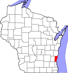 | |
| Villages | ||
| Towns | ||
| CDP | ||
| Unincorporated communities | ||
| Footnotes | ‡This populated place also has portions in an adjacent county or counties | |
Municipalities and communities of Sheboygan County, Wisconsin, United States | ||
|---|---|---|
| Cities | 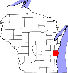 | |
| Villages | ||
| Towns | ||
| CDPs | ||
| Unincorporated communities | ||
| Ghost towns | ||
| Footnotes | ‡This populated place also has portions in an adjacent county or counties | |
This article is issued from Wikipedia - version of the 7/28/2016. The text is available under the Creative Commons Attribution/Share Alike but additional terms may apply for the media files.