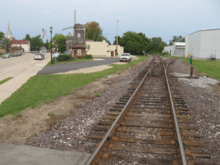
Cedar Grove, Wisconsin
| Cedar Grove, Wisconsin | |
|---|---|
| Village | |
 Location of Cedar Grove, Wisconsin | |
| Coordinates: 43°34′6″N 87°49′22″W / 43.56833°N 87.82278°WCoordinates: 43°34′6″N 87°49′22″W / 43.56833°N 87.82278°W | |
| Country | United States |
| State | Wisconsin |
| County | Sheboygan |
| Area[1] | |
| • Total | 2.18 sq mi (5.65 km2) |
| • Land | 2.14 sq mi (5.54 km2) |
| • Water | 0.04 sq mi (0.10 km2) |
| Elevation[2] | 719 ft (219 m) |
| Population (2010)[3] | |
| • Total | 2,113 |
| • Estimate (2012[4]) | 2,102 |
| • Density | 987.4/sq mi (381.2/km2) |
| Time zone | Central (CST) (UTC-6) |
| • Summer (DST) | CDT (UTC-5) |
| Area code(s) | 920 |
| FIPS code | 55-13475[5] |
| GNIS feature ID | 1562844[2] |
| Website | www.cedargrovewi.com |
Cedar Grove is a village in Sheboygan County, Wisconsin, United States. The population was 2,113 at the 2010 census. It is included in the Sheboygan, Wisconsin Metropolitan Statistical Area.
History
A post office called Cedar Grove has been in operation since 1849.[6] The village was named from groves of cedar near the town site.[7]
Geography
Cedar Grove is located at 43°34′6″N 87°49′22″W / 43.56833°N 87.82278°W (43.568213, -87.822915).[8]
According to the United States Census Bureau, the village has a total area of 2.18 square miles (5.65 km2), of which, 2.14 square miles (5.54 km2) of it is land and 0.04 square miles (0.10 km2) is water.[1]
Demographics
| Historical population | |||
|---|---|---|---|
| Census | Pop. | %± | |
| 1900 | 327 | — | |
| 1910 | 498 | 52.3% | |
| 1920 | 654 | 31.3% | |
| 1930 | 814 | 24.5% | |
| 1940 | 907 | 11.4% | |
| 1950 | 1,010 | 11.4% | |
| 1960 | 1,175 | 16.3% | |
| 1970 | 1,276 | 8.6% | |
| 1980 | 1,420 | 11.3% | |
| 1990 | 1,521 | 7.1% | |
| 2000 | 1,887 | 24.1% | |
| 2010 | 2,113 | 12.0% | |
| Est. 2015 | 2,112 | [9] | 0.0% |
2010 census
As of the census[3] of 2010, there were 2,113 people, 842 households, and 597 families residing in the village. The population density was 987.4 inhabitants per square mile (381.2/km2). There were 881 housing units at an average density of 411.7 per square mile (159.0/km2). The racial makeup of the village was 97.8% White, 0.1% African American, 0.4% Native American, 0.4% Asian, 0.5% from other races, and 0.8% from two or more races. Hispanic or Latino of any race were 3.3% of the population.
There were 842 households of which 35.0% had children under the age of 18 living with them, 60.8% were married couples living together, 6.2% had a female householder with no husband present, 3.9% had a male householder with no wife present, and 29.1% were non-families. 26.2% of all households were made up of individuals and 14.5% had someone living alone who was 65 years of age or older. The average household size was 2.51 and the average family size was 3.02.
The median age in the village was 37.8 years. 27.2% of residents were under the age of 18; 6.5% were between the ages of 18 and 24; 26.6% were from 25 to 44; 24.7% were from 45 to 64; and 15% were 65 years of age or older. The gender makeup of the village was 50.2% male and 49.8% female.
2000 census
As of the census[5] of 2000, there were 1,887 people, 699 households, and 529 families residing in the village. The population density was 917.9 people per square mile (353.7/km²). There were 724 housing units at an average density of 352.2 per square mile (135.7/km²). The racial makeup of the village was 98.36% White, 0.05% African American, 0.48% Native American, 0.16% Asian, 0.11% from other races, and 0.85% from two or more races. Hispanic or Latino of any race were 2.65% of the population.
There were 699 households out of which 38.1% had children under the age of 18 living with them, 67.7% were married couples living together, 6.2% had a female householder with no husband present, and 24.2% were non-families. 21.6% of all households were made up of individuals and 10.2% had someone living alone who was 65 years of age or older. The average household size was 2.70 and the average family size was 3.17.
In the village the population was spread out with 29.7% under the age of 18, 7.0% from 18 to 24, 28.2% from 25 to 44, 19.8% from 45 to 64, and 15.3% who were 65 years of age or older. The median age was 36 years. For every 100 females there were 98.2 males. For every 100 females age 18 and over, there were 94.3 males.
The median income for a household in the village was $49,674, and the median income for a family was $55,781. Males had a median income of $42,112 versus $21,701 for females. The per capita income for the village was $20,658. About 3.0% of families and 2.4% of the population were below the poverty line, including 1.6% of those under age 18 and 5.9% of those age 65 or over.
Education
The village is served by the Cedar Grove-Belgium School District, a district shared with Belgium, a village located to the south in Ozaukee County. Cedar Grove-Belgium High School is the local high school.
Arts and culture
Every year the town remembers its Dutch heritage with a two-day celebration, the Holland Fest, held in Memorial Park the last Friday and Saturday in July. The festival features ethnic foods, music, and 2-mile and 10K runs. Before the Saturday afternoon parade the main street is scrubbed by children and adults dressed in traditional Dutch costumes to prepare the road for the Klompen Dancers and parade to follow. Another nod to the village's Dutch roots is a full-sized replica windmill in Windmill Park downtown. In addition to Klompen Dancing, the festival also holds an annual wooden shoe race where children race one another while wearing traditional Dutch wooden shoes. The festival also is known for its Oliebollen, which is a type of Dutch doughnut. Holland Fest is one of the largest "dry festivals" in Wisconsin.
In the media
In a September 9, 2006 episode of the Fox series Prison Break etitled "Subdivision", Cedar Grove was mentioned in the plot. Escaped inmate Charles Patoshik found himself in the village where he ended up in the home of a blind woman who mistook him for her son. The woman had a painting of the Netherlands on her wall (a reference to the town’s Dutch heritage), which the inmate stole because he thought it looked like a beautiful place to live. The series films in the Dallas area, so the Cedar Grove shown in the episode was a fictional representation.
Notable people
- David Claerbaut, author and educator, was raised in Cedar Grove.
- John Mentink, farmer, businessman, and politician, was born near Cedar Grove.[11]
- Henry Ott, farmer, businessman, and politician, was born in Cedar Grove.[12]
- Henry Walvoord, farmer and politician, lived in Cedar Grove.[13]
References
- 1 2 "US Gazetteer files 2010". United States Census Bureau. Archived from the original on 2012-01-24. Retrieved 2012-11-18.
- 1 2 "US Board on Geographic Names". United States Geological Survey. 2007-10-25. Retrieved 2008-01-31.
- 1 2 "American FactFinder". United States Census Bureau. Retrieved 2012-11-18.
- ↑ "Population Estimates". United States Census Bureau. Archived from the original on 2013-06-17. Retrieved 2013-06-24.
- 1 2 "American FactFinder". United States Census Bureau. Archived from the original on 2013-09-11. Retrieved 2008-01-31.
- ↑ "Sheboygan County". Jim Forte Postal History. Retrieved 28 February 2015.
- ↑ Chicago and North Western Railway Company (1908). A History of the Origin of the Place Names Connected with the Chicago & North Western and Chicago, St. Paul, Minneapolis & Omaha Railways. p. 53.
- ↑ "US Gazetteer files: 2010, 2000, and 1990". United States Census Bureau. 2011-02-12. Retrieved 2011-04-23.
- ↑ "Annual Estimates of the Resident Population for Incorporated Places: April 1, 2010 to July 1, 2015". Retrieved July 2, 2016.
- ↑ "Census of Population and Housing". Census.gov. Archived from the original on May 11, 2015. Retrieved June 4, 2015.
- ↑ 'Wisconsin Blue Book 1929,' Biographical Sketch of John Mentink, pg. 574
- ↑ 'Wisconsin Blue Book 1923,' Biographical Sketch of Henry Ott, pg. 637
- ↑ 'Wisconsin Blue Book 1885,' Biographical Sketch of Henry Walvoord, pg. 441
External links
Municipalities and communities of Sheboygan County, Wisconsin, United States | ||
|---|---|---|
| Cities | 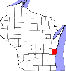 | |
| Villages | ||
| Towns | ||
| CDPs | ||
| Unincorporated communities | ||
| Ghost towns | ||
| Footnotes | ‡This populated place also has portions in an adjacent county or counties | |