Belgium, Wisconsin
| Belgium, Wisconsin | |
|---|---|
| Village | |
 Location of Belgium, Wisconsin | |
| Coordinates: 43°29′39″N 87°51′33″W / 43.49417°N 87.85917°WCoordinates: 43°29′39″N 87°51′33″W / 43.49417°N 87.85917°W | |
| Country | United States |
| State | Wisconsin |
| County | Ozaukee |
| Area[1] | |
| • Total | 2.42 sq mi (6.27 km2) |
| • Land | 2.42 sq mi (6.27 km2) |
| • Water | 0 sq mi (0 km2) |
| Elevation[2] | 738 ft (225 m) |
| Population (2010)[3] | |
| • Total | 2,245 |
| • Estimate (2012[4]) | 2,259 |
| • Density | 927.7/sq mi (358.2/km2) |
| Time zone | Central (CST) (UTC-6) |
| • Summer (DST) | CDT (UTC-5) |
| Area code(s) | 262 |
| FIPS code | 55-06175[5] |
| GNIS feature ID | 1582782[2] |
| Website |
village |

Belgium is a village located in the Town of Belgium in Ozaukee County, Wisconsin, United States. The population was 2,245 at the 2010 census.
History
The first settlement at Belgium was made in 1848.[6] A large share of the early settlers being natives of Belgium caused the name to be selected.[7] A post office called Belgium has been in operation since 1857.[8]
Geography
Belgium is located at 43°30′2″N 87°50′48″W / 43.50056°N 87.84667°W (43.500735, -87.846897).[9]
According to the United States Census Bureau, the village has a total area of 2.42 square miles (6.27 km2), all of it land.[1]
Belgium is two miles (3 km) west of Lake Michigan, adjacent to conjoined Interstate 43-State Highway 32.
Demographics
| Historical population | |||
|---|---|---|---|
| Census | Pop. | %± | |
| 1930 | 268 | — | |
| 1940 | 356 | 32.8% | |
| 1950 | 460 | 29.2% | |
| 1960 | 643 | 39.8% | |
| 1970 | 809 | 25.8% | |
| 1980 | 892 | 10.3% | |
| 1990 | 928 | 4.0% | |
| 2000 | 1,678 | 80.8% | |
| 2010 | 2,245 | 33.8% | |
| Est. 2015 | 2,261 | [10] | 0.7% |
2010 census
As of the census[3] of 2010, there were 2,245 people, 817 households, and 608 families residing in the village. The population density was 927.7 inhabitants per square mile (358.2/km2). There were 848 housing units at an average density of 350.4 per square mile (135.3/km2). The racial makeup of the village was 94.5% White, 0.4% African American, 0.4% Native American, 0.9% Asian, 2.9% from other races, and 0.8% from two or more races. Hispanic or Latino of any race were 5.2% of the population.
There were 817 households of which 41.9% had children under the age of 18 living with them, 66.0% were married couples living together, 5.1% had a female householder with no husband present, 3.3% had a male householder with no wife present, and 25.6% were non-families. 20.7% of all households were made up of individuals and 6% had someone living alone who was 65 years of age or older. The average household size was 2.74 and the average family size was 3.24.
The median age in the village was 35 years. 29.7% of residents were under the age of 18; 4.6% were between the ages of 18 and 24; 33.8% were from 25 to 44; 23.5% were from 45 to 64; and 8.3% were 65 years of age or older. The gender makeup of the village was 51.0% male and 49.0% female.
2000 census
As of the census[5] of 2000, there were 1,678 people, 582 households, and 444 families residing in the village. The population density was 1,163.0 people per square mile (449.9/km²). There were 592 housing units at an average density of 410.3 per square mile (158.7/km²). The racial makeup of the village was 96.31% White, 0.48% Black or African American, 0.42% Native American, 0.18% Asian, 1.49% from other races, and 1.13% from two or more races. 4.11% of the population were Hispanic or Latino of any race. There were 1582 households out of which 44.5% had children under the age of 18 living with them, 67.9% were married couples living together, 5.8% had a female householder with no husband present, and 23.7% were non-families. 19.6% of all households were made up of individuals and 7.4% had someone living alone who was 65 years of age or older. The average household size was 2.85 and the average family size was 3.31.
In the village the population was spread out with 31.8% under the age of 18, 6.8% from 18 to 24, 36.1% from 25 to 44, 16.5% from 45 to 64, and 8.8% who were 65 years of age or older. The median age was 32 years. For every 100 females there were 101.2 males. For every 100 females age 18 and over, there were 99.5 males.
The median income for a household in the village was $53,523, and the median income for a family was $59,375. Males had a median income of $40,152 versus $25,609 for females. The per capita income for the village was $20,659. About 1.8% of families and 2.4% of the population were below the poverty line, including 2.8% of those under age 18 and 6.0% of those age 65 or over.
Notable people
- Nicholas J. Bichler - Wisconsin State Assemblyman
- William J. Bichler - Wisconsin State Senator
- Henry Ellenbecker - Wisconsin State Assemblyman
Education
The village shares the Cedar Grove-Belgium School District with Cedar Grove. The Cedar Grove-Belgium High School is the local high school.
References
- 1 2 "US Gazetteer files 2010". United States Census Bureau. Archived from the original on 2012-01-24. Retrieved 2012-11-18.
- 1 2 "US Board on Geographic Names". United States Geological Survey. 2007-10-25. Retrieved 2008-01-31.
- 1 2 "American FactFinder". United States Census Bureau. Retrieved 2012-11-18.
- ↑ "Population Estimates". United States Census Bureau. Archived from the original on 2013-06-17. Retrieved 2013-06-24.
- 1 2 "American FactFinder". United States Census Bureau. Archived from the original on 2013-09-11. Retrieved 2008-01-31.
- ↑ "Newland Became Cedarburg". The Milwaukee Sentinel. 4 September 1967. pp. Part 5, Page 5. Retrieved 23 April 2015.
- ↑ Chicago and North Western Railway Company (1908). A History of the Origin of the Place Names Connected with the Chicago & North Western and Chicago, St. Paul, Minneapolis & Omaha Railways. p. 43.
- ↑ "Ozaukee County". Jim Forte Postal History. Retrieved 23 April 2015.
- ↑ "US Gazetteer files: 2010, 2000, and 1990". United States Census Bureau. 2011-02-12. Retrieved 2011-04-23.
- ↑ "Annual Estimates of the Resident Population for Incorporated Places: April 1, 2010 to July 1, 2015". Retrieved July 2, 2016.
- ↑ "Census of Population and Housing". Census.gov. Archived from the original on May 11, 2015. Retrieved June 4, 2015.
External links
Municipalities and communities of Ozaukee County, Wisconsin, United States | ||
|---|---|---|
| Cities | 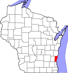 | |
| Villages | ||
| Towns | ||
| CDP | ||
| Unincorporated communities | ||
| Footnotes | ‡This populated place also has portions in an adjacent county or counties | |